
Selangor Travel Guide
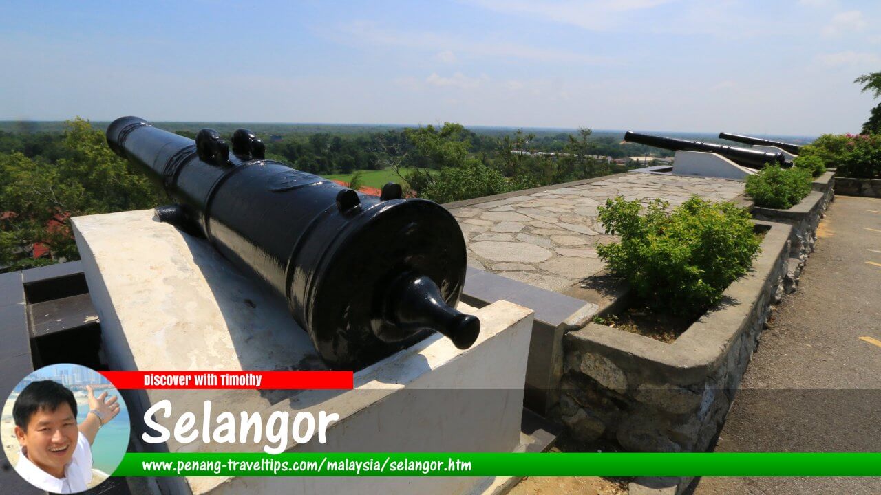 Discover Selangor (7 July, 2016)
Also Available: Panduan Melawat Selangor
Selangor is the most developed and most populous state in Malaysia. Surrounding the federal territories of Kuala Lumpur and Putrajaya, it forms the core of the Klang Valley, the country's largest metropolitan area and economic heartland. Although Kuala Lumpur is Malaysia's national capital, much of the infrastructure, industry, commerce, logistics and residential development that support the capital are located within Selangor. As the state that has played a central role in Malaysia's economic growth, urban development and industrialisation, understanding Selangor is essential to understanding modern Malaysia.1
Situated on the west coast of Peninsular Malaysia, Selangor offers a remarkable diversity of landscapes and communities. It encompasses thriving cities, planned townships, industrial estates, historic royal centres, fishing villages, agricultural districts, tropical rainforests and popular beach destinations. The state's strategic location along the Strait of Malacca, coupled with its extensive transport infrastructure, has made it the country's principal gateway for trade, investment and international travel.2
Selangor's influence extends well beyond its administrative boundaries. The state is home to Port Klang, Malaysia's busiest seaport, and Kuala Lumpur International Airport (KLIA), the country's primary aviation gateway. It also contains many of Malaysia's leading universities, research institutions, manufacturing centres and corporate headquarters. Together with Kuala Lumpur and Putrajaya, Selangor forms one of Southeast Asia's most dynamic metropolitan regions, making it an important destination for business travellers, expatriates, students and tourists alike.3
Quick Facts
State: Selangor
Capital: Shah Alam
Royal Capital: Klang
Largest City: Petaling Jaya
Area: Approximately 7,956 sq km (3,072 sq mi)
Population: About 7.5 million (2024 estimate)
Administrative Districts: Gombak, Hulu Langat, Hulu Selangor, Klang, Kuala Langat, Kuala Selangor, Petaling, Sabak Bernam and Sepang
Highest Point: Gunung Semangkok (1,824 m)
Major Rivers: Klang River, Langat River, Selangor River and Bernam River
Main Airport: Kuala Lumpur International Airport (KLIA)
Main Seaport: Port Klang
Time Zone: Malaysia Standard Time (UTC+8)
Major Expressways: North-South Expressway, Federal Highway, New Klang Valley Expressway (NKVE), Guthrie Corridor Expressway (GCE), Shah Alam Expressway (KESAS), South Klang Valley Expressway (SKVE), ELITE Expressway and Damansara-Shah Alam Elevated Expressway (DASH)
Understanding Selangor
For many international visitors, Selangor is often experienced before it is recognised. A traveller arriving at Kuala Lumpur International Airport lands in Selangor. Someone staying in Petaling Jaya or Shah Alam may assume they are in Kuala Lumpur, while commuters frequently cross municipal and state boundaries without realising it. This close relationship between Selangor and the federal territories has led many visitors to underestimate the state's importance. In reality, Selangor is not simply the state surrounding Kuala Lumpur—it is the foundation upon which much of modern metropolitan Malaysia has developed.4
Selangor is one of the thirteen states of Malaysia, occupying much of the central-western coast of Peninsular Malaysia. It shares borders with the states of Perak to the north, Pahang to the east and Negeri Sembilan to the south, while its western coastline faces the Straits of Malacca, one of the world's busiest maritime trade routes. Enclosed within Selangor are the two federal territories of Kuala Lumpur and Putrajaya, both of which were formerly part of the state before being ceded to the federal government.5
Selangor, Kuala Lumpur and Putrajaya
One of the most common misconceptions among overseas visitors is that Kuala Lumpur and Selangor are separate and unrelated destinations. Historically, Kuala Lumpur developed within Selangor and served as the state's capital for almost a century. In 1974, the city was separated from Selangor to become a Federal Territory and Malaysia's national capital. Despite this administrative change, Kuala Lumpur remains completely surrounded by Selangor, and the two have continued to grow into a single, highly integrated metropolitan area.6
A similar arrangement exists with Putrajaya. During the 1990s, the Malaysian Government established a new administrative capital to accommodate the expanding federal civil service. Land was ceded by Selangor for the purpose, and Putrajaya became Malaysia's third Federal Territory in 2001. Today, Kuala Lumpur remains the national capital and seat of Parliament, while Putrajaya houses most federal ministries and government agencies. Together with Selangor, these three administrations form the political, economic and administrative heart of the nation.7
Understanding the Klang Valley
The term Klang Valley frequently appears in discussions about Malaysia, yet it is often misunderstood by visitors. Contrary to popular belief, the Klang Valley is not an administrative division but a metropolitan region centred on the Klang River basin. It encompasses Kuala Lumpur, Putrajaya and much of Selangor, including major cities such as Petaling Jaya, Shah Alam, Klang, Subang Jaya, Puchong, Ampang Jaya and Kajang. Over the decades, these communities have expanded and merged into a continuous urban landscape that is home to more than one-third of Malaysia's population and a substantial share of its economic activity.8
The concentration of government institutions, industries, universities, financial services, logistics hubs and transport infrastructure within the Klang Valley has made it the country's principal centre of commerce and innovation. As the largest state within this metropolitan region, Selangor plays a pivotal role in supporting its continued growth. Many of Malaysia's largest industrial parks, business districts, residential townships and commercial developments are located within Selangor, even though they are commonly associated with Kuala Lumpur by international visitors.9
Geography
Selangor's geography has been one of the principal factors behind its historical and economic development. The state consists largely of fertile coastal plains that gradually rise towards the forested foothills of the Titiwangsa Range in the east. This varied landscape has supported agriculture, settlement, mining and, more recently, extensive urban and industrial development. The state's central location on the west coast of Peninsular Malaysia has also provided convenient access to both domestic and international markets through the Strait of Malacca.10
Although modern Selangor is often associated with skyscrapers and expressways, large areas of the state remain covered by forest reserves, wetlands, mangrove ecosystems and agricultural land. Rice cultivation continues in Sabak Bernam, while oil palm plantations occupy extensive areas in the state's northern and southern districts. These contrasting landscapes illustrate how Selangor has balanced rapid urbanisation with the conservation of important natural environments and food-producing regions.11
Rivers of Selangor
The history of Selangor cannot be understood without appreciating the importance of its rivers. Long before the construction of modern highways and railways, rivers served as the state's principal transport routes, linking inland settlements with the coast. They facilitated trade, enabled agricultural development and provided access to mineral-rich areas that later fuelled the state's economic expansion.12
The Klang River gave rise to the settlement that became Kuala Lumpur, while the Langat River supported communities across southern Selangor for centuries. The Selangor River played an important role in the early development of Kuala Selangor and remains a vital source of water for the Klang Valley today. Further north, the Bernam River forms part of Selangor's boundary with Perak and has long supported agriculture and riverine settlements. Together, these waterways shaped the distribution of settlements long before the arrival of modern infrastructure.13
Climate
Like the rest of Peninsular Malaysia, Selangor experiences an equatorial climate characterised by consistently warm temperatures, high humidity and abundant rainfall throughout the year. Average daytime temperatures generally range between 30°C and 33°C, while rainfall is influenced by both the southwest and northeast monsoon seasons. These climatic conditions have supported the state's rich biodiversity and historically contributed to the success of crops such as rubber, oil palm and rice.14
Population
Selangor is Malaysia's most populous state and one of the country's most culturally diverse. Its rapid population growth reflects decades of industrialisation, urban expansion and economic opportunity, attracting people from every state in Malaysia as well as expatriates and foreign workers from around the world. Today, its cities and townships comprise communities representing Malaysia's multicultural society, contributing to a vibrant blend of languages, cultures, cuisines and religious traditions.15
The state's continuing growth has been accompanied by carefully planned urban development. Purpose-built townships, integrated transport networks and modern infrastructure have enabled Selangor to accommodate a steadily expanding population while maintaining its position as Malaysia's leading centre for commerce, education, innovation and industry. The story of how Selangor evolved into this role, however, begins many centuries before the rise of its modern cities, in a history shaped by rivers, trade, migration and the discovery of tin.
History of Selangor
Selangor's transformation into Malaysia's most developed state was neither sudden nor inevitable. For centuries, the region consisted of scattered riverine settlements connected by waterways that flowed from the interior to the Strait of Malacca. Its fortunes changed through successive waves of migration, trade, political rivalry and economic opportunity. The discovery of tin in the nineteenth century accelerated this transformation, while British colonial administration introduced new infrastructure and institutions that reshaped the state's economy and settlement patterns. The modern Selangor of today is the product of these successive phases of development.16
Etymology
The origin of the name Selangor remains uncertain, and several explanations have been proposed over the years. One popular tradition attributes the name to the langau, a large horsefly. According to local folklore, a warrior resting beside a river was repeatedly disturbed by these insects. Interpreting the incident as a memorable event, he named the place Se-Langau, which is said to have evolved linguistically into Selangor over time.17
Another theory links the state's name to the Mentangau tree, which was once said to grow abundantly along the banks of the Selangor River. The river mouth became known as Kuala Sungai Mentangau, and through gradual changes in pronunciation, the name may have evolved into Kuala Selangor and eventually Selangor itself. Although neither explanation can be proven conclusively, both reflect the close relationship between the state's identity and its rivers, which have shaped its history since the earliest settlements.18
Early Settlements
Long before the emergence of organised states, Selangor's rivers supported small Malay communities engaged in fishing, agriculture and riverine trade. Archaeological discoveries indicate that parts of present-day Selangor were inhabited centuries before the rise of the Malacca Sultanate, while coastal settlements maintained trading links with merchants from across the Malay Archipelago, India and China. The rivers provided access deep into the interior, making them the natural corridors along which people, goods and ideas travelled.19
Following the rise of the Malacca Sultanate during the fifteenth century, much of present-day Selangor came under its influence. The prosperity of Malacca encouraged settlement along the west coast of the Malay Peninsula, and the rivers of Selangor became increasingly important as routes connecting inland communities with one of Asia's busiest trading ports. This period laid the foundations for the state's later economic importance.20
From Malacca to the Selangor Sultanate
The Portuguese conquest of Malacca in 1511 dramatically altered the political landscape of the Malay Peninsula. With the fall of Malacca, the territories that now form Selangor became contested by several regional powers, including the Johor Sultanate, the Acehnese, the Portuguese and, at various times, the Sultanate of Perak. Control shifted repeatedly as competing rulers sought to dominate the strategically important west coast and its maritime trade.21
During the seventeenth century, Minangkabau settlers from Sumatra established communities across parts of western Peninsular Malaysia, including Selangor. In the eighteenth century, they were joined—and eventually overshadowed—by Bugis migrants from Sulawesi. Renowned as skilled sailors, merchants and warriors, the Bugis gradually established political influence throughout the region. Their growing prominence culminated in the establishment of the Selangor Sultanate in 1766, when Raja Lumu was recognised as Sultan Salehuddin Shah, the first Sultan of Selangor. The state's present royal family traces its lineage to these Bugis origins.22
Klang: The Original Centre of Selangor
Before Kuala Lumpur emerged as Malaysia's principal city, Klang was the political and commercial heart of Selangor. Situated near the mouth of the Klang River, it served as an important administrative centre and trading port, connecting inland settlements with the Strait of Malacca. Goods produced in the interior were transported downstream to Klang before continuing to markets throughout the region, making the town a natural focal point for trade and governance.23
Klang's position also reflected the importance of rivers in the pre-modern Malay world. At a time when roads were few and dense tropical forests covered much of the peninsula, waterways offered the most efficient means of transportation. The Klang River thus became the artery along which settlement, commerce and political authority developed, setting the stage for the remarkable events that would soon unfold further upstream.24
Tin Mining and the Birth of Kuala Lumpur
The event that transformed Selangor more than any other was the discovery of rich tin deposits during the nineteenth century. Tin had become an increasingly valuable commodity as industrialisation accelerated in Europe and North America, creating strong international demand. Large deposits were discovered in the Klang Valley, particularly around Ampang, where Chinese miners were recruited to develop the mines. Their arrival marked the beginning of one of the most significant periods in the state's history.25
The mining settlements required a supply and trading centre close to the confluence of the Klang and Gombak rivers. This strategic location offered access to both the mines upstream and the trading routes downstream towards Klang and the Strait of Malacca. What began as a modest frontier settlement gradually evolved into Kuala Lumpur, a town whose growth would eventually reshape not only Selangor but the entire nation.26
Tin mining brought unprecedented prosperity, but it also intensified competition among local Malay chiefs seeking control of the lucrative mining districts. Rival Chinese secret societies aligned themselves with different factions, turning economic competition into armed conflict. These disputes culminated in the Klang War (1867-1874), a prolonged civil conflict that devastated parts of Selangor and disrupted the tin trade upon which the state's prosperity depended.27
British Administration and Modernisation
The instability caused by the Klang War provided the British with an opportunity to expand their influence in Selangor. In 1874, the same year that the Pangkor Treaty introduced the Residential System in Perak, Sultan Abdul Samad accepted a British Resident whose advice was to be followed in most administrative matters. Although the arrangement curtailed the Sultan's political authority, it also ushered in a period of greater stability that encouraged investment, expanded tin production and strengthened government administration.28
British rule transformed Selangor's physical landscape. Roads and railways connected mining districts with ports, administrative institutions became more structured, and modern municipal services gradually emerged in towns such as Kuala Lumpur and Klang. These improvements not only supported the mining industry but also laid the foundations for the urban and industrial development that would continue throughout the twentieth century.29
Rubber, Plantations and a Changing Landscape
As the global demand for natural rubber expanded with the rise of the motor vehicle industry during the early twentieth century, Selangor diversified beyond tin mining. Vast tracts of tropical forest were cleared for rubber estates, many financed by British capital. The plantation economy attracted large numbers of migrant workers and stimulated the construction of additional roads, railways and processing facilities, further integrating Selangor into the global economy.30
Later in the century, oil palm cultivation gradually replaced many rubber estates, while other plantations gave way to expanding residential neighbourhoods, industrial parks and planned townships. This continual adaptation of the landscape—from rainforest to mines, plantations and ultimately modern cities—illustrates Selangor's remarkable ability to evolve in response to changing economic opportunities. That adaptability would become one of the defining characteristics of the state in the decades that followed.31
The Emergency and the Road to Independence
Following the Second World War, Selangor entered another period of profound change. Between 1948 and 1960, Malaya experienced the Emergency, an armed insurgency fought between British and Commonwealth forces and the Malayan National Liberation Army, the military wing of the Malayan Communist Party. As one of the country's most economically important states, Selangor became one of the principal theatres of the conflict, particularly in areas where tin mining and rubber plantations were concentrated.32
To deny communist guerrillas access to supplies and intelligence, the British administration introduced the Briggs Plan, relocating hundreds of thousands of rural residents into purpose-built settlements known as New Villages. Many of these settlements were established in Selangor and later developed into thriving towns and suburbs. Although created as a security measure, they would have a lasting influence on the state's urban landscape long after the Emergency had ended.33
The Emergency also accelerated investment in roads, public administration and security infrastructure. By the time the Federation of Malaya achieved independence on 31 August 1957, Selangor already possessed many of the physical and administrative foundations that would support its rapid post-independence development.34
The Federal Territory of Kuala Lumpur
Throughout the first decades after independence, Kuala Lumpur continued to serve as both the national capital and the capital of Selangor. However, as the city expanded rapidly, its dual role increasingly presented administrative challenges. The Federal Government required direct control over the nation's capital, while Selangor needed a state capital that could accommodate its own growing administration.35
On 1 February 1974, Kuala Lumpur was separated from Selangor and became Malaysia's first Federal Territory. Although this marked a significant constitutional change, it did not diminish the close relationship between the city and the surrounding state. Instead, Kuala Lumpur and Selangor continued to develop as an integrated metropolitan region, with people living, working and travelling seamlessly across the new administrative boundary every day.36
Why Shah Alam Became the Capital
The creation of the Federal Territory left Selangor without a state capital. Rather than selecting an existing town, the state government chose to establish an entirely new administrative centre at Shah Alam. The site, formerly occupied by extensive rubber and oil palm estates, offered ample land for long-term expansion and was strategically located between Kuala Lumpur, Klang and Subang Airport, placing it near the centre of the state's rapidly growing urban corridor.37
Shah Alam was conceived as more than simply a replacement for Kuala Lumpur. It was planned as a modern state capital with wide boulevards, government complexes, residential neighbourhoods, educational institutions and recreational areas. Officially declared the capital of Selangor in 1978, Shah Alam has since grown into one of Malaysia's largest planned cities while continuing to serve as the administrative centre of the state.38
The Creation of Putrajaya
By the late twentieth century, the continued growth of Kuala Lumpur prompted the Federal Government to establish a new administrative capital. A site in southern Selangor was selected, and construction of Putrajaya began during the 1990s. Like Kuala Lumpur before it, Putrajaya was carved out of Selangor and became a Federal Territory in 2001.39
Today, Kuala Lumpur, Putrajaya and Selangor function as closely interconnected components of Malaysia's principal metropolitan region. Kuala Lumpur remains the national capital and financial centre, Putrajaya houses most federal ministries and government agencies, while Selangor provides much of the residential, industrial, commercial and logistical infrastructure that supports both federal territories.40
Economy
Selangor possesses the largest state economy in Malaysia and consistently contributes the greatest share of the nation's Gross Domestic Product (GDP). This position is not the result of any single industry, but rather the combination of strategic geography, historical development, modern infrastructure and economic diversification. Few regions in Southeast Asia possess such a concentration of manufacturing, logistics, finance, technology, education and international connectivity within a single metropolitan area.41
Manufacturing and Industry
Manufacturing remains one of the principal pillars of Selangor's economy. Industrial estates developed across Shah Alam, Klang, Petaling Jaya, Subang Jaya, Bangi, Rawang and other parts of the state produce products ranging from electronics and semiconductors to automotive components, pharmaceuticals, chemicals and food products. Their proximity to ports, airports and expressways enables manufacturers to distribute goods efficiently throughout Malaysia and international markets.42
Port Klang
Port Klang is Malaysia's busiest seaport and among the leading container ports in the world. Situated along the Strait of Malacca, one of the world's most important maritime shipping lanes, it serves as the country's principal gateway for imports and exports. Modern container terminals, free commercial zones and extensive logistics facilities have established Port Klang as a critical hub linking Malaysia with global supply chains.43
The port's success also reflects Selangor's geography. For centuries, goods from the interior travelled down the Klang River towards the coast. Modern highways and railways now perform much of that function, but Port Klang continues the historical role of connecting the state's economy with international trade routes.44
Kuala Lumpur International Airport
Located in Sepang, Kuala Lumpur International Airport (KLIA) is Malaysia's primary international aviation gateway. Since opening in 1998, it has developed into one of Southeast Asia's major aviation hubs, supporting passenger travel, air cargo, tourism and international business. Its location within Selangor has encouraged the development of logistics parks, aerospace industries and commercial activities throughout the southern part of the state.45
Technology and Innovation
Over recent decades, Selangor has diversified beyond traditional manufacturing into knowledge-based industries and advanced technology. Cities such as Cyberjaya have emerged as centres for digital technology, data centres, information and communications technology (ICT), research and innovation. The presence of universities, research institutions and multinational corporations has helped position Selangor as one of Malaysia's leading locations for high-value industries and the digital economy.46
Agriculture
Despite its reputation as Malaysia's most urbanised state, agriculture continues to play an important role in Selangor's economy. Oil palm plantations remain widespread, while Sabak Bernam is recognised as one of the country's leading rice-producing districts. Fruit orchards, vegetable farms, aquaculture and fisheries also contribute to the state's agricultural diversity, demonstrating that modern industry and traditional food production continue to coexist within Selangor.47
A Diverse Economy
The strength of Selangor's economy lies in its diversity. Rather than depending upon a single sector, the state combines manufacturing, logistics, international trade, finance, aviation, technology, education, healthcare, tourism and agriculture into a highly integrated economic system. This diversity has enabled Selangor to adapt repeatedly to changing global economic conditions, from the era of tin mining and rubber plantations to today's knowledge-based economy.
Equally important is the state's extensive transport infrastructure, which links its cities, industries, ports and airports into a single interconnected network. The development of these transport systems has shaped not only Selangor's economy but also the daily lives of millions of people who live and work within the Klang Valley. It is this modern infrastructure that has enabled Selangor to function as the engine of Malaysia's economy, a subject explored in the next section.
Transportation
Selangor possesses the most extensive transportation network in Malaysia, reflecting its role as the country's principal economic and population centre. A comprehensive system of expressways, rail transit lines, commuter rail services, airports and seaports connects the state's cities, industrial parks, commercial centres and residential townships. This integrated transport infrastructure enables millions of people to travel efficiently throughout the Klang Valley while supporting the movement of goods across Malaysia and international markets.48
Expressways
Few places in Malaysia are served by as many major expressways as Selangor. The North-South Expressway forms the backbone of the national highway network, while urban expressways such as the Federal Highway, New Klang Valley Expressway (NKVE), Shah Alam Expressway (KESAS), Guthrie Corridor Expressway (GCE), South Klang Valley Expressway (SKVE), Damansara-Shah Alam Elevated Expressway (DASH), ELITE Expressway and Sungai Besi Expressway (BESRAYA) link towns and cities throughout the state. These highways have played a significant role in shaping modern development by encouraging the growth of new residential townships, industrial estates and commercial districts.49
Rail Transit
Selangor is served by Malaysia's most comprehensive urban rail network. The Rapid KL LRT, MRT and Monorail systems, together with the KTM Komuter network, connect many of the state's principal cities with Kuala Lumpur and one another. Towns such as Petaling Jaya, Subang Jaya, Shah Alam, Puchong, Kajang, Sungai Buloh, Klang and Putra Heights are linked by high-capacity public transport, making rail an increasingly important mode of travel within the Klang Valley.50
The expansion of the rail network has also influenced patterns of urban development. New residential and commercial projects are increasingly planned around railway stations, encouraging transit-oriented development that reduces dependence on private vehicles while supporting sustainable long-term growth.51
Air and Sea Transport
Selangor occupies a unique position in Malaysia's transportation system by serving as the location of both the country's principal international airport and its busiest seaport. Kuala Lumpur International Airport provides global air connectivity, while Port Klang handles the majority of Malaysia's containerised maritime trade. Together, these facilities reinforce Selangor's role as the nation's foremost logistics and distribution hub.52
Education
Education has been one of the principal drivers of Selangor's economic development. The state is home to numerous public and private universities, international branch campuses, technical institutions and research centres, attracting students from across Malaysia and abroad. This concentration of educational institutions has helped create a highly skilled workforce that supports industries ranging from manufacturing and healthcare to finance, engineering and information technology.53
Among the state's best-known institutions are Universiti Teknologi MARA (UiTM) in Shah Alam, Universiti Putra Malaysia (UPM) in Serdang, Monash University Malaysia, Sunway University, Taylor's University and several international schools that serve the expatriate community. The close relationship between universities, research institutions and industry has contributed significantly to Selangor's transition towards a knowledge-based economy.54
Healthcare
Selangor possesses one of Malaysia's most comprehensive healthcare systems, comprising government hospitals, university medical centres, specialist hospitals and private healthcare providers. Residents benefit from a wide range of medical services, while international patients increasingly choose hospitals in Selangor for specialised treatment and medical tourism.55
Major healthcare facilities are located throughout the state, particularly within Shah Alam, Petaling Jaya, Subang Jaya, Klang and Kajang. Together with neighbouring Kuala Lumpur, these centres form one of Southeast Asia's leading medical corridors, supported by advanced diagnostic facilities, specialist expertise and internationally recognised healthcare providers.56
Shopping and Commerce
As Malaysia's wealthiest state, Selangor offers an exceptionally diverse retail landscape. International shopping centres stand alongside neighbourhood malls, traditional markets and commercial districts, reflecting the needs of one of the country's largest urban populations. Cities such as Petaling Jaya, Subang Jaya, Shah Alam and Klang contain many of Malaysia's most prominent retail destinations, while newer townships continue to develop integrated commercial centres as part of their master plans.57
Retail development has evolved alongside urban planning. Many modern townships are designed around mixed-use commercial centres that integrate shopping, dining, offices and residential developments within walkable environments. This approach reflects the changing lifestyle of Selangor's growing urban population and contributes to the state's reputation as one of Malaysia's leading shopping destinations.58
Culture and Heritage
Selangor's cultural identity reflects centuries of migration, trade and urbanisation. Traditional Malay villages coexist with modern planned cities, while Chinese, Indian and other communities have contributed to the state's multicultural character. Mosques, temples, churches and gurdwaras stand throughout the state, illustrating the religious diversity that has long characterised the Klang Valley.59
Although widely recognised for its modern cities and industries, Selangor also preserves an important historical legacy. Royal traditions continue in Klang, while towns such as Kuala Selangor retain links to the early history of the Selangor Sultanate. Museums, heritage buildings and archaeological sites provide insights into the state's evolution from riverine settlements to one of Southeast Asia's most dynamic metropolitan regions.60
Nature and Recreation
Despite its high level of urbanisation, Selangor retains an impressive variety of natural landscapes. Forest reserves protect significant areas of tropical rainforest, while mangrove forests, wetlands, rivers and coastal habitats support diverse ecosystems. Parks, botanical gardens and recreational forests provide opportunities for hiking, camping, birdwatching and outdoor recreation within easy reach of the state's major cities.61
The state's coastline offers beaches, fishing villages and mangrove estuaries, while inland districts contain waterfalls, reservoirs and forest recreation areas. Together with numerous golf courses, sports complexes, cycling trails and public parks, these natural attractions contribute significantly to the quality of life enjoyed by Selangor's residents.62
Why People Choose to Live in Selangor
Selangor consistently attracts new residents because it combines economic opportunity with a high standard of infrastructure and public services. Employment opportunities, educational institutions, healthcare facilities, efficient transport networks and a wide range of housing options have made it the preferred destination for many Malaysians relocating from other states, as well as expatriates working in the Klang Valley.63
Equally important is the diversity of lifestyles available within the state. Those seeking a vibrant urban environment may choose cities such as Petaling Jaya, Subang Jaya or Shah Alam, while others prefer quieter communities in Kuala Selangor, Sabak Bernam or Hulu Selangor. This ability to accommodate different lifestyles within a single state is one of Selangor's defining strengths and has contributed significantly to its continued growth. The diversity of its districts and cities is explored in the next section.
Administrative Divisions
For administrative purposes, Selangor is divided into nine districts: Gombak, Hulu Langat, Hulu Selangor, Klang, Kuala Langat, Kuala Selangor, Petaling, Sabak Bernam and Sepang. Each district has developed its own distinctive character, reflecting differences in geography, history and patterns of settlement. While the districts of Petaling, Klang, Gombak and Sepang have become highly urbanised as part of the Klang Valley metropolitan area, the northern districts of Kuala Selangor and Sabak Bernam continue to retain important agricultural landscapes, while Hulu Selangor preserves extensive forest reserves and highland environments.64
The diversity of these districts illustrates one of Selangor's defining characteristics. Within a relatively compact area, the state encompasses some of Malaysia's busiest commercial centres, internationally connected transport hubs, productive agricultural districts, historic royal towns, coastal fishing communities and protected natural landscapes. This variety enables Selangor to support a broad range of economic activities while offering very different living environments across the state.65
Major Cities and Towns
Selangor's urban network has evolved over more than a century, with each major city fulfilling a distinctive role within the state's development. Rather than competing with one another, these cities complement each other, forming an interconnected metropolitan region that supports Malaysia's economy, government and international connectivity.66
- Shah Alam serves as the state capital and administrative centre, housing the Selangor State Government and numerous educational institutions.
- Klang, the royal capital, remains closely associated with the Selangor Sultanate while also supporting Malaysia's busiest seaport at nearby Port Klang.
- Petaling Jaya has grown from Malaysia's first planned satellite town into one of the country's leading commercial, educational and residential cities.
- Subang Jaya is recognised for its educational institutions, mature residential neighbourhoods and thriving commercial districts.
- Kajang has evolved into an important regional centre serving southeastern Selangor while maintaining its reputation for satay.
- Sepang is internationally known as the location of Kuala Lumpur International Airport and the Sepang International Circuit.
- Kuala Selangor preserves much of the state's early history and serves as a gateway to important natural attractions along the coast.
- Selayang, Ampang Jaya, Puchong, Rawang, Semenyih and numerous other towns continue to contribute to Selangor's expanding metropolitan economy.
During the late twentieth and early twenty-first centuries, Selangor also became a pioneer in the development of master-planned townships. Communities such as Kota Kemuning, Bandar Sunway, Setia Alam, Denai Alam, Elmina, Bandar Bukit Raja and many others demonstrate how integrated planning has created self-contained neighbourhoods combining housing, commerce, education, recreation and employment opportunities. These developments have played an important role in accommodating the state's rapidly growing population while maintaining a high standard of urban infrastructure.67
Tourism
Selangor offers a remarkable variety of attractions reflecting both its natural and cultural diversity. Visitors can explore royal heritage in Klang, colonial history in Kuala Kubu Bharu, archaeological sites in Kuala Selangor, rainforest recreation in the eastern districts, mangrove ecosystems along the coast and modern shopping, dining and entertainment throughout the Klang Valley. The state also serves as the gateway to many destinations elsewhere in Malaysia, thanks to its extensive transport infrastructure and international airport.68
Nature lovers are drawn to forest reserves, waterfalls, firefly sanctuaries, wetlands and beaches, while families enjoy theme parks, botanical gardens and recreational parks. Food enthusiasts encounter an equally diverse culinary landscape, from seafood restaurants along the coast to traditional Malay cuisine, Chinese specialities, Indian eateries and the cosmopolitan dining scene found throughout the state's cities. This diversity reflects Selangor's multicultural population and centuries of migration, trade and cultural exchange.69
Why Selangor Matters
Selangor occupies a unique position in Malaysia. Few places illustrate the nation's historical and economic development as clearly as this state. Its rivers first supported early settlements and trade, its tin deposits fuelled the growth of Kuala Lumpur, its plantations connected Malaya with global markets, and its transport infrastructure laid the foundations for modern industrialisation. Each stage of its history built upon what came before, creating a state that has continually adapted to changing circumstances while remaining central to the nation's progress.70
Today, Selangor is far more than the state surrounding Kuala Lumpur. It is home to Malaysia's largest metropolitan region, busiest seaport, principal international airport, leading industrial centres and many of its foremost educational and research institutions. Its planned cities, extensive transport networks and diversified economy continue to attract investment, innovation and people from across Malaysia and around the world.71
Understanding Selangor therefore means understanding the story of modern Malaysia itself. From its origins as a collection of riverine settlements to its emergence as the country's economic heartland, Selangor has continually demonstrated an extraordinary capacity for adaptation and growth. As Malaysia continues to evolve in the twenty-first century, Selangor remains at the forefront of that journey, shaping the nation's future while preserving the historical legacy that made its success possible.72
Map of Towns in Selangor
Major Towns in Selangor
- Shah Alam - state capital (GPS: 3.07328, 101.51846)

- Klang (GPS: 3.04491, 101.44556)

- Kuala Selangor (GPS: 3.34018, 101.24976)

- Petaling Jaya (GPS: 3.12788, 101.59448)

- Port Klang (GPS: 3.00507, 101.40859)

Townships and Neighbourhoods in Selangor
- Ampang

- Balakong

- Bandar Sungai Long

- Bandar Sunway

- Bangi

- Banting

- Batang Kali

- Batu Caves

- Bestari Jaya

- Bukit Lanjan

- Cheras

- Cyberjaya

- Dengkil

- Hulu Langat

- Jenjarom

- Jugra
- Kajang

- Kelana Jaya
- Kepong

- Klang
- Kuala Kubu Bharu
- Kuala Selangor

- Pandamaran

- Petaling Jaya

- Port Klang

- Puchong

- Rasa

- Rawang

- Sabak Bernam

- Sekinchan

- Selayang

- Semenyih

- Sepang

- Serendah

- Seri Kembangan

- Subang

- Sungai Buloh

- Taman Melawati

- Tanjung Karang

- Teluk Panglima Garang

- USJ

- Johan Setia

- Bukit Tinggi

- Tropicana

- Damansara Idaman

- Ara Damansara

- Damansara Jaya

- Damansara Perdana

- Kota Damansara

- Mutiara Damansara

- Bandar Utama

- Damansara Utama

- Bukit Jelutong

- Bandar Sri Damansara

- Ampang Jaya

- Subang Jaya

- PJ Old Town

- PJ New Town

- Taman Jaya

- Taman Paramount

- Taman SEA

- SEA Park

- Taman Mayang

- SS2

- Putra Heights

- Kampung Sungai Kayu Ara

- Glenmarie

- Temasya Glenmarie

- Seksyen 14, Petaling Jaya

- Seksyen 17, Petaling Jaya

- Seksyen 16, Petaling Jaya

- Seksyen 13, Petaling Jaya

- Seksyen 11, Petaling Jaya

- Seksyen 12, Petaling Jaya

- Seksyen 20, Petaling Jaya

- Kampung Tunku, Petaling Jaya

- Taman Universiti, Petaling Jaya

- Bukit Gasing, Petaling Jaya

Map of Places of Interest in Selangor
Places of Interest in Selangor
- Batu Caves (GPS: 3.23796, 101.68417)

- Forest Research Institute Malaysia (GPS: 3.23486, 101.62984)
- Gedung Raja Abdullah (GPS: 3.0432, 101.44759)
- Gombak Orang Asli Museum (GPS: 3.29276, 101.73157)
- Jugra (GPS: 2.86335, 101.43976)
- KLIA Mosque (GPS: 2.78782, 101.67642)
- Kota Malawati (GPS: 3.34141, 101.24639)
- Kota Raja Mahdi (GPS: 3.0452, 101.44494)
- Kuala Selangor Fireflies (GPS: 3.36212, 101.30158 (Kampung Kuantan ); GPS: 3.38638, 101.27857 (Kampung Bukit Belimbing ))
- Mines Resort City (GPS: 3.02961, 101.71734)
- Morib Beach (GPS: 2.74853, 101.44325)
- Pantai Redang (GPS: 3.50323, 101.09407)
- Pulau Ketam (GPS: 3.01747, 101.25283)
- Sekinchan (GPS: 3.50656, 101.10237)
- Selangor Culture Cove (GPS: 3.23665, 101.68074)
- Semenyih Dam (GPS: 3.07691, 101.88244)
- Sepang International Circuit (GPS: 2.75941, 101.73177)
- Sultan Suleiman Royal Mosque (GPS: 3.03455, 101.45047)
- Sunway Lagoon (GPS: 3.03455, 101.45047)
- Zoo Negara (GPS: 3.20802, 101.75745)
Categories of sights in Selangor
- TOWNS IN SELANGOR
- PLACES OF INTEREST IN SELANGOR
- PETROL STATIONS IN SELANGOR
- Auditoriums in Selangor
- Beaches in Selangor
- Bridges in Selangor
- Caves in Selangor
- Cave temples in Selangor
- Chinese Restaurants in Selangor
- Churches in Selangor
- Commercial Centres of Selangor
- Convention Centres in Selangor
- Forts in Selangor
- Gurdwaras in Selangor
- Hills in Selangor
- Hindu temples in Selangor
- Hospitals in Selangor
- Hot Springs in Selangor
- Islands in Selangor
- Lighthouses in Selangor
- Mausoleums in Selangor
- Monuments in Selangor
- Mosques in Selangor
- MRT stations in Selangor
- Museums in Selangor
- Neighbourhoods and Townships in Selangor
- Parks in Selangor
- Properties in Selangor
- Rivers in Selangor
- Roundabouts in Selangor
- Schools in Selangor
- Shopping Malls in Selangor
- Train stations in Selangor
Natural Attractions of Selangor
- Bukit Cahaya Seri Alam
- Selangor Heritage Park
- Sungai Congkak Recreational Forest
- Sungai Dusun Wildlife Reserve
- Sungai Gabai Waterfalls
- Templer's Park
Districts of Selangor
- Gombak District
- Hulu Langat
- Hulu Selangor District
- Klang District
- Kuala Langat District
- Kuala Selangor District
- Petaling District
- Sabak Bernam District
- Sepang District
Schools in Selangor
Living in Selangor
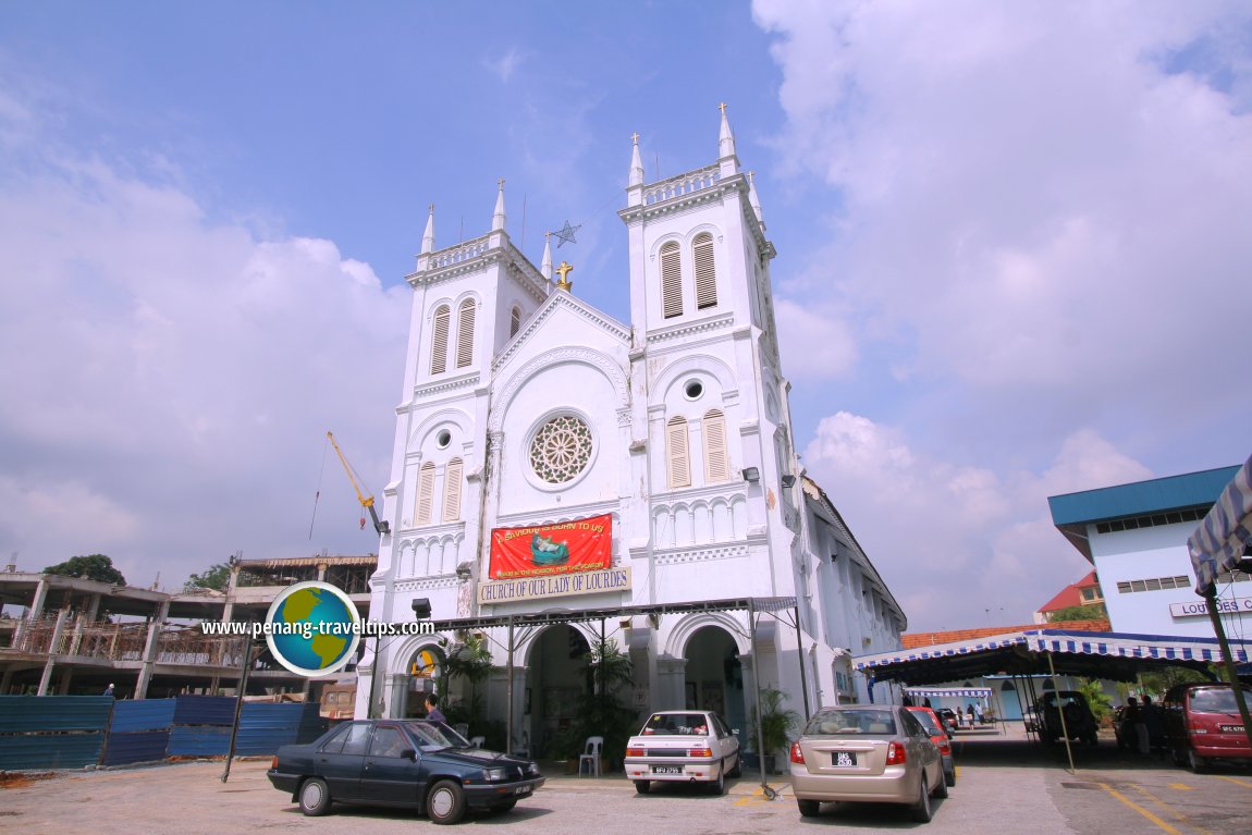
Church of Our Lady of Lourdes, Klang (29 December, 2006)
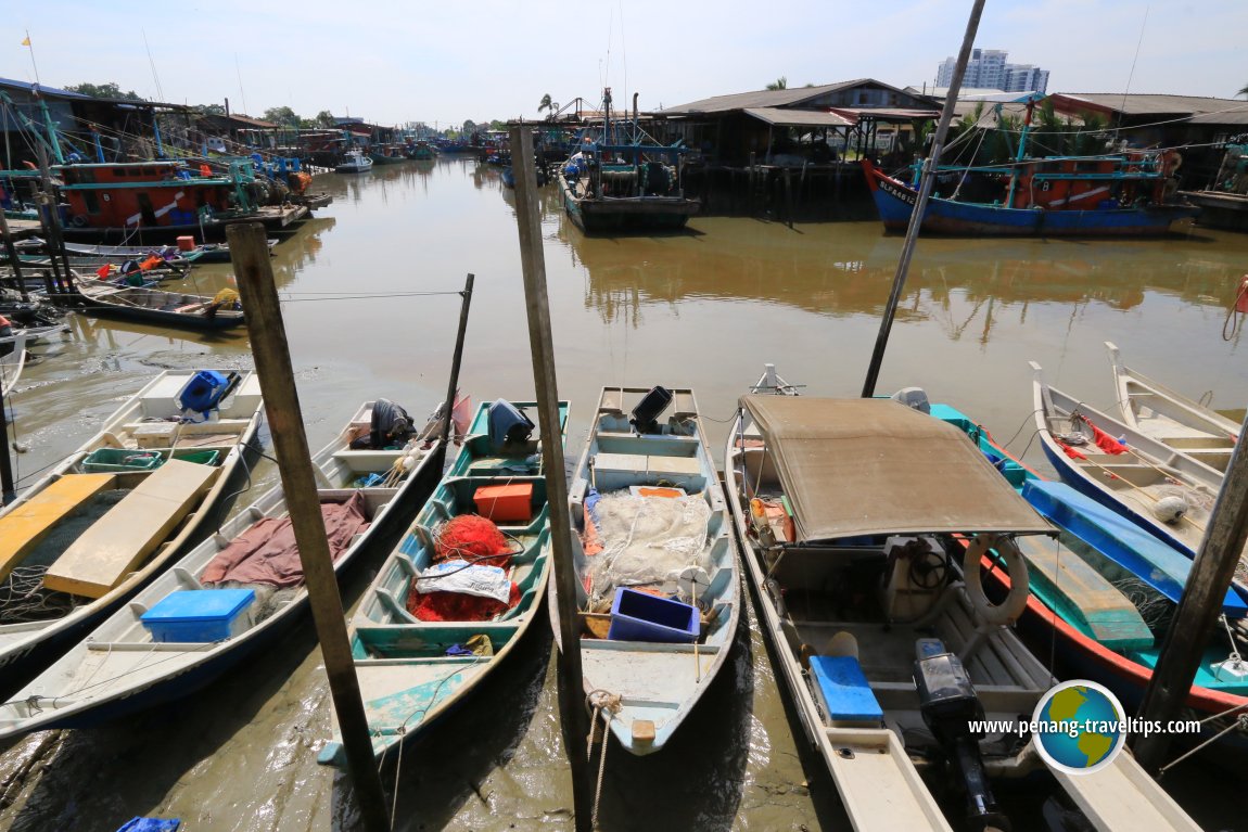 Sekinchan Fishermen Wharf (1 July, 2016)
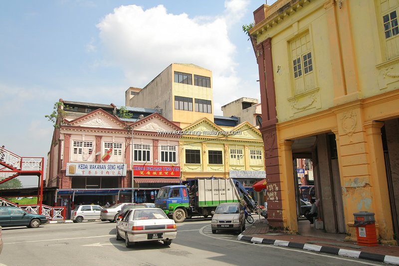
Klang, Selangor (29 December, 2006)
References
- Department of Statistics Malaysia (DOSM). Population and demographic statistics.
- Selangor State Government. Official Portal of the State of Selangor.
- PLANMalaysia. National Physical Planning information.
- Arkib Negara Malaysia. Historical records of Selangor.
- National Library Board Singapore. Historical resources on Selangor and Kuala Lumpur.
- Journal of the Malaysian Branch of the Royal Asiatic Society. Various articles on Selangor history.
- Port Klang Authority. Official information on Port Klang.
- Malaysia Airports Holdings Berhad. Kuala Lumpur International Airport.
- Tourism Selangor. Official tourism information.
- Relevant academic publications on the history, geography and development of Selangor.
- Perbadanan Adat Melayu dan Warisan Negeri Selangor
Page Details
This page was created on 20 July 2026. Hi, my name is Timothy and created it from my research, for my own entertainment, knowledge and to satisfy my curiosity. I am providing the information to you in good faith and hope it is useful. I try to get the details as accurate as possible. I also try to update the page whenever I stumble on new details. So this and all my other pages are perpetual work in progress. If you discover any error, please politely inform me, pointing out where the error lies, and I will correct it as soon as possible. Your helpfulness will keep this page accurate, relevant and helpful to those who need the information.My Videos of Malaysia
 Latest Pages & Updates
Buy Me A Coffee
If you enjoy the information I provide and want to support the work I do, please buy me a coffee! I appreciate it immensely, thank you so much!
