
Shah Alam Travel Guide
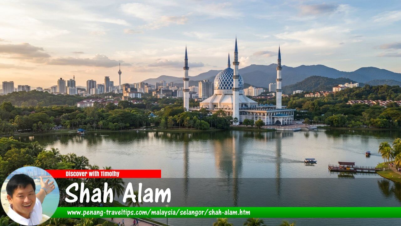 Shah Alam, Selangor (AI Generated on 17 July 2026)
Also available: Malay Edition
Shah Alam is the capital city of Selangor and one of Malaysia’s most important planned cities. Located in the western part of the Klang Valley, the city serves as the administrative centre of Selangor while also being a major hub for industry, education, commerce and residential development. Unlike older Malaysian cities that evolved organically from trading ports or mining settlements, Shah Alam was deliberately planned as a modern state capital, with dedicated government precincts, organised neighbourhoods, industrial zones, wide roads and extensive green spaces.
The story of Shah Alam is closely connected to Malaysia’s post-independence development. Its creation reflected the aspirations of a newly developing nation seeking to establish modern urban centres beyond the traditional dominance of Kuala Lumpur. The city also represents an important chapter in the evolution of planned urban development in the Klang Valley, following earlier examples such as Petaling Jaya and later inspiring future planned cities such as Putrajaya.
Today, Shah Alam combines the functions of a state capital with those of a thriving metropolitan city. From the iconic Sultan Salahuddin Abdul Aziz Shah Mosque to major industrial estates, universities, shopping centres and modern townships, the city reflects the transformation of Selangor from an agricultural economy into one of Malaysia’s most developed states.
Quick Facts
- Location: Shah Alam, Selangor, Malaysia
- State: Selangor
- Districts: Petaling District and Klang District
- Status: Capital city of Selangor
- City status: Granted on 10 October 2000
- State capital since: 1978
- Local authority: Shah Alam City Council (MBSA)
- Distance from downtown Kuala Lumpur (Dataran Merdeka): Approximately 27 km west
- Known as: Bandar Raya Anggerik (Orchid City)
- Major highways: Federal Highway, North–Klang Valley Expressway (NKVE), Shah Alam Expressway (KESAS), Guthrie Corridor Expressway and ELITE
- Major attractions: Sultan Salahuddin Abdul Aziz Shah Mosque, Shah Alam Lake Gardens, Taman Botani Negara Shah Alam and i-City
History
Origins and Early Development
Before Shah Alam became a modern city, the area was predominantly agricultural land covered by rubber plantations and oil palm estates. During the colonial period and the early years after independence, Selangor’s economic growth was closely tied to plantation agriculture, mining and trade. The Klang Valley, particularly Kuala Lumpur and Petaling Jaya, experienced rapid population growth as industrialisation accelerated.
By the mid-20th century, Kuala Lumpur had become increasingly congested. The success of Petaling Jaya, established in 1952 as Malaysia’s first planned satellite town, demonstrated that carefully planned urban expansion could help accommodate population growth while creating new economic centres outside the traditional city core.
The experience gained from Petaling Jaya provided valuable lessons in neighbourhood planning, land-use zoning and the creation of self-contained communities. As Selangor continued to grow, the need emerged for a new urban centre that could serve not only as a residential area but also as the administrative capital of the state.
The Founding of Shah Alam
The idea of developing a new city for Selangor emerged in the early 1960s. At the time, Kuala Lumpur was still the capital of Selangor, but the city’s rapid expansion created challenges. Furthermore, Kuala Lumpur was increasingly becoming the economic heart of the region, making it necessary for Selangor to establish its own administrative centre.
The area selected for the new city was strategically located between Kuala Lumpur and Port Klang, close to existing transportation routes and industrial areas. Its location allowed the new city to support both government administration and economic development.
Development of the new city began in 1963, initially under the name Sungai Renggam before eventually being named Shah Alam in honour of the late Sultan Alam Shah, the Sultan of Selangor from 1936 to 1960.
From the beginning, Shah Alam was conceived as a planned city rather than an extension of an existing settlement. Its layout incorporated residential neighbourhoods, industrial areas, commercial centres, government facilities, schools, religious institutions and recreational spaces. The intention was to create a balanced city where residents could live, work and access essential services within a well-organised urban environment.
Becoming the Capital of Selangor
A major turning point in Shah Alam’s history came in 1978, when Kuala Lumpur became a Federal Territory and was separated from Selangor. This created the need for Selangor to establish a new state capital, and Shah Alam was officially designated as the capital of Selangor.
The move transformed Shah Alam from a planned township into the political and administrative centre of one of Malaysia’s most important states. Government offices, state institutions and administrative facilities were gradually relocated to the city, creating a new civic identity.
The construction of the Sultan Salahuddin Abdul Aziz Shah Building, which houses the Selangor State Secretariat, symbolised Shah Alam’s role as the heart of state administration. The development of the Sultan Salahuddin Abdul Aziz Shah Mosque, completed in 1988, further strengthened the city’s identity as the capital of Selangor.
Growth into a Modern City
Following its designation as the state capital, Shah Alam continued to expand rapidly. Industrial development became one of the key drivers of growth, with manufacturing estates attracting companies involved in automotive, engineering, food processing, logistics and other industries.
Residential development also accelerated as new neighbourhoods were created to accommodate the growing workforce. The original numbered sections of Shah Alam were gradually complemented by newer master-planned townships such as Bukit Jelutong, Kota Kemuning, Setia Alam, Denai Alam and Elmina.
In 2000, Shah Alam was officially granted city status, recognising its growth into a major urban centre. Today, it is not only the administrative capital of Selangor but also an important component of the wider Klang Valley metropolitan area.
The evolution of Shah Alam reflects Malaysia’s broader transformation from a plantation-based economy into a modern industrial and service-oriented nation. Its carefully planned layout, strong institutional presence and continued expansion demonstrate the lasting influence of planned urban development in shaping Malaysia’s cities.
Urban Planning
One of the defining characteristics of Shah Alam is that it was conceived as a planned city from its earliest days. Unlike Kuala Lumpur, which grew organically from a mining settlement, or George Town, which developed as a colonial trading port, Shah Alam was designed with a clear vision: to become a modern state capital with a balanced combination of administration, industry, residential areas and public amenities.
The Influence of Petaling Jaya
The development of Shah Alam took place within the wider evolution of urban planning in the Klang Valley. Before Shah Alam, Petaling Jaya had already demonstrated the potential of planned suburban development. Established in 1952, Petaling Jaya was Malaysia's first major planned satellite town, created to address population pressure in Kuala Lumpur and provide new residential and industrial areas.
The success of Petaling Jaya provided important lessons for future urban development. Planners recognised the value of organising neighbourhoods around residential communities, separating incompatible land uses, reserving space for schools and public facilities, and providing road networks capable of supporting future growth.
When Shah Alam was conceived in the 1960s, it built upon these principles while adopting a much broader ambition. It was not merely intended to be a satellite town; it was designed to become the capital of an entire state. As a result, Shah Alam incorporated dedicated government precincts, larger industrial zones, extensive green spaces and a more structured urban layout.
The relationship between Petaling Jaya and Shah Alam represents an important chapter in Malaysia's urban development. Petaling Jaya demonstrated how planned suburban growth could succeed, while Shah Alam expanded that concept into a complete city with administrative, economic and social functions.
Planning Philosophy
The planning philosophy behind Shah Alam was based on creating a self-contained city where residents could access essential facilities close to their homes. Residential areas were developed together with schools, places of worship, neighbourhood shops, recreational spaces and public facilities.
The city was also designed around a hierarchy of land uses. Government buildings and civic institutions were concentrated in strategic areas, while industrial zones were located separately to support economic development without disrupting residential neighbourhoods.
Wide roads, landscaped avenues and reserved green spaces were incorporated into the original plan. This gave Shah Alam a more spacious character compared with older cities that developed under tighter land constraints.
The emphasis on greenery became one of Shah Alam's defining features. The city earned the nickname Bandar Raya Anggerik (Orchid City), reflecting its landscaped environment and the importance placed on creating a pleasant urban setting.
The Section System
One of the most recognisable features of Shah Alam is its use of numbered sections, known locally as Seksyen. This system was introduced as part of the city's planned layout and helped organise its expansion into clearly defined precincts.
The original city was developed around a series of numbered sections containing residential neighbourhoods, commercial areas, institutions and government facilities. Rather than relying primarily on traditional place names, these sections provided a systematic approach to organising a rapidly expanding city.
Some sections developed distinctive identities over time. For example, Seksyen 7 became strongly associated with Universiti Teknologi MARA (UiTM) and its large student population, while Seksyen 13 became known for its sports facilities, industrial areas and commercial developments. Seksyen 14 emerged as one of the city's established residential neighbourhoods.
As Shah Alam expanded, additional areas were incorporated using the U-section system. These later sections, such as U5, U8, U10, U12 and U13, represent the city's expansion beyond its original core into newer residential and mixed-use developments.
Expansion Beyond the Original City
Although Shah Alam began as a planned administrative city, its growth eventually extended beyond the original sections. Large-scale master-planned townships were developed around the city's outskirts, each with its own identity and character.
Developments such as Bukit Jelutong, Setia Alam, Kota Kemuning, Denai Alam and Elmina introduced new styles of suburban living, with gated communities, lifestyle commercial centres, landscaped parks and integrated developments.
These newer townships expanded Shah Alam's role from a government and industrial centre into a broader metropolitan city offering diverse residential options. They also strengthened Shah Alam's connection with surrounding areas such as Subang Jaya, Klang, Petaling Jaya and Sungai Buloh.
Geography
Location
Shah Alam is located in the western part of the Klang Valley, approximately 27 km west of downtown Kuala Lumpur, measured from Dataran Merdeka. The city occupies a strategic position between Kuala Lumpur and Port Klang, one of Malaysia's most important maritime gateways.
The city's location has been one of its greatest advantages. It sits along major transportation corridors connecting the eastern and western parts of Selangor, allowing it to function as both an administrative centre and an industrial hub.
Shah Alam shares borders with several important urban areas:
- Petaling Jaya and Subang Jaya to the east.
- Klang to the west.
- Putra Heights and Puchong to the south.
- Sungai Buloh and Kota Damansara to the north.
Landscape and Environment
The landscape of Shah Alam reflects its origins as former plantation land. Unlike older cities built around dense urban cores, Shah Alam was developed with more generous land reserves, allowing planners to incorporate parks, lakes and landscaped corridors.
The city's natural landscape includes gently undulating terrain, waterways and green areas that have been preserved as part of the urban environment. The Shah Alam Lake Gardens and Taman Botani Negara Shah Alam are examples of how recreational spaces were integrated into the city's design.
The combination of planned development and environmental features has contributed to Shah Alam's reputation as one of Malaysia's greener cities.
Demographics
As the capital of Selangor and part of the Klang Valley metropolitan region, Shah Alam has experienced significant population growth since its establishment. The city attracts residents from across Malaysia due to its employment opportunities, educational institutions, housing options and proximity to major economic centres.
The population of Shah Alam reflects Malaysia's multicultural character, with communities from different ethnic backgrounds contributing to the city's social and economic life. The presence of universities, particularly Universiti Teknologi MARA, has also created a significant student population that adds vibrancy to the city.
The city's demographic profile has evolved alongside its physical expansion. While the original sections were primarily designed around established residential communities, newer townships have introduced a wider range of housing types catering to different groups, from young professionals to families and retirees.
Administrative Capital of Selangor
The role of Shah Alam as the Administrative Capital of Selangor is central to its identity. After Kuala Lumpur became a Federal Territory in 1978, Shah Alam assumed the responsibility of serving as the seat of the Selangor state government.
The relocation of state administration gave Shah Alam a civic importance that distinguishes it from other cities in the Klang Valley. Government institutions, state departments and official buildings were developed around the city, creating an administrative precinct that serves the entire state.
The Sultan Salahuddin Abdul Aziz Shah Building, commonly known as the Selangor State Secretariat Building, is the most important symbol of this role. Together with the Sultan Salahuddin Abdul Aziz Shah Mosque, the building forms part of Shah Alam's most recognisable skyline.
Beyond its government function, Shah Alam's role as the state capital has influenced its wider development. The presence of government institutions has attracted supporting services, businesses, educational facilities and residential communities, helping transform Shah Alam into a complete modern city.
Economy
The economy of Shah Alam reflects the transformation of Selangor from an agricultural state into Malaysia's leading industrial and commercial region. When the city was first planned in the 1960s, one of its key objectives was to support economic development by providing space for industries while also serving as the administrative centre of Selangor.
Its strategic location between Kuala Lumpur and Port Klang gave Shah Alam a significant advantage. The city is connected to Malaysia's major economic corridors, allowing manufacturers, logistics operators and service businesses to benefit from access to urban markets, highways and one of the country's busiest ports.
Over the decades, Shah Alam has developed into a diversified economy consisting of manufacturing, logistics, retail, education, healthcare and professional services. While industry remains an important foundation of the city, its economy has evolved significantly beyond its original industrial role.
Manufacturing and Industry
Industrial development has been one of the main pillars of Shah Alam's growth. From its early years, the city was planned with dedicated industrial areas to attract investment and create employment opportunities for its growing population.
The Shah Alam industrial areas became home to companies involved in automotive manufacturing, engineering, food processing, electronics, chemicals and other sectors. The city's proximity to Port Klang, the Federal Highway and major expressways further strengthened its attractiveness as an industrial location.
One of Shah Alam's most significant industrial milestones was the establishment of the national automotive industry. The presence of automotive-related manufacturing activities helped position the city as an important centre within Malaysia's industrial landscape.
Industrial development also influenced the city's residential expansion. As factories and businesses created employment opportunities, demand grew for nearby housing, schools, commercial facilities and public amenities, contributing to the formation of many of Shah Alam's neighbourhoods.
Commerce and Services
While manufacturing remains important, Shah Alam has increasingly developed into a service-oriented city. The growth of government administration, education institutions, healthcare facilities and commercial centres has created a broader economic base.
Commercial districts have expanded across the city, ranging from traditional neighbourhood shopping areas to modern integrated developments. Areas such as Setia Alam, i-City and Kota Kemuning have introduced new lifestyle retail concepts, offices and mixed-use developments.
The city's role as the Selangor state capital has also generated demand for professional services, including finance, legal services, consultancy firms and government-related businesses.
Transportation
Transportation has played a crucial role in Shah Alam's development. As a planned city, Shah Alam was designed around a network of major roads and highways that connect its various sections and provide access to neighbouring cities.
Historically, private vehicles played a dominant role in the city's transport system. However, as the population grew and the Klang Valley became more interconnected, public transportation improvements became increasingly important.
Road Network
Shah Alam enjoys excellent highway connectivity, which has supported both residential growth and industrial development.
The city's major road connections include:
- Federal Highway: The historic east-west highway connecting Kuala Lumpur, Petaling Jaya, Shah Alam and Klang. It remains one of the most important transport corridors in the Klang Valley.
- North Klang Valley Expressway (NKVE): Providing a fast connection between Shah Alam, Petaling Jaya, Kuala Lumpur and northern Selangor.
- Shah Alam Expressway (KESAS): Connecting Shah Alam with Subang Jaya, Puchong, Bandar Kinrara and Kuala Lumpur's southern suburbs.
- Guthrie Corridor Expressway (GCE): Improving connectivity between Shah Alam, northern Selangor and areas such as Sungai Buloh.
- ELITE Highway: Providing access towards Kuala Lumpur International Airport and southern Selangor.
The extensive highway network has been one of Shah Alam's greatest strengths, allowing residents and businesses to access surrounding urban centres efficiently. It has also encouraged the growth of newer townships on the city's outskirts.
Rail Transport
Although Shah Alam was originally developed during a period when private vehicles dominated urban mobility, rail transportation has become increasingly important as the Klang Valley moves towards a more integrated public transport system.
The city is served by the KTM Komuter network, which provides rail connections between Shah Alam and other parts of Selangor and Kuala Lumpur. Stations such as Shah Alam KTM Station and Batu Tiga KTM Station connect residents to the wider Klang Valley rail network.
A major development in Shah Alam's public transportation history is the LRT Shah Alam Line, part of the Rapid KL rail network. The new line is designed to improve connectivity between Shah Alam, Petaling Jaya, Subang Jaya and Klang, providing an alternative mode of transport for residents and reducing dependence on private vehicles.
The introduction of mass transit represents a new phase in Shah Alam's development, complementing the city's original road-based planning with more sustainable urban mobility options.
Bus Services
Bus services remain an important part of Shah Alam's public transport system. Rapid KL bus services connect residential neighbourhoods, commercial areas, educational institutions and transport hubs throughout the city.
As Shah Alam expanded into newer townships, bus connectivity became increasingly important in linking suburban communities with employment centres and public facilities.
Education
Education has played a significant role in shaping Shah Alam's identity. The city is home to major universities, colleges and schools, making it one of Selangor's important educational centres.
Universities and Higher Education
The most prominent educational institution in Shah Alam is Universiti Teknologi MARA (UiTM), one of Malaysia's largest public universities. Its main campus occupies a significant area of the city and has had a profound influence on Shah Alam's development.
The presence of UiTM has contributed to the growth of student communities, rental housing, retail businesses and supporting services. It has also strengthened Shah Alam's reputation as a knowledge and education hub.
Other higher education institutions in and around Shah Alam include:
- Management and Science University (MSU)
- Universiti Selangor (UNISEL)
- Politeknik Sultan Salahuddin Abdul Aziz Shah
- various private colleges and training institutions
Schools
As a planned city, Shah Alam was developed with schools integrated into residential neighbourhoods. Primary and secondary schools are distributed throughout the city's sections and townships, allowing communities to have access to education facilities close to home.
The growth of newer townships such as Setia Alam, Kota Kemuning and Denai Alam has also brought the development of additional schools, including private and international schools catering to a diverse population.
Healthcare
Healthcare facilities form an important part of Shah Alam's role as a complete modern city. As the population expanded, the city developed a range of public and private healthcare facilities serving both Shah Alam residents and communities from surrounding areas.
The main public healthcare facility is Shah Alam Hospital, which provides specialist and general medical services for the population of the city and surrounding districts.
Private healthcare facilities have also expanded, including specialist hospitals that serve the growing residential communities of Shah Alam and the wider Klang Valley.
Among the notable healthcare providers in Shah Alam are:
- Shah Alam Hospital
- KPJ Selangor Specialist Hospital
- Avisena Specialist Hospital
- Columbia Asia Hospital – Setia Alam
The growth of healthcare services reflects Shah Alam's transition from a planned administrative city into a mature metropolitan centre capable of supporting a large and diverse population.
Shopping
The shopping landscape of Shah Alam reflects the city's evolution from a planned administrative and industrial centre into a mature metropolitan city. While the city was not originally developed as a retail destination, population growth and the emergence of newer townships have resulted in a diverse range of shopping facilities serving different communities.
Shopping centres in Shah Alam range from established city-centre malls to modern lifestyle developments integrated with residential and commercial areas. These provide residents with everyday conveniences, dining options, entertainment facilities and community spaces.
Among the notable shopping destinations in Shah Alam are:
- AEON Mall Shah Alam: A major shopping centre serving residents in the central and eastern parts of the city, offering retail stores, supermarkets, dining outlets and entertainment facilities.
- Central i-City: A modern integrated shopping mall located within i-City, combining retail, dining, entertainment and hospitality facilities as part of a larger mixed-use development.
- Kompleks PKNS Shah Alam: One of the city's earliest major commercial complexes, located near the state administrative area and historically significant as a retail landmark in Shah Alam.
- Plaza Alam Sentral: A shopping centre located in the city centre, serving surrounding residential communities and government offices.
- SACC Mall: A city-centre shopping mall connected with the Shah Alam Convention Centre, offering retail, dining and lifestyle facilities.
- Setia City Mall: A major lifestyle shopping destination serving Setia Alam and the western parts of Shah Alam, featuring a wide range of retail, food and entertainment options.
The development of newer retail destinations, particularly in Setia Alam and i-City, reflects a broader trend in Shah Alam's urban growth. Commercial centres are increasingly designed as lifestyle destinations rather than simply places for shopping, combining retail with recreation, dining and public spaces.
Parks and Recreation
Green spaces have always been an important element of Shah Alam's urban planning philosophy. Unlike many older cities where parks were added after urbanisation, Shah Alam incorporated recreational areas into its original design.
The city's landscaped environment was intended to create a better balance between development and nature. This approach contributed to Shah Alam's reputation as one of Malaysia's greener cities and reinforced its identity as a family-friendly place to live.
Among the major parks and recreational areas in Shah Alam are:
- Shah Alam Lake Gardens: A central recreational landmark featuring landscaped lakes, walking paths, gardens and open spaces for leisure activities.
- Taman Botani Negara Shah Alam: One of Malaysia's largest botanical parks, preserving natural landscapes while offering educational and recreational activities.
- Setia Alam Community Trail: A recreational area popular among residents for walking, jogging and outdoor activities.
- Kota Kemuning Lakeside: A landscaped recreational area serving one of Shah Alam's established townships.
These recreational spaces demonstrate how Shah Alam's planners incorporated quality of life considerations into the city's development. Parks were not treated as leftover spaces but as essential components of urban living.
Tourist Attractions of Shah Alam
Although Shah Alam is primarily known as the administrative capital of Selangor, the city has developed a growing collection of attractions that showcase its architecture, culture, history, nature and modern lifestyle.
The attractions below are arranged alphabetically for easier navigation. Some of these landmarks have become closely associated with Shah Alam's identity and may warrant their own dedicated pages in the future.
i-City
i-City is one of Shah Alam's best-known modern attractions. Located in the western part of the city, this integrated development combines commercial, residential, hospitality and entertainment components.
The development became particularly famous for its digital light displays and illuminated attractions, earning recognition as a popular evening destination. Beyond entertainment, i-City represents the newer phase of Shah Alam's transformation into a modern lifestyle city.
Kompleks PKNS Shah Alam
Kompleks PKNS Shah Alam is one of the city's earliest commercial landmarks. Developed by the Selangor State Development Corporation (PKNS), the complex played an important role in providing retail facilities when Shah Alam was still developing as a new state capital.
Its location near the civic centre reflects the importance placed on creating commercial facilities close to government and residential areas.
Laman Seni 7
Laman Seni 7 is an outdoor art space that showcases street art and creative works. Located in the Seksyen 7 area, it reflects the changing character of Shah Alam's urban spaces, where commercial areas are increasingly incorporating art and community activities.
The attraction has become a popular location for photography and a representation of Shah Alam's younger, more creative side.
Masjid Sultan Salahuddin Abdul Aziz Shah
Masjid Sultan Salahuddin Abdul Aziz Shah, also known as the Blue Mosque, is the most recognisable landmark in Shah Alam. Completed in 1988, the mosque features one of the world's largest mosque domes and dominates the city's skyline.
Beyond its religious function, the mosque has become a symbol of Shah Alam's identity as the capital of Selangor. Its architecture reflects Islamic design traditions while representing the aspirations of a modern Malaysian state.
MBSA Gallery
MBSA Gallery provides visitors with insights into the history, development and administration of Shah Alam. Operated by the Shah Alam City Council, the gallery helps explain the city's transformation from plantation land into a planned modern city.
Shah Alam Convention Centre
Shah Alam Convention Centre serves as one of the city's important venues for conferences, exhibitions, meetings and community events. Its location near the city centre reinforces Shah Alam's role as an administrative and business hub.
Shah Alam Lake Gardens
Shah Alam Lake Gardens is one of the city's most significant recreational landmarks. Designed as part of Shah Alam's planned landscape, the gardens feature lakes, landscaped areas and walking trails that provide residents and visitors with a natural retreat within the city.
The gardens represent one of the clearest examples of Shah Alam's original planning philosophy, where greenery and recreation were integrated into urban development.
Sultan Alam Shah Museum
Sultan Alam Shah Museum preserves and presents the history, culture and heritage of Selangor. Located near the city's administrative centre, the museum provides visitors with an understanding of the state's historical development.
Taman Botani Negara Shah Alam
Taman Botani Negara Shah Alam is one of Malaysia's most important urban botanical parks. Covering a large area, it contains forests, gardens, lakes and educational facilities that allow visitors to experience nature within an urban environment.
The park reflects Shah Alam's commitment to preserving green spaces while promoting environmental awareness and outdoor recreation.
Wet World Shah Alam
Wet World Shah Alam is a family-oriented water theme park that has been a recreational destination for residents and visitors for many years.
Located near the Shah Alam Lake Gardens, it complements the city's wider collection of leisure attractions and contributes to Shah Alam's reputation as a family-friendly city.
Major Townships of Shah Alam
The growth of Shah Alam has extended far beyond its original planned sections. Over the decades, new master-planned townships have emerged around the city, each contributing a distinct identity to the wider Shah Alam urban area.
Unlike the original sections, which were organised primarily through a numbered planning system, these newer developments were created as independent townships with their own residential communities, commercial centres, recreational facilities and lifestyle offerings.
The following major townships are arranged alphabetically for easier reference.
Batu Tiga
Batu Tiga is one of the older localities associated with the Shah Alam area. Located along the important Kuala Lumpur–Klang corridor, it predates the development of modern Shah Alam and has historical significance as a transport and industrial area.
The locality is served by Batu Tiga KTM Komuter Station and has long been associated with industrial activities due to its strategic position between Kuala Lumpur, Shah Alam and Klang.
Bukit Jelutong
Bukit Jelutong is a prestigious township developed on the eastern side of Shah Alam. Known for its landscaped environment, low-density residential areas and emphasis on green spaces, it represents a newer generation of planned suburban development.
The township features residential communities, commercial areas, recreational facilities and strong connectivity to surrounding areas such as Subang Jaya, Petaling Jaya and Kuala Lumpur.
Denai Alam
Denai Alam is a modern township developed with an emphasis on family-oriented living and a green environment. Located in the northern part of Shah Alam, it features residential neighbourhoods, parks and community facilities.
The township forms part of the newer expansion of Shah Alam, reflecting the city's continued growth beyond its original boundaries.
Elmina
Elmina is a large-scale township development that has become one of the most significant growth areas in northern Shah Alam. Developed as a master-planned township, it combines residential areas, commercial districts, parks and business developments.
The township is known for its emphasis on green spaces, including large recreational areas that form part of its identity as a modern sustainable development.
Glenmarie
Glenmarie is a mixed-use township located on the eastern side of Shah Alam, close to Subang Jaya and Petaling Jaya. It has developed into an important commercial, industrial and residential area.
The township is known for its business parks, automotive-related industries, golf facilities and upscale residential developments. Its strategic location has made it one of the most connected parts of Greater Shah Alam.
Kota Kemuning
Kota Kemuning is one of Shah Alam's established residential townships, located in the southern part of the city. Developed as a self-contained township, it features residential neighbourhoods, commercial centres, schools, parks and recreational facilities.
The township is particularly known for its landscaped environment, lakeside areas and family-oriented lifestyle.
Setia Alam
Setia Alam is one of the largest and most prominent townships in Shah Alam. Developed as a comprehensive township, it combines residential communities, commercial areas, educational facilities and recreational spaces.
The township has become a major growth centre in western Shah Alam and is recognised for its integrated planning, Setia City Mall, landscaped parks and extensive range of housing options.
Subang Bestari
Subang Bestari is a residential township located in the northern part of Shah Alam near Sultan Abdul Aziz Shah Airport. Despite its name, it is administratively associated with Shah Alam rather than Subang Jaya.
The township offers a range of residential developments and benefits from its proximity to educational institutions, highways and surrounding commercial areas.
Temasya
Temasya is a modern mixed-use development located near Glenmarie. It combines commercial, business and residential components, reflecting the trend towards integrated urban developments within the Klang Valley.
Its location provides convenient access to Shah Alam, Subang Jaya, Petaling Jaya and Kuala Lumpur, making it attractive to both businesses and residents.
Notable Sections of Shah Alam
The original Shah Alam was organised according to a numbered section system. While many sections continue to function primarily as neighbourhood areas, several have developed distinct identities due to their institutions, commercial activities or historical importance.
Only sections with particularly notable characteristics are highlighted below.
Seksyen 7
Seksyen 7 is one of Shah Alam's best-known sections, largely due to its close association with Universiti Teknologi MARA (UiTM). The large student population has shaped the area's character, creating a vibrant environment with restaurants, accommodation, retail outlets and services.
The section is also home to attractions such as Laman Seni 7 and has become one of the more active commercial areas of Shah Alam.
Seksyen 9
Seksyen 9 is closely associated with the civic centre of Shah Alam. Located near major government buildings and landmarks, it forms part of the administrative heart of the city.
The section benefits from its proximity to the Sultan Salahuddin Abdul Aziz Shah Mosque, state government facilities and central recreational areas.
Seksyen 13
Seksyen 13 is one of Shah Alam's major commercial and sports districts. It is known for the Shah Alam Stadium area, industrial developments, business premises and educational institutions.
The section demonstrates the original planning concept of separating different urban functions while creating dedicated zones for specific activities.
Seksyen 14
Seksyen 14 is one of Shah Alam's mature residential neighbourhoods. It represents the established character of the original city, with older housing developments, local amenities and established communities.
Its location near the city centre provides residents with convenient access to government facilities, shopping areas and public amenities.
Why Live in Shah Alam?
Shah Alam offers a unique combination of advantages that distinguish it from many other cities in the Klang Valley. As a planned city, it provides a more spacious urban environment compared with denser neighbouring cities, while still offering excellent connectivity to major employment centres.
The city's strengths include:
- Strategic location: Situated between Kuala Lumpur and Port Klang with access to major highways.
- Planned environment: Wide roads, green spaces and organised neighbourhoods.
- Employment opportunities: Strong industrial, administrative and service sectors.
- Education facilities: Home to major universities including UiTM.
- Family-friendly environment: Numerous schools, parks and recreational facilities.
- Diverse housing options: From established neighbourhoods to modern master-planned townships.
For residents seeking a balance between urban convenience and a more spacious suburban lifestyle, Shah Alam remains one of Selangor's most attractive cities.
Overview
Shah Alam represents one of Malaysia's most successful examples of planned urban development. From its origins as former plantation land to its emergence as the capital of Selangor, the city reflects the country's transformation during the post-independence era.
The city's development was influenced by earlier planned towns such as Petaling Jaya, yet it expanded those ideas further by combining administration, industry, residential communities and recreation within a single planned environment.
Today, Shah Alam is more than just the seat of the Selangor government. It is a complete city with a strong economic base, established institutions, diverse communities and a growing collection of townships that continue to shape its future.
Understanding Shah Alam means understanding an important chapter in Malaysia's urban story: the transition from organically grown towns towards deliberately planned cities designed for modern living.
Shah Alam is  on the Map of Towns in Selangor
Map of sights in Shah Alam
List of sights in Shah Alam
- IDCC Mall (GPS: 3.06603, 101.52745)

- SACC Mall (GPS: 3.07162, 101.51811)

- Setia City Mall (GPS: 3.10925, 101.46012)

- Shah Alam Convention Centre (GPS: 3.07008, 101.51851)

- Shah Alam Royale Theatre (GPS: 3.07473, 101.52333)

- Sultan Salahuddin Abdul Aziz Shah Mosque (GPS: 3.07826, 101.52157)

- Taman Botani Negara Shah Alam (GPS: 3.09541, 101.51143)

- Taman Tasik Shah Alam (GPS: 3.07291, 101.5139)

- UOA Business Park (GPS: 3.08601, 101.58727)

Categories of sights in Shah Alam
- Auditoriums in Shah Alam
- Chinese Restaurants in Shah Alam
- Convention Centres in Shah Alam
- Parks in Shah Alam
- Shopping Malls in Shah Alam
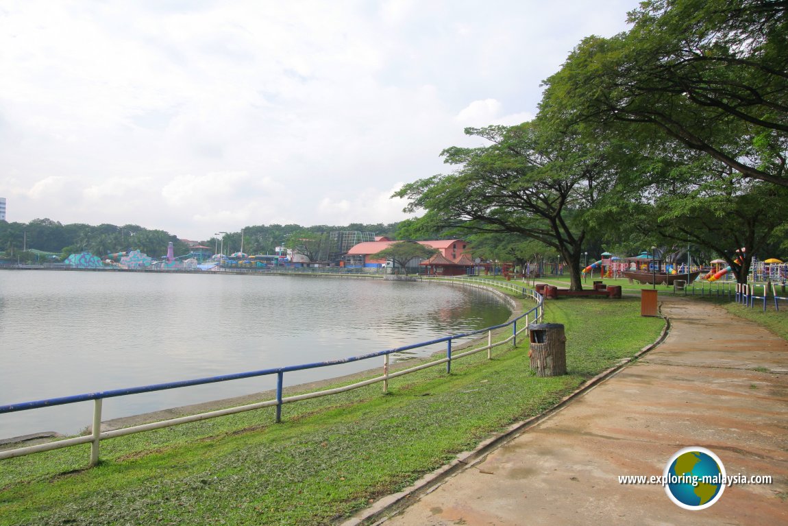 Taman Tasik Shah Alam (29 December, 2006)
References
- Shah Alam City Council (MBSA) – Official information on Shah Alam's history, administration and development.
- Selangor State Government – Information on the administration and development of Selangor.
- Petaling Jaya City Council (MBPJ) – Historical background of Petaling Jaya as Malaysia's first planned satellite town.
- Universiti Teknologi MARA (UiTM) – Information on its Shah Alam campus.
- Relevant township developers and official development websites.
Page Details
This page was created on 17 July 2026. Hi, my name is Timothy and created it from my research, for my own entertainment, knowledge and to satisfy my curiosity. I am providing the information to you in good faith and hope it is useful. I try to get the details as accurate as possible. I also try to update the page whenever I stumble on new details. So this and all my other pages are perpetual work in progress. If you discover any error, please politely inform me, pointing out where the error lies, and I will correct it as soon as possible. Your helpfulness will keep this page accurate, relevant and helpful to those who need the information.Living in Selangor
 Latest Pages & Updates
Buy Me A Coffee
If you enjoy the information I provide and want to support the work I do, please buy me a coffee! I appreciate it immensely, thank you so much!
