
Bukit Mertajam Travel Guide
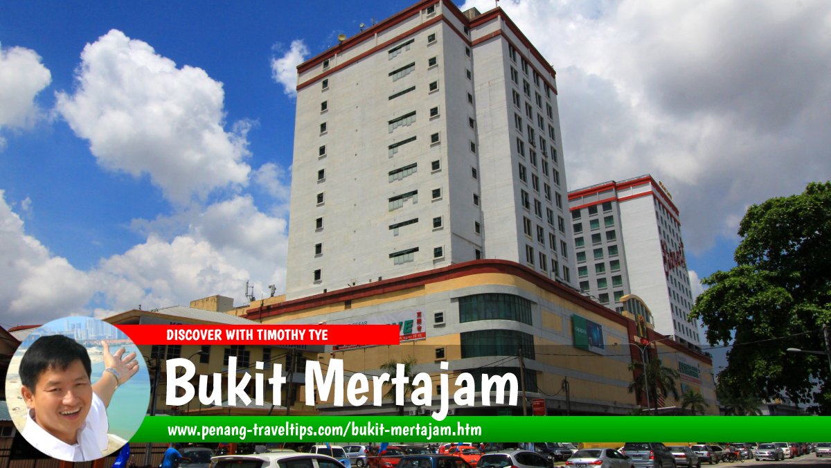 Bukit Mertajam, Seberang Perai, Penang (3 May 2015)

Also available: Panduan Melawat Bukit Mertajam
Bukit Mertajam is a major town in Seberang Perai Tengah, on the mainland portion of Penang, Malaysia. Located near the foot of the hill that gives the town its name, it serves as a commercial, transport and residential centre for the surrounding communities. Bukit Mertajam is known for its traditional town centre, railway station, local markets, nearby forest reserve and the Minor Basilica of St Anne, an important Catholic pilgrimage destination that attracts visitors from Malaysia and abroad.1
Quick Facts
Name: Bukit Mertajam
Malay name: Bukit Mertajam
Jawi: بوکيت مرتاجم
Chinese name: 大山脚
Chinese Pinyin: Dà Shān Jiǎo
Penang Hokkien: Tua33 Snua3 Kha1
State: Penang, Malaysia
District: Seberang Perai Tengah
Local authority: Seberang Perai City Council (MBSP)
Geographical coordinates: 5.36552° N, 100.46056° E
Known for: Cherok Tokun, the Minor Basilica of St Anne, its historic town centre and railway station
Geography and Location
Bukit Mertajam is situated in Seberang Perai Tengah, one of the administrative districts on Penang's mainland. It lies inland from the coast and is surrounded by a mixture of established residential neighbourhoods, commercial areas, industrial developments and agricultural land. The town is part of the wider urban area of central Seberang Perai, which also includes places such as Perai, Bukit Tengah, Alma and Juru.
The town developed near a prominent hill known as Bukit Mertajam. The hill and its surrounding green areas provide a natural landmark amid the increasingly urbanised landscape of mainland Penang. The surrounding lowlands have historically supported agriculture, while roads, railways and newer developments have strengthened the area's connections with other parts of the state.
Bukit Mertajam's approximate geographical coordinates are 5.36552° N, 100.46056° E. These coordinates identify the town area rather than a single official boundary or a specific tourist attraction.
History of Bukit Mertajam
Bukit Mertajam developed from a settlement serving the agricultural communities of central Seberang Perai. The surrounding countryside supported farming, and the town gradually became a centre where residents could obtain supplies, conduct business and access public services.
Chinese communities, including Teochew and Hakka settlers, played an important role in the development of the town and its surrounding settlements. Agriculture was a significant part of the local economy, alongside the shops, markets and services that supported farmers and other residents.
As the population increased, Bukit Mertajam developed a more established commercial centre. Traditional shophouses, places of worship and local markets became part of its urban landscape. The town also benefited from the development of road and railway connections, which linked it with other settlements in Penang and the wider Malay Peninsula.
Over time, Bukit Mertajam expanded beyond its original town centre. Residential neighbourhoods, schools, commercial premises and industrial areas developed around it, reflecting the broader urbanisation of Seberang Perai. Despite these changes, the older part of town remains an important place for understanding its development as a regional centre.
Historic buildings and religious sites provide evidence of the communities that helped shape the town. The area around St Anne's Church, in particular, reflects the long history of Catholic settlement and pilgrimage in Bukit Mertajam.2
Origin of the Name Bukit Mertajam
The name Bukit Mertajam combines the Malay word bukit, meaning hill, with Mertajam, the name associated with the nearby hill. The Chinese name 大山脚 (Dà Shān Jiǎo) is commonly used for the town.
The precise origin of the word Mertajam is not entirely settled. One explanation connects it with the Malay word tajam, meaning sharp or pointed, possibly referring to the shape or profile of the hill. Another traditional explanation associates the name with a tree known locally as mertajam. The tree has been identified botanically as Lepisanthes rubiginosa, formerly known as Erioglossum rubiginosum.
These explanations should be treated as proposed interpretations rather than a definitively established etymology. The name of the hill became the name of the growing settlement at its foot.
The Hill and Cherok Tokun
Bukit Mertajam Hill
The hill is a prominent natural feature near the town. Its forested slopes contrast with the built-up surroundings and form part of the area's landscape identity. The hill is closely associated with Cherok Tokun, a forested area popular with people who enjoy outdoor recreation.
Cherok Tokun
Cherok Tokun is one of the best-known natural attractions in the Bukit Mertajam area. It is associated with the forest reserve on the hill and is visited by hikers, walkers and people seeking a green environment away from the busy town centre.
The area is known for its forest vegetation, uphill trails and natural surroundings. Visitors should be prepared for uneven paths and changes in elevation, and should wear suitable footwear. Weather conditions can affect trail surfaces, particularly after rain.
Cherok Tokun also has historical interest. The wider area contains features that have attracted attention from heritage researchers, including evidence of earlier infrastructure and traces of the region's past. The combination of natural and historical interest makes it an important part of Bukit Mertajam's local identity.3
Visitors should check current access arrangements and local guidance before setting out. Facilities, trail conditions and restrictions may change, and not every forested area is necessarily open to unrestricted public access.
The Historic Town Centre
The older town centre of Bukit Mertajam contains traditional commercial streets, shophouses, local businesses and places of worship. These streets developed to serve the surrounding farming settlements and later became part of a larger urban centre.
Traditional shophouses are a characteristic feature of many Malaysian towns established during the late nineteenth and early twentieth centuries. In Bukit Mertajam, the older commercial buildings reflect the town's role as a place for retail trade, food businesses and everyday services. Some buildings have been altered or replaced as the town has modernised, but the older streets continue to provide a sense of its earlier urban form.
Exploring the town centre on foot is a useful way to observe its commercial character. Visitors may encounter traditional coffee shops, bakeries, provision shops, markets and businesses serving local residents. As in many established towns, the atmosphere varies according to the time of day and the activity of individual streets.
The town is also known for its diverse religious landscape. Chinese temples, Hindu temples, churches and other places of worship reflect the communities that have lived in and around Bukit Mertajam. These buildings are part of the area's social and cultural history, although visitors should observe the rules and customs of each site.
Minor Basilica of St Anne
The Minor Basilica of St Anne is one of Bukit Mertajam's most significant religious landmarks. Located in the town's wider vicinity, the Catholic church and its surrounding grounds form an important centre of worship and pilgrimage. The history of the Catholic community in the area dates back to the nineteenth century.2
The site developed as a place of worship for Catholic communities in the region. Over the years, the church became increasingly well known for its annual celebration in honour of St Anne, the mother of the Virgin Mary in Christian tradition. The pilgrimage attracts large numbers of worshippers, including visitors from other parts of Malaysia and overseas.
The annual St Anne's feast is generally held in July, although the dates and programme vary from year to year. Celebrations may include religious services, prayers, processions and other activities organised by the church. The event is widely recognised as one of Malaysia's major Catholic pilgrimages.4
The basilica and its associated religious buildings are of interest to both pilgrims and visitors studying the history of Christianity in Penang. Visitors who are not attending religious services should dress respectfully, follow the site's instructions and avoid disrupting worship.
Anyone planning a visit during the feast should allow extra time for travel, as the large crowds can affect road access, parking and movement around the church. For dates, service schedules and access arrangements, consult the church's official announcements before travelling.
Bukit Mertajam Railway Station
Bukit Mertajam Railway Station is an important transport facility serving the town and surrounding parts of mainland Penang. The station forms part of Malaysia's national railway network and provides connections for passengers travelling along the west coast rail corridor.
The station is significant because Bukit Mertajam lies near the junction of railway routes serving the northern part of Peninsular Malaysia. It provides access to other destinations along the network, subject to the services and timetables in operation. The station has also undergone modernisation as part of the wider development of Malaysia's electrified railway system.5
Rail passengers should check the current timetable, ticket availability and service information before travelling. The availability of particular train services can change, and not every train necessarily stops at every station.
Bukit Mertajam Market and Local Food
Markets and food businesses are part of the everyday life of Bukit Mertajam. The town serves residents from its older neighbourhoods as well as people who travel from surrounding villages and newer residential areas to shop, eat or conduct business.
Traditional markets are places to find fresh produce, household necessities and locally prepared food. Their operating hours and range of goods may differ, so visitors interested in a particular market should confirm its current schedule locally.
Local Food
Bukit Mertajam's food scene reflects the multicultural character of Penang. Chinese, Malay and Indian food businesses operate in the town and surrounding neighbourhoods, offering a range of everyday meals, snacks and drinks.
Visitors may find familiar Penang favourites such as char koay teow, curry mee, noodle dishes, rice meals, roti canai and local coffee-shop fare. The availability and style of particular dishes vary between establishments, and a dish's presence should not be taken to mean that it originated in Bukit Mertajam.
For visitors seeking a more local experience, exploring the older commercial streets and neighbourhood food outlets can be worthwhile. Some businesses operate mainly in the morning, while others are more active in the evening. It is advisable to check opening hours before making a special trip to a particular stall or restaurant.
Muslim travellers should verify whether a food outlet is halal-certified or otherwise suitable for their requirements rather than assuming that every establishment serving a particular dish meets those requirements.
Places of Worship and Cultural Heritage
In addition to the Minor Basilica of St Anne, Bukit Mertajam and its surrounding communities contain religious buildings associated with different ethnic and faith communities. Chinese temples and shrines, Hindu temples and churches form part of the area's cultural landscape.
These places of worship serve their respective communities and may also be of interest to visitors studying local history, architecture and religious practice. Their significance is best understood in the context of the communities that established and maintain them.
Visitors should be mindful that active places of worship are not simply tourist attractions. Photography may be restricted in certain areas, and access to particular rooms or ceremonies may be limited. Asking permission and following posted instructions helps ensure a respectful visit.
Getting to Bukit Mertajam
Bukit Mertajam is accessible by road and rail. Its position in central Seberang Perai makes it a useful base for travelling to other parts of mainland Penang, as well as to Penang Island through the road connections across the Penang Strait.
By Car
Visitors can reach Bukit Mertajam through the road network serving Seberang Perai. The North-South Expressway and local roads connect the area with other towns in northern Peninsular Malaysia. Travellers coming from Penang Island can use either of the two Penang bridges, depending on their starting point and destination.
Road travel times vary with traffic conditions, particularly during peak commuting hours, weekends and major religious events. Visitors attending the St Anne's feast should allow additional time for congestion and follow any temporary traffic arrangements.
By Train
The railway station provides an alternative for visitors travelling from other towns served by Malaysia's rail network. Passengers should select a service that stops at Bukit Mertajam and arrange onward transport from the station if their accommodation or destination is not within convenient walking distance.
By Bus and Local Transport
Local and regional bus services may connect Bukit Mertajam with other parts of Seberang Perai and Penang. Routes, frequencies and operating hours can change, so travellers should check current service information before relying on a particular bus connection.
Ride-hailing services and taxis may be useful for reaching attractions and residential areas that are not well served by public transport. Availability can vary by location and time of day.
Road Distances from Bukit Mertajam
The following distances are measured by road from the junction of Jalan Arumugam Pillai and Jalan Aston, near the centre of Bukit Mertajam. They are approximate and may vary according to the route selected.
- Penang Sentral, Butterworth: 11.9 km
- Penang Bridge access: 10.2 km
- Second Penang Bridge access: 23.2 km
- Penang International Airport: 28.0 km
These figures indicate road distances rather than straight-line measurements. Actual journey times depend on traffic, road conditions and the precise entrance or access point used.
Accommodation
Bukit Mertajam and the wider Seberang Perai Tengah area offer accommodation options for visitors travelling for business, family visits, religious events or sightseeing. Depending on availability, choices may include hotels, budget accommodation and other short-stay lodging.
Visitors attending the St Anne's feast may prefer to arrange accommodation well in advance, as demand can increase considerably during the pilgrimage period. Those planning to explore several parts of Penang may also compare accommodation in Bukit Mertajam with options in Butterworth, Perai and other nearby towns.
When choosing a place to stay, consider its distance from the railway station or bus services, access to food outlets, parking availability and the destinations you intend to visit. Current prices, facilities and availability should be confirmed directly with the accommodation provider.
Shopping and Commercial Activities
Bukit Mertajam functions as a commercial centre for nearby residential areas and smaller settlements. Its shops and services cater to everyday needs, including groceries, clothing, household goods, food, personal services and vehicle-related businesses.
The older town centre remains useful for visitors interested in traditional shops and local businesses, while newer commercial developments around the wider urban area provide additional shopping and service options. The exact range of outlets changes over time as businesses open, relocate or close.
For travellers, shopping in Bukit Mertajam is generally more about everyday local commerce than visiting a single major tourist shopping landmark. Visitors can combine a walk through the older streets with a meal at a local food outlet or a visit to nearby cultural and natural attractions.
Getting Around Bukit Mertajam
The best way to explore Bukit Mertajam depends on the places being visited. The older town centre can be explored on foot, although pavement conditions, traffic and the distance between destinations should be taken into account.
A car or ride-hailing service is more convenient for reaching destinations outside the centre, including Cherok Tokun and the St Anne's pilgrimage site. Public transport may be suitable for certain journeys, but visitors should check routes and schedules in advance.
Those planning to hike should prepare separately for the terrain and weather. Carry drinking water, wear suitable footwear and follow any restrictions or safety advice posted at the site. Avoid entering closed trails or unfamiliar forest areas without appropriate guidance.
Best Time to Visit
Bukit Mertajam can be visited throughout the year. The town centre, markets and food outlets are suitable for ordinary day visits, while Cherok Tokun may appeal to visitors looking for outdoor recreation.
Travellers interested in the St Anne's pilgrimage should plan around the annual feast in July and check the church's announcements for the confirmed dates and programme. The pilgrimage period is also likely to be the busiest time around the church, so visitors who prefer a quieter visit may wish to choose another date.
Penang's tropical climate is generally warm and humid, with rain possible throughout the year. For outdoor activities, check the weather forecast and avoid exposed or slippery trails during heavy rain.
Conclusion
Bukit Mertajam is an important town in central Seberang Perai, combining a long-established commercial centre with modern residential and transport infrastructure. Its identity is closely connected to the nearby hill, the forested area of Cherok Tokun, the historic railway connection and the Minor Basilica of St Anne.
For visitors, the town offers a view of mainland Penang beyond the better-known destinations on the island. Its older streets, diverse places of worship, local food businesses and access to nearby natural areas make it a useful destination for exploring the history and everyday life of Seberang Perai.
 Map of Bukit Mertajam
Sights in Bukit Mertajam in alphabetical order
Apartments and condominiums in Bukit Mertajam
- Aston Acacia (GPS: 5.36321, 100.46549)

- Berjaya Condominium (GPS: 5.34858, 100.47082)

- BM City Suites (GPS: 5.36717, 100.43873)

- BM Residence (GPS: 5.36026, 100.45446)

- Casa Residence (GPS: 5.35133, 100.46506)

- Dutamas Residence (GPS: 5.36795, 100.45523)

- Evoke Residence (GPS: 5.37036, 100.41668)

- Exo Residences (GPS: 5.34296, 100.43531)

- Goodfields Residence (GPS: 5.32971, 100.44958)

- Mahkota Impian (GPS: 5.3656, 100.42769)

- Metropol (GPS: 5.3701, 100.43682)

- Pangsapuri Seri Jaya (GPS: 5.3656, 100.42769)

- Prominence (GPS: 5.3656, 100.42769)

- Rumah Pangsa Desa Wawasan (GPS: 5.35627, 100.44711)

- Sentosa Residence (GPS: 5.35374, 100.46929)

- Spectrum Residence (GPS: 5.34864, 100.45879)

- The Signature (GPS: 5.36693, 100.41875)
- The Sky (GPS: 5.30984, 100.4972) planned

- Utama Sanctuary (GPS: 5.33443, 100.46243)

- Taman Daya Maju townhouse (GPS: 5.35038, 100.46516)

 Banks in Bukit Mertajam
- Bank Simpanan Nasional, Jalan Aston (GPS: 5.365083, 100.462061)
- CIMB Bank, Jalan Stesen (GPS: 5.361991, 100.461535)
- Hong Leong Bank, Jalan Song Ban Kheng (GPS: 5.350657, 100.438895)
- Maybank, Jalan Danby (GPS: 5.363134, 100.461728)
- OCBC, Pusat Perniagaan Gemilang (GPS: 5.350911, 100.440048)
- Public Bank, Jalan Aston (GPS: 5.362840, 100.463263)
Businesses in Bukit Mertajam
- Baby Farlin
- Esteem Beauty Centre
- Ezone Computer Centre
- Jade Nursing Home (GPS: 5.3607, 100.42337)

- Pusat Digital Wah Lee Group
- Suka Computer Service
- YewSoft Systems (Software Solution Company), 23, Lorong Sentul 9, Taman Sentul Indah, 14000 Bukit Mertajam.
Business Hours: Mon-Fri 8:30am to 6:00pm
Website: http://www.yewsoft.com.my/
Phone: 0194770728
Cemeteries in Bukit Mertajam
- Berapit Chinese Cemetery (GPS: 5.38837, 100.48796)

- Bukit Mertajam Roman Catholic Cemetery (GPS: 5.35532, 100.47454)

- The Heaven Memorial Park (GPS: 5.37473, 100.5221)

Commercial Properties in Bukit Mertajam
- Exo Horizon (GPS: 5.34203, 100.43478)

- Utama Plaza (GPS: 5.36652, 100.45879)
 (disused)
- Orange BM (GPS: 5.3524, 100.45543)

Eateries in Bukit Mertajam
- Kedai Kopi Bukit Mertajam
- Kedai Makanan Heng Lee (GPS: 5.36259, 100.46077)

- Kedan Makanan & Minuman Sentosa Corner (GPS: 5.35377, 100.47217)

- Medan Selera Taman Sentosa (GPS: 5.35361, 100.47249)

- Restoran Chiap Hong (GPS: 5.36286, 100.46072)

- Restoran Xin Fu
Food Stalls in Bukit Mertajam
- Orang Hock Rojak Stall (GPS: 5.36286, 100.46072)
Government buildings in Bukit Mertajam
- Bandar Perda Fire & Rescue Station (GPS: 5.37153, 100.44547)

- Ibu Pejabat Polis Seberang Perai Tengah (GPS: 5.37176, 100.44289)

- Seberang Perai City Council Building (GPS: 5.37098, 100.43282)

Hospitals and health clinics in Bukit Mertajam
- Hospital Bukit Mertajam (GPS: 5.35986, 100.46463)

- KPJ Penang Specialist Hospital (GPS: 5.36938, 100.43334)

Hotels in Bukit Mertajam
- Citadines Prai Penang (GPS: 5.34179, 100.43469)

- FUHotel (GPS: 5.35475, 100.41956)

- Sri Indar Hotel (GPS: 5.36441, 100.45096)


- Summit Hotel Bukit Mertajam (GPS: 5.36592, 100.46156)

- E-Red Hotel Alma Cosmo (GPS: 5.33172, 100.48519)


- E-Red Hotel Bandar Perda (GPS: 5.36647, 100.43677)

- Hotel Palm Inn Bukit Mertajam (GPS: 5.36407, 100.43181)

- Iconic Hotel Penang (GPS: 5.34196, 100.43274)


- My Hotel Bukit Mertajam (GPS: 5.34965, 100.47278)

Housing estates in Bukit Mertajam
- 98 Residence (GPS: 5.32646, 100.43763)

- Aston Heights (GPS: 5.36393, 100.46552)

- Aston Park East (GPS: 5.36749, 100.46492)

- Aston Villa (GPS: 5.36545, 100.46437)

- BM Highland (Taman Jadi Indah)
 (GPS: 5.32646, 100.51483)

- BM Permai (GPS: 5.33281, 100.452)

- Casa Perdana (GPS: 5.37602, 100.41126)

- Desa Impian 2 (GPS: 5.30752, 100.49315)

- Desa Prominence (GPS: 5.3665, 100.42835)

- Hillpark Residences (GPS: 5.32513, 100.49464)

- Jesselton Hills (GPS: 5.31775, 100.4881)

- Kensington Residence (GPS: 5.34752, 100.46728)

- Orange Villa (GPS: 5.35564, 100.45181)

- Permatang Sanctuary (GPS: 5.30789, 100.48289)

- Quattro Regency (GPS: 5.35913, 100.45108)

- Residency Palma (GPS: 5.31438, 100.48972)

- Residensi Bukit Kecil (GPS: 5.35355, 100.4552)

- Residensi Harmoni (GPS: 5.36225, 100.45105)

- Residensi Seri Pauh (GPS: 5.37229, 100.41889)

- Sentinelle Ville (GPS: 5.33114, 100.46273)
- Sentrino (GPS: 5.33137, 100.48361)

- Signature Two (GPS: 5.36751, 100.41797)
- Spectrum Garden (GPS: 5.34846, 100.45888)

- Sunway Wellesley (GPS: 5.36943, 100.45663)

- Taman Alma Jaya (GPS: 5.32581, 100.47944)

- Taman Bukit Permata (GPS: 5.33633, 100.48226)

- Taman Desa Cahaya (GPS: 5.33633, 100.48226)

- Taman Camellia (GPS: 5.37449, 100.4393)

- Taman Gemilang Permai (GPS: 5.3522, 100.43871)

- Taman Harmoni (GPS: 5.36206, 100.45149)

- Taman Manggis Indah (GPS: 5.36282, 100.45463)

- Taman Kerjasama (GPS: 5.35971, 100.42621)

- Taman Saujana Permai (GPS: 5.34583, 100.46501)

- Taman Seri Betik (GPS: 5.36206, 100.45149)
- Vila Seri Setia (GPS: 5.35643, 100.42061)

- Taman Setia (GPS: 5.35827, 100.42121)

- The Glades (GPS: 5.31852, 100.48466)

- Tropicale Residency (GPS: 5.33434, 100.50031)

- Villa Lagenda (GPS: 5.35478, 100.44198)

Industrial Properties in Bukit Mertajam
- Alma Signature (GPS: 5.31236, 100.47643)

Places of interest in Bukit Mertajam
- Bandar Perda Bicycle Lane
- Bukit Mertajam Recreational Forest (GPS: 5.35901, 100.49344)

- Bukit Tengah Roundabout (GPS: 5.36453, 100.42525)

- Cherok Tokun Relics (GPS: 5.35277, 100.47659)

- Dewan MBSP Taman Kota Permai (GPS: 5.34143, 100.45854)

- Rumah Tuan Guru Haji Othman (GPS: 5.40728, 100.47435)

- Suling Hill (GPS: 5.40703, 100.5091)

- Woodhaven (GPS: 5.3549, 100.44822)

Markets in Bukit Mertajam
- Bukit Mertajam Market (GPS: 5.3635, 100.46042)

- Pasar Awam Kampung Baru Bukit Mertajam (GPS: 5.34866, 100.47326)

- Pasar Pemborong Ikan Bukit Mertajam (GPS: 5.36579, 100.44083)

- Taman Sri Rambai Market (GPS: 5.34684, 100.44687)

Places of worship in Bukit Mertajam
- Bukit Mertajam Baptist Church (GPS: 5.35634, 100.46822)
- Bukit Mertajam Gospel Centre (GPS: 5.34567, 100.44586)

- Bukit Mertajam Tua Pek Kong Temple (GPS: 5.34567, 100.44586)

- Cherok Tokun Jiu Long Gong Temple (GPS: 5.3547, 100.49198)

- Chinese Methodist Church Bukit Mertajam (GPS: 5.36053, 100.46465)

- Church of the Sacred Heart of Jesus (ruins) (GPS: 5.35887, 100.52077)

- Dhammavana Meditation Centre (GPS: 5.361, 100.47092)

- Faith Community Church (GPS: 5.35352, 100.4693)

- Hai Tang Ma Temple (GPS: 5.34736, 100.52256)

- Kompleks Sukan MPSP (GPS: 5.35469, 100.44956)

- Kuan Yin Temple (GPS: 5.36765, 100.46297)

- Masjid Daerah Seberang Perai Tengah (GPS: 5.36978, 100.43068)

- Masjid Jamek Al-Hidayah (GPS: 5.36805, 100.41931)

- Masjid Jamek Cherok Tokun Bawah (GPS: 5.34674, 100.48617)

- Masjid Jamek Permatang Kebun Sireh (GPS: 5.36095, 100.43707)

- Nandaka Vihara Buddhist Monastery (GPS: 6.435766, 100.190755)

- Shui Lian Gong Temple 大山脚栳叶园水濂宫 (GPS: 5.35249, 100.4579)

- Sri Dewa Jada Muniswarar Temple (GPS: 5.35955, 100.46501)

- Sri Mangalanayagi Amman Devasthanam Temple (GPS: 5.36122, 100.46405)

- St Andrew's Presbyterian Church (GPS: 5.35112, 100.47023)

- St Anne's Church (GPS: 5.35272, 100.47722)

- Taman Jernih Tua Pek Kong Temple (GPS: 5.34232, 100.47958)

- Taman Sentosa Tua Pek Kong Temple (GPS: 5.3533, 100.47331)

- Taman Tema MPSP (GPS: 5.35361, 100.45059)

- Wat Chanthararam (GPS: 5.40703, 100.5091)

- Wat Rajchaphohong (GPS: 5.42833, 100.5108)

- Yew Min Kung Temple (GPS: 5.3555, 100.4703)

Organisations in Bukit Mertajam
- Chang Hua Kor Moral Uplifting Society (GPS: 5.36915, 100.46296)

- Tek Chiao Tze Ch'ih Ko Moral Uplifting Society (GPS: 5.35593, 100.4704)

Petrol Stations in Bukit Mertajam
- BHPetrol Bukit Minyak (GPS: 5.34103, 100.4374)

- BHPetrol Bukit Tengah (GPS: 5.34103, 100.4374)

- BHPetrol Jalan Kulim (GPS: 5.34848, 100.48325)

- BHPetrol Jalan Sungai Rambai (GPS: 5.34848, 100.48325)

- Caltex Alma (GPS: 5.32211, 100.47713)

- Caltex Bandar Perda (GPS: 5.36786, 100.42601)

- Caltex Bukit Minyak (GPS: 5.32878, 100.44888)

- Caltex Jalan Song Ban Kheng (GPS: 5.351, 100.45366)

- Caltex Jalan Sungai Rambai (GPS: 5.36418, 100.45254)

- Caltex Permatang Rawa (GPS: 5.3684, 100.44571)

- Caltex Taman Sentosa (GPS: 5.3531, 100.47371)

- Petron Jalan Kulim (GPS: 5.361767, 100.463867)

- Petron Cherok Tokun (GPS: 5.34434, 100.48719)

- Petron Bukit Minyak (GPS: 5.32936, 100.44812)

- Petron Bukit Tengah (GPS: 5.36581, 100.4225)

- Petron Jalan Rozhan (GPS: 5.33751, 100.48416)

- Petron Permatang Batu (GPS: 5.36494, 100.42958)

- Petronas Alma (GPS: 5.32473, 100.47709)

- Petronas Bandar Perda (GPS: 5.367727, 100.428559)

- Petronas Bukit Minyak (GPS: 5.33834, 100.44015)

- Petronas Bukit Tengah (GPS: 5.35046, 100.43374)

- Petronas Cherok Tok Kun (GPS: 5.34501, 100.492)

- Petronas Jalan Rozhan (GPS: 5.3347, 100.48275)

- Petronas Permatang Batu (GPS: 5.36448, 100.43406)

- Petronas Permatang Batu (GPS: 5.3692, 100.44921)

- Petronas Tanah Liat (GPS: 5.37547, 100.4645)

- Shell Bukit Minyak (GPS: 5.33493, 100.46472)

- Shell Jalan Bukit Tengah (GPS: 5.359272, 100.427179)

- Shell Kubang Semang (GPS: 5.39451, 100.46466)

Private Buildings in Bukit Mertajam
- St Joachim Hall (GPS: 5.35592, 100.46739)
Public Transport in Bukit Mertajam
- Bukit Mertajam Railway Station (GPS: 5.36889, 100.4477)

Roads in Bukit Mertajam
- Jalan Alma
- Jalan Aston
- Jalan Arumugam Pillai
- Jalan Betek 1
- Jalan Bukit Minyak
- Jalan Bukit Permata
- Jalan Bunga Raya
- Jalan Chian Heng Kai
- Jalan Damai
- Jalan Danby
- Jalan Dato Ooh Chooi Cheng
- Jalan Kampung Baru
- Jalan Kampung Besar
- Jalan Kebun Sireh
- Jalan Kota Permai
- Jalan Kulim
- Jalan Lembah Permai 2
- Jalan Maju
- Jalan Maju Flyover
- Jalan Megat Harun
- Jalan Murthy
- Jalan Muthu Palaniappan
- Jalan Pasar
- Jalan Perda Selatan
- Jalan Rozhan
- Jalan Seri Bukit
- Jalan Song Ban Kheng
- Jalan Stesyen
- Jalan Sungai Rambai
- Lengkok Bukit Kecil
- Lorong Bukit Kecil Indah 2
- Lorong Bukit Tengah
- Lorong Kota Permai 7
- Lorong Mertajam
- Lorong Nangka 5
- Lorong Perda Utama 3
- Lorong Setia Sentral 2
- Lorong Tembikai 2
- Lorong Usahaniaga 1
- Lorong Usahaniaga 4
Schools in Bukit Mertajam
- Convent Bukit Mertajam (GPS: 5.35889, 100.46523)
- Sekolah Kebangsaan Kebun Sireh (GPS: 5.35796, 100.43621)

- SJK(C) Beng Teik (GPS: 5.3474, 100.45705)

- SJK (C) Peng Bin (GPS: 5.34928, 100.43505)

- Sekolah Menengah Kebangsaan Bukit Mertajam (GPS: 5.350804, 100.470528)
Shopping centres and hypermarkets in Bukit Mertajam
- AEON Mall Bukit Mertajam (GPS: 5.32013, 100.47705)

- Billion Shopping Centre (GPS: 5.34197, 100.45931)

- Mydin Mall (GPS: 5.36884, 100.4147)

- Perda City Mall (GPS: 5.37003, 100.44054)
- The Summit Bukit Mertajam Plaza (GPS: 5.36592, 100.46156)
Map of villages in Bukit Mertajam
Map of places in Bukit Mertajam
- Bukit Mertajam Town Centre (GPS: 6.435766, 100.190755)
- Alma (GPS: 5.32241, 100.48207)
- Ara Kuda (GPS: 5.43858, 100.51228)
- Bandar Perda (GPS: 5.37017, 100.44031)

- Berapit (GPS: 5.38351, 100.47657)
- Cherok Tokun (GPS: 5.34689, 100.48692)
- Kampung Gambir (GPS: 5.36376, 100.4387)

- Kampung Kebun Sireh (GPS: 5.35753, 100.4363)

- Kampung Pelet (GPS: 5.41397, 100.46173)
- Kampung Siam (GPS: 5.3608, 100.43706)

- Kampung Telok (GPS: 5.33527, 100.45372)
- Kampung Teluk Wang (GPS: 5.42406, 100.50958)
- Kampung Tok Elong (GPS: 5.38724, 100.46316)
- Kubang Semang (GPS: 5.3994, 100.46473)
- Kubang Ulu (GPS: 5.40721, 100.47516)
- Ladang Chip Joo (GPS: 5.34903, 100.43466)

- Machang Bubok (GPS: 6.435766, 100.190755)
- Mengkuang (GPS: 5.34198, 100.50374)
- Padang Lalang (GPS: 5.36519, 100.44776)
- Penanti (GPS: 5.40682, 100.46917)
- Permatang Nibong (GPS: 5.38995, 100.43707)
- Permatang Rawa (GPS: 5.36945, 100.44992)
- Sungai Lembu (GPS: 5.39099, 100.52202)
- Sungai Rambai (GPS: 5.36421, 100.4536)
- Sungai Semambu (GPS: 5.39317, 100.46429)
- Tanah Liat (GPS: 5.3787, 100.46482)
How to go to Bukit Mertajam
Rapid Penang Bus Nos. 701, 702 and 802 go to Bukit Mertajam.
If you are driving there, the coordinate for the Bukit Mertajam town centre is 6.435766, 100.190755.
Bukit Mertajam is on the Map of Seberang Perai
References
- Visit Penang: Bukit Mertajam
- MyPenang: St Anne's Church
- Penang Heritage Trust: Cherok Tokun and the Heritage of Bukit Mertajam
- Visit Penang: St Anne's Feast Day
- Malaysia Railway: Bukit Mertajam Railway Station
- Seberang Perai City Council: Heritage Map
- MyPenang: Seberang Perai Discovery Trail
Page Details
This page was created on 20 October 2026. Hi, my name is Timothy and created it from my research, for my own entertainment, knowledge and to satisfy my curiosity. I am providing the information to you in good faith and hope it is useful. I try to get the details as accurate as possible. I also try to update the page whenever I stumble on new details. So this and all my other pages are perpetual work in progress. If you discover any error, please politely inform me, pointing out where the error lies, and I will correct it as soon as possible. Your helpfulness will keep this page accurate, relevant and helpful to those who need the information.Want to share your Penang travel experiences or get tips from fellow travellers?
Join the Penang Travel Tips Facebook GroupUseful guides for visiting Penang
My Videos of Penang
Latest Pages & Updates
Buy Me A Coffee
If you enjoy the information I provide and want to support the work I do, please buy me a coffee! I appreciate it immensely, thank you so much!
