
Gelugor
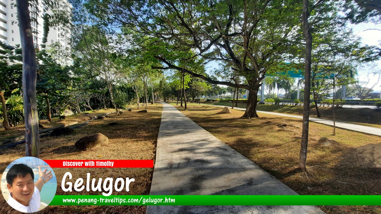 The Light Linear Park in Gelugor, Penang (30 January 2022)

Also available: Gelugor (Edisi BM) & 格鲁戈
Gelugor (Tamil: குளுகோர்) is an established urban district on the eastern side of Penang Island, immediately south of George Town. Historically an agricultural area of coconut plantations and cattle-rearing land, it has developed into a mixed residential, educational, commercial and waterfront district. It is best known today as the home of Universiti Sains Malaysia (USM), the residential neighbourhoods of Bukit Gelugor and Minden Heights, and the coastal corridor along the Tun Dr Lim Chong Eu Expressway. The area also retains traces of its earlier Malay and Indian communities, whose history is closely connected with the former Brown Estate.1
Quick Facts
- Name: Gelugor, also officially spelt Glugor in gazetted place-name usage
- Location: Eastern side of Penang Island, south of George Town
- GPS coordinates: 5.38003, 100.30785
- Historical land use: Coconut cultivation, agricultural estates and cattle rearing
- Associated historical landowner: David Brown
- Major institution: Universiti Sains Malaysia (USM)
- Main road: Jalan Sultan Azlan Shah
- Other important roads: Tun Dr Lim Chong Eu Expressway and Jalan Bukit Gambir
- Nearby areas: George Town, Batu Uban, Sungai Nibong, Minden Heights and Bukit Gelugor
- Approximate distance to Komtar: 7.3 km by road from Gelugor Roundabout
- Approximate distance to Penang Bridge access: 5.6 km by road
- Public transport: Rapid Penang buses along Jalan Sultan Azlan Shah
- Character: University district, residential neighbourhood, commercial corridor and waterfront development area
Geography and Location
Gelugor occupies part of the eastern coastal plain of Penang Island, between the urban districts around George Town and the southern neighbourhoods leading towards Sungai Nibong and Bayan Lepas. Its landscape includes low-lying coastal land, older settlements, residential streets and elevated areas such as Bukit Gelugor and Bukit Dumbar. The wider locality has expanded considerably as agricultural land was converted into housing, educational institutions, roads and commercial developments.
The Gelugor Roundabout is a useful reference point for identifying the northern part of the district. Historically, it marked the southern edge of George Town's built-up area, beyond which the land was regarded as being outside the city. Today, urban development extends continuously through this part of Penang Island, and the distinction between George Town and its southern suburbs is less apparent on the ground.
The district's main transport corridor is Jalan Sultan Azlan Shah, which runs along the eastern side of the island and connects Gelugor with George Town, Sungai Nibong and the southern parts of Penang. The Tun Dr Lim Chong Eu Expressway provides a faster coastal route for through traffic, while Jalan Bukit Gambir serves areas around the university and the inland residential neighbourhoods.
Gelugor also has an important relationship with the sea. Coastal land along the eastern side of the district has undergone substantial redevelopment, including the creation of modern residential and commercial projects. The Light waterfront development is one example of the transformation of this part of the coast.
History of Gelugor
The Agricultural Estate of David Brown
During the nineteenth century, much of the land in what is now Gelugor and the surrounding Minden area formed part of the estate associated with David Brown, a Scottish landowner and agricultural entrepreneur who held extensive property on Penang Island. The estate included land used for cultivation and cattle rearing. Coconut groves and grazing areas were among the agricultural features of the district before modern urban development took place.2
The estate economy brought different communities into the area. Malay families lived in traditional settlements, including the settlement around Sungai Gelugor, while Indian workers and cattle keepers became associated with the agricultural land. The area's social history was therefore shaped by both established village life and the labour needs of the estate.
The Indian community's connection with cattle rearing remained particularly visible in the history of Kampung Buah Pala, a village whose residents included descendants of workers associated with the former Brown Estate. The village later became widely known as “High Chaparral”, reflecting its rural character and cattle-rearing heritage within a rapidly urbanising district.
From Rural District to Urban Suburb
Gelugor remained substantially rural into the middle of the twentieth century. Agricultural land, village settlements and grazing areas continued to occupy much of the district, even as George Town expanded southwards. The construction of new roads and the establishment of public institutions gradually changed the area's role within Penang Island.
A military installation known as Minden Barracks was established in the area in 1939. The barracks remained in use until 1971, and its land subsequently became the site of Universiti Sains Malaysia's main campus. The military history of Minden is an important part of Gelugor's transition from an agricultural district to an institutional and residential centre.3
Universiti Sains Malaysia and Minden
Universiti Sains Malaysia (USM) was established in 1969 as Malaysia's second university. Initially known as Universiti Pulau Pinang, it moved to its present campus at Minden in 1971. The campus occupies a substantial area of land and has become one of the defining features of modern Gelugor.4
The arrival of USM brought students, academics, administrative staff and other workers into the district. It also stimulated demand for housing, food outlets, shops, transport and other services. Over time, the area around the university developed into a major education-related residential and commercial zone.
The university's presence continues to influence local life. Student accommodation, private apartments, food businesses and shops serve the campus community, while the institution's research and educational activities connect Gelugor with other parts of Malaysia and the wider international academic community.
Housing Development in Bukit Gelugor and Minden Heights
As Penang Island became more urbanised, the former estate land was progressively converted into housing and public facilities. Residential development spread across Bukit Gelugor and neighbouring areas, including government housing and established neighbourhoods such as Brown Garden. The name Brown Garden commemorates the historical association with David Brown and the former estate.
Government quarters were also built in parts of the district, including the area around Hilir Pemancar. Over subsequent decades, private housing estates, apartment buildings and condominiums expanded to accommodate a growing population. Minden Heights became one of the better-known residential neighbourhoods, while other parts of Gelugor developed a mix of landed homes and higher-density housing.
The growth of residential development changed the local landscape. Land once used for agriculture became streets, housing estates, commercial premises and institutional facilities. Some of the older village areas and religious sites survived within the new urban environment, providing links with the district's earlier communities.
Kampung Buah Pala
Kampung Buah Pala, also known as High Chaparral, was a traditional Indian settlement in Bukit Gelugor associated with the history of the former Brown Estate. Its residents included families whose ancestors had worked in cattle rearing and other estate-related activities. The village became the focus of a major land dispute when redevelopment plans threatened the settlement.
The dispute attracted widespread public attention in the 2000s. After a series of legal proceedings, houses in the village were demolished in 2009 to make way for redevelopment. The loss of Kampung Buah Pala marked a significant change in the district's cultural landscape and remains an important episode in discussions of land rights, urban development and the preservation of traditional communities in Penang.5
The former village is no longer an intact traditional settlement. Its history, however, helps explain the connection between the present-day urban district and the agricultural estate that preceded it.
Origin and Spelling of the Name Gelugor
The name Gelugor is the spelling widely used by residents and in everyday references to the district. The spelling Glugor is also used in official gazetted place-name usage. In 2019, the Penang state government announced a move to standardise place names and restore gazetted spellings, including Glugor. The two spellings can therefore appear in different maps, records and local business names.6
The place name is commonly associated with the Malay word “gelugur”, which refers to a tree known in English as the garcinia or asam gelugur tree. Its fruit is used in regional cooking, particularly as a souring ingredient. The spelling and pronunciation of place names can change over time, so the local form Gelugor and the gazetted form Glugor coexist in modern usage.
Gelugor should not be confused with a single town centre. It is a broad locality containing several neighbourhoods and institutions, while the Gelugor postal designation may also cover nearby places beyond the narrower historical district.
Neighbourhoods and Residential Areas
Gelugor is made up of several distinct neighbourhoods, each with its own character. Some are established residential areas with landed homes, while others contain apartments, condominiums or newer mixed-use developments. The presence of USM also means that the district has housing occupied by students, university employees and people working in nearby parts of Penang.
Bukit Gelugor
Bukit Gelugor is an elevated residential area within the wider district. It includes established housing, apartments and newer residential developments. Some parts of the neighbourhood occupy sloping ground, with roads connecting the residential streets to Jalan Sultan Azlan Shah and Jalan Bukit Gambir.
The area's development reflects the gradual conversion of former estate land into urban housing. It is also associated with the history of Kampung Buah Pala, which stood in this part of Gelugor before its demolition in 2009.
Minden and Minden Heights
Minden is best known as the location of the main USM campus and the former Minden Barracks. The university campus occupies a large tract of land and includes academic buildings, student facilities, research centres, sports grounds and landscaped areas.
Minden Heights is a residential neighbourhood near the university. It contains landed properties and other housing, and benefits from access to the university, local shops and the wider road network. Despite their proximity, the university campus and the residential neighbourhood have distinct functions and should not be treated as a single development.
Brown Garden
Brown Garden is an established residential enclave whose name recalls the historical association of the area with David Brown. Its development is part of the wider shift from agricultural land to planned housing in Gelugor. The neighbourhood is connected to the surrounding roads and local facilities serving the district.
Bukit Dumbar and Nearby Housing Areas
Bukit Dumbar and the surrounding residential areas form part of the wider urban landscape around Gelugor. The area contains housing, local streets and recreational spaces. Depending on the boundary being used, nearby neighbourhoods and postal addresses may also be described as part of Gelugor even where they are regarded locally as separate areas.
Places of Interest in Gelugor
Universiti Sains Malaysia
USM is Gelugor's most prominent institution and a major centre of higher education in Malaysia. Its main campus includes faculties, libraries, student facilities, research centres and sports amenities. The campus is extensive, and access to individual buildings or facilities may be subject to university rules, security arrangements and scheduled activities.
For visitors interested in education and the history of the area, USM provides a useful point of reference for understanding the transformation of Minden from a military site into a university campus. The university's institutional history also reflects the expansion of higher education in Malaysia after independence.
Historic Minden Barracks Site
The former Minden Barracks occupied the land that later became the main USM campus. The barracks operated from 1939 to 1971, and the site's military history has been documented through historical research and oral accounts. Although the university campus has largely taken over the former barracks landscape, the site's past remains relevant to the history of Gelugor and Minden.3
Visitors should not assume that all parts of the university grounds or any surviving historical structures are open for unrestricted sightseeing. Those wishing to explore the campus should check current visitor arrangements and respect university access requirements.
Sri Veerama Kaliamman Devasthanam
Sri Veerama Kaliamman Devasthanam is a Hindu temple associated with the Indian community of Gelugor. Hindu shrines and temples in the district provide evidence of the longstanding presence of Tamil communities, including families whose history is linked with the former agricultural estate.
The temple remains part of the area's religious and cultural landscape. Visitors should be mindful of worshippers, dress respectfully and follow any instructions displayed at the temple, especially during religious ceremonies.
Masjid Jamek Sungai Gelugor
Masjid Jamek Sungai Gelugor serves the local Muslim community and is associated with the traditional Malay settlement around Sungai Gelugor. The mosque reflects the older village history of the district, which predates the expansion of modern residential and university development.
The Light Waterfront
The Light is a modern waterfront development along the eastern coast of Gelugor. It includes residential and commercial components and forms part of the redevelopment of the coastal corridor beside the Tun Dr Lim Chong Eu Expressway. The area represents a newer phase of urban development, contrasting with the older village streets and housing areas further inland.
Some parts of the waterfront may provide views of the sea and the mainland across the channel. Access to private residential or commercial areas may be restricted, so visitors should use public spaces and follow posted access rules.
Penang Bridge
The Penang Bridge is an important landmark in the coastal landscape south of Gelugor. The bridge connects Penang Island with Seberang Perai on the mainland and is a major route for commuters, freight and intercity travel. The coastal road network near Gelugor provides access towards the bridge, although the bridge itself is reached via its designated approach roads.
Shopping and Daily Amenities
Gelugor is a functioning urban district rather than a standalone tourist town. Residents have access to supermarkets, neighbourhood shops, convenience stores, pharmacies, restaurants and other daily services along Jalan Sultan Azlan Shah and around the residential areas.
Commercial developments near the coast and along the main road provide additional shopping and dining options. The e-Gate commercial area and Udini Square are among the retail destinations in the wider Gelugor area, while local shops and food stalls continue to serve long-established neighbourhoods.
For fresh produce and everyday groceries, residents can use local markets and food shops, including the Taman Tun Sardon Market. As individual shops, tenants and opening hours may change, visitors should verify current information when planning a specific shopping trip.
Food in Gelugor
Gelugor's food scene reflects its mixed residential population, university community and position along one of Penang Island's main urban corridors. Food outlets include Chinese coffee shops, hawker stalls, Malay eateries, Indian restaurants, cafés, bakeries and casual dining businesses. Many are concentrated along Jalan Sultan Azlan Shah and around the university and commercial developments.
Visitors can find everyday Penang favourites such as noodles, rice dishes, roti canai, nasi campur, local snacks and drinks. The presence of students and university staff supports a range of reasonably priced meals, while newer commercial areas provide cafés and restaurants with different dining styles.
For a local experience, explore the neighbourhood food shops rather than expecting a single central food street. Opening hours vary: breakfast stalls and coffee shops may operate early, while some restaurants and cafés serve customers into the evening. During university semesters, food outlets near USM can be particularly active around class changes and meal times.
Education and Public Facilities
Besides USM, Gelugor has primary and secondary schools serving families in the surrounding residential neighbourhoods. The presence of schools, university facilities and training institutions has made education a major part of the district's identity.
The district also contains public and community facilities, places of worship, sports venues and government offices. The Fisheries Department maintains an office on Jalan Akuarium in Gelugor, reflecting the area's continuing connection with Penang's coastal and fisheries administration.7
Healthcare is available through clinics and medical practices in the wider district, while major hospital services can be reached elsewhere on Penang Island. The choice of facility depends on the type of care required and the patient's location.
How to Get to Gelugor
By Car
Gelugor is accessible from George Town and other parts of Penang Island through Jalan Sultan Azlan Shah. From the city centre, drivers can travel south along the main urban road towards the Gelugor Roundabout and continue towards the university, Batu Uban or Sungai Nibong, depending on their destination.
The Tun Dr Lim Chong Eu Expressway offers an alternative route for through traffic along the eastern coast. Jalan Bukit Gambir is useful for reaching USM and inland residential areas. Drivers should select a route based on the specific neighbourhood or building, since Gelugor extends across a large area and some local roads serve only particular residential developments.
Distances from Gelugor
Measured from Gelugor Roundabout, the approximate road distances to selected destinations are:
- Komtar, George Town: 7.3 km
- Penang Bridge access: 5.6 km
- Second Penang Bridge access: 13.6 km
- Penang International Airport: 11.2 km
These are approximate road distances, not straight-line measurements. The actual distance and journey time depend on the precise starting point, the route selected and the bridge access point used. Traffic can be heavy during commuting periods, particularly on the roads connecting George Town, Gelugor, the bridge and the southern employment areas.
By Bus
Rapid Penang buses operate along Jalan Sultan Azlan Shah, connecting Gelugor with other districts on Penang Island. Routes serving stops along this corridor have included services 102, 206, 301, 302, 303, 304 and 401, although routes and timetables can change.8
Passengers travelling to USM, the local commercial areas or residential neighbourhoods should check the nearest bus stop and current route information before setting out. The nearest stop may still require a walk, especially for destinations within the university campus or on the inland side of the main road.
The Sungai Nibong Express Bus Terminal is located in the wider area to the south of Gelugor. It provides long-distance coach services to destinations on the Malaysian mainland and elsewhere in the country. Travellers arriving by intercity coach can continue to Gelugor by local bus, taxi or e-hailing service, depending on their destination and arrival time.
By Taxi or E-hailing
Taxi and e-hailing services are practical options for travelling between Gelugor, George Town, the airport, USM and the southern parts of Penang Island. They are particularly convenient for visitors carrying luggage or travelling to locations that are not close to a bus stop.
When arranging a pick-up at USM, a residential complex or a commercial development, use a clearly identified entrance or meeting point. The campus and some housing developments cover large areas, so providing the building name or exact entrance can help avoid confusion.
Getting Around Gelugor
Jalan Sultan Azlan Shah is the principal road for travelling through Gelugor, but it is not always the most direct route between two nearby destinations. Local roads connect residential neighbourhoods to the main corridor, while the expressway is primarily intended for longer-distance traffic.
Walking is practical within individual neighbourhoods, around some commercial areas and within parts of the USM campus. However, the district is spread out, and walking between the coast, the university and inland housing areas can involve substantial distances, road crossings or steep sections. Visitors should consider the weather, pavement conditions and the availability of safe pedestrian crossings.
Cycling may be suitable for some local journeys, but the main roads carry significant traffic. Riders should plan routes carefully and avoid assuming that all major roads provide continuous protected cycling facilities.
Traffic and Urban Development
Gelugor's road network carries several types of traffic: residents travelling to work and school, students and staff moving to USM, vehicles heading towards the Penang Bridge, and traffic travelling between George Town and the southern parts of the island. These overlapping movements can lead to congestion, particularly during morning and evening peak periods.
The Tun Dr Lim Chong Eu Expressway helps accommodate coastal through traffic, but access points and junctions can still become busy. Jalan Sultan Azlan Shah also serves local businesses and residential entrances, meaning that local turning movements and vehicles entering or leaving commercial premises can slow traffic.
Continued development of residential and commercial properties has increased the importance of transport planning, pedestrian access, drainage and public amenities. The district's mix of older village settlements, university land, established housing and newer waterfront development means that its urban form is varied rather than uniform.
Where to Stay in Gelugor
Gelugor is not primarily a hotel district, but its location between George Town and the southern part of Penang Island makes it a practical base for some visitors. Accommodation may include hotels or serviced apartments in the wider area, as well as privately operated short-term rentals where legally available. Travellers should verify the exact address, current availability and any restrictions before booking.
Visitors attending conferences, academic programmes or events at USM may find accommodation in or near Gelugor convenient because it reduces the distance to the campus. Those visiting family or conducting business in the southern districts may also benefit from the area's road connections.
For travellers whose main interest is George Town's heritage core, staying in the city centre may be more convenient for walking to historic buildings, museums and central dining areas. Gelugor is accessible from George Town, but travel times depend on traffic and the location of the accommodation. Visitors without a car should consider bus frequency, walking distances and the availability of e-hailing services.
Gelugor's Role in Modern Penang
Gelugor illustrates the transformation of Penang Island from an economy based partly on plantations and rural settlements into a highly urbanised environment. Its history includes agricultural estates, Malay village life, Tamil communities, a military installation and the establishment of a major public university. These different layers remain important to understanding the district's present character.
Today, the area combines residential neighbourhoods, educational institutions, commercial centres and coastal development. The university brings an academic and research dimension, while the main road corridor connects the district with the wider urban economy of Penang Island.
Although much of the original agricultural landscape has disappeared, historical names, religious sites and the story of Kampung Buah Pala preserve aspects of the district's past. Gelugor is therefore both a modern urban suburb and a place where the social and economic changes of Penang can be traced over more than a century.
Updates on Gelugor
9 May, 2019The Star Penang state executive member Zairil Khir Johari announced that the Bahasa Malaysia spelling various places in Penang will be changed back to the gazetted. Penang Travel Tips likewise makes this update to its pages, updating "Gelugor" to "Gelugor". Some entities will continue to bear the spelling "Gelugor" if they were spelled that way from their founding. ref
Map of Gelugor, Penang
 Chinese Temples in Gelugor
- Poh Guat Keong Temple (GPS: 5.38056, 100.30834)

Amenities in Gelugor
- Gelugor Post Office (GPS: 5.36843, 100.30977)

Apartments and condominiums in Gelugor
- Bayswater (GPS: 5.37668, 100.31459)

- Bukit Dumbar Indah (GPS: 5.38159, 100.31006)

- Bukit Dumbar Permai (GPS: 5.38032, 100.31017)

- Centrio Avenue Apartments (GPS: 5.37298, 100.29992)

- E-Park Condominium (GPS: 5.35091, 100.30836)

- Ideal Residency (GPS: 5.37394, 100.30155)

- Ideal Venice Residency (GPS: 5.37339, 100.30409)

- Keeperz Suites (GPS: 5.37566, 100.31775)

- Mezzo (GPS: 5.36908, 100.31605)

- Morning Dew Tower (GPS: 5.38116, 100.31021)

- Mutiara Place (GPS: 5.37692, 100.30078)

- Pearl Regency Residences (GPS: 5.3787, 100.31436)

- Platino Condominium (GPS: 5.3767, 100.31352)

- Sea Breeze Tower Apartment (GPS: 5.38152, 100.31128)

- Stallions Apartment (GPS: 5.38036, 100.31159)

- Stark Executive Suites (GPS: 5.37591, 100.31767)

- Sunny Ville Condominium (GPS: 5.35148, 100.30714)

- Sunshine Tower (GPS: 5.38146, 100.31075)

- Taman Bukit Dumbar Apartment (GPS: 5.38099, 100.31034)

- The Enzo @ Vona Parkcity (GPS: 5.36361, 100.29541)

- The Light Collection (GPS: 5.36511, 100.31631)

- The Light Linear (GPS: 5.36502, 100.31525)

- The Light Point (GPS: 5.36273, 100.31604)

- The Lighthauz (GPS: 5.3759, 100.31714)

- The Oasis (GPS: 5.37621, 100.30518)

- The Uban Residence (GPS: 5.34618, 100.30747)

- The View (GPS: 5.3561, 100.31055)

- U-Garden (GPS: 5.36044, 100.29715)

- University Place (GPS: 5.35837, 100.29262)

- Vertiq (GPS: 5.37859, 100.31359)

- Vista Gambier Condominium (GPS: 5.37505, 100.29907)

- Waterside Residence
 (GPS: 5.36849, 100.31529)

Commercial Properties
- e-Gate (GPS: 5.37616, 100.31526)

- Udini Square (GPS: 5.378, 100.31396)

- Plaza Ivory (GPS: 5.35802, 100.2926)

Hindu Temples in Gelugor
- Shree Kumbamuneeshwarar Thirukovil Temple (GPS: 5.38503, 100.3111)

- Sri Krishna Bagawan Alagam Temple (GPS: 5.35039, 100.29565)

- Sri Muneeshwarar Temple (GPS: 5.37967, 100.30963)

- Sri Poomarathammal Temple (GPS: 5.37298, 100.30945)

- Sri Ragunatha Swami Madalayam (GPS: 5.38398, 100.30845)

- Sri Veerama Kaliamman Devasthanam (GPS: 5.36883, 100.31049)

Landed Residential Properties
- Bukit Dumbar Indah (GPS: 5.38159, 100.31006)
- The Light Collection (GPS: 5.36511, 100.31631) landed component
Low-, Medium-Cost & Affordable Residential Properties
- Century Park Apartment (GPS: 5.34658, 100.30773)

- Desa Bistari Apartment (GPS: 5.34605, 100.30563)

- Desa Bukit Dumbar Apartment (GPS: 5.38473, 100.31407)

- Desa Pinang Apartment (GPS: 5.37854, 100.30325)

- Halaman Sentosa Apartment (GPS: 5.35979, 100.29829)

- Jade View Apartment (GPS: 5.36333, 100.29427)

- Mutiara Ria Apartment (GPS: 5.37493, 100.29982)

- N-Park (GPS: 5.35007, 100.30795)

- Pulse Condominium (GPS: 5.37687, 100.30502)

- Sinar Bukit Dumbar Apartment (GPS: 5.38335, 100.31545)

- Taman Batu Uban 2 Apartment (GPS: 5.34503, 100.30405)

- Taman Pusaka (GPS: 5.38226, 100.31457)

- Villa Sri Kenanga Apartment (GPS: 5.35258, 100.30761)

Markets in Gelugor
- Taman Tun Sardon Market (GPS: 5.36941, 100.30565)

Mosques in Gelugor
- Masjid Jamek Batu Uban (GPS: 5.35041, 100.30901)

- Masjid Jamek Sungai Gelugor (GPS: 5.37085, 100.31042)

Neighbourhoods and Housing Estates in Gelugor
- Brown Garden
- Bukit Dumbar
- Bukit Dumbar Villa
- Bukit Gambir
- Bukit Gelugor
- Bukit Jenaton
Kampung Buah Pala- Kampung Kastam
- MetroEast-Udini
- Minden Heights
- Penang Waterfront
- Taman Buah Pala
- Taman Bukit Gambier
Office Buildings in Gelugor
- Menara IJM Land (GPS: 5.37878, 100.31499)

Petrol Stations in Gelugor
- Caltex E-Gate (GPS: 5.37498, 100.3151)

- Petron Gelugor (GPS: 5.37237, 100.30915)

- Petronas Jalan Bukit Gambir (GPS: 5.377, 100.30776)

- Shell Gelugor (GPS: 5.377, 100.30776)

Restaurants patronized by Food Universe Members in Gelugor
- Easter Yeoh ordered from The Portugis Grill By Divasam by FoodPanda on 13 September, 2019
Private clinics in Gelugor
Schools in Gelugor
- Sekolah Kebangsaan Sungai Gelugor (GPS: 5.36367, 100.31157)

Sights in Gelugor
- Bukit Gambir Waterfall (GPS: 5.37332, 100.29438)

- "Coastal Runners" Sculpture (GPS: 5.36872, 100.31426)

- Dato' Jenaton's Grave (GPS: 5.36017, 100.29906)

- Lin Xiang Xiong Art Gallery (GPS: 5.37652, 100.31929)

- Lotus's Penang E-Gate (GPS: 5.37789, 100.31526)

- Marine Department (GPS: 5.37297, 100.31438)

- Nicol David International Squash Centre (GPS: 5.38395, 100.30977)

- Penang Badminton Centre (GPS: 5.3846, 100.31055)

- Penang Bridge (GPS: 5.35822, 100.3179)

- Penang Waterfront Convention Centre (GPS: 5.37037, 100.3157)

- SEAMEO-RECSAM (GPS: 5.37713, 100.30894)

- Taman Bukit Dumbar Timur (GPS: 5.38297, 100.31484)

- Taman Rekreasi Jabatan Laut (GPS: 5.37387, 100.31335)

- The Light Waterfront (GPS: 5.36478, 100.31732)

- The Light Waterfront Linear Park (GPS: 5.36767, 100.31438)

- Tunku Kudin House (GPS: 5.37533, 100.3137)

- Universiti Sains Malaysia (GPS: 5.35898, 100.30689)

- Volunteer Reserved Unit of the Royal Malaysian Navy (GPS: 5.3712, 100.31383)

Streets in Gelugor
- Cangkat Bukit Gambir
- Cangkat Bukit Gambir 1
- Cangkat Bukit Gambir 2
- Cangkat Bukit Gambir 3
- Cangkat Minden Jalan 1
- Cangkat Minden Jalan 2
- Cangkat Minden Jalan 3
- Cangkat Minden Jalan 4
- Cangkat Minden Jalan 5
- Cangkat Minden Jalan 6
- Cangkat Minden Jalan 7
- Cangkat Minden Jalan 8
- Cangkat Minden Jalan 12
- Cangkat Minden Jalan 13
- Cangkat Minden Jalan 14
- Cangkat Minden Jalan 15
- Cangkat Minden Jalan 16
- Cangkat Minden Lorong 1
- Cangkat Minden Lorong 2
- Cangkat Minden Lorong 3
- Cangkat Minden Lorong 4
- Cangkat Minden Lorong 6
- Cangkat Minden Lorong 7
- Cangkat Minden Lorong 8
- Cangkat Minden Lorong 9
- Cangkat Minden Lorong 10
- Cangkat Minden Lorong 11
- Cangkat Minden Lorong 12
- Cangkat Minden Lorong 14
- Gerbang Minden
- Gerbang Minden 1
- Halaman Bukit Gambir
- Halaman Bukit Gambir 1
- Halaman Bukit Gambir 2
- Halaman Bukit Gambir 8
- Jalan Akuarium
- Jalan Bukit Gambir
- Jalan Bunga Cempaka
- Jalan Bunga Raya
- Jalan Kaki Bukit
- Jalan Khemah
- Jalan Molek
- Jalan Pantai Sinaran
- Jalan Permai
- Jalan Sultan Azlan Shah
- Jalan Tunku Kudin
- Lebuh Minden 1
- Lebuh Tunku Kudin 1
- Lebuh Tunku Kudin 2
- Lebuh Tunku Kudin 3
- Lebuhraya Bingham
- Lebuhraya Gelugor
- Lengkok Bawah
- Lintang Minden 3
- Lintang Permai 1
- Lintang Permai 2
- Lintang Permai 3
- Lintang Permai 4
- Lorong Buah Pala
- Lorong Bukit Gambir 1
- Lorong Bukit Gambir 2
- Lorong Bukit Gambir 3
- Lorong Endah 1
- Lorong Endah 2
- Lorong Endah 3
- Lorong Endah 4
- Lorong Endah 5
- Lorong Endah 6
- Lorong Endah 7
- Lorong Permai 1
- Lorong Permai 2
- Lorong Permai 3
- Lorong Permai 4
- Lorong Permai 5
- Lorong Permai 6
- Lorong Permai 7
- Persiaran Bukit Gambir
- Persiaran Minden
- Persiaran Minden 1
- Persiaran Minden 3
- Persiaran Pantai Sinaran
- Solok Permai
- Tingkat Permai
- Tingkat Permai 1
- Tingkat Permai 2
- Yeap Chor Ee Road
Roundabouts in Gelugor
References
- Gelugor (Glugor), Penang – Penang Travel Tips. Locality overview, geography, historical background, neighbourhoods and transport information.
- Kampung Buah Pala (High Chaparral) – Penang Travel Tips. Background on the former Brown Estate and the Indian village associated with cattle rearing.
- Coming Home to Minden Barracks: Historical Site at Universiti Sains Malaysia (USM). Research on the former military barracks, its period of operation and its transition into the university campus.
- Universiti Sains Malaysia: Corporate Information. Official history of USM, its establishment in 1969 and its move to Minden in 1971.
- Malaysiakini: “Kerja roboh Kpg Buah Pala disambung hari ini”. Contemporary reporting on the demolition of Kampung Buah Pala in September 2009.
- The Star: “Restoring original road names”. Report on Penang's 2019 initiative to standardise place-name spellings and restore gazetted forms.
- Department of Fisheries Malaysia: Pulau Pinang State Fisheries Office. Official contact information for the Fisheries Department office on Jalan Akuarium, Gelugor.
- BusMaps: Public Transport on Jalan Sultan Azlan Shah. Public transport route information for the road corridor through Gelugor.
Page Details
This page was created on 22 October 2026. Hi, my name is Timothy and created it from my research, for my own entertainment, knowledge and to satisfy my curiosity. I am providing the information to you in good faith and hope it is useful. I try to get the details as accurate as possible. I also try to update the page whenever I stumble on new details. So this and all my other pages are perpetual work in progress. If you discover any error, please politely inform me, pointing out where the error lies, and I will correct it as soon as possible. Your helpfulness will keep this page accurate, relevant and helpful to those who need the information.Want to share your Penang travel experiences or get tips from fellow travellers?
Join the Penang Travel Tips Facebook GroupUseful guides for visiting Penang
My Videos of Penang
Latest Pages & Updates
Buy Me A Coffee
If you enjoy the information I provide and want to support the work I do, please buy me a coffee! I appreciate it immensely, thank you so much!
