
Beach Street (Lebuh Pantai), George Town
 Go Back - Latest PENANG Sights/Streets/New Properties > Malaysia > World | Hokkien : Lessons : Dictionary | YouTube | Facebook | About Me : Contact Me
, George Town, Penang") Beach Street (Lebuh Pantai), George Town, Penang (20 May 2023)
Beach Street (Lebuh Pantai), George Town, Penang (20 May 2023)
B. Melayu
Beach Street
 ; Malay: Lebuh Pantai) is one of the oldest streets in George Town, Penang. It was built as early as 1786 or 1787, subsequent to Light Street, to be the main commercial street of the newly established George Town. Beach Street is older and has been around longer than many of the towns on the Malayan Peninsula including Singapore, Taiping, Ipoh and Kuala Lumpur. Unlike arrow-straight Light Street, Beach Street was built to follow the curve of the beach, which was then right beside it. The result, as can be seen to this day, is a meandering street as it makes its way towards the southern hinterland. Today both streets meet at the Light Street Roundabout.
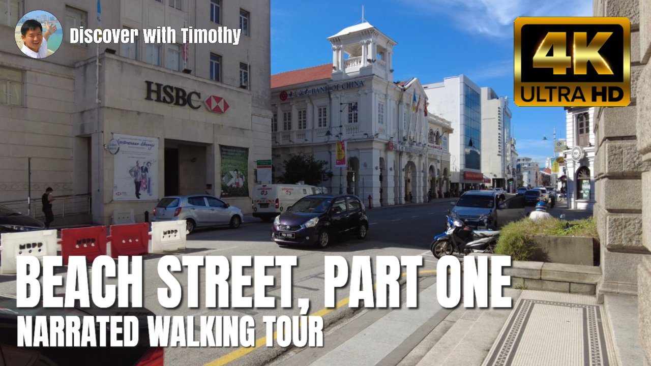
Beach Street Narrated Walking Tour, Part 1
In part 1 of this walk, we start at Light Street Roundabout and walk to the Chulia Street Intersection to get to know the sights along the way.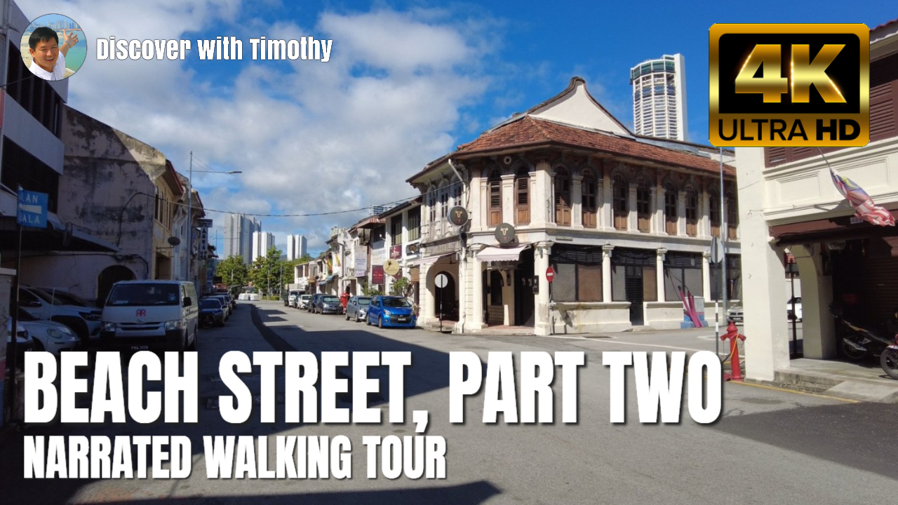
Beach Street Narrated Walking Tour, Part 2
In part 2 of this walk, we continue from the Chulia Street Intersection to Prangin Road. Map of Beach Street, Penang
Hotels on Beach Street
- B Street Hotel (GPS: 5.41303, 100.33707)

 Sights and Buildings along Beach Street
The following are heritage buildings and significant structures along Beach Street. Sights marked with ( * ) are of considerable interest and sights marked with ( * * ) are of major interest. As far as possible, ensembles of buildings are numbered ascending or descending from left to right. About the street numbering, buildings with odd-number addresses are on the shore-side (east-side) of Beach Street while those with even numbers are on the inland-side (west-side) of the street.- 72, 70 & 68 Beach Street
- 316, 314, 312, 310 & 308 Beach Street
- 221 & 223 Beach Street
- 224 Beach Street
- 1886 Building (GPS: 5.41715, 100.34171)

- Anson Bridge
- Ban Hin Lee Bank Building (GPS: 5.41637, 100.34127)

- Bangunan Su Hock
- Beach Street Fire Station (GPS: 5.41519, 100.33955)

- Gudang Acheh (GPS: 5.41363, 100.33726)

- HSBC Building (GPS: 5.41819, 100.3434)

- India House (GPS: 5.41737, 100.34245)

- Islamic Council Building (GPS: 5.41857, 100.34383)

- Khoo Si Toon Keng Tong Kongsi (GPS: 5.41237, 100.33563)

- Kongsoon House (GPS: 5.41734, 100.34191)

- Logan Heritage Building (GPS: 5.41833, 100.34286)

- Old OCBC Building (GPS: 5.41725, 100.34179)

- George Town Dispensary (GPS: 5.41659, 100.34158)

- Immigration Department (GPS: 5.41899, 100.34366)

- Little India Arch (GPS: 5.41611, 100.34063)

- PhilipCapital Building (GPS: 5.41706, 100.34216)

- Royal Bank of Scotland Building (GPS: 5.41806, 100.3432)

- Saw Seng Kew Building (GPS: 5.41752, 100.34254)

- Standard Chartered Bank Penang (GPS: 5.41615, 100.34033)

- SPACES Beach Street / Standard Chartered Building (former location of Standard Chartered Bank Penang) (GPS: 5.41859, 100.34328)

- Tan Kongsi (GPS: 5.41333, 100.33622)
 *
* - The Whiteaways Arcade (GPS: 5.41763, 100.34225)

- Thio Thiaw Siat Building (GPS: 5.41667, 100.3417)

- TM Asia Life Building (GPS: 5.41665, 100.34107)

- Wonderfood Museum Penang (GPS: 5.41632, 100.34117)

Street Art along Beach Street
Banks along Beach Street
Museums along Beach Street
Coffee Shops & Restaurants along Beach Street
- Black Kettle (GPS: 5.41541, 100.33971)

Kedai Kopi Lam Ahdefunct (Beach Street Gu Bak Koay Teowmoved)- Old Town White Coffee, Whiteaways Outlet
- Pho Viet Cafe (GPS: 5.41222, 100.33451)

- Subway Sandwich, Whiteaways Outlet
Businesses along Beach Street
- Bian Teik Lee Co. Sdn. Bhd.
- Chiat Cheong Sdn Bhd
- Chua Dental Surgery
- Garuda Semangat Sdn Bhd (trading company)
- Genius Parking
- Ghee Hiang (Chinese pastries)
- Global Money Changer
- Guan Kongsi Sdn. Bhd.
- Haja Shareef K.P.M Abdul Kader (money changer)
- Hiap Seng Whatt Trading Sdn Bhd (trading company)
- Ima Klinik Beach Street
- Kim Hing Hardware
- Koleksi Vipasana
- Navrose Trading (money changer)
- R. Kalander (money changer)
- Shahjahan V.M Mohamad Ibrahim (money changer)
- S.M. Badjenid & Son (perfume)
- S.M.K Shaik Mohamed (money changer)
- Seng Huat Hang Sdn Bhd (trading company)
- Shaik Dawood Feroz (SAP) Sdn Bhd (sundry shop)
- Sin Chiat Hong Sdn Bhd (wholesaler/trading)
- Souq Al-Arabia (specialty shop)
- Store Your Luggage
- Su Hong Sdn Bhd (trading company)
- TCE Sports (sports goods)
- Teow Hin Chan (crockery)
- TSE Supplier (tools & safety equipment)
- Weng Seng Heng Medical Hall
Car Parks
 Beach Street at Ghee Hiang shows the road width before and after widening (5 July 2008)
Updates on Beach Street
21 September, 2013: A section of Beach Street between Downing Street and Church Street will be made part of the Occupy Beach Street Project where, every Sunday, the stretch is pedestrianized for various activities.History of Beach Street
Beach Street is one of the oldest streets in George Town as well as in Malaysia. This history can be appreciated as you make your way going south from the clock tower towards Sia Boey.The Ghauts of Beach Street
Late 18th Century to mid 19th centuryBeach Street, in its earliest incarnation, was a coastal road. On one side were the earliest commercial houses, mostly of wood and attap, none of which survived to this day. On the other side was the sea, or pockets of mangrove that have not been thoroughly cleared. Punctuating the coastline were piers that ran out into the sea, so that arriving ships could berth. At irregular intervals were piers as well as stone steps that reached down into the water. These were wharves for sampans and small perahus to berth, from where goods were off loaded and passengers disembarked. These stone steps, called "ghauts", after the ghats in India, were to increase in number as the city spread southwards. Though they have all disappeared with the land reclamation of late 19th century, you can get an idea how they would have looked like by viewing the ghats in Varanasi.
 The Ghats of Varanasi, similar to those that existed along Beach Street in the early 19th century (16 November 2004)
Opposite the ghauts, perpendicular to Beach Street, new roads were built inland. As with the buildings on Beach Street itself, the earliest structures along these off-roads were of wood and attap. Among them was the Catholic church which gave its name to Church Street, before it moved to Farquhar Street, and is still there, as the Church of the Assumption. The Presbytery of the bishop of the Church of the Assumption gave its name to Bishop Street, which was the closest street off Beach Street from the European quarter at Light Street.
The Chinese settled along what is now called China Street. It runs from their earliest temple, the Kuan Im Teng, right to the ghaut at water's edge in Beach Street. As their temple sat on a knoll looking down towards the sea, the early Chinese regarded it as good feng shui, and they built their attap houses on both sides of China Street.
 Ang3mor3 Thau3kor4 Kay1, or European Commercial Street, was the name given
by the Hokkiens to the northern part of Beach Street (2 November 2008) © Timothy Tye
The Chinese community, which never had much regard over what the colonial masters called the street, came up with their own naming. This often reflect the character of each particular section of the street. See the blue table on the right for the different names of Beach Street.
Early to Mid 19th Century
Land reclamation between 1880 and 1904 created the George Town that we know today, forever changing the character of Beach Street. Although it is no longer right at the beach, it still retains the name. The mid 19th Century, from 1850 to 1900, was a prosperous time for George Town. The discovery of tin in Larut, Perak fueled an economic boom. Tin ore was transported to Penang where it was smelted and shipped. The resulting prosperity created jobs, and with that, an influx of cheap labour from China and India. The land reclamation of the seaward side of Beach Street extended the shore outward, and on the newly reclaimed land sprouted the new commercial district of George Town.
 The yellow pavement at Church Street Ghaut marks the approximate location of the stone steps that led down from Beach Street to the water's edge during the early 19th century. (12 November 2008)
Late 19th Century to turn of 20th Century
The northernmost part of Beach Street was occupied by European commercial interest. The Hokkiens called this section Ang3 Mor3 Thau3 Khor3 Kay1, meaning "White Men's Commercial Street". While the buildings fronting Beach Street acted as shop fronts, extending behind them were warehouses (called "godown", after the Malay word "gudang"). For that reason, Beach Street became known as Jalan Gudang (not Jalan Gedung, despite it documented as such in some books and on the Historic Blue Plaques) in Malay in the late 19th Century, before becoming Jalan Pantai today.
As we move south, the character of Beach Street evolved. As we approached Che Em Lane, it started to develop a Subcontinent character, which comes into full blast at Market Street, one of the main streets of Penang's Little India.
 View of Beach Street, from the junction with Chulia Street (12 November 2008)
Continuing south, past the Chulia Street junction, Beach Street enters the heart of the Chinese commercial district, also called the Chinese Trades Neighbourhood. This is where the Chinese traders had their trading offices and warehouses, and this continues till today.
Until Victoria Street was created just before the 20th Century, many of those Chinese shophouses on the seaward side of Beach Street extended right to the shore in the form of godowns. These were cut short by the creation of Victoria Street.
Between 1786 and today (late 2008), Beach Street has existed for over two hundred years, yet almost half of that time, it remained an unpaved road. It was only in 1894 that a short section of Beach Street, between Union Street and Bishop Street were tarred, the first road in Penang to receive such a treatment. It was an expensive endeavour not to be implemented for another ten years.
 The Sia Boey section of Beach Street (4 December 2008)
Also around the same time, Beach Street was widened. The widening came to an abrupt stop where the Ghee Hiang biscuit company is located. There was no clear explanation why the widening stopped there, except perhaps the section beyond that point belonged to the Chinese who objected to demolishing their shop front for the widening.
Early to mid 20th Century
Due to the importance of Beach Street, most of the buildings, especially those on the northernmost section, are quite new. As you walk down Beach Street today, you will see the majority of them were built during the late 19th century or later. Many of these have Art Deco façades, which meant the buildings were built in the early 20th Century, or that the façades were added to older buildings when Art Deco became fashionable.
 Beach Street towards Sia Boey (24 November 2012)
21st Century
Beach Street continued to retain its European character right up to the mid 20th Century. After independence, as the activities of the harbor declined, the godown along Beach Street became unutilized. Many fell into neglect, and some still stand forlorn today, waiting for a more glorious tomorrow.
As George Town itself was inscribed as a Unesco World Heritage Site, I hope that will generate an interest to redevelop and readapt these heritage warehouses for 21st Century use. Already the commercial buildings along Beach Street were undergoing restoration, namely Kongsoon House, 1886 Building, Whiteways & Laidlows, to name a few.
Beach Street continues to play an important role as the main banking street of George Town. Most banks have a branch or even their regional head office on Beach Street or any of its off-roads, chiefly Bishop Street. As you explore Beach Street, note the architectural style. Apart from the modern office blocks, the older buildings are in either Art Deco or Neoclassical style. In between the buildings fronting Beach Street are alleyways through which you catch a glimpse of an unused godown.
 Beach Street at dusk (4 February 2009)
Getting there
From the Weld Quay Ferry & Bus Terminal, use the pedestrian bridge to cross Pengkalan Weld. Turn right, walk a short distance down Pengkalan Weld to the junction of Gat Lebuh China. Turn left, walk the length of Gat Lebuh China, and you will arrive at Beach Street (Lebuh Pantai).Alternatively, you can also reach Beach Street by taking the Rapid Penang Free Shuttle Bus to Station No. 3 (Little India) and Station No. 4 (Imigresen).
Self Guided Tour
Explore Beach Street on your own using our free Upper Beach Street Walking Tour. Sights along the way are detailed on the tour. Beach Street plaque (12 November 2008)
Nearby Sights
 Whiteaways Arcade, one of the restored historic buildings along Beach Street (22 May 2011)
In Other Words ...
Beach Street is known by a variety of names in Hokkien depending on which section of it we are talking about. From Light Street to China Street, it is called Ang3mor3 Thor3khor3 Kay1 紅毛土庫街 meaning "European Commercial Street". From China Street to Chulia Street, it is called Kang3a1 Khau4 港仔口 or "Harbour Front", a name that came about before the late 19th century land reclamation erased the harbour front from Beach Street.From Chulia Street to Armenian Street, it is called Teong3 Kay1 中街 [tiɔŋ-ke]
meaning "Middle Street"; from Armenian Street to Acheen Street, it was once called Tuan1 Lo1sin4 Kay1 緞羅申街 [tuan-lo-sin-ke] , meaning "Tengku Syed Hussain's Street"; from Acheen Street to Malay Street, it is called Phak1 Thik1 Kay1 拍鐵街 [phaʔ-thik-ke] or "Ironmonger's Street", and finally, from Malay Street to the Prangin Canal, it is called Sia33 Boey4 社尾 [sia-boe] meaning "Town's End".Although Beach Street is today known officially as Lebuh Pantai, the Malays had their own vernacular names for Beach Street. The section north of Acheen Street was Jalan Gudang while south of Acheen Street it was called Hujung Pasir ("Sand's End").
 Lebuh Pantai, George Town, Penang (3 January 2020)
List of Streets in Penang and Streets in Malaysia
Buy, rent or sell properties in Penang
Do you have a property for sale or to rent out? Are you looking to buy or rent a property? Get in touch with me. WhatsApp me (Timothy Tye) at 012 429 9844, and I will assign one of my property agents to serve you. I will choose the agent for you, according to your property needs. So when you message me, provide me some details of what you need, whether to sell, to buy, to rent or to rent out, and what type of property, is it condo, apartment, house, shop, office or land.Adakah anda mempunyai hartanah untuk dijual atau disewakan? Adakah anda ingin membeli atau menyewa hartanah? Hubungi saya. WhatsApp saya (Timothy Tye) di 012 429 9844, dan saya akan menugaskan salah seorang ejen hartanah saya untuk berkhidmat kepada anda. Saya akan pilih ejen untuk anda, mengikut keperluan hartanah anda. Oleh itu, apabila anda menghantar mesej kepada saya, berikan saya beberapa butiran tentang apa yang anda perlukan, sama ada untuk menjual, untuk membeli, untuk disewakan atau untuk disewakan, dan jenis hartanah apakah itu kondo, pangsapuri, rumah, kedai, pejabat atau tanah.
您有待出售或出租的房产吗? 您想购买或租赁房产吗? 与我联系。 WhatsApp 我 (Timothy Tye) 012 429 9844,我将指派一名房地产经纪人为您服务。 我会根据您的房产需求,为您选择代理。 因此,当您给我发消息时,请向我提供一些您需要的详细信息,无论是出售、购买、出租还是出租,以及房产类型,是公寓、公寓、房屋、商店、办公室还是土地。
New Properties in Penang
Looking to buy property in Penang? Get the e-brochures right here without having to visit or contact individual developers.- Anggun Residences E-Brochure, Batu Kawan
- Aston Acacia E-Brochure, Bukit Mertajam
- Beacon Executive Suites E-Brochure, George Town
- Beverly Heights @ Bukit Gambir E-Brochure, Gelugor
- BM Highland E-Brochure, Bukit Mertajam
- Cypress Villa E-Brochure, Sungai Ara
- D'Zone Condominium E-Brochure, Teluk Kumbar
- Elements Garden E-Brochure, Butterworth
- Ferringhi Residence 2 E-Brochure, Batu Ferringhi
- GEM Residences E-Brochure, Prai
- Golden Triangle 2 E-Brochure, Sungai Ara/Relau
- Grace Residence E-Brochure, Jelutong
- Granito @ Permai E-Brochure, Tanjong Bungah
- Green City Residence E-Brochure, Jelutong
- Havana Beach Residences E-Brochure, Bayan Lepas
- Imperial Residences E-Brochure, Sungai Ara/Relau
- Imperial Grande E-Brochure, Sungai Ara/Relau
- Lucerne Residence E-Brochure, Bayan Lepas
- Mezzo @ The Light City E-Brochure, Gelugor
- Middleton E-Brochure, Gelugor
- Orchard Villa 3 E-Brochure, Simpang Ampat
- Primero Heights E-Brochure, Permatang Pauh
- Queens Waterfront Q2 E-Brochure, Bayan Lepas
- Royale Heights @ Tambun Royale City E-Brochure, Simpang Ampat
- Royale Infinity @ Tambun Royale City E-Brochure, Simpang Ampat
- Rubica @ Harbour Place E-Brochure, Butterworth
- Sensasi Commercial Suites E-Brochure, Batu Kawan
- Setia Sky Ville E-Brochure, Jelutong
- Setia Sky Vista E-Brochure, Sungai Ara/Relau
- Setia V Residence E-Brochure, Gurney Drive
- Sinaran Residence E-Brochure, Batu Kawan
- Sky @ TriPark E-Brochure, Bukit Mertajam
- Skyridge Garden E-Brochure, Tanjong Tokong
- Starhill Luxury Residences E-Brochure, Gelugor
- Straits Residences E-Brochure, Tanjong Tokong
- Taman Nuri Emas E-Brochure, Nibong Tebal
- The Light Collection IV E-Brochure, Gelugor
- The Loft @ Southbay E-Brochure, Batu Maung
- The Terraces Condominium E-Brochure, Bukit Jambul
- Trehaus Condo Villas E-Brochure, Bukit Jambul
- Triuni Residences E-Brochure, Batu Uban
- Urban Suites E-Brochure, Tanjong Tokong
- Valencia Residence E-Brochure, Bayan Lepas
- Vertu Resort E-Brochure, Batu Kawan
- Vivo Executive Apartment E-Brochure, Batu Kawan
- Viluxe E-Brochure, Batu Kawan
- Waterside Residence E-Brochure, Gelugor
Latest updates on Penang Travel Tips
Discover with Timothy YouTube Channel
PG Food Channel
Learn Penang Hokkien YouTube Channel
SojiMart Videos
Share your travels and/or ask a travel-related question
Join the Penang Travel Tips Facebook Group to share photos, tips and anything related to your travels, or ask travel-related questions.
Map of Roads in Penang
Looking for information on Penang? Use this Map of Roads in Penang to zoom in on information about Penang, brought to you road by road. Discover with Timothy
Let me take you to explore and discover Penang through my series of walking tours on YouTube. You may use these videos as your virtual tour guide. At the beginning of each video, I provide the starting point coordinates which you may key into your GPS, Google Maps or Waze, to be navigated to where I start the walk, and use the video as your virtual tour guide.Disclaimer
Please use the information on this page as guidance only. The author endeavours to update the information on this page from time to time, but regrets any inaccuracies if there be any.Latest from Discover with Timothy: Gurney Bay - what to see and do there
About this website

Hello and thanks for reading this page. My name is Timothy and my hobby is in describing places so that I can share the information with the general public. My website has become the go to site for a lot of people including students, teachers, journalists, etc. whenever they seek information on places, particularly those in Malaysia and Singapore. I have been doing this since 5 January 2003, for over twenty years already. You can read about me at Discover Timothy. By now I have compiled information on thousands of places, mostly in Peninsular Malaysia and Singapore, and I continue to add more almost every day. My goal is to describe every street in every town in Malaysia and Singapore.
Robbie's Roadmap
- Episode 1: Robbie's Journey to Financial Freedom
- Episode 2: Lost in America
- Episode 3: The Value of Money
- Episode 4: The Mentor
- Episode 5: The Thing that Makes Money
- Episode 6: The walk with a Billionaire
- Episode 7: The Financial Freedom Awakening
- Episode 8: Meet Mr Washington
- Episode 9: The Pizzeria Incident
Copyright © 2003-2024 Timothy Tye. All Rights Reserved.