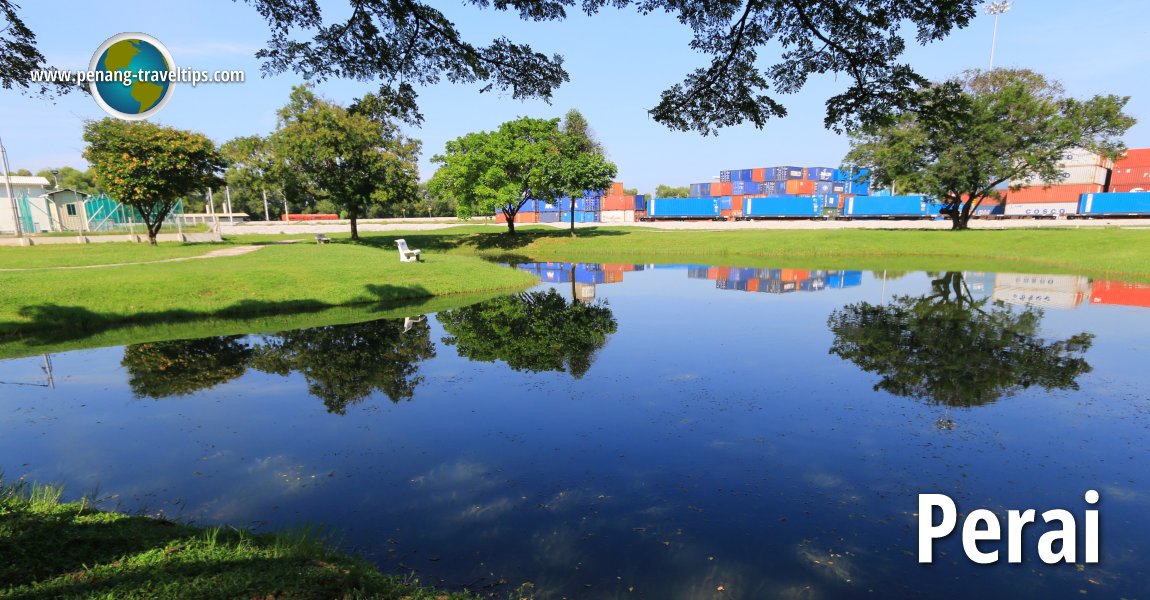
 View of Prima Prai Park in Perai (11 September 2015)
Prai (GPS: 5.38778, 100.38162; variant: Perai; Traditional Chinese: 北賴; Simplified Chinese: 北赖; Pinyin: Běilài; Penang Hokkien: Koay1 Kang4) also written Perai in Malay, is a township that gave its name to Seberang Perai. Located in Seberang Perai Tengah, Perai is a settlement along the southern bank of the Perai River. In old 19th century maps, the settlement is spelled Prye.
Perai has been settled even earlier than Penang Island. When Francis Light eyed Penang with interest, Chinese traders and farmers who were in Perai were gearing to move across the channel once the settlement is established. When Province Wellesley was originally formed, the border between it and Kedah was the Prai River, which is why going acros the Prai River from Kedah is going to "seberang Perai" in Malay, and "koay1 kang4" in Hokkien.
The settlement of Perai was named after the Perai River. The area which is defined as Perai is located around the estuary of the river. Much of it is mangrove swamp with large tracts having been cleared and developed.
Today Perai is best known for its industrial estate, which is the largest in northern Malaysia.
Location of Perai
Measured from the interchange between Jalan Baru and Jalan Chain Ferry (GPS: 5.384751, 100.387238), Perai is 2.7 km to Penang Sentral, 5.4 km to the Penang Bridge, 25.9 km to the Second Penang Bridge and 23.3 km to the Penang International Airport.
 Map of Perai
Apartments and condominiums in Perai
- Evoke Residence (GPS: 5.37053, 100.4172)

- K Residence (GPS: 5.39328, 100.4119)

- Kelisa Residence (GPS: 5.39362, 100.41072)

- Laguna Indah (GPS: 5.37189, 100.40672)

- Palma Laguna Water Park Condo (GPS: 5.37248, 100.40595)

- Pinang Laguna Water Park Condo (GPS: 5.37168, 100.40656)

- Pangsapuri Perai Utama (GPS: 5.38618, 100.37871)

- Pangsapuri Setia Wira (GPS: 5.38581, 100.37937)

- Pavilion Residence (GPS: 5.40296, 100.40951)

- Prai Inai Condominium (GPS: 5.38516, 100.38242)

- Primero Heights (GPS: 5.38984, 100.41138)

- River Tropics Condominium (GPS: 5.40691, 100.4054)

- Signature Two (GPS: 5.36751, 100.41797)

- The Signature (GPS: 5.38059, 100.39654)

Bridges in Prai
- Prai River Bridge (GPS: 5.38958, 100.37638)

- Prai Railway Turnstile Bridge (GPS: 5.38958, 100.37638)

 Commercial Properties in Perai
- Gravitas (GPS: 5.37036, 100.41668)

Hospitals and public health clinics in Perai
- Klinik Kesihatan Seberang Jaya (GPS: 5.39326, 100.39846)

 Hotels in Perai
 Hotels in Perai
- Grand Orient Hotel (GPS: 5.37247, 100.40642)

- Ixora Hotel (GPS: 5.3779, 100.39831)

- Pearl View Hotel (GPS: 5.38283, 100.39234)

- Sunway Hotel Seberang Jaya (GPS: 5.39552, 100.39793)

- The Light Hotel Seberang Jaya (GPS: 5.39462, 100.39848)

 Housing Estates in Perai
- Chai Leng Park (GPS: 5.38209, 100.39325)

Markets in Perai
- Pasar Awam Taman Chai Leng (GPS: 5.37036, 100.41668)

- Prai Market (demolished) (GPS: 5.3893, 100.37895)

Neighbourhoods in Perai
Parks in Perai
- Prima Prai Park (GPS: 5.38681, 100.37797)

- Taman Rekreasi Awam Sembilang (GPS: 5.4044, 100.4002)

 Petrol Stations in Perai
- Caltex Chai Leng Park (GPS: 5.38165, 100.39419)

- Caltex Seberang Jaya (GPS: 5.399876, 100.400910)

- Petron Jalan Hussin Onn (GPS: 5.40319, 100.40747)

- Petron Jalan Tenggiri (GPS: 5.392314, 100.401350)

- Petron Jalan Jelawat (GPS: 5.40541, 100.3925)

- Petronas Seberang Jaya (GPS: 5.400226, 100.399845)

- Shell Jalan Tenggiri (GPS: 5.395743, 100.401936)

Places of Worship in Perai
- Gurdwara Sahib Perai (GPS: 5.38967, 100.38012)

- Masjid Jamek Kampung Setol (GPS: 5.37239, 100.40963)

- Masjid Jamek Perai (GPS: 5.38621, 100.38389)

- Prai Baptist Church (GPS: 5.38942, 100.38003)

- Sri Kalikaambal Temple (GPS: 5.38942, 100.38003)

- Sri Muniswarar Temple (GPS: 5.38035, 100.39505)

- Sri Selva Vinayagar Temple (GPS: 5.38847, 100.38102)

Roads in Prai
 Schools in Perai
- Sekolah Jenis Kebangsaan (Cina) Chung Hwa 3 Perai (GPS: 5.3849, 100.3841)

- Sekolah Jenis Kebangsaan (Cina) Seng Keow, Seberang Jaya (GPS: 5.39597, 100.41142)

- Sekolah Kebangsaan Seberang Jaya (GPS: 5.38455, 100.40042)

- Sekolah Kebangsaan St Mark, Perai (GPS: 5.38645, 100.38067)

- SMK Seberang Jaya (GPS: 5.40229, 100.39947)

Shopping Malls and Hypermarkets in Perai
- AEON Big Seberang Jaya (GPS: 5.38958, 100.40816)

- Pasaraya Billion (GPS: 5.3973, 100.39798)

- Giant Hypermarket Prima Prai (GPS: 5.38586, 100.38244)

- Megamal Pinang (GPS: 5.37697, 100.39936)

- Mydin Wholesale Hypermarket Prai (GPS: 5.36884, 100.4147)

- Sunway Carnival Mall (GPS: 5.39767, 100.39825)

- Tesco Extra Seberang Jaya (GPS: 5.40528, 100.40427)

Sights in Perai
- Puspakom Prai (GPS: 5.37752, 100.38484)

- Malayan Sugar Manufacturing Company (GPS: 5.38661, 100.40238)

Villages in Prai
- Kampung Main Road (GPS: 5.38615, 100.3843)

- Kampung Manis (GPS: 5.3899, 100.37823)

- Kampung Selut (GPS: 5.38958, 100.37638)

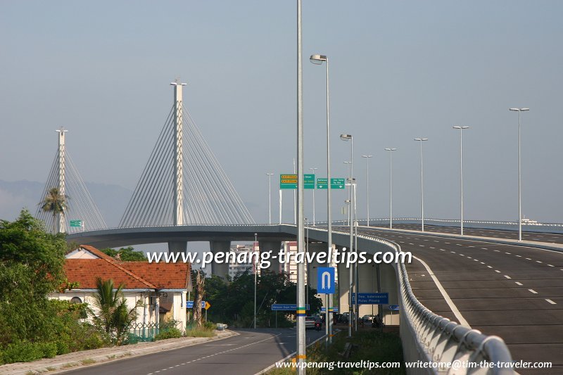
 View of Perai at the approach of the Sungai Prai Bridge (15 April 2006)
Getting there
Exit the North-South Expressway at Exit 160 (Juru Interchange) to reach Perai. Alternatively, Exit 161 (Penang Bridge Interchange) and Exit 162 (Perai Interchange) will also get you there, depending on which part of Perai you are heading to.Perai is  on the map of Seberang Perai
More on Penang Mainland; List of Towns in Penang and Towns in Malaysia

Copyright © 2003-2025 Timothy Tye. All Rights Reserved.

 Go Back