Piccadilly, London
A historic street that links elegance, history, and the heart of the West End
Where is Piccadilly?
Piccadilly is located in the heart of London's West End, running in a west-to-east direction between Hyde Park Corner and Piccadilly Circus. It is part of the City of Westminster and serves as one of the main arteries of central London, forming a prominent boundary between the affluent districts of Mayfair to the north and St James's to the south.
How Long is Piccadilly, and Is It Also an Area?
The street stretches for approximately 0.75 miles (1.2 kilometres) from Hyde Park Corner in the west to Piccadilly Circus in the east.
While the name Piccadilly primarily refers to the street itself, the surrounding locale, especially near Piccadilly Circus, is sometimes loosely referred to as “the Piccadilly area.” However, it is not officially recognised as a separate district like Mayfair or Soho.
The Origins and History of Piccadilly
The route of what is now Piccadilly can be traced back to medieval times when it was little more than a country lane known as "Portugal Street" in the 17th century. It connected the village of Knightsbridge to the area now known as Soho.
By the 18th century, the street had evolved into a fashionable residential and commercial district, lined with aristocratic mansions, private clubs, and elegant shops. Its proximity to the royal parks and palaces helped enhance its prestige, and it gradually became one of London's most prominent thoroughfares.
Piccadilly saw numerous transformations in the 19th and 20th centuries with the expansion of commercial enterprises, road developments, and the establishment of key landmarks that still stand today.
How Did Piccadilly Get Its Name?
Piccadilly derives its name from the term “piccadill” – a type of fashionable stiff collar made of lace that was popular in the late 16th and early 17th centuries. A wealthy tailor named Robert Baker made his fortune selling these collars and used the money to build a large house near what is now Piccadilly Circus. The house came to be known as Piccadilly Hall, and over time, the name was applied to the surrounding area and road.
The name Piccadilly became officially established in the late 17th century, replacing earlier names like Portugal Street.
The word is commonly pronounced as:
- “Pick-a-DIL-ee”
- IPA pronunciation: /ˌpɪkəˈdɪli/

Map of Piccadilly, London
Roads Connecting to Piccadilly?
- Albemarle Street
- Berkeley Street
- Bolton Street
- Brick Street
- Clarges Street
- Hamilton Place
- Knightsbridge
- Old Park Lane
- Park Lane
- Regent Street
- Shaftesbury Avenue
- St James's Street
- Stratton Street
- White Horse Street
Sights along Piccadilly
- Fortnum & Mason (GPS: 51.50836, -0.1383)

Major Buildings and Landmarks Along Piccadilly
Piccadilly is home to several iconic buildings and institutions that reflect its historic and cultural significance. Among them:
- Ritz Hotel – One of London's most luxurious and famous hotels, opened in 1906.
- Royal Academy of Arts – Founded in 1768 and located in Burlington House, it hosts exhibitions and promotes the visual arts.
- Fortnum & Mason – An iconic department store established in 1707, known for its luxury goods, tea, and hampers.
- Burlington Arcade – A beautifully preserved 19th-century shopping arcade full of exclusive boutiques.
- St James's Church, Piccadilly – Designed by Sir Christopher Wren and consecrated in 1684, it remains a place of worship and community activity.
- Albany – A prestigious residential complex that has housed many notable figures, including Lord Byron.
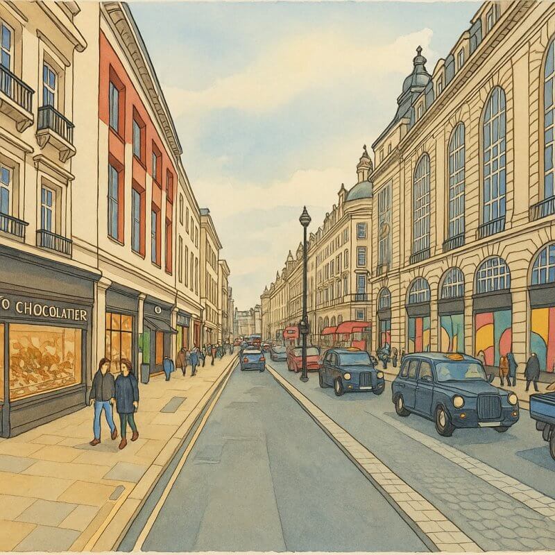
Painting of Piccadilly (View full-size image here)
Nearest Underground Stations and Tube Lines
Several London Underground stations provide convenient access to Piccadilly:
- Green Park Station – Located at the western end of Piccadilly. Served by the Piccadilly, Jubilee, and Victoria lines.
- Piccadilly Circus Station – Located at the eastern end. Served by the Piccadilly and Bakerloo lines.
- Hyde Park Corner Station – A short distance west of Piccadilly. Served by the Piccadilly line.
Fun Facts About Piccadilly
Piccadilly is more than just a busy street — it has a few fascinating quirks and facts that even some Londoners might not know:
- The Piccadilly line on the London Underground is named after the street, reflecting its importance in the city's layout.
- Piccadilly once hosted the grand mansion of the Earl of Burlington, known as Burlington House, which is now home to several learned societies and the Royal Academy of Arts.
- Queen Elizabeth II was born just off Piccadilly, at 17 Bruton Street, Mayfair – only a few minutes' walk from the street.
- The name “Piccadilly Circus” is often mistaken for an actual circus or performance venue. In this context, “circus” means a circular traffic junction or public space – similar to Oxford Circus or Cambridge Circus.
- Lord Byron, W. H. Auden, and Terence Rattigan all once lived in Albany, the exclusive residence on Piccadilly.
Why Piccadilly Remains Important Today
Piccadilly continues to play a vital role in London life, balancing its historic grandeur with contemporary culture. From hosting luxury hotels and elegant shops to being a gateway to major attractions like Green Park and Piccadilly Circus, the street is a hub of activity for tourists and locals alike.
Its position between Mayfair and St James's makes it a prime location for walking tours, cultural exploration, and even celebrity spotting. Whether you're enjoying afternoon tea at Fortnum & Mason, catching an exhibition at the Royal Academy, or simply strolling down its storied pavement, Piccadilly offers a quintessentially London experience.
Piccadilly | London Streets & Sights Illustrated Guide
Moving to London?
New to London and need a place to live? Read our Renting A Flat Guide. This guide covers everything you need to know about renting a flat in London, from viewing to signing.Streets of London
Come, let's explore and discover the streets of London together! Listed here afre the Streets of London that I have documented. Dive in and discover!Map of Streets in London
View all the streets that I have documented on Google Maps in this Map of Streets in London.Want to share your London travel experiences or get tips from fellow travellers?
Join the London Travel Tips Facebook GroupMore information for visiting London
Here are some related articles to help you get to know London better.- Cost of Living in London: Discover the true cost of living in London, including housing, transport, groceries, and more - plus tips for budgeting in one of the world's most expensive cities.
- Driving in London: Planning to drive in London? Learn about roads, car rentals, parking, tolls, and key tips for tourists and visitors from outside the capital.
- Driving Tips for Visiting London: Thinking of driving to London? Discover the best times to travel, congestion tips, parking apps, breakdown help, and petrol advice for a smoother journey.
- Evolution of London's Streets: Discover the fascinating history of how London's streets developed from ancient footpaths to today's complex network of roads across the capital.
- History of Immigration to London: Discover the rich history of immigration to London, from Huguenots to Bangladeshis, and how diverse communities have shaped the city's vibrant identity.
- How Big Is London Compared to Other World Cities?
- How London's Streets Measure Up: A Global Comparison of Road Widths
- How Streets of London are Named: Discover how London streets get their names, who decides them, and how historic, political, and public influences shape street naming in the capital.
- How the Grosvenor Family Came to Own Much of Mayfair, Belgravia and Pimlico: Explore how the Grosvenor family came to own much of Mayfair, Belgravia, and Pimlico, and learn about their historical connection (or lack thereof) with the British royal family and government.
- Living and working in London
- London's Quiet Collapse: How Living Standards Fell as Costs Skyrockted (1975-2025): Explore how London residents endured rising costs and falling living standards from 1975 to 2025 - from rocketing rents to wage stagnation and inflation.
- Marvel of the London Underground: Discover the history, challenges, and triumphs of the London Underground - the world's first underground railway and a vital transport lifeline for the UK capital since 1863.
- Moving to London: Expat Tips for Settling in Westminster: Essential advice for expats moving to London's Westminster: neighborhood insights, cost of living, transportation, housing, healthcare, schools, and tips to help you feel at home in the heart of the city.
- Places in London that aren't pronounced the way they're spelled
- Shopping in London: Discover London's diverse shopping scene
- Taking the bus in London: This is your complete guide to taking the bus when in London.
- The Anglican Faith: A Visitor's Guide to the Church of England: Learn about the Anglican faith and its deep ties to London's landmarks like Westminster Abbey and St Paul's Cathedral.
- Top 10 London Streets Every Visitor Must See: Discover London through its most iconic thoroughfares - 10 streets every visitor must experience. From historic Abbey Road to vibrant Camden High Street, explore culture, shopping, and hidden gems.
- Why are most roads in Central London so narrow? Learn why there are so few multi-lane roads and elevated highways in the heart of the city.

