Greycoat Street, London
Greycoat Street, Westminster SW1: History, Character, and Local Insight
Greycoat Street is located in the heart of the City of Westminster, Central London. It runs from Rochester Row at its eastern end to a T-junction with Elverton Street at its western end. Along the way, it branches into Rochester Street.This quiet but well-connected road lies just a short walk from Victoria Station and is close to the major thoroughfares of Victoria Street and Horseferry Road, positioning it within easy reach of some of London's most iconic institutions, including Westminster Abbey and the Houses of Parliament.
Length and Layout of the Street
Greycoat Street measures approximately 300 metres (984 feet) in length, with a broad and walkable pavement on both sides. There is no formal square or plaza named after it, but it offers a generous streetscape with occasional tree plantings and period lamp posts.The road is split into two traffic sections:
- One-way traffic flows from Rochester Row to the junction with Rochester Street.
- Two-way traffic is permitted from the Rochester Street junction to Elverton Street.
History of Greycoat Street
Greycoat Street has its origins in the early 18th century, developing as part of the gradual expansion of Westminster from a largely ecclesiastical district into a more urbanised civic area. It was initially laid out to serve as housing and access for workers and officials connected to the growing government presence in Whitehall and Westminster.The street became better known in the 19th century, especially due to its proximity to the Grey Coat Hospital, a charity school founded in 1698 for the education of poor children. Though the school was founded before the street was officially established, its enduring presence heavily influenced the naming and social history of the road.
How Greycoat Street Got Its Name
The name "Greycoat Street" is derived directly from the Grey Coat Hospital, which originally clothed its pupils in distinctive grey uniforms. The street gained its name during the 18th century when formal mapping and naming of Westminster's road network took place. The use of institutional names was common in this part of London, reflecting the charitable and religious foundations prevalent in the area.Connecting Streets and Nearby Roads
Greycoat Street connects to or branches into the following streets:- Rochester Row – a main road running north-south and serving as the northern gateway to Greycoat Street.
- Rochester Street – a short residential street branching westward from Greycoat Street.
- Elverton Street – located at the southeastern end, forming a T-junction with Greycoat Street.
Real Estate Prices and Property Sizes
As of early 2025, property prices on Greycoat Street remain well above the London average. A typical two-bedroom flat measuring around 850 square feet (79 square metres) might fetch between £950,000 and £1.2 million, depending on condition and amenities.In contrast, comparable properties across London average around £525,000 for similar square footage. Larger maisonettes or townhouses on Greycoat Street – sometimes exceeding 1,500 sq ft (139 sq m) – can command prices upwards of £2 million.
The area is popular with both investors and professionals who work in nearby Westminster, Whitehall, and Victoria.
Street Character and Atmosphere
Greycoat Street is primarily a residential road with a dignified, almost village-like character. The architecture is mixed, featuring:- Georgian and Victorian terraced houses
- Mid-20th-century flats
- Modernised apartment buildings and office conversions
Nearest London Underground Stations
Greycoat Street is very well connected to London's transport system. The two closest Underground stations are:- St. James's Park (District and Circle lines) – about a 6-minute walk.
- Victoria Station (Victoria, District, and Circle lines, plus National Rail) – around 10 minutes on foot.
Fun Fact: The School That Named a Street
A delightful quirk of Greycoat Street is that its name commemorates a school that still operates nearby today: The Grey Coat Hospital, a Church of England secondary school for girls. Although no longer on the street itself, the institution's long-standing presence in Westminster—and its early 18th-century uniforms—left a permanent mark on the city map.It's not every day you walk down a London street named after a children's uniform!
Quick Facts About Greycoat Street
- Location: Westminster, SW1
- Length: Approx. 300 metres (984 feet)
- Traffic: One-way from Rochester Row to Rochester Street; two-way from Rochester Street to Elverton Street
- Named After: Grey Coat Hospital charity school
- Branching Roads: Rochester Row, Rochester Street, Elverton Street
- Nearest Tube Stations: St. James's Park and Victoria
- Character: Predominantly residential, some offices and school facilities
- Property Prices (2025): £950,000–£2 million depending on size and condition
- Property Sizes: Typically 850–1,500 sq ft (79–139 sq m)
- Fun Fact: Named after a charity school's uniform from 1698
Map of Greycoat Street, London
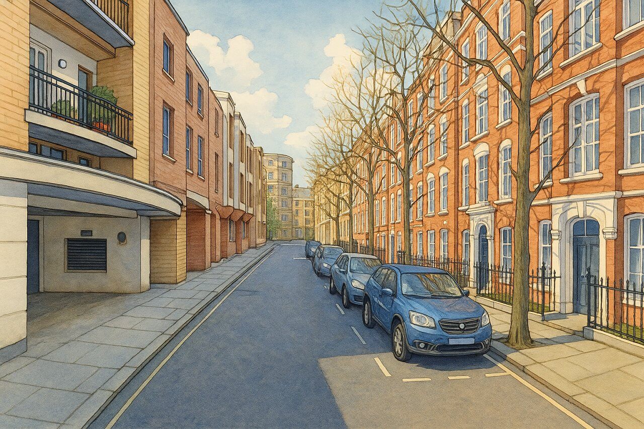
Painting of Greycoat Street, London (View image in full size)
Page Details
This page was created on 3 May 2025. Hi, my name is Timothy and created it from my research, for my own entertainment, knowledge and to satisfy my curiosity. I am providing the information to you in good faith and hope it is useful. I try to get the details as accurate as possible. I also try to update the page whenever I stumble on new details. So this and all my other pages are perpetual work in progress. If you discover any error, please politely inform me, pointing out where the error lies, and I will correct it as soon as possible. Your helpfulness will keep this page accurate, relevant and helpful to those who need the information.Moving to London?
New to London and need a place to live? Read our Renting A Flat Guide. This guide covers everything you need to know about renting a flat in London, from viewing to signing.Streets of London
Come, let's explore and discover the streets of London together! Listed here afre the Streets of London that I have documented. Dive in and discover!Map of Streets in London
View all the streets that I have documented on Google Maps in this Map of Streets in London.Want to share your London travel experiences or get tips from fellow travellers?
Join the London Travel Tips Facebook GroupMore information for visiting London
Here are some related articles to help you get to know London better.- Cost of Living in London: Discover the true cost of living in London, including housing, transport, groceries, and more - plus tips for budgeting in one of the world's most expensive cities.
- Driving in London: Planning to drive in London? Learn about roads, car rentals, parking, tolls, and key tips for tourists and visitors from outside the capital.
- Driving Tips for Visiting London: Thinking of driving to London? Discover the best times to travel, congestion tips, parking apps, breakdown help, and petrol advice for a smoother journey.
- Evolution of London's Streets: Discover the fascinating history of how London's streets developed from ancient footpaths to today's complex network of roads across the capital.
- History of Immigration to London: Discover the rich history of immigration to London, from Huguenots to Bangladeshis, and how diverse communities have shaped the city's vibrant identity.
- How Big Is London Compared to Other World Cities?
- How London's Streets Measure Up: A Global Comparison of Road Widths
- How Streets of London are Named: Discover how London streets get their names, who decides them, and how historic, political, and public influences shape street naming in the capital.
- How the Grosvenor Family Came to Own Much of Mayfair, Belgravia and Pimlico: Explore how the Grosvenor family came to own much of Mayfair, Belgravia, and Pimlico, and learn about their historical connection (or lack thereof) with the British royal family and government.
- Living and working in London
- London's Quiet Collapse: How Living Standards Fell as Costs Skyrockted (1975-2025): Explore how London residents endured rising costs and falling living standards from 1975 to 2025 - from rocketing rents to wage stagnation and inflation.
- Marvel of the London Underground: Discover the history, challenges, and triumphs of the London Underground - the world's first underground railway and a vital transport lifeline for the UK capital since 1863.
- Moving to London: Expat Tips for Settling in Westminster: Essential advice for expats moving to London's Westminster: neighborhood insights, cost of living, transportation, housing, healthcare, schools, and tips to help you feel at home in the heart of the city.
- Places in London that aren't pronounced the way they're spelled
- Shopping in London: Discover London's diverse shopping scene
- Taking the bus in London: This is your complete guide to taking the bus when in London.
- The Anglican Faith: A Visitor's Guide to the Church of England: Learn about the Anglican faith and its deep ties to London's landmarks like Westminster Abbey and St Paul's Cathedral.
- Top 10 London Streets Every Visitor Must See: Discover London through its most iconic thoroughfares - 10 streets every visitor must experience. From historic Abbey Road to vibrant Camden High Street, explore culture, shopping, and hidden gems.
- Why are most roads in Central London so narrow? Learn why there are so few multi-lane roads and elevated highways in the heart of the city.

