Vauxhall Bridge Road, London
Vauxhall Bridge Road: A Vital Artery through the City of Westminster
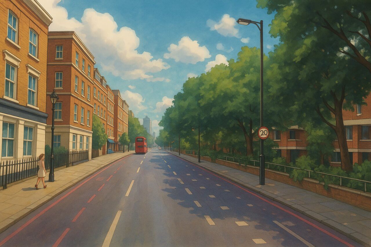
Vauxhall Bridge Road is a prominent thoroughfare in central London, located in the City of Westminster. It runs northward from Vauxhall Bridge on the River Thames and stretches towards Victoria Station, making it an essential connector between South London and central Westminster.This road serves as a bustling entry point into Westminster for traffic crossing Vauxhall Bridge, and its location places it right at the heart of the capital's administrative, residential, and commercial zones.
Length and Route
Vauxhall Bridge Road is approximately 1 mile (1.6 kilometres) in length. It begins at the northern end of Vauxhall Bridge (on the southern bank of the Thames) and travels north to Victoria Station. Along the way, it cuts through Pimlico and skirts the edges of Westminster, acting as a key connector between two major parts of London.History of Vauxhall Bridge Road
The road's history is closely tied to that of Vauxhall Bridge, which opened in 1816 as Regent Bridge. It was the first iron bridge over the Thames and allowed easier access between Westminster and the then-growing suburb of Vauxhall. Vauxhall Bridge Road developed as the principal northern approach to the bridge and quickly became a strategic transport route as London expanded throughout the 19th and early 20th centuries.During the Victorian era, the road saw major urban development, with the construction of housing, public buildings, and the eventual extension of London's rail and underground systems in the vicinity.
How Did It Get Its Name?
Vauxhall Bridge Road takes its name from the bridge it leads to - Vauxhall Bridge. The name "Vauxhall" is believed to have derived from a manor house once owned by Falkes de Breauté, a mercenary soldier who served King John in the 13th century. His house was known as "Falkes' Hall," which evolved into "Foxhall" and later "Vauxhall."Connecting Roads and Intersections
Vauxhall Bridge Road connects or intersects with several key roads, including:- Bloomburg Street
- Chapter Street
- Charlwood Street
- Drummond Gate
- Francis Street
- Gillingham Row
- Gillingham Street
- Grosvenor Road
- Hatherley Street
- John Islip Street
- Millbank
- Neathouse Place
- Rampayne Street
- Regency Street
- Rochester Row
- Stanford Street
- Udall Street
- Upper Tachbrook Street
- Vauxhall Bridge
- Warwick Way
- Wilton Road
The Character of the Street
Vauxhall Bridge Road is a mixed-use street with a blend of residential, commercial, and institutional elements. While the southern end near the river and Pimlico is quieter and more residential, the northern section near Victoria becomes increasingly busy, with:- Office buildings
- Hotels and hostels
- Shops and restaurants
- Government departments and public institutions
Notable Buildings and Sights Along the Way
Traveling along Vauxhall Bridge Road, visitors can find:- Tate Britain (just off the road on Millbank)
- MI5 headquarters across the bridge on the south bank
- Westminster Cathedral - just a short walk from the northern end
- Victoria Palace Theatre - home to blockbuster musicals
- Various listed buildings from the Victorian and Edwardian periods
Nearest London Underground Stations
Vauxhall Bridge Road is well served by multiple London Underground stations:- Victoria Station (Victoria, Circle, and District Lines)
- Pimlico Station (Victoria Line)
- Vauxhall Station (Victoria Line, plus National Rail)
Fun Fact: Art on the Bridge
Here's something quirky to look out for: Vauxhall Bridge itself features a series of striking bronze statues on either side, depicting figures representing various disciplines, including architecture, engineering, pottery, and the arts. Though technically part of the bridge, these sculptures can be admired from Vauxhall Bridge Road as it crosses the river - making the road not just a commuter route, but a mini open-air gallery.Conclusion
Vauxhall Bridge Road is much more than a functional traffic artery. It's a gateway into the City of Westminster, lined with significant landmarks and filled with the everyday rhythm of London life. Whether you're exploring London's political core, enjoying the arts, or simply heading to Victoria Station, this road is a key thread in the fabric of the capital.Map of Vauxhall Bridge Road, London
Painting of Horseferry Road
Moving to London?
New to London and need a place to live? Read our Renting A Flat Guide. This guide covers everything you need to know about renting a flat in London, from viewing to signing.Streets of London
Come, let's explore and discover the streets of London together! Listed here afre the Streets of London that I have documented. Dive in and discover!Map of Streets in London
View all the streets that I have documented on Google Maps in this Map of Streets in London.Want to share your London travel experiences or get tips from fellow travellers?
Join the London Travel Tips Facebook GroupMore information for visiting London
Here are some related articles to help you get to know London better.- Cost of Living in London: Discover the true cost of living in London, including housing, transport, groceries, and more - plus tips for budgeting in one of the world's most expensive cities.
- Driving in London: Planning to drive in London? Learn about roads, car rentals, parking, tolls, and key tips for tourists and visitors from outside the capital.
- Driving Tips for Visiting London: Thinking of driving to London? Discover the best times to travel, congestion tips, parking apps, breakdown help, and petrol advice for a smoother journey.
- Evolution of London's Streets: Discover the fascinating history of how London's streets developed from ancient footpaths to today's complex network of roads across the capital.
- History of Immigration to London: Discover the rich history of immigration to London, from Huguenots to Bangladeshis, and how diverse communities have shaped the city's vibrant identity.
- How Big Is London Compared to Other World Cities?
- How London's Streets Measure Up: A Global Comparison of Road Widths
- How Streets of London are Named: Discover how London streets get their names, who decides them, and how historic, political, and public influences shape street naming in the capital.
- How the Grosvenor Family Came to Own Much of Mayfair, Belgravia and Pimlico: Explore how the Grosvenor family came to own much of Mayfair, Belgravia, and Pimlico, and learn about their historical connection (or lack thereof) with the British royal family and government.
- Living and working in London
- London's Quiet Collapse: How Living Standards Fell as Costs Skyrockted (1975-2025): Explore how London residents endured rising costs and falling living standards from 1975 to 2025 - from rocketing rents to wage stagnation and inflation.
- Marvel of the London Underground: Discover the history, challenges, and triumphs of the London Underground - the world's first underground railway and a vital transport lifeline for the UK capital since 1863.
- Moving to London: Expat Tips for Settling in Westminster: Essential advice for expats moving to London's Westminster: neighborhood insights, cost of living, transportation, housing, healthcare, schools, and tips to help you feel at home in the heart of the city.
- Places in London that aren't pronounced the way they're spelled
- Shopping in London: Discover London's diverse shopping scene
- Taking the bus in London: This is your complete guide to taking the bus when in London.
- The Anglican Faith: A Visitor's Guide to the Church of England: Learn about the Anglican faith and its deep ties to London's landmarks like Westminster Abbey and St Paul's Cathedral.
- Top 10 London Streets Every Visitor Must See: Discover London through its most iconic thoroughfares - 10 streets every visitor must experience. From historic Abbey Road to vibrant Camden High Street, explore culture, shopping, and hidden gems.
- Why are most roads in Central London so narrow? Learn why there are so few multi-lane roads and elevated highways in the heart of the city.

