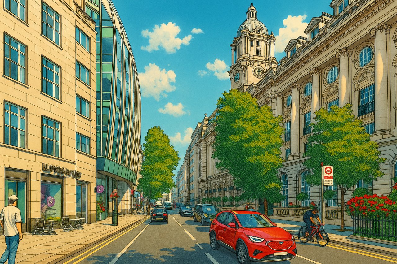
High Holborn, London
High Holborn is a major thoroughfare running across the boundary of the City of Westminster and the borough of Camden in London. It stretches from the junction with St Giles High Street and Shaftesbury Avenue in the west to the point where it meets Holborn in the east. As a continuation of the A40 route through central London, High Holborn is a bustling commercial artery, lined with a dynamic blend of modern offices, historic buildings, retail outlets, and theatres.
Geographical Layout and Surrounding Streets
High Holborn runs east-west through central London, bisecting two iconic districts—the West End to the west and the historic legal and publishing quarter of Holborn to the east. The street links directly with Long Acre and parallels Drury Lane to the south. North of the street lies Bloomsbury and the British Museum quarter, while the area to the south gradually descends toward Covent Garden.
High Holborn is intersected by several notable roads, including Kingsway, Southampton Row, and Gray’s Inn Road. These arteries allow easy movement through this vital part of London, connecting it with districts like Soho, Clerkenwell, and Fitzrovia.
Connecting Streets
- Brownlow Street
- Chancery Lane
- Drury Lane
- Endell Street
- Grape Street
- Grays Inn Road
- Great Turnstile
- Holborn (street)
- Kingsway
- Little Turnstile
- Museum Street
- New Oxford Street
- Newton Street
- Procter Street
- Red Lion Street
- Shaftesbury Avenue
- Smart's Place
- Southampton Buildings
- Southampton Place
- Southampton Row
- St Giles High Street
Origin of the Name and Pronunciation
The name "Holborn" derives from the Old English words "hōl" (meaning hollow) and "burna" (meaning stream or brook), referring to the River Fleet that once flowed nearby. Thus, Holborn can be interpreted as "hollow brook" or "stream in a valley." The modern pronunciation is HOH-bə(r)n, represented in the International Phonetic Alphabet (IPA) as /ˈhəʊbən/.
Historical Background
High Holborn has deep medieval roots and served as a key route into the City of London since at least the 12th century. In earlier times, it formed part of the pilgrimage route toward Canterbury. Over the centuries, the area developed into a mixed-use zone, housing inns, markets, guild halls, and eventually legal institutions such as Gray’s Inn and Lincoln’s Inn.
The street was heavily modified in the late 19th and early 20th centuries with the construction of Kingsway and the Aldwych area to the south, reshaping the landscape of Holborn. Though bombed during the Blitz, many buildings along High Holborn have been restored or replaced with sympathetic modern structures.
What to See and Do Around High Holborn
While High Holborn itself is primarily a commercial street, it is surrounded by a host of cultural and historic attractions:
- Sir John Soane's Museum – A unique house-museum just a short walk away, filled with architectural curiosities.
- Lincoln’s Inn Fields – London’s largest public square and home to historic legal buildings.
- Bloomsbury – Just north of High Holborn, Bloomsbury offers literary heritage and leafy garden squares.
- Covent Garden – South of the street, filled with theatres, restaurants, and shopping options.
Real Estate and Property Values
As of June 2025, real estate on or near High Holborn commands premium prices due to its central location. Residential flats average around £1,300–£1,600 per sq ft (£13,990–£17,220 per sq m), depending on the exact street frontage and building condition.
For example, a one-bedroom flat of about 550 sq ft (51 sq m) could fetch upwards of £715,000, while larger two-bedroom flats of 950 sq ft (88 sq m) could exceed £1.3 million. Rental prices reflect similar exclusivity: a one-bedroom flat typically rents for £3,000–£3,500 per month, with larger units commanding £5,000 or more.
Transport Connections
London Underground
High Holborn is extremely well-served by the London Underground Stations. Key stations include:
- Holborn Station – Serving the Central and Piccadilly lines.
- Chancery Lane Station – Also on the Central line, located on the eastern end of High Holborn.
Bus Services
Several Transport for London (TfL) bus stops are situated along High Holborn. Routes include the 8, 25, 521, and night services, offering connections to Oxford Circus, Shoreditch, and Waterloo. Bus stops are typically spaced at 200–300 metre intervals and include shelters, maps, and digital arrival boards.
Fun Fact
Did you know? High Holborn was once home to the world’s first underground public lavatory, which opened in 1855. Complete with gas lighting and mahogany doors, it marked a major advancement in public sanitation—and was operated by a doorman!
Quick Facts
- Location: Runs from St Giles High Street and Shaftesbury Avenue to Holborn
- District: City of Westminster, bordering Camden
- Pronunciation: HOH-bə(r)n /ˈhəʊbən/
- Historical Use: Medieval route into London; legal and commercial hub
- Nearby Sights: Sir John Soane’s Museum, Covent Garden, Bloomsbury, Lincoln’s Inn
- Property Prices (2025): £1,300–£1,600 per sq ft; rents from £3,000/month
- Underground Stations: Holborn Station, Chancery Lane Station
- Bus Routes: 8, 25, 521, N8, N25
- Fun Fact: Site of the world’s first underground public lavatory, opened in 1855
References
- Historic UK – The History of Holborn
- Rightmove – High Holborn Properties (Accessed June 2025)
- Transport for London – Bus Route Maps
Map of High Holborn, London
 Painting of High Holborn, London