
Jalan Teluk Kumbar
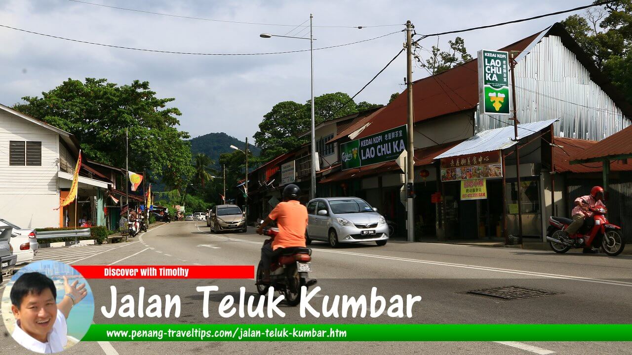 Jalan Teluk Kumbar (9 September 2017)

Jalan Teluk Kumbar is a main road on the southwestern part of Penang Island. It connects with Jalan Bayan Lepas on the eastern end and with Jalan Balik Pulau with the western. The road also forms a junction with Jalan Gertak Sanggul at Teluk Kumbar village. This road is part of Federal Route 6 that encircles Penang Island. The road was first laid out by the British in the 1920s. It underwent a major upgrading between 2005 and 2013 (described under Balik Pulau hill road), a much delayed project that eventually reduced that sharp cornerings on the hill road and added six viaducts.
Updates on Jalan Teluk Kumbar
12 October 2026: Property News reports that Jalan Teluk Kumbar is set for widening to ease traffic congestion. This follows a RM5 million design study by the federal government for the proposed widening of the approximately 3km road, said Bayan Lepas Assemblyman Datuk Azrul. The widening will cover a stretch from Sekolah Kebangsaan Sungai Batu to the Teluk Kumbar vehicle inspection centre. This is the current phase.
The next phase of widening will extend from Sekolah Kebangsaan Sungai Batu to the junction of Cangkat Bukit Belah. This will involve two developers with residential projects which are either underway or planned in the area.
Map of Jalan Teluk Kumbar
 Sights along Jalan Teluk Kumbar
- Bukit Genting (GPS: 5.31587, 100.2246)

- Flat Taman Emas (GPS: 5.28589, 100.23684)

- Former Penang Yellow Bus Depot (GPS: 5.28701, 100.23323)

- Lexis Suites Penang (GPS: 5.28644, 100.23299)

- Masjid Ridwaniah Sungai Batu (GPS: 5.28602, 100.24098)

- Masjid Teluk Kumbar (GPS: 5.30153, 100.23176)

- Pavilion Resort Condominium (GPS: 5.29373, 100.25412)

- Platinum III (GPS: 5.28821, 100.24926)

- Pusat Pemeriksaan Kenderaan Berkomputer (Puspakom), (GPS: 5.29728, 100.2325)

- Saujana Heights Apartment (GPS: 5.29373, 100.25412)

- Sekolah Kebangsaan Sungai Batu (GPS: 5.28749, 100.24246)

- Sekolah Kebangsaan Teluk Kumbar (GPS: 5.29068, 100.2321)

- Sekolah Menengah Kebangsaan Teluk Kumbar (GPS: 5.28749, 100.24246)

- Sekolah Rendah Yang Cheng (new location GPS: 5.30068, 100.23206)
 ; (old location GPS: 5.28743, 100.2332)

- Southwest District Muslim Cemetery (GPS: 5.29728, 100.2325)
- Teluk Kumbar Good Friend Seafood (GPS: 5.28644, 100.23299)

- Teluk Kumbar Heights (GPS: 5.28967, 100.2509)

- Teluk Kumbar Pillbox (GPS: 5.29108, 100.23269)

 Jalan Teluk Kumbar, as seen from Lexis Suites Penang (21 November 2018)

 Newly upgraded Jalan Teluk Kumbar passing the Bukit Belah neighbourhood. (9 February 2018)
 Jalan Teluk Kumbar aerial view, as seen from Lexis Suites Penang. (10 September 2017)
 Sekolah Kebangsaan Teluk Kumbar (10 September 2017)
Page Details
This page was created on 26 August 2026. Hi, my name is Timothy and created it from my research, for my own entertainment, knowledge and to satisfy my curiosity. I am providing the information to you in good faith and hope it is useful. I try to get the details as accurate as possible. I also try to update the page whenever I stumble on new details. So this and all my other pages are perpetual work in progress. If you discover any error, please politely inform me, pointing out where the error lies, and I will correct it as soon as possible. Your helpfulness will keep this page accurate, relevant and helpful to those who need the information.Want to share your Penang travel experiences or get tips from fellow travellers?
Join the Penang Travel Tips Facebook GroupUseful guides for visiting Penang
My Videos of Penang
Latest Pages & Updates
Buy Me A Coffee
If you enjoy the information I provide and want to support the work I do, please buy me a coffee! I appreciate it immensely, thank you so much!
