St George's Drive, London
St George's Drive is a long, tree-lined residential street in the City of Westminster, running from Elizabeth Bridge in Victoria to Lupus Street in Pimlico. With its classic Victorian terraces and close proximity to major transport links, it is one of central London's most desirable residential addresses.
Where Is St George's Drive?
St George's Drive runs north–south through the heart of Westminster, beginning near Elizabeth Bridge, adjacent to Victoria Station, and ending at Lupus Street in Pimlico. It lies within the SW1V postcode district and is part of the Pimlico Conservation Area.
Streets connected to St George's Drive
- Charlwood Street
- Clarendon Street
- Eccleston Square
- Elizabeth Bridge
- Gloucester Street
- Hugh Street
- Sussex Street
- Warwick Way
How Long Is the Road?
St George's Drive is approximately 0.6 miles (1 kilometre) in length. It provides a straight and scenic route between Victoria and Pimlico, intersecting with several cross-streets including Warwick Way, Belgrave Road, and Gloucester Street.
History and Origins
The development of St George's Drive began in the mid-19th century, as part of the wider expansion of Pimlico by the Grosvenor Estate. The area was laid out by the famous planner Thomas Cubitt, who transformed Pimlico into a grid of stately streets with elegant white stucco-fronted houses.
The name "St George's Drive" likely reflects the area's Victorian-era tradition of naming streets after saints and royalty. St George is the patron saint of England, and the name would have been chosen to evoke a sense of national pride and dignity, typical of Cubitt's development ethos. The street was fully established by the 1860s.
Character and Architecture
St George's Drive is known for its uniform rows of white stucco-fronted Victorian townhouses, many of which have been converted into flats. These buildings exhibit classical architectural elements such as tall sash windows, black iron railings, and porticoed entrances.
The street is predominantly residential and quiet, with mature trees lining both pavements. Some buildings remain single-family homes, while others have been subdivided into high-end apartments or guesthouses. Despite its central location, St George's Drive has a peaceful and refined atmosphere.
Sights and Attractions Nearby
While the street itself is residential, it benefits from proximity to several major London sights:
- Victoria Station – a major transport hub with rail, bus, and Underground services
- Pimlico Gardens – a peaceful riverside green space at the southern end of Pimlico
- Tate Britain – one of London's most important art museums, just a 10-minute walk away
- Eccleston Yards – a redeveloped courtyard with boutiques, eateries, and co-working spaces
- The Apollo Victoria Theatre – home to long-running West End productions, such as "Wicked"
Real Estate Prices
As of May 2025, properties on St George's Drive command premium prices, reflecting its central location and historic charm. A typical one-bedroom flat (approximately 600 sq ft / 56 sq m) costs around £850,000. Two- and three-bedroom flats range from £1.2 million to £2.5 million, with larger maisonettes or whole townhouses fetching upwards of £4 million.
By comparison, the average house price across London is currently just over £700,000, making St George's Drive significantly more expensive than average. Rental prices are also high, with one-bedroom flats letting for £3,000–£3,500 per month.
Nearest Transport Links
London Underground
- Victoria Station (Victoria, District, and Circle lines) – north end of St George's Drive
- Pimlico Station (Victoria line) – 5-minute walk from the southern end of the road
Bus Services
There are several bus stops located near both ends of the street:
- Warwick Way (Stop P) – served by routes 24, 11, and 211
- Victoria Coach Station – served by numerous national and London bus routes
- Lupus Street – served by routes 24, 360, and C10
Fun Fact
St George's Drive has often been used as a filming location for period dramas due to its well-preserved Victorian architecture. Its classic white façades make it a stand-in for various 19th-century London settings. Fans of British television may recognise parts of the street in shows like "Call the Midwife" or "Mr Selfridge."
Quick Facts
- Location: Westminster, SW1V
- Length: Approx. 0.6 miles (1 km)
- Established: Mid-19th century (c. 1860s)
- Named after: St George, patron saint of England
- Main character: Residential, Victorian architecture
- Nearby sights: Tate Britain, Victoria Station, Eccleston Yards
- Average flat price (2025): £850,000–£2.5 million
- Nearest tube stations: Victoria (Victoria, District, Circle), Pimlico (Victoria)
- Bus stops: Warwick Way, Lupus Street, Victoria Coach Station
- Fun fact: Street frequently used in TV period dramas
Map of St George's Drive, London
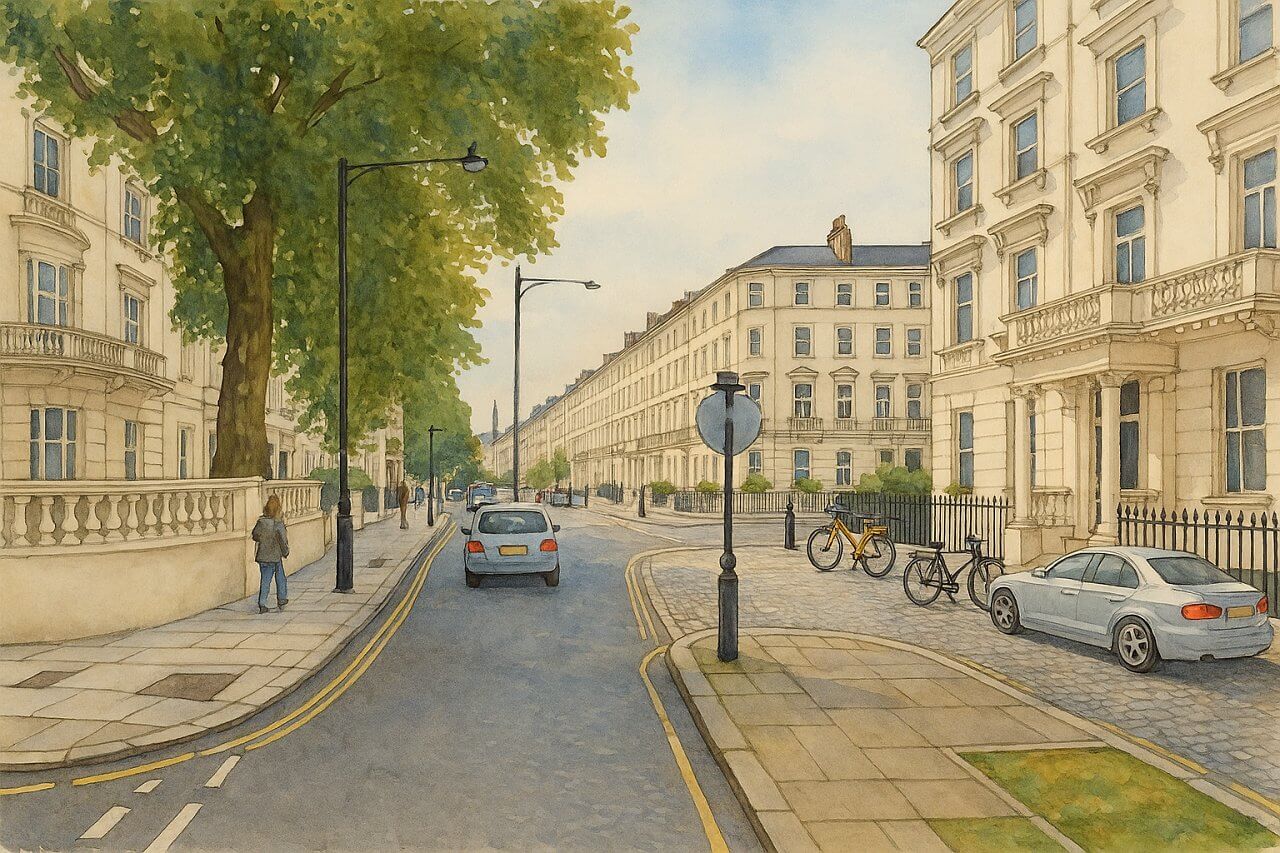
Painting of St George's Drive, London (View image in full size)
Page Details
This page was created on 11 May 2025. Hi, my name is Timothy and created it from my research, for my own entertainment, knowledge and to satisfy my curiosity. I am providing the information to you in good faith and hope it is useful. I try to get the details as accurate as possible. I also try to update the page whenever I stumble on new details. So this and all my other pages are perpetual work in progress. If you discover any error, please politely inform me, pointing out where the error lies, and I will correct it as soon as possible. Your helpfulness will keep this page accurate, relevant and helpful to those who need the information.List of Places in London, Map of Places in London
Want to share your London travel experiences or get tips from fellow travellers?
Join the London Travel Tips Facebook GroupMore information for visiting London
Here are some related articles to help you get to know London better.- Cost of Living in London: Discover the true cost of living in London, including housing, transport, groceries, and more - plus tips for budgeting in one of the world's most expensive cities.
- Driving in London: Planning to drive in London? Learn about roads, car rentals, parking, tolls, and key tips for tourists and visitors from outside the capital.
- Driving Tips for Visiting London: Thinking of driving to London? Discover the best times to travel, congestion tips, parking apps, breakdown help, and petrol advice for a smoother journey.
- Evolution of London's Streets: Discover the fascinating history of how London's streets developed from ancient footpaths to today's complex network of roads across the capital.
- History of Immigration to London: Discover the rich history of immigration to London, from Huguenots to Bangladeshis, and how diverse communities have shaped the city's vibrant identity.
- How Big Is London Compared to Other World Cities?
- How London's Streets Measure Up: A Global Comparison of Road Widths
- How Streets of London are Named: Discover how London streets get their names, who decides them, and how historic, political, and public influences shape street naming in the capital.
- How the Grosvenor Family Came to Own Much of Mayfair, Belgravia and Pimlico: Explore how the Grosvenor family came to own much of Mayfair, Belgravia, and Pimlico, and learn about their historical connection (or lack thereof) with the British royal family and government.
- Living and working in London
- London's Quiet Collapse: How Living Standards Fell as Costs Skyrockted (1975-2025): Explore how London residents endured rising costs and falling living standards from 1975 to 2025 - from rocketing rents to wage stagnation and inflation.
- Marvel of the London Underground: Discover the history, challenges, and triumphs of the London Underground - the world's first underground railway and a vital transport lifeline for the UK capital since 1863.
- Moving to London: Expat Tips for Settling in Westminster: Essential advice for expats moving to London's Westminster: neighborhood insights, cost of living, transportation, housing, healthcare, schools, and tips to help you feel at home in the heart of the city.
- Places in London that aren't pronounced the way they're spelled
- Shopping in London: Discover London's diverse shopping scene
- Taking the bus in London: This is your complete guide to taking the bus when in London.
- The Anglican Faith: A Visitor's Guide to the Church of England: Learn about the Anglican faith and its deep ties to London's landmarks like Westminster Abbey and St Paul's Cathedral.
- Top 10 London Streets Every Visitor Must See: Discover London through its most iconic thoroughfares - 10 streets every visitor must experience. From historic Abbey Road to vibrant Camden High Street, explore culture, shopping, and hidden gems.
- Why are most roads in Central London so narrow? Learn why there are so few multi-lane roads and elevated highways in the heart of the city.

