The Metropolitan Line of the London Underground
Introduction to the Metropolitan Line
The Metropolitan Line is one of the oldest and most fascinating lines on the London Underground network. Known for its deep-rooted history and far-reaching route, the line offers both a vital commuting corridor and a journey through London’s suburban expansion.Its significance extends beyond daily transport—it played a fundamental role in shaping modern suburbia in Britain. From central London to the far reaches of Buckinghamshire, the Metropolitan Line traverses a diverse range of neighbourhoods and landscapes.
Geography and Route
The Metropolitan Line stretches from the bustling streets of Aldgate in the City of London to the peaceful suburbs of Amersham and Chesham in Buckinghamshire.It serves several different branches, making it one of the more complex Underground lines. The line splits into four northern termini:
- Amersham
- Chesham
- Uxbridge
- Watford
Length and Passenger Usage
The Metropolitan Line covers a total distance of approximately 66.7 km (41.5 miles), making it the second-longest line on the Underground network, after the Central Line.As of recent estimates, the Metropolitan Line carries over 60 million passengers annually, playing a critical role in connecting commuters from the outer suburbs to central London.
Historical Background
The Metropolitan Line is steeped in history. It was the first underground railway in the world, opening to the public on 10 January 1863 between Paddington (then Bishop’s Road) and Farringdon.Constructed by the Metropolitan Railway company, it was initially built using the cut-and-cover method and operated with steam locomotives. The idea of underground trains was revolutionary at the time, and the success of the Metropolitan Railway laid the foundation for the rest of the Underground network.
Electrification began in the early 20th century, and extensions into the countryside throughout the early 1900s turned it into a line that promoted suburban living.
Painting of Metropolitan Line (View full-size image here)
Origin of the Name
The line got its name from its original operator, the Metropolitan Railway, which was formed to create the first underground railway. The name “Metropolitan” referred to the line's intended role in serving the greater metropolitan area of London.The term “Metropolitan Line” became standardised as part of the London Underground branding during the 1930s when London Transport was formed.
Number of Stations
There are a total of 34 stations on the Metropolitan Line, though not every train stops at every station, particularly on the express services which skip stops between central London and the outer suburbs.- Aldgate Tube Station (Travelcard Zone 1)
- Liverpool Street Station (Travelcard Zone 1) is an interchange with the Circle Line, District Line and Hammersmith & City Line
- Moorgate Tube Station (Travelcard Zone 1) is an interchange with the Circle Line and Hammersmith & City Line
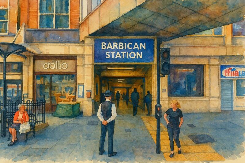
- Barbican Tube Station (Travelcard Zone 1) is an interchange with the Circle Line and Hammersmith & City Line
- Farringdon Tube Station (Travelcard Zone 1) is an interchange with the Circle Line and Hammersmith & City Line
- King's Cross St Pancras Station (Travelcard Zone 1) is an interchange with the Circle Line, Hammersmith & City Line and Piccadilly Line
- Euston Square Station (Travelcard Zone 1) is an interchange with the Circle Line and Hammersmith & City Line
- Great Portland Street Tube Station (Travelcard Zone 1) is an interchange with the Circle Line and Hammersmith & City Line
- Baker Street Station (Travelcard Zone 1) is an interchange with the Circle Line, Hammersmith & City Line, Bakerloo Line and Jubilee Line
- Finchley Road Tube Station (Travelcard Zone 2) is an interchange with the Jubilee Line
- Wembley Park Tube Station (Travelcard Zone 4) is an interchange with the Jubilee Line
- Preston Road Tube Station (Travelcard Zone 4)
- Northwick Park Tube Station (Travelcard Zone 4)
- Harrow-on-the-Hill Tube Station (Travelcard Zone 5)
- West Harrow Tube Station (Travelcard Zone 5)
- Rayners Lane Tube Station (Travelcard Zone 5) is an interchange with the Piccadilly Line
- Eastcote Tube Station (Travelcard Zone 5) is an interchange with the Piccadilly Line
- Ruislip Manor Tube Station (Travelcard Zone 6) is an interchange with the Piccadilly Line
- Ruislip Tube Station (Travelcard Zone 6) is an interchange with the Piccadilly Line
- Ickenham Tube Station (Travelcard Zone 6) is an interchange with the Piccadilly Line
- Hillingdon Tube Station (Travelcard Zone 6) is an interchange with the Piccadilly Line
- Uxbridge Tube Station (Travelcard Zone 6) is an interchange with the Piccadilly Line
- North Harrow Tube Station (Travelcard Zone 5)
- Pinner Tube Station (Travelcard Zone 5)
- Northwood Hills Tube Station (Travelcard Zone 6)
- Northwood Tube Station (Travelcard Zone 6)
- Moor Park Tube Station (Border between Travelcard Zone 6 and A)
- Croxley Tube Station (Travelcard Zone A)
- Watford Tube Station (Travelcard Zone A)
- Rickmansworth Tube Station (Travelcard Zone A)
- Chorleywood Tube Station (Travelcard Zone B)
- Chalfont & Latimer Tube Station (Travelcard Zone C)
- Chesham Tube Station (Travelcard Zone D)
- Amersham Tube Station (Travelcard Zone D)
Uxbridge Branch
Northwood Branch (continuing from Harrow-on-the-Hill)
Watford Branch
Towards Amersham (continuing from Moor Park)
The train continues to Amersham or straight to Chesham during peak hours.
Areas and Neighbourhoods Served
The line covers a wide range of areas, from the financial centre of the City to leafy commuter towns in Buckinghamshire and Hertfordshire. Key areas served include:- The City of London (Aldgate, Liverpool Street)
- Baker Street and Marylebone
- Harrow
- Uxbridge (west London)
- Watford (northwest London)
- Rickmansworth, Chorleywood, and Amersham (Chilterns)
- Chesham, the furthest station from central London on the network
Major Interchange Stations
The Metropolitan Line intersects with many other Underground and National Rail lines. Notable interchanges include:- Aldgate: Connection to the Circle Line
- Liverpool Street: Central, Circle, Hammersmith & City lines; National Rail and Elizabeth Line
- Moorgate: Northern Line and National Rail
- King's Cross St Pancras: Six Underground lines and National Rail, Eurostar services
- Baker Street: Junction with Jubilee, Bakerloo, Circle, and Hammersmith & City lines
- Finchley Road: Jubilee Line
- Harrow-on-the-Hill: Key interchange for line branching; National Rail (Chiltern Railways)
- Uxbridge: Piccadilly Line
Unique Features and Services
Unlike most Underground lines, the Metropolitan Line offers a distinctive feature: express services. These trains skip several stops between Harrow-on-the-Hill and central London, significantly reducing travel time for long-distance commuters. It also has the longest distance between two adjacent stations on the Underground: the stretch between Chesham and Chalfont & Latimer is approximately 6.3 km (about 3.9 miles).Fun Facts About the Metropolitan Line
- Chesham, one of the line’s termini, is the most distant station from central London—about 25 miles from Charing Cross.
- The line is featured in the famous Harry Beck Tube map, created in 1931, and was one of the first lines represented in the iconic colour-coded style (dark magenta).
- During the 1930s, the Metropolitan Line marketed suburban homes along the route under the name “Metro-land”, promoting countryside living with a quick commute to the city—effectively giving rise to modern British suburbia.
- In 2013, the line celebrated its 150th anniversary with special steam train journeys and public events.
Conclusion
The Metropolitan Line is not just a transit route—it's a historic corridor that shaped London and its surroundings. Whether you’re commuting from Amersham or exploring the City, this line connects past and present in a uniquely London way. From being the first underground railway in the world to transforming suburban life, the Metropolitan Line remains a remarkable part of London’s identity.Map of London Underground
List of London Underground Lines
Want to share your London travel experiences or get tips from fellow travellers?
Join the London Travel Tips Facebook GroupMore information for visiting London
Here are some related articles to help you get to know London better.- Cost of Living in London: Discover the true cost of living in London, including housing, transport, groceries, and more - plus tips for budgeting in one of the world's most expensive cities.
- Driving in London: Planning to drive in London? Learn about roads, car rentals, parking, tolls, and key tips for tourists and visitors from outside the capital.
- Driving Tips for Visiting London: Thinking of driving to London? Discover the best times to travel, congestion tips, parking apps, breakdown help, and petrol advice for a smoother journey.
- Evolution of London's Streets: Discover the fascinating history of how London's streets developed from ancient footpaths to today's complex network of roads across the capital.
- History of Immigration to London: Discover the rich history of immigration to London, from Huguenots to Bangladeshis, and how diverse communities have shaped the city's vibrant identity.
- How Big Is London Compared to Other World Cities?
- How London's Streets Measure Up: A Global Comparison of Road Widths
- How Streets of London are Named: Discover how London streets get their names, who decides them, and how historic, political, and public influences shape street naming in the capital.
- How the Grosvenor Family Came to Own Much of Mayfair, Belgravia and Pimlico: Explore how the Grosvenor family came to own much of Mayfair, Belgravia, and Pimlico, and learn about their historical connection (or lack thereof) with the British royal family and government.
- Living and working in London
- London's Quiet Collapse: How Living Standards Fell as Costs Skyrockted (1975-2025): Explore how London residents endured rising costs and falling living standards from 1975 to 2025 - from rocketing rents to wage stagnation and inflation.
- Marvel of the London Underground: Discover the history, challenges, and triumphs of the London Underground - the world's first underground railway and a vital transport lifeline for the UK capital since 1863.
- Moving to London: Expat Tips for Settling in Westminster: Essential advice for expats moving to London's Westminster: neighborhood insights, cost of living, transportation, housing, healthcare, schools, and tips to help you feel at home in the heart of the city.
- Places in London that aren't pronounced the way they're spelled
- Shopping in London: Discover London's diverse shopping scene
- Taking the bus in London: This is your complete guide to taking the bus when in London.
- The Anglican Faith: A Visitor's Guide to the Church of England: Learn about the Anglican faith and its deep ties to London's landmarks like Westminster Abbey and St Paul's Cathedral.
- Top 10 London Streets Every Visitor Must See: Discover London through its most iconic thoroughfares - 10 streets every visitor must experience. From historic Abbey Road to vibrant Camden High Street, explore culture, shopping, and hidden gems.
- Why are most roads in Central London so narrow? Learn why there are so few multi-lane roads and elevated highways in the heart of the city.

