The Hammersmith & City Line of the London Underground
Overview of the Hammersmith & City Line
The Hammersmith & City Line is one of the London Underground’s most distinctive and historically significant lines. Recognised by its pale pink colour on the Tube map, this line weaves across the northern section of Central London, connecting key destinations from the western suburb of Hammersmith to the eastern terminus at Barking.Geography and Route
The Hammersmith & City Line runs east–west, crossing through Inner London and parts of East London. It largely parallels the route of the Circle and District Lines in Central London, sharing track with them between Paddington and Aldgate East.From its western terminus at Hammersmith, it moves through areas like Shepherd’s Bush, Paddington, Euston, King’s Cross, and Mile End, before reaching its final stop at Barking in East London.
Length and Ridership
The line stretches over a distance of approximately 25.5 km (15.8 miles).Pre-pandemic statistics showed that the Hammersmith & City Line carried around 114 million passengers annually, making it one of the mid-range lines in terms of usage. The ridership is a mix of commuters, students, and tourists, owing to the varied neighbourhoods and interchanges it serves.
Historical Background
The roots of the Hammersmith & City Line trace back to the very origins of the London Underground itself. It was originally part of the Metropolitan Railway, which opened in 1863 and was the world’s first underground railway.The section from Paddington to Farringdon opened in January 1863, and the line extended over time both westwards to Hammersmith and eastwards towards Barking. By the 1930s, the services that would become the Hammersmith & City Line were operating under the umbrella of the Metropolitan Line.
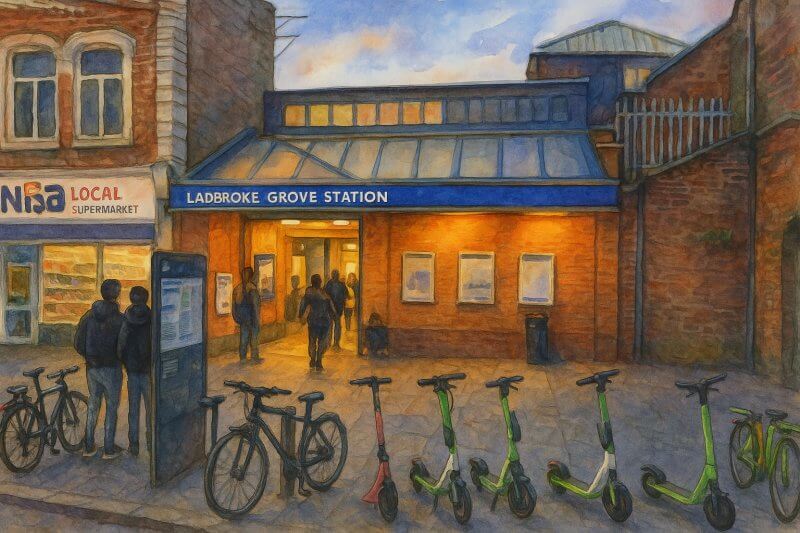
Painting of Ladbroke Grove Station of the London Underground (View full-size image here)
How It Got Its Name
Although trains had long run the route, the Hammersmith & City Line only became a separate named line in 1990. Before that, it was considered part of the Metropolitan Line. The renaming helped reduce passenger confusion and better reflect its unique routing. The name itself is derived from its two terminus points: Hammersmith in the west and the City of London in the east, which the line enters via Aldgate East and beyond.Stations on the Line
- Hammersmith Tube Station (Travelcard Zone 2) is an interchange with the Circle Line.
- Goldhawk Road Tube Station (Travelcard Zone 2) is an interchange with the Circle Line.
- Shepherd's Bush Market Tube Station (Travelcard Zone 2) is an interchange with the Circle Line.
- Wood Lane Tube Station (Travelcard Zone 2) is an interchange with the Circle Line.
- Latimer Road Tube Station (Travelcard Zone 2) is an interchange with the Circle Line.
- Ladbroke Grove Tube Station (Travelcard Zone 2) is an interchange with the Circle Line.
- Westbourne Park Tube Station (Travelcard Zone 2) is an interchange with the Circle Line.
- Royal Oak Tube Station (Travelcard Zone 2) is an interchange with the Circle Line.
- Paddington Tube Station is a central London train terminus and London Underground station. It is also the terminus of the Heathrow Express. (Travelcard Zone 1) is an interchange with the Bakerloo Line, Circle Line and District Line.
- Edgware Road Tube Station are actually two different stations with the same name. The Circle line interchanges with District and Hammersmith & City Lines with the same station, while 150 meters away is another Edgware Road tube station served by only the Bakerloo line. (Travelcard Zone 1) is an interchange with the District and Circle Line.
- Baker Street Station is actually three different stations with the same name. The station for Circle Line and Hammersmith & City Line is between Great Portland Street and Edgware Road. Between Great Portland Street and Finchley Road is another station, for the Metropolitan Line, while between Regent's Park and Marylebone Tube Station, between Bond Street and St John's Wood is the Baker Street Station for the Jubilee Line.
(Travelcard Zone 1) is an interchange with the Circle Line. - Great Portland Street Tube Station (Travelcard Zone 1) is an interchange with the Circle Line & Metropolitan Line.
- Euston Square Station is a different station from the nearby Euston tube station. It is within walking distance of the Euston railway station. (Travelcard Zone 1) is an interchange with the Circle Line and Metropolitan Line.
- King's Cross St Pancras Station serves both the King's Cross and St Pancras railway stations. This is the biggest interchange Tube Station for the London Underground served by six underground lines on its four pairs of tracks.
(Travelcard Zone 1) is an interchange with the Circle Line, Metropolitan Line, Northern Line, Piccadilly Line, Victoria Line. - Farringdon Tube Station is a London Underground and National Rail station. (Travelcard Zone 1) is an interchange with the Circle Line and Metropolitan Line.
- Barbican Tube Station (Travelcard Zone 1) is an interchange with the Circle Line and Metropolitan Line.
- Moorgate Tube Station is a London Underground and National Rail station (Travelcard Zone ) is an interchange with the Circle Line and Metropolitan Line.
- Liverpool Street Station is a central London railway terminus served by the London Underground. It is the London terminus of the Great Eastern Main Line to Norwich and the West Anglia Main Line to Cambridge. (Travelcard Zone 1) is an interchange with the Central Line, Circle Line and Metropolitan Line.
- Aldgate East Tube Station (Travelcard Zone 1) is an interchange with the District Line.
- Whitechapel Station (Travelcard Zone 2) is an interchange with the District Line.
- Stepney Green Tube Station (Travelcard Zone 2) is an interchange with the District Line.
- Mile End Tube Station (Travelcard Zone 2) is an interchange with the Central Line and District Line.
- Bow Road Tube Station (Travelcard Zone 2) is an interchange with the District Line.
- Bromley-by-Bow Tube Station (Border of Travelcard Zone 2 & 3) is an interchange with the District Line.
- West Ham Tube Station (Travelcard Zone 3) is an interchange with the District Line and Jubilee Line.
- Plaistow Tube Station (Travelcard Zone 3) is an interchange with the District Line.
- Upton Park Tube Station (Travelcard Zone 3) is an interchange with the District Line.
- East Ham Tube Station (Border Travelcard Zone 3 & 4) is an interchange with the District Line.
- Barking Tube Station (Travelcard Zone 4) is an interchange with the District Line.
Neighbourhoods and Areas Served
The line serves a variety of London’s most vibrant and diverse neighbourhoods, including:- Hammersmith – a cultural and commercial hub in West London
- Shepherd's Bush – home to the famous market and Westfield shopping centre
- Paddington – a major transport interchange and canal-side district
- Baker Street and Marylebone – areas rich in history and Georgian architecture
- King’s Cross and Euston – London's academic and transport core
- Whitechapel and Stepney – diverse East End communities with deep historical roots
- West Ham and Barking – important residential and regenerating districts in East London
Major Interchange Stations
The Hammersmith & City Line offers excellent connectivity with other lines across the Underground and National Rail network. Major interchanges include:- Paddington: Bakerloo, Circle, District, Elizabeth Line, and National Rail
- Edgware Road: Circle and District Lines
- Baker Street: Jubilee, Metropolitan, Circle, and Bakerloo Lines
- King’s Cross St Pancras: Northern, Piccadilly, Victoria, Circle, and National Rail
- Liverpool Street: Central, Circle, Elizabeth Line, and National Rail
- Mile End: Central and District Lines
- West Ham: Jubilee, District, DLR, and National Rail
Fun Facts About the Line
Here are a few quirky and interesting facts about the Hammersmith & City Line:- The line runs through London Paddington Station on a dedicated platform, separate from the Circle and District Lines, although the services overlap in this section.
- Several of its stations, including Great Portland Street and Farringdon, were part of the world’s first underground railway dating back to 1863.
- At Wood Lane Station, the line passes near the BBC Television Centre – once the heart of British broadcasting.
- The line shares many of its tracks with the Circle Line, but they are operationally distinct and run different schedules.
A Line Connecting London’s Heritage and Modernity
From its 19th-century roots as part of the world’s pioneering underground network to its current role as a reliable link between West and East London, the Hammersmith & City Line embodies both the heritage and innovation of the capital.Whether you're a daily commuter, a student, or a tourist exploring the city's layers of history, this line offers a front-row seat to London's ever-changing urban landscape.
Map of London Underground
List of London Underground Lines
Want to share your London travel experiences or get tips from fellow travellers?
Join the London Travel Tips Facebook GroupMore information for visiting London
Here are some related articles to help you get to know London better.- Cost of Living in London: Discover the true cost of living in London, including housing, transport, groceries, and more - plus tips for budgeting in one of the world's most expensive cities.
- Driving in London: Planning to drive in London? Learn about roads, car rentals, parking, tolls, and key tips for tourists and visitors from outside the capital.
- Driving Tips for Visiting London: Thinking of driving to London? Discover the best times to travel, congestion tips, parking apps, breakdown help, and petrol advice for a smoother journey.
- Evolution of London's Streets: Discover the fascinating history of how London's streets developed from ancient footpaths to today's complex network of roads across the capital.
- History of Immigration to London: Discover the rich history of immigration to London, from Huguenots to Bangladeshis, and how diverse communities have shaped the city's vibrant identity.
- How Big Is London Compared to Other World Cities?
- How London's Streets Measure Up: A Global Comparison of Road Widths
- How Streets of London are Named: Discover how London streets get their names, who decides them, and how historic, political, and public influences shape street naming in the capital.
- How the Grosvenor Family Came to Own Much of Mayfair, Belgravia and Pimlico: Explore how the Grosvenor family came to own much of Mayfair, Belgravia, and Pimlico, and learn about their historical connection (or lack thereof) with the British royal family and government.
- Living and working in London
- London's Quiet Collapse: How Living Standards Fell as Costs Skyrockted (1975-2025): Explore how London residents endured rising costs and falling living standards from 1975 to 2025 - from rocketing rents to wage stagnation and inflation.
- Marvel of the London Underground: Discover the history, challenges, and triumphs of the London Underground - the world's first underground railway and a vital transport lifeline for the UK capital since 1863.
- Moving to London: Expat Tips for Settling in Westminster: Essential advice for expats moving to London's Westminster: neighborhood insights, cost of living, transportation, housing, healthcare, schools, and tips to help you feel at home in the heart of the city.
- Places in London that aren't pronounced the way they're spelled
- Shopping in London: Discover London's diverse shopping scene
- Taking the bus in London: This is your complete guide to taking the bus when in London.
- The Anglican Faith: A Visitor's Guide to the Church of England: Learn about the Anglican faith and its deep ties to London's landmarks like Westminster Abbey and St Paul's Cathedral.
- Top 10 London Streets Every Visitor Must See: Discover London through its most iconic thoroughfares - 10 streets every visitor must experience. From historic Abbey Road to vibrant Camden High Street, explore culture, shopping, and hidden gems.
- Why are most roads in Central London so narrow? Learn why there are so few multi-lane roads and elevated highways in the heart of the city.

