Edgware Road, London
Edgware Road: London's Historic Gateway to the North
A Storied Road That Connects Centuries of London Life
Edgware Road is one of London's most famous thoroughfares, rich in history, culture, and life. Stretching through the heart of the capital, it links central London to the suburbs and has served as a vital artery for centuries. Today, Edgware Road is known for its distinctive Middle Eastern character, vibrant street life, and important role in London's daily flow.Where Is Edgware Road?
Edgware Road runs north-west from the busy intersection at Marble Arch, situated at the northeastern corner of Hyde Park. It extends through Paddington, Maida Vale, and Kilburn before reaching Edgware in the London Borough of Barnet. The road forms a major route out of central London, heading towards the north-western suburbs and beyond.How Long Is Edgware Road?
Edgware Road is approximately 10 miles (16 kilometers) long from Marble Arch to Edgware. However, when most people refer to Edgware Road, they often mean the central London portion, which is around 2.5 miles (4 kilometers) from Marble Arch to Maida Vale.The History of Edgware Road
Edgware Road dates back to Roman times. It was originally part of Watling Street, a major Roman road that connected London to St Albans and further north-west to Wroxeter.The route has remained in continuous use since Roman times, serving as a major exit point from London toward the Midlands and north-west England. Its significance has evolved over centuries from a Roman highway to a bustling London street known for commerce, transport, and residential life.
How Edgware Road Got Its Name
Edgware Road derives its name from the town of Edgware at its northern end. The name "Edgware" comes from the Old English "Ecgi's weir," referring to a weir belonging to a man named Ecgi. By the medieval period, the name Edgware was firmly established, and the road leading to it naturally became known as Edgware Road. Historical references to the name date back to at least the 13th century.Map of Edgware Road, London
Connecting Roads and Major Intersections
Several important roads connect to Edgware Road along its route. Key junctions include:- Oxford Street – At Marble Arch, a major east-west shopping street.
- Marylebone Road – An important east-west link north of the West End.
- Harrow Road – Branches off at Maida Hill towards west London.
- Paddington Green – A historic green space just off Edgware Road.
Streets that connect to Edgware Road
- Aberdeen Place
- Bayswater Road
- Bell Street
- Blomfield Road
- Boscobel Street
- Broadley Street
- Bryanston Street
- Burwood Place
- Chapel Street
- Church Street
- Connaught Place
- Connaught Square
- Crawford Place
- Crompton Street
- Cuthbert Street
- Frampton Street
- George Street
- Harrow Road
- Harrowby Street
- Kendal Street
- Maida Avenue
- Marylebone Road
- Newcastle Place
- Old Marylebone Road
- Orchardson Street
- Penfold Place
- Praed Street
- Seymore Street
- St Michael's Street
- Star Street
- Stourcliffe Street
- Sussex Garden
- Upper Berkeley Street
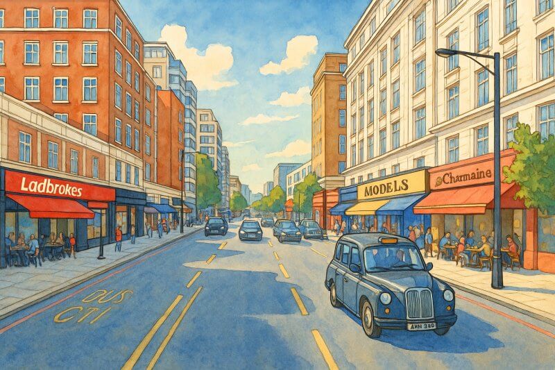
Painting of Edgware Road (View full-size image here)
Major Buildings and Real Estate Along Edgware Road
Edgware Road is a mix of commercial and residential properties. Major buildings and landmarks along the road include:- Marble Arch – The iconic white marble monument near Hyde Park.
- Hilton London Metropole – One of the largest hotels in London, popular with tourists and conference-goers.
- Paddington Green Police Station – Historically one of the most important police stations in London for handling terrorism cases.
- Church of St Mary on Paddington Green – A historic church dating back to 1791.
The character of the street is predominantly commercial near Marble Arch, with a strong presence of retail shops, restaurants, cafés, and hotels. Further north, it becomes more residential, with tree-lined streets and mansion blocks.
Nearest London Underground Stations
Edgware Road is well served by multiple Underground stations. Note that there are two Underground stations called Edgware Road, located about 150 meters apart from each other. These two stations are distinct and not physically connected.- Edgware Road (Bakerloo Line) – Serves the Bakerloo line towards Elephant & Castle and Harrow & Wealdstone.
- Edgware Road (Circle, District, and Hammersmith & City Lines) – A separate station complex that serves three major lines, providing excellent connectivity.
- Marble Arch Station – Located at the southern end of Edgware Road on the Central Line, offering quick access to Oxford Street and the West End.
- Paddington Station – A short walk from the central section of Edgware Road, providing National Rail services, Heathrow Express, and several Underground lines.
Fun Fact About Edgware Road
A fun and little-known fact about Edgware Road is that it is sometimes called "Little Beirut" or "Little Arabia" because of its vibrant Middle Eastern community. The stretch near Marble Arch is famous for its Arabic cafés, shisha lounges, and restaurants serving everything from Lebanese kebabs to Iraqi masgouf.During the summer, especially in the evenings, the street comes alive with outdoor dining, Arabic music, and a buzzing cosmopolitan atmosphere that feels like stepping into another part of the world—all while still in central London!
Moving to London?
New to London and need a place to live? Read our Renting A Flat Guide. This guide covers everything you need to know about renting a flat in London, from viewing to signing.Streets of London
Come, let's explore and discover the streets of London together! Listed here afre the Streets of London that I have documented. Dive in and discover!Map of Streets in London
View all the streets that I have documented on Google Maps in this Map of Streets in London.Want to share your London travel experiences or get tips from fellow travellers?
Join the London Travel Tips Facebook GroupMore information for visiting London
Here are some related articles to help you get to know London better.- Cost of Living in London: Discover the true cost of living in London, including housing, transport, groceries, and more - plus tips for budgeting in one of the world's most expensive cities.
- Driving in London: Planning to drive in London? Learn about roads, car rentals, parking, tolls, and key tips for tourists and visitors from outside the capital.
- Driving Tips for Visiting London: Thinking of driving to London? Discover the best times to travel, congestion tips, parking apps, breakdown help, and petrol advice for a smoother journey.
- Evolution of London's Streets: Discover the fascinating history of how London's streets developed from ancient footpaths to today's complex network of roads across the capital.
- History of Immigration to London: Discover the rich history of immigration to London, from Huguenots to Bangladeshis, and how diverse communities have shaped the city's vibrant identity.
- How Big Is London Compared to Other World Cities?
- How London's Streets Measure Up: A Global Comparison of Road Widths
- How Streets of London are Named: Discover how London streets get their names, who decides them, and how historic, political, and public influences shape street naming in the capital.
- How the Grosvenor Family Came to Own Much of Mayfair, Belgravia and Pimlico: Explore how the Grosvenor family came to own much of Mayfair, Belgravia, and Pimlico, and learn about their historical connection (or lack thereof) with the British royal family and government.
- Living and working in London
- London's Quiet Collapse: How Living Standards Fell as Costs Skyrockted (1975-2025): Explore how London residents endured rising costs and falling living standards from 1975 to 2025 - from rocketing rents to wage stagnation and inflation.
- Marvel of the London Underground: Discover the history, challenges, and triumphs of the London Underground - the world's first underground railway and a vital transport lifeline for the UK capital since 1863.
- Moving to London: Expat Tips for Settling in Westminster: Essential advice for expats moving to London's Westminster: neighborhood insights, cost of living, transportation, housing, healthcare, schools, and tips to help you feel at home in the heart of the city.
- Places in London that aren't pronounced the way they're spelled
- Shopping in London: Discover London's diverse shopping scene
- Taking the bus in London: This is your complete guide to taking the bus when in London.
- The Anglican Faith: A Visitor's Guide to the Church of England: Learn about the Anglican faith and its deep ties to London's landmarks like Westminster Abbey and St Paul's Cathedral.
- Top 10 London Streets Every Visitor Must See: Discover London through its most iconic thoroughfares - 10 streets every visitor must experience. From historic Abbey Road to vibrant Camden High Street, explore culture, shopping, and hidden gems.
- Why are most roads in Central London so narrow? Learn why there are so few multi-lane roads and elevated highways in the heart of the city.

