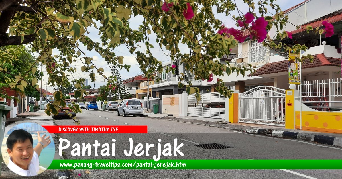
 Pantai Jerjak (14 December 2020)
Pantai Jerjak (GPS: 5.34553, 100.30268), also written Pantai Jerejak, is a middle-class residential neighbourhood in Sungai Nibong, Penang. It got its name from being on the coast overlooking Pulau Jerjak. Pantai Jerjak was established in the late 1970's and early 1980's as the population of Penang began to spill southwards and former countryside made way for residential development. It was originally called Saw Kit Garden, named after the wife of the late tycoon Loh Boon Siew who owned the land.1
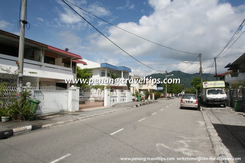
The houses in Pantai Jerjak comprise single-storey link house, double-storey link house and double-storey semi-detached houses. In more recent times, there are also a few high rises built around the periphery of the housing estate.
 Map of Pantai Jerjak, Penang
 Roads in Pantai Jerjak
- Jalan Aziz Ibrahim
- Jalan Pantai Aziz Ibrahim
- Jalan Pantai Pantai Jerjak
- Jalan Pantai Pantai Jerjak 1
- Jalan Pantai Pantai Jerjak 2
- Jalan Pantai Pantai Jerjak 3
- Jalan Pantai Pantai Jerjak 4
- Jalan Pantai Pantai Jerjak 5
- Jalan Pantai Pantai Jerjak 6
- Jalan Pantai Pantai Jerjak 8
- Jalan Pantai Pantai Jerjak 9
- Jalan Pantai Pantai Jerjak 10
- Jalan Pantai Pantai Jerjak 13
- Jalan Pantai Pantai Jerjak 14
- Jalan Pantai Pantai Jerjak 15
- Jalan Pantai Pantai Jerjak 18
- Lintang Pantai Jerjak
- Lintang Pantai Jerjak 2
- Lintang Pantai Jerjak 3
- Lintang Pantai Jerjak 4
- Lintang Pantai Jerjak 5
- Lintang Pantai Jerjak 6
- Lorong Pantai Jerjak
- Medan Pantai Jerjak
- Persiaran Pantai Jerjak
- Persiaran Pantai Jerjak 1
- Persiaran Pantai Jerjak 2
- Persiaran Pantai Jerjak 3
- Persiaran Pantai Jerjak 5
- Persiaran Pantai Jerjak 6
- Persiaran Pantai Jerjak 7
- Persiaran Pantai Jerjak 8
- Persiaran Pantai Jerjak 9
- Persiaran Pantai Jerjak 10
- Solok Pantai Jerjak
- Tingkat Pantai Jerjak
 Sights in Pantai Jerjak
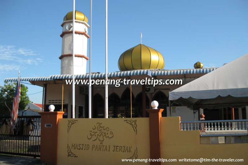
- Masjid Pantai Jerjak
- Persiaran Pantai Jerjak 10 Neighbourhood Park (GPS: 5.33677, 100.30399)

 Eating places at Pantai Jerjak
- Bao Li Kopitiam (GPS: 5.34055, 100.30383)

- Teluk Bayan Hawker Centre (GPS: 5.34089, 100.30204)

 Clinics in Pantai Jerjak
 Apartments and Condominiums in Pantai Jerjak
- Century Bay Apartments (GPS: 5.34499, 100.30519)

- Desa Bistari Apartment (GPS: 5.34605, 100.30563)

- Taman Batu Uban 2 (GPS: 5.34503, 100.30405)

- The Uban Residence (GPS: 5.34618, 100.30747)

 Traffic in Pantai Jerjak
Traffic is smooth except for Wednesday nights, where there's a Pasar Malam (night market) along Jalan Aziz Ibrahim. Also, some weekend evening rush hours may see jams along Jalan Aziz Ibrahim. Jalan Sultan Azlan Shah, across from the Pesta Site, will see congestion in the month of December when the annual Pesta Pulau Pinang takes place.
 Public Transport in Pantai Jerjak
Pantai Jerjak is served by Rapid Penang Bus No. 401. To get more buses, you need to walk to Jalan Sungai Dua, some 200 meters away.
Amenities in Pantai Jerjak
The nearest schools include Sekolah Menengah Jenis Kebangsaan (Cina) Phor Tay, and three Chinese primary schools, Sekolah Rendah Jenis Kebangsaan (Cina) Keong Hoe in Sungai Dua; and Kwang Hwa Primary School and Shih Chung (Primary) Branch School in Sungai Nibong. The nearest market from Pantai Jerjak is the Lip Sin Market and the Super Tanker Market. The nearest shopping mall is Queensbay Mall. The nearest hypermarket is Tesco Extra. The nearest petrol station from Pantai Jerjak is the Mobil across from the Pesta Site. There isn't a hospital really nearby. Pantai Hospital and Lam Wah Ee Hospital are both about equal distance away. Another view of Masjid Pantai Jerjak (22 November 2012)
Pantai Jerjak is  on the Map of Jalan Sultan Azlan Shah
Pantai Jerjak is  on the Map of Tun Dr Lim Chong Eu Expressway
 Pantai Jerjak neighbourhood, Sungai Nibong, Penang (20 September 2009)
References
- Informed to me by Ms Molly Ooi on Facebook.
List of Housing Estates in Penang and Housing Estates in Malaysia

Copyright © 2003-2025 Timothy Tye. All Rights Reserved.

 Go Back