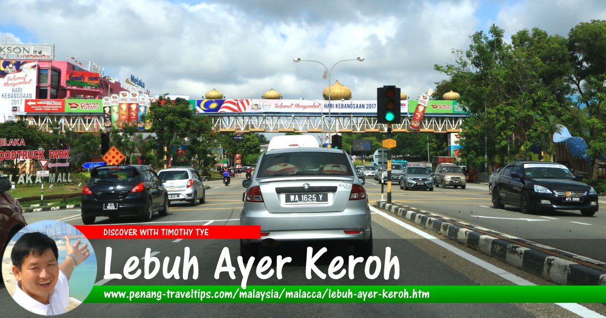
 Lebuh Ayer Keroh, Malacca (9 August 2017)
Lebuh Ayer Keroh is a major road in Malacca. Named after the town of Ayer Keroh, it connect Exit 231 of the North-South Expressway (Southern Route) with Jalan Mufti Haji Khalil, and is the main road to reach the city centre of Malacca. It is part of Federal Route 143.
Lebuh Ayer Keroh forms junctions with Jalan Durian Tunggal (M29), Jalan Utem, Lebuh Spa (Route 33), Jalan Taman Botanikal, Jalan Mitc, Jalan Seri Negeri, Jalan Komersial, Jalan Ayer Keroh Lama, Jalan Muzffar Shah, Lingkungan Usaha, Jalan Kilang, Jalan Istana, Jalan Bukit Katil, Jalan Imam Hj. Ismail, Jalan Sidang Md Amin, Jalan Bukit Beruang, Jalan Penghulu Abas, Jalan Sentosa, Jalan Padang Jambu, Jalan Pengkalan Batu, Jalan Bukit Sebukor, Jalan Munshyi Abdullah and Jalan Taman Desa Baru.
Map of Lebuh Ayer Keroh, Malacca
Sights along Lebuh Ayer Keroh
- AEON Melaka (GPS: 2.23192, 102.28208)

- Ayer Keroh Post Office (GPS: 2.26202, 102.29116)

- BhP Petrol Station (GPS: 2.25248, 102.29121)

- Bukit Sebukor Waterfall (GPS: 2.23055, 102.27749)

- Caltex Ayer Keroh (GPS: 2.23559, 102.28649)

- Dataran Sejarah (GPS: 2.27372, 102.29795)

- Dewan Kasturi Taman Ayer Keroh Heights (GPS: 2.25906, 102.29099)

- Expo Centre (GPS: 2.27418, 102.29678)

- Gerbang Ayer Keroh (GPS: 2.28762, 102.30424)

- Hotel Seri Malaysia (GPS: 2.28708, 102.30527)

- Hutan Rekreasi Ayer Keroh (GPS: 2.2807, 102.30063)

- INB Resort (GPS: 2.29759, 102.30848)

- Jabatan Kastam Diraja Malaysia Melaka (GPS: 2.28971, 102.30384)

- Kompleks Kraf Melaka (GPS: 2.28659, 102.30464)

- Latter Day Saints Chapel (GPS: 2.23006, 102.27636)

- Mahkamah Majistret Melaka (GPS: 2.23586, 102.28482)

- Majlis Bandaraya Melaka Bersejarah (GPS: 2.23304, 102.28027)

- Masjid Ubudiah Ayer Keroh (GPS: 2.25887, 102.29045)

- Melaka Handicraft Shop (GPS: 2.27967, 102.29997)

- Melaka Mall (GPS: 2.23192, 102.28208)

- Muzium Orang Asli (GPS: 2.27871, 102.29917)

- Mydin Hypermarket Ayer Keroh (GPS: 2.2708, 102.29257)

- Pantai Hospital (GPS: 2.23754, 102.28705)

- Petron Ayer Keroh (GPS: 2.23865, 102.28938)

- Petron Ayer Keroh Melaka Mall (GPS: 2.23148, 102.28055)

- Petronas Ayer Keroh 2 (GPS: 2.23611, 102.28709)

- Sekolah Menengah Sains Muzaffar Shah (GPS: 2.24369, 102.2901)

- Shell Petrol Station (GPS: 2.24929, 102.29167)

- Shell Petrol Station 2 (GPS: 2.2331, 102.28355)

- Taman Buaya & Rekreasi Melaka (GPS: 2.27693, 102.29778)

- Taman Budaya Negeri Melaka (GPS: 2.28908, 102.30503)

- Tourist Help Centre (GPS: 2.28777, 102.30505)

- Taman Mini Malaysia/Asean (GPS: 2.28272, 102.30387)

- Zoo Melaka (GPS: 2.27639, 102.299)

Discover Malacca; list of Streets in Malacca and Streets in Malaysia
 Map of Roads in Malacca
 Latest updates on Penang Travel Tips

Copyright © 2003-2025 Timothy Tye. All Rights Reserved.

 Go Back