Thorney Street, London
Thorney Street, Westminster: A Hidden Gem Linking History and Modern Living
Thorney Street is a short but important street located in the heart of Westminster, in the City of Westminster, central London.It runs between Horseferry Road on its northwestern end and Millbank on its southeastern end. Just steps away from the River Thames and the historic Houses of Parliament, Thorney Street sits in one of London's most prestigious and politically significant neighbourhoods.
How Long Is Thorney Street?
Thorney Street is approximately 160 metres (525 feet) in length.Though not a long road, it plays a vital connecting role between key arterial routes, serving as a quiet passageway amidst the dense political and governmental buildings of Westminster.
History of Thorney Street
The area around Thorney Street has deep historical roots. The land upon which it lies was once part of the ancient Isle of Thorney—a low-lying island surrounded by the River Tyburn and the Thames.By the 19th century, the area was being rapidly redeveloped as part of London's Victorian expansion. Thorney Street itself emerged in the early 20th century, likely developed during the urban improvements of the 1900s aimed at modernising Westminster and improving access to the growing administrative offices nearby.
Its existence is tightly bound to Westminster's transformation from a monastic zone into the seat of government.
Origin of the Name
Thorney Street takes its name from the Isle of Thorney, the historic name for the patch of land on which Westminster Abbey and the Palace of Westminster were built.The name "Thorney" likely derives from the Old English word þornig, meaning “thorny” or overgrown with thorns. The area was originally a marshy, thorn-covered island before being drained and developed during the Middle Ages.
Naming the street “Thorney” serves as a nod to the rich ecclesiastical and political history of the district. The street's name was in use by the mid-20th century.
Connecting Roads
Thorney Street connects two major thoroughfares in Westminster:- Horseferry Road – a long road leading west toward Vauxhall Bridge Road and Pimlico.
- Millbank – which runs parallel to the River Thames, connecting Parliament Square to Lambeth Bridge and beyond.
Real Estate and Property Prices
Thorney Street is part of a high-demand real estate zone. Most of the street is lined with purpose-built residential flats, including those in the Riverwalk and Abell and Cleland House developments, both highly desirable luxury complexes.As of May 2025, average property prices on Thorney Street are around £1,750 to £2,000 per square foot (£18,800 to £21,500 per sq metre), significantly higher than the Greater London average of approximately £750 per square foot (£8,000 per sq metre).
Typical apartments on the street range from:
- 1-bedroom flats: 600–750 sq ft (55–70 sq m)
- 2-bedroom flats: 800–1,200 sq ft (75–110 sq m)
- Penthouses: 1,500+ sq ft (140+ sq m)
Character of Thorney Street
Thorney Street is a residential street with a calm, private feel. Unlike many roads in Westminster, it lacks through-traffic and has limited commercial activity.Its character is defined by modern luxury apartments, landscaped public areas, and a secure, peaceful atmosphere.
While close to major government offices and political centres, the street itself maintains a tranquil, almost secluded ambiance that appeals to high-income residents.
Nearest London Underground Stations
Thorney Street is well-served by several nearby Underground stations:- St James's Park – on the District and Circle lines (about a 10-minute walk).
- Pimlico – on the Victoria line (also about a 10-minute walk).
- Westminster Station – served by the Jubilee, District, and Circle lines, is roughly 15 minutes away on foot.
Fun Fact
Despite its modest size, Thorney Street has been home to several high-profile residents, including civil servants and political figures who appreciate its discreet location near the heart of British government.One of the more striking features of the street is its integration of modern architecture with classical Westminster design, offering striking views of the Thames and the iconic MI5 headquarters just across the river.
Quick Facts
- Location: Westminster, City of Westminster, London
- Connects: Horseferry Road (NW) to Millbank (SE)
- Length: Approximately 160 metres (525 feet)
- History: Developed in early 20th century on former Isle of Thorney
- Name Origin: Named after the historic Isle of Thorney
- Character: Residential, luxury apartments
- Nearby Stations: St James's Park, Pimlico, Westminster
- Average Property Price (May 2025): £1,750–£2,000 per sq ft (£18,800–£21,500 per sq m)
- Nearby Attractions: River Thames, MI5 Building, Tate Britain, Parliament
- Fun Fact: Offers rare river views in a political neighbourhood
Map of Thorney Street, London
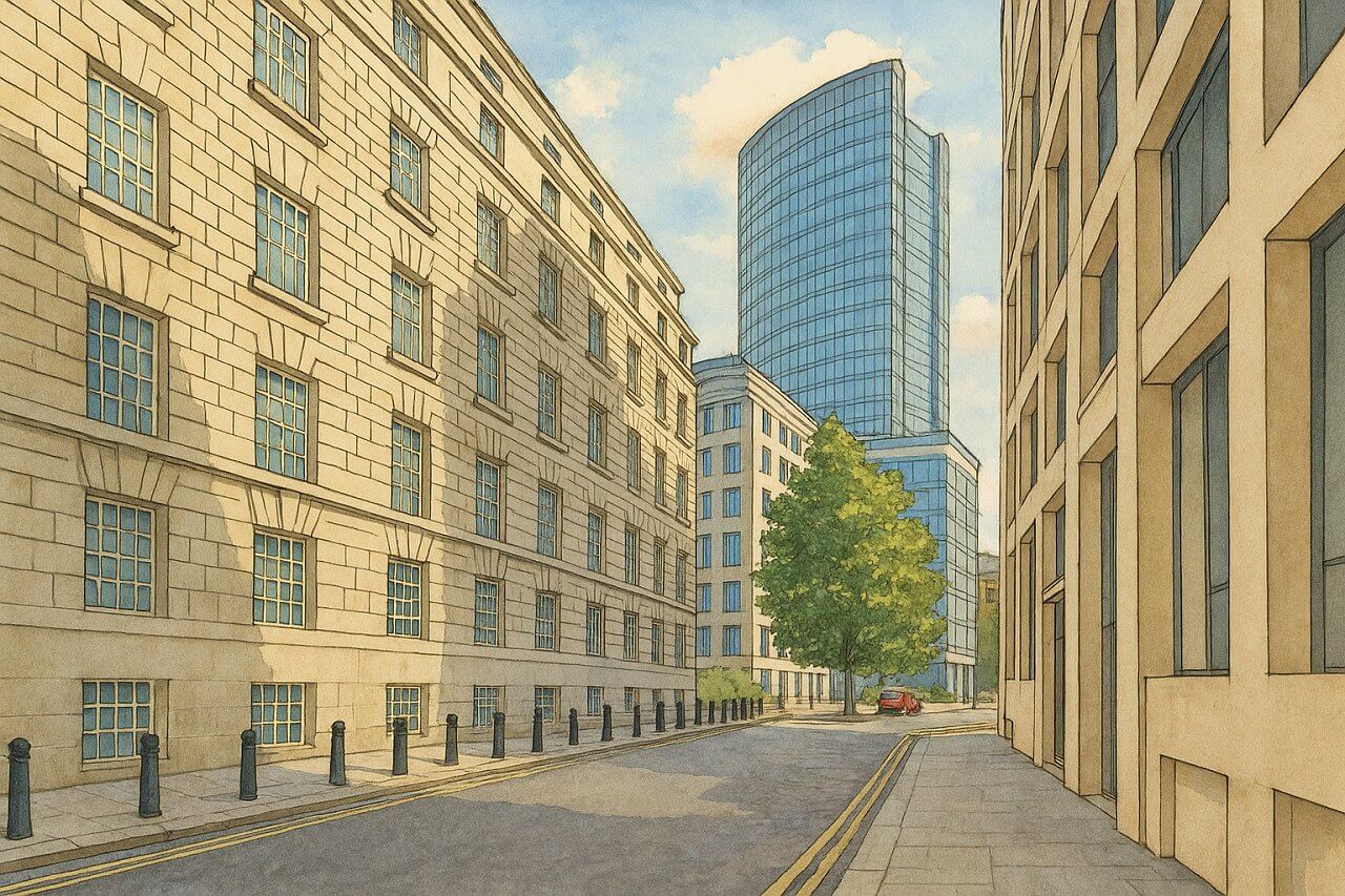
Painting of Thorney Street, London (View image in full size)
Page Details
This page was created on 2 May 2025. Hi, my name is Timothy and created it from my research, for my own entertainment, knowledge and to satisfy my curiosity. I am providing the information to you in good faith and hope it is useful. I try to get the details as accurate as possible. I also try to update the page whenever I stumble on new details. So this and all my other pages are perpetual work in progress. If you discover any error, please politely inform me, pointing out where the error lies, and I will correct it as soon as possible. Your helpfulness will keep this page accurate, relevant and helpful to those who need the information.Moving to London?
New to London and need a place to live? Read our Renting A Flat Guide. This guide covers everything you need to know about renting a flat in London, from viewing to signing.Streets of London
Come, let's explore and discover the streets of London together! Listed here afre the Streets of London that I have documented. Dive in and discover!Map of Streets in London
View all the streets that I have documented on Google Maps in this Map of Streets in London.Want to share your London travel experiences or get tips from fellow travellers?
Join the London Travel Tips Facebook GroupMore information for visiting London
Here are some related articles to help you get to know London better.- Cost of Living in London: Discover the true cost of living in London, including housing, transport, groceries, and more - plus tips for budgeting in one of the world's most expensive cities.
- Driving in London: Planning to drive in London? Learn about roads, car rentals, parking, tolls, and key tips for tourists and visitors from outside the capital.
- Driving Tips for Visiting London: Thinking of driving to London? Discover the best times to travel, congestion tips, parking apps, breakdown help, and petrol advice for a smoother journey.
- Evolution of London's Streets: Discover the fascinating history of how London's streets developed from ancient footpaths to today's complex network of roads across the capital.
- History of Immigration to London: Discover the rich history of immigration to London, from Huguenots to Bangladeshis, and how diverse communities have shaped the city's vibrant identity.
- How Big Is London Compared to Other World Cities?
- How London's Streets Measure Up: A Global Comparison of Road Widths
- How Streets of London are Named: Discover how London streets get their names, who decides them, and how historic, political, and public influences shape street naming in the capital.
- How the Grosvenor Family Came to Own Much of Mayfair, Belgravia and Pimlico: Explore how the Grosvenor family came to own much of Mayfair, Belgravia, and Pimlico, and learn about their historical connection (or lack thereof) with the British royal family and government.
- Living and working in London
- London's Quiet Collapse: How Living Standards Fell as Costs Skyrockted (1975-2025): Explore how London residents endured rising costs and falling living standards from 1975 to 2025 - from rocketing rents to wage stagnation and inflation.
- Marvel of the London Underground: Discover the history, challenges, and triumphs of the London Underground - the world's first underground railway and a vital transport lifeline for the UK capital since 1863.
- Moving to London: Expat Tips for Settling in Westminster: Essential advice for expats moving to London's Westminster: neighborhood insights, cost of living, transportation, housing, healthcare, schools, and tips to help you feel at home in the heart of the city.
- Places in London that aren't pronounced the way they're spelled
- Shopping in London: Discover London's diverse shopping scene
- Taking the bus in London: This is your complete guide to taking the bus when in London.
- The Anglican Faith: A Visitor's Guide to the Church of England: Learn about the Anglican faith and its deep ties to London's landmarks like Westminster Abbey and St Paul's Cathedral.
- Top 10 London Streets Every Visitor Must See: Discover London through its most iconic thoroughfares - 10 streets every visitor must experience. From historic Abbey Road to vibrant Camden High Street, explore culture, shopping, and hidden gems.
- Why are most roads in Central London so narrow? Learn why there are so few multi-lane roads and elevated highways in the heart of the city.

