Euston Road, London
Euston Road: Gateway Through Central London
Euston Road is a key arterial route that runs across central London. It lies primarily within the London Borough of Camden, though a short portion near its western end falls into the City of Westminster.The road forms part of the London Inner Ring Road and serves as the northern boundary of central London's congestion charge zone. It's a critical east-west route connecting Paddington to Islington, and a key access point to several major London transport hubs.
How Long is Euston Road?
Euston Road stretches approximately 1.1 miles (1.8 kilometres) from Marylebone Road at Great Portland Street in the west to Pentonville Road at King's Cross in the east. It is part of the longer A501 route, which runs from the A40 at Paddington to the A1 at Angel.A Brief History of Euston Road
Euston Road was originally built as the New Road in the 18th century. Opened in 1756, it was one of the earliest bypasses created to reduce congestion in central London, allowing cattle and goods to move more easily to Smithfield Market from the northwest.The New Road was a pioneering development of its time—wider and straighter than most London streets—and marked a significant improvement in road planning. As London expanded, the New Road was gradually absorbed into the urban fabric and renamed in segments.
The section we now know as Euston Road took on its present name in the mid-19th century, following the opening of Euston Station in 1837.
Map of Euston Road, London
Origin of the Name “Euston”
Euston Road is named after Euston Hall, the ancestral home of the Dukes of Grafton in Suffolk. The station, and later the road, were named in honour of the Earl of Euston, the heir to the Grafton dukedom.The renaming was likely a way to bring prestige and a sense of heritage to the newly established railway terminus and its surrounding infrastructure during the Victorian railway boom.
Connecting Streets
Euston Road intersects with many significant streets and thoroughfares. These include:- Marylebone Road (western continuation)
- Pentonville Road (eastern continuation)
- Great Portland Street
- Gower Street
- Tottenham Court Road
- Upper Woburn Place
- Gordon Street
- Hampstead Road
- Eversholt Street
- York Way
- Gray's Inn Road
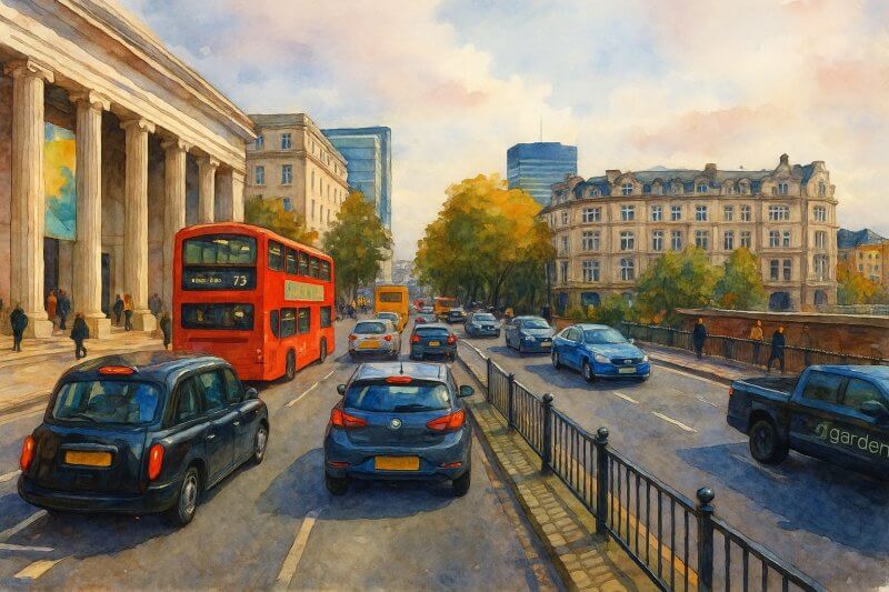
Painting of Euston Road (View full-size image here)
Major Landmarks and Buildings Along Euston Road
Euston Road is flanked by an impressive range of buildings, from historic landmarks to modern architectural feats. Key sites include: On the North Side:- University College London Hospital (UCLH) – A major NHS teaching hospital with cutting-edge medical facilities.
- Wellcome Collection – A free museum and library exploring health and human experience.
- St Pancras Renaissance Hotel – A striking Victorian Gothic building restored to its former grandeur.
- British Library – The UK's national library and one of the world's largest, holding over 170 million items.
- Euston Station – One of London's major railway termini, serving the West Midlands, North West England, and Scotland.
- Friends House – Headquarters of the Quakers in Britain, offering public events and exhibitions.
- Regent's Place – A modern business and residential campus home to tech and media companies.
Nearest London Underground Stations
Euston Road is extremely well-served by public transport, especially the Underground. Key nearby stations include:- Euston – Northern and Victoria lines
- Euston Square – Circle, Hammersmith & City, and Metropolitan lines
- King's Cross St Pancras – Northern, Piccadilly, Victoria, Circle, Hammersmith & City, and Metropolitan lines
- Great Portland Street – Circle, Hammersmith & City, and Metropolitan lines
Fun Facts About Euston Road
- The British Library houses the Magna Carta, Beatles manuscripts, and handwritten lyrics by the likes of The Rolling Stones and Adele.
- St Pancras Station, right off Euston Road, is often considered the most beautiful train station in the UK—and home to the Eurostar terminal.
- Euston Road is part of the original Monopoly board game, grouped in the blue set along with Pentonville Road and The Angel Islington.
- The Wellcome Collection often features quirky exhibitions like the history of laughter, pain, or bodily fluids—completely free and open to all.
Conclusion
Euston Road is more than just a busy thoroughfare—it's a historic boundary line, a vital artery of London's transport system, and home to some of the city's most important cultural and academic institutions.Whether you're hopping off a train, heading to the British Library, or simply navigating central London, Euston Road serves as a gateway and a destination in its own right.
Moving to London?
New to London and need a place to live? Read our Renting A Flat Guide. This guide covers everything you need to know about renting a flat in London, from viewing to signing.Streets of London
Come, let's explore and discover the streets of London together! Listed here afre the Streets of London that I have documented. Dive in and discover!Map of Streets in London
View all the streets that I have documented on Google Maps in this Map of Streets in London.Want to share your London travel experiences or get tips from fellow travellers?
Join the London Travel Tips Facebook GroupMore information for visiting London
Here are some related articles to help you get to know London better.- Cost of Living in London: Discover the true cost of living in London, including housing, transport, groceries, and more - plus tips for budgeting in one of the world's most expensive cities.
- Driving in London: Planning to drive in London? Learn about roads, car rentals, parking, tolls, and key tips for tourists and visitors from outside the capital.
- Driving Tips for Visiting London: Thinking of driving to London? Discover the best times to travel, congestion tips, parking apps, breakdown help, and petrol advice for a smoother journey.
- Evolution of London's Streets: Discover the fascinating history of how London's streets developed from ancient footpaths to today's complex network of roads across the capital.
- History of Immigration to London: Discover the rich history of immigration to London, from Huguenots to Bangladeshis, and how diverse communities have shaped the city's vibrant identity.
- How Big Is London Compared to Other World Cities?
- How London's Streets Measure Up: A Global Comparison of Road Widths
- How Streets of London are Named: Discover how London streets get their names, who decides them, and how historic, political, and public influences shape street naming in the capital.
- How the Grosvenor Family Came to Own Much of Mayfair, Belgravia and Pimlico: Explore how the Grosvenor family came to own much of Mayfair, Belgravia, and Pimlico, and learn about their historical connection (or lack thereof) with the British royal family and government.
- Living and working in London
- London's Quiet Collapse: How Living Standards Fell as Costs Skyrockted (1975-2025): Explore how London residents endured rising costs and falling living standards from 1975 to 2025 - from rocketing rents to wage stagnation and inflation.
- Marvel of the London Underground: Discover the history, challenges, and triumphs of the London Underground - the world's first underground railway and a vital transport lifeline for the UK capital since 1863.
- Moving to London: Expat Tips for Settling in Westminster: Essential advice for expats moving to London's Westminster: neighborhood insights, cost of living, transportation, housing, healthcare, schools, and tips to help you feel at home in the heart of the city.
- Places in London that aren't pronounced the way they're spelled
- Shopping in London: Discover London's diverse shopping scene
- Taking the bus in London: This is your complete guide to taking the bus when in London.
- The Anglican Faith: A Visitor's Guide to the Church of England: Learn about the Anglican faith and its deep ties to London's landmarks like Westminster Abbey and St Paul's Cathedral.
- Top 10 London Streets Every Visitor Must See: Discover London through its most iconic thoroughfares - 10 streets every visitor must experience. From historic Abbey Road to vibrant Camden High Street, explore culture, shopping, and hidden gems.
- Why are most roads in Central London so narrow? Learn why there are so few multi-lane roads and elevated highways in the heart of the city.

