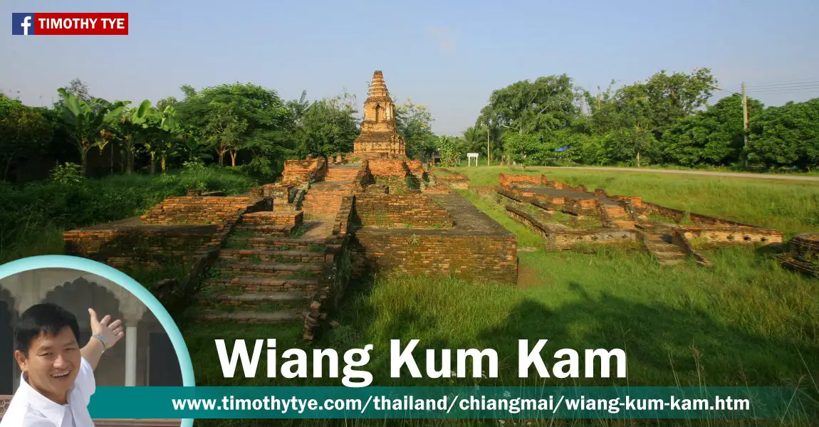
 Wiang Kum Kam, Chiang Mai, Thailand (26 October, 2006)
Wiang Kum Kam (GPS: 18.7474, 99.00173; Thai: เวียงกุมกาม
 ) is an ancient fortified city that is older than Chiang Mai itself. Located to the south of Chiang Mai, it was the site where King Mangrai moved his capital after capturing Lamphun, then the capital of the Kingdom of Haripunchai, in 1281.
Wiang Kum Kam was founded in 1286. It is located some 15 km from Lamphun. King Mangrai fortified the settlement with a palisade and a moat, using water channeled from nearby Ping River for this purpose.
Wiang Kum Kam served as King Mangrai's capital for only ten years. In 1296 he founded Chiang Mai and relocated there. From then on, Wiang Kum Kam was an abandoned site. By the 16th century, the Ping River changed its course, causing the ancient city to be flooded.
Wiang Kum Kam remained a desolate, abandoned site until the 20th century, when it was rediscovered and marginally settled. Excavations were conducted in the 1980's revealing a dozen or so temple ruins. Many of these have been restored, although the majority has only their foundations intact. There is also an on-site museum showcasing the history and artifacts of Wiang Kum Kam.
On the western side of the ruins of Wiang Kum Kam stands Wat Chedi Liam, or Monastery of the Square Chedi. This temple dates back to 1288-9, and was originally built by King Mangrai. It includes a square chedi which is a replica of the square Mon-style chedi at Wat Chama Thewi (also known as Wat Kukut) at Lamphun.
The present Wat Chedi Liam in Wiang Kum Kam was restored in 1908 through funds provided by Luang Yonakanvijit, an ethnic Mon of Burmese nationality who brought Burmese artisans over to restore the chedi and to add stucco designs.
Map of sights in Wiang Kum Kam
Sights at Wiang Kum Kam
- Wiang Kum Kam Information Center ศูนย์ข้อมูลเวียงกุมกาม
 (GPS: 18.74444, 98.99435)
Ruins at Wiang Kum Kam
Here's a list of some of the ruins. Many of these names were given by the locals, as they do not appear in any historical documents.- Wat Chang Kham วัดช้างค้ำ
 (GPS: 18.74787, 99.00199)
- Wat Chediliem วัดเจดีย์เหลี่ยม
 (GPS: 18.75391, 98.99595)
- Wat E-Kang วัดอีค่าง
 (GPS: 18.74985, 98.99933)
- Wat Ku Khao วัดกูขาว
 (GPS: 18.74985, 98.99933)
- Wat Huanong วัดหัวหนอง
 (GPS: 18.74871, 99.00518)
- Wat Ku Ailan วัดกู่อ้ายหลาน
 (GPS: 18.74958, 99.00358)
- Wat Kumkam วัดกุมกาม
 (GPS: 18.74973, 99.0024)
- Wat Nan Chang วัดหนานช้าง
 (GPS: 18.75122, 98.99891)
- Wat Phan Lao วัดพันเลา
 (GPS: 18.75115, 99.00361)
- Wat Phra Chao Ong Dum วัดพระเจ้าองค์ดำ
 (GPS: 18.75204, 98.99759)
- Wat Phya Mangrai วัดพญามังราย
 (GPS: 18.75246, 98.99747)
- Wat Pupia วัดปู่เปี้ย
 (GPS: 18.7497, 98.99759)
- Wat Sao Hin วัดเสาหิน
 (GPS: 18.75383, 99.00296)
- Wat Si Bunruang วัดศรีบุญเรือง
 (GPS: 18.75359, 98.99963)
- Wat That Kaow วัดธาตุขาว
 (GPS: 18.75104, 98.99658)
- Wat That Noi วัดธาตุน้อย
 (GPS: 8.74792, 99.00079)
 Latest updates on Penang Travel Tips
 Map of Roads in Penang
Looking for information on Penang? Use this Map of Roads in Penang to zoom in on information about Penang, brought to you road by road.
Copyright © 2003-2025 Timothy Tye. All Rights Reserved.

 Go Back