Broadway, London
Where Government Meets the Historic Heart of Westminster
Broadway is a short but historically significant street in the City of Westminster, London. It is situated just south of St James's Park and north of Victoria Street, making it an important connector within the central government and administrative quarter of the capital.The street runs from its junction with Victoria Street and continues northeast until it meets Tothill Street and Petty France. This area is known for its proximity to key government buildings and offices, and lies just a short walk from the Houses of Parliament and Westminster Abbey.
Length and Layout
Broadway is a relatively short street, measuring approximately 300 metres (around 980 feet) in length. Despite its modest size, the street plays an important role in the layout of Westminster's civic core.Its shape gently curves and narrows as it leads from Victoria Street toward Tothill Street. The street is flanked by large institutional and office buildings and has wide pavements with limited retail activity, reflecting its businesslike character.
Historical Background
Broadway dates back several centuries and evolved as part of Westminster's expansion during the 17th and 18th centuries. The area around Broadway was once open land known as Tothill Fields, used for markets and public gatherings. Over time, the fields gave way to dense development as Westminster grew into the administrative heart of the British government.By the 19th century, Broadway had become associated with civil administration and public service, a legacy that continues to this day. It was never a commercial high street or residential boulevard, but rather a functional and strategic corridor close to the power centres of British politics.
Origin of the Name
The name "Broadway" likely originates from the street's relatively wider dimensions compared to surrounding lanes and alleys of old Westminster. “Broadway” was a common name used across England for wider-than-usual roads in medieval and early modern periods.While it is difficult to pinpoint the exact date the name was formally adopted, records show the street being referred to as Broadway in maps and documents from the mid-18th century onwards.
Streets that connect to Broadway
- Caxton Street
- Dacre Street
- Petty France
- Queen Anne's Gate
- St Ermin's Hill
- Tothill Street
- Victoria Street
Major Buildings and Institutions
Broadway is lined with key government and public service buildings, reinforcing its status as a centre of officialdom:- 55 Broadway – An iconic Art Deco building and former headquarters of London Underground, designed by Charles Holden. It was once the tallest office block in London and is a Grade I listed building.
- UK Passport Office – A major branch of His Majesty's Passport Office is located along Broadway, often attracting visitors from across the country.
- New Scotland Yard (former site) – From 1967 to 2016, Broadway was home to the headquarters of the Metropolitan Police Service. Its revolving sign became one of London's iconic symbols. The HQ has since moved to Victoria Embankment, but the building remains a notable address.
Sights and Attractions Nearby
While Broadway itself is not tourist-oriented, it lies within easy reach of major Westminster landmarks:- St James's Park – Just to the north, this royal park offers views of Buckingham Palace and quiet green spaces.
- Westminster Abbey – Only a few minutes' walk away, this historic church is central to British ceremonial life.
- Houses of Parliament – Accessible via Tothill Street and Parliament Square.
Character and Use
Broadway is firmly in the administrative and institutional category of London streets. It is dominated by government buildings, public offices, and corporate headquarters.There is minimal retail activity, though a few cafés and coffee shops serve the working population. The street is quiet during weekends but busy on weekdays due to footfall from civil servants and business visitors.
In short, Broadway's character is professional, governmental, and utilitarian, with little residential presence.
Transport and Nearest Underground Stations
Broadway is exceptionally well-served by public transport. Two London Underground stations are very close:- St James's Park Station – Located directly at the eastern end of Broadway, this station is on the District and Circle lines.
- Victoria Station – Just a short walk southwest via Victoria Street, served by the Victoria, District, and Circle lines, as well as National Rail and coach services.
Fun Fact
One of London's most celebrated buildings, 55 Broadway, was controversial when completed in 1929 due to the presence of nude sculptures on its exterior. The sculptures, by artists like Eric Gill and Henry Moore, caused a public outcry at the time but are now considered important examples of British modernist art.Did Broadway in London Inspire Broadway in New York?
No — Broadway in Westminster, London, did not inspire the name of Broadway in New York City.
The name "Broadway" is a descriptive term used in both English and Dutch to refer to a wide street or thoroughfare. In New York's case, the name comes from the Dutch Brede Weg ("Broad Way"), used by settlers when the city was known as New Amsterdam in the 17th century. It referred to a broad Native American trail that was widened into a central road through Manhattan.
While London's Broadway dates back several centuries, it was never prominent or influential enough to lend its name across the Atlantic. In fact, many English towns and villages have streets named "Broadway" — it was a common naming convention for wider-than-usual roads.
So although both cities have a "Broadway," their names developed independently from similar linguistic roots rather than one inspiring the other.
Quick Facts
- Borough: City of Westminster
- Length: Approx. 300 metres
- Connected Streets: Victoria Street, Tothill Street, Petty France
- Main Use: Government and public services
- Nearest Tube Stations: St James's Park (District & Circle), Victoria (Victoria, District & Circle)
- Notable Buildings: 55 Broadway, former New Scotland Yard, HM Passport Office
- Nearby Sights: Westminster Abbey, St James's Park, Houses of Parliament
- Fun Fact: 55 Broadway's nude sculptures sparked 1920s controversy
Map of Broadway, London
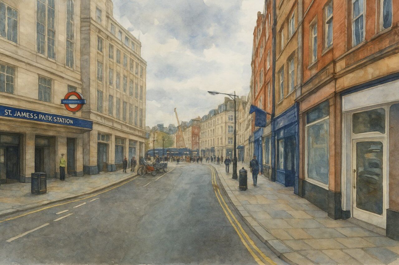
Painting of Broadway, London
Page Details
This page was created on 29 April 2025, modified on 15 May 2025. Hi, my name is Timothy and created it from my research, for my own entertainment, knowledge and to satisfy my curiosity. I am providing the information to you in good faith and hope it is useful. I try to get the details as accurate as possible. I also try to update the page whenever I stumble on new details. So this and all my other pages are perpetual work in progress. If you discover any error, please politely inform me, pointing out where the error lies, and I will correct it as soon as possible. Your helpfulness will keep this page accurate, relevant and helpful to those who need the information.Moving to London?
New to London and need a place to live? Read our Renting A Flat Guide. This guide covers everything you need to know about renting a flat in London, from viewing to signing.Streets of London
Come, let's explore and discover the streets of London together! Listed here afre the Streets of London that I have documented. Dive in and discover!Map of Streets in London
View all the streets that I have documented on Google Maps in this Map of Streets in London.Want to share your London travel experiences or get tips from fellow travellers?
Join the London Travel Tips Facebook GroupMore information for visiting London
Here are some related articles to help you get to know London better.- Cost of Living in London: Discover the true cost of living in London, including housing, transport, groceries, and more - plus tips for budgeting in one of the world's most expensive cities.
- Driving in London: Planning to drive in London? Learn about roads, car rentals, parking, tolls, and key tips for tourists and visitors from outside the capital.
- Driving Tips for Visiting London: Thinking of driving to London? Discover the best times to travel, congestion tips, parking apps, breakdown help, and petrol advice for a smoother journey.
- Evolution of London's Streets: Discover the fascinating history of how London's streets developed from ancient footpaths to today's complex network of roads across the capital.
- History of Immigration to London: Discover the rich history of immigration to London, from Huguenots to Bangladeshis, and how diverse communities have shaped the city's vibrant identity.
- How Big Is London Compared to Other World Cities?
- How London's Streets Measure Up: A Global Comparison of Road Widths
- How Streets of London are Named: Discover how London streets get their names, who decides them, and how historic, political, and public influences shape street naming in the capital.
- How the Grosvenor Family Came to Own Much of Mayfair, Belgravia and Pimlico: Explore how the Grosvenor family came to own much of Mayfair, Belgravia, and Pimlico, and learn about their historical connection (or lack thereof) with the British royal family and government.
- Living and working in London
- London's Quiet Collapse: How Living Standards Fell as Costs Skyrockted (1975-2025): Explore how London residents endured rising costs and falling living standards from 1975 to 2025 - from rocketing rents to wage stagnation and inflation.
- Marvel of the London Underground: Discover the history, challenges, and triumphs of the London Underground - the world's first underground railway and a vital transport lifeline for the UK capital since 1863.
- Moving to London: Expat Tips for Settling in Westminster: Essential advice for expats moving to London's Westminster: neighborhood insights, cost of living, transportation, housing, healthcare, schools, and tips to help you feel at home in the heart of the city.
- Places in London that aren't pronounced the way they're spelled
- Shopping in London: Discover London's diverse shopping scene
- Taking the bus in London: This is your complete guide to taking the bus when in London.
- The Anglican Faith: A Visitor's Guide to the Church of England: Learn about the Anglican faith and its deep ties to London's landmarks like Westminster Abbey and St Paul's Cathedral.
- Top 10 London Streets Every Visitor Must See: Discover London through its most iconic thoroughfares - 10 streets every visitor must experience. From historic Abbey Road to vibrant Camden High Street, explore culture, shopping, and hidden gems.
- Why are most roads in Central London so narrow? Learn why there are so few multi-lane roads and elevated highways in the heart of the city.

