Caxton Street, London
Caxton Street, Westminster - A Historic Link Between Broadway and Buckingham Gate
Streets that connect to Caxton Street
Caxton Street is located in the City of Westminster, in central London. It runs in a west-east direction, connecting Broadway to Buckingham Gate, just a stone's throw from St James's Park and Victoria.This street lies in a prime location for visitors exploring Westminster, as it's surrounded by key government buildings, hotels, and notable institutions.
Length and Layout
Caxton Street is a relatively short street, measuring approximately 180 metres (about 590 feet) in length. Despite its modest size, it is packed with architectural interest and historical significance.Historical Background
Caxton Street dates back to the mid-19th century, emerging during a period of major urban development in Westminster. It was laid out at a time when the area was being reshaped by Victorian planners aiming to modernise the city's street layout and improve access across the borough.The buildings that line the street today reflect a blend of styles from different periods, most notably the Victorian and Edwardian eras.
How Caxton Street Got Its Name
The street is named after William Caxton (c. 1422-1491), the first English printer. Caxton introduced the printing press to England in 1476, an innovation that revolutionised literature and learning across the country.The street was so named in the late 19th century to honour Caxton's contribution to English culture and publishing, symbolising progress, communication, and education - ideals valued in Victorian society.
Connecting Roads
Caxton Street connects two notable roads in Westminster:- Broadway - on its eastern end, a busy thoroughfare near Victoria Street
- Buckingham Gate - on its western end, which leads toward the royal precincts of Buckingham Palace
Notable Buildings and Attractions
Caxton Street is lined with elegant brick buildings, many of which have been converted into offices, residences, and hospitality venues. Key sites include:- St Ermin's Hotel - a grand Edwardian hotel with links to World War II espionage activities. MI6 agents reportedly met here during the early days of the war.
- Caxton Hall - formerly a town hall and now converted into luxury apartments. It was once used for civil marriages and has hosted weddings for celebrities like Elizabeth Taylor and Diana Dors.
Character of the Street
Today, Caxton Street is primarily mixed-use, with a balance of commercial and residential properties. The presence of St Ermin's Hotel gives the street a distinguished character, and its quiet charm stands in contrast to the busier roads nearby.
Nearest London Underground Stations
The nearest stations are:- St James's Park (served by the District and Circle lines) - approximately 2 minutes' walk
- Victoria Station (served by the Victoria, District, and Circle lines) - approximately 7 minutes' walk
Fun Fact
During World War II, Caxton Street and the adjoining St Ermin's Hotel played a secretive role as a rendezvous point for British intelligence officers and members of the Special Operations Executive (SOE). This lends the street a fascinating connection to London's wartime spy history.Quick Facts
- Location: City of Westminster, Central London
- Connects: Broadway and Buckingham Gate
- Length: Approximately 180 metres
- Named After: William Caxton, England's first printer
- Nearby Stations: St James's Park (District/Circle), Victoria (Victoria/District/Circle)
- Major Sites: St Ermin's Hotel, Caxton Hall
- Street Type: Mixed-use (residential, hotel, office)
- Fun Fact: Used by British intelligence during WWII
Map of Caxton Street, London
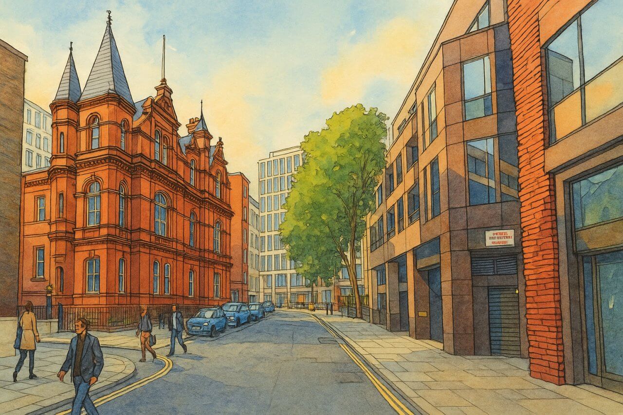
Painting of Caxton Street, London (View image in full size)
Page Details
This page was created on 30 April 2025. Hi, my name is Timothy and created it from my research, for my own entertainment, knowledge and to satisfy my curiosity. I am providing the information to you in good faith and hope it is useful. I try to get the details as accurate as possible. I also try to update the page whenever I stumble on new details. So this and all my other pages are perpetual work in progress. If you discover any error, please politely inform me, pointing out where the error lies, and I will correct it as soon as possible. Your helpfulness will keep this page accurate, relevant and helpful to those who need the information.Moving to London?
New to London and need a place to live? Read our Renting A Flat Guide. This guide covers everything you need to know about renting a flat in London, from viewing to signing.Streets of London
Come, let's explore and discover the streets of London together! Listed here afre the Streets of London that I have documented. Dive in and discover!Map of Streets in London
View all the streets that I have documented on Google Maps in this Map of Streets in London.Want to share your London travel experiences or get tips from fellow travellers?
Join the London Travel Tips Facebook GroupMore information for visiting London
Here are some related articles to help you get to know London better.- Cost of Living in London: Discover the true cost of living in London, including housing, transport, groceries, and more - plus tips for budgeting in one of the world's most expensive cities.
- Driving in London: Planning to drive in London? Learn about roads, car rentals, parking, tolls, and key tips for tourists and visitors from outside the capital.
- Driving Tips for Visiting London: Thinking of driving to London? Discover the best times to travel, congestion tips, parking apps, breakdown help, and petrol advice for a smoother journey.
- Evolution of London's Streets: Discover the fascinating history of how London's streets developed from ancient footpaths to today's complex network of roads across the capital.
- History of Immigration to London: Discover the rich history of immigration to London, from Huguenots to Bangladeshis, and how diverse communities have shaped the city's vibrant identity.
- How Big Is London Compared to Other World Cities?
- How London's Streets Measure Up: A Global Comparison of Road Widths
- How Streets of London are Named: Discover how London streets get their names, who decides them, and how historic, political, and public influences shape street naming in the capital.
- How the Grosvenor Family Came to Own Much of Mayfair, Belgravia and Pimlico: Explore how the Grosvenor family came to own much of Mayfair, Belgravia, and Pimlico, and learn about their historical connection (or lack thereof) with the British royal family and government.
- Living and working in London
- London's Quiet Collapse: How Living Standards Fell as Costs Skyrockted (1975-2025): Explore how London residents endured rising costs and falling living standards from 1975 to 2025 - from rocketing rents to wage stagnation and inflation.
- Marvel of the London Underground: Discover the history, challenges, and triumphs of the London Underground - the world's first underground railway and a vital transport lifeline for the UK capital since 1863.
- Moving to London: Expat Tips for Settling in Westminster: Essential advice for expats moving to London's Westminster: neighborhood insights, cost of living, transportation, housing, healthcare, schools, and tips to help you feel at home in the heart of the city.
- Places in London that aren't pronounced the way they're spelled
- Shopping in London: Discover London's diverse shopping scene
- Taking the bus in London: This is your complete guide to taking the bus when in London.
- The Anglican Faith: A Visitor's Guide to the Church of England: Learn about the Anglican faith and its deep ties to London's landmarks like Westminster Abbey and St Paul's Cathedral.
- Top 10 London Streets Every Visitor Must See: Discover London through its most iconic thoroughfares - 10 streets every visitor must experience. From historic Abbey Road to vibrant Camden High Street, explore culture, shopping, and hidden gems.
- Why are most roads in Central London so narrow? Learn why there are so few multi-lane roads and elevated highways in the heart of the city.

