Harold Wood Station, London
Harold Wood Station is a key railway station located in the eastern section of the London Borough of Havering, forming part of the outer London transport network. Positioned within Travelcard Zone 6, it lies roughly 15.5 miles (25 kilometres) from Charing Cross by road, serving as an important commuter hub connecting residents of Harold Wood and its surrounding areas with central London and destinations further afield.
History and Origins
Harold Wood Station opened on 1 December 1868 as part of the Great Eastern Railway’s expansion eastward from the City. It retained the same name from its inception, taking it from the nearby locality of Harold Wood, which itself was named after King Harold Godwinson of the 11th century. The area was largely rural until the arrival of the railway, which spurred its suburban development in the late 19th and early 20th centuries.
Station Building and Layout
The station building retains a largely traditional appearance, with red-brick architecture and a pitched roof. A modern ticket office and electronic gates have been installed, providing step-free access via lifts to all platforms. The main entrance is on Station Road, with a footbridge connecting the two platforms across the tracks. Recent upgrades under the Crossrail programme included platform extensions and accessibility enhancements to support the increased passenger flow of the Elizabeth Line.
Rail Services at Harold Wood
While Harold Wood is not served by the London Underground network, it plays an essential role in London’s wider transport ecosystem. It is classified as one of the London Underground Stations due to its inclusion in integrated fare systems, even though it is served solely by National Rail services.
Today, Harold Wood is served exclusively by the Elizabeth Line, providing direct, frequent services westbound to Reading and Heathrow Airport and eastbound to Shenfield. It does not have direct access to other London Underground lines such as the Bakerloo Line, Central Line, or District Line, but passengers can easily interchange at major hubs like Stratford or Liverpool Street.
Preceding and Following Stations on the Elizabeth Line
- Westbound: The preceding station is Brentwood; the following station is Gidea Park.
- Eastbound: Harold Wood is one stop before the eastern terminus at Shenfield.
Travelcard Zone and Ticket Prices
Harold Wood is in Travelcard Zone 6. As of 2025, the adult fare rates for the following destinations are as follows:
To Reading Station (westbound terminus)
- Single paper ticket: £24.30
- Oyster/contactless: £18.50 (peak), £13.90 (off-peak)
- Estimated journey time: approx. 1 hour 25 minutes
To Shenfield Station (eastbound terminus)
- Single paper ticket: £4.10
- Oyster/contactless: £2.60 (peak), £2.00 (off-peak)
- Estimated journey time: approx. 4 minutes
To Charing Cross Station (via Elizabeth Line and Underground)
- Interchanges required: Elizabeth Line to Tottenham Court Road, then transfer to Northern Line southbound
- Single paper ticket: £6.70
- Oyster/contactless: £4.10 (peak), £3.20 (off-peak)
- Estimated journey time: approx. 50 minutes
Fun Fact
One quirky local legend claims that the area of Harold Wood may have been part of the ancient hunting forests of King Harold before the Norman conquest—though no direct evidence exists, the association adds a layer of intrigue to the station’s name and character. Today, the surrounding Harold Wood Park and Pages Wood offer a pleasant green retreat within walking distance of the station.
Quick Facts
- Name: Harold Wood Station
- Opened: 1 December 1868
- Borough: London Borough of Havering
- Distance from Charing Cross: approx. 15.5 miles by road
- Served by: Elizabeth Line
- Preceding station: Brentwood (westbound)
- Following station: Gidea Park (westbound), Shenfield (eastbound terminus)
- Travelcard Zone: Zone 6
- Fares to Reading: £24.30 paper / £18.50 peak Oyster / £13.90 off-peak Oyster
- Fares to Shenfield: £4.10 paper / £2.60 peak Oyster / £2.00 off-peak Oyster
- Fares to Charing Cross: £6.70 paper / £4.10 peak Oyster / £3.20 off-peak Oyster
- Estimated journey time to Reading: 1h 25m
- Estimated journey time to Shenfield: 4 minutes
- Estimated journey time to Charing Cross: 50 minutes
- Architecture: Traditional red-brick station with modern step-free access
- Fun Fact: The station is named after King Harold and lies near Harold Wood Park
Harold Wood Station is  on the Map of London Underground
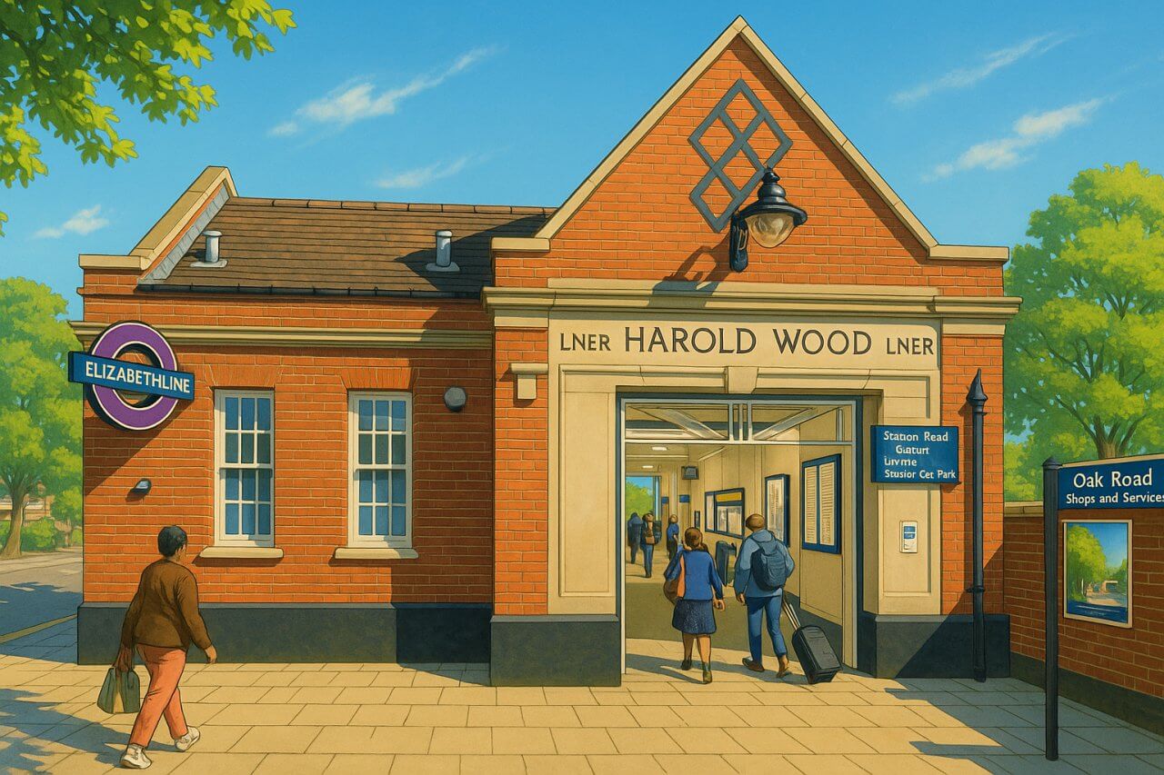
Painting of Harold Wood Station, London (View image in full size)
Page Details
This page was created on 30 May 2025. Hi, my name is Timothy and created it from my research, for my own entertainment, knowledge and to satisfy my curiosity. I am providing the information to you in good faith and hope it is useful. I try to get the details as accurate as possible. I also try to update the page whenever I stumble on new details. So this and all my other pages are perpetual work in progress. If you discover any error, please politely inform me, pointing out where the error lies, and I will correct it as soon as possible. Your helpfulness will keep this page accurate, relevant and helpful to those who need the information.Want to share your London travel experiences or get tips from fellow travellers?
Join the London Travel Tips Facebook GroupMore information for visiting London
Here are some related articles to help you get to know London better.- Cost of Living in London: Discover the true cost of living in London, including housing, transport, groceries, and more - plus tips for budgeting in one of the world's most expensive cities.
- Driving in London: Planning to drive in London? Learn about roads, car rentals, parking, tolls, and key tips for tourists and visitors from outside the capital.
- Driving Tips for Visiting London: Thinking of driving to London? Discover the best times to travel, congestion tips, parking apps, breakdown help, and petrol advice for a smoother journey.
- Evolution of London's Streets: Discover the fascinating history of how London's streets developed from ancient footpaths to today's complex network of roads across the capital.
- History of Immigration to London: Discover the rich history of immigration to London, from Huguenots to Bangladeshis, and how diverse communities have shaped the city's vibrant identity.
- How Big Is London Compared to Other World Cities?
- How London's Streets Measure Up: A Global Comparison of Road Widths
- How Streets of London are Named: Discover how London streets get their names, who decides them, and how historic, political, and public influences shape street naming in the capital.
- How the Grosvenor Family Came to Own Much of Mayfair, Belgravia and Pimlico: Explore how the Grosvenor family came to own much of Mayfair, Belgravia, and Pimlico, and learn about their historical connection (or lack thereof) with the British royal family and government.
- Living and working in London
- London's Quiet Collapse: How Living Standards Fell as Costs Skyrockted (1975-2025): Explore how London residents endured rising costs and falling living standards from 1975 to 2025 - from rocketing rents to wage stagnation and inflation.
- Marvel of the London Underground: Discover the history, challenges, and triumphs of the London Underground - the world's first underground railway and a vital transport lifeline for the UK capital since 1863.
- Moving to London: Expat Tips for Settling in Westminster: Essential advice for expats moving to London's Westminster: neighborhood insights, cost of living, transportation, housing, healthcare, schools, and tips to help you feel at home in the heart of the city.
- Places in London that aren't pronounced the way they're spelled
- Shopping in London: Discover London's diverse shopping scene
- Taking the bus in London: This is your complete guide to taking the bus when in London.
- The Anglican Faith: A Visitor's Guide to the Church of England: Learn about the Anglican faith and its deep ties to London's landmarks like Westminster Abbey and St Paul's Cathedral.
- Top 10 London Streets Every Visitor Must See: Discover London through its most iconic thoroughfares - 10 streets every visitor must experience. From historic Abbey Road to vibrant Camden High Street, explore culture, shopping, and hidden gems.
- Why are most roads in Central London so narrow? Learn why there are so few multi-lane roads and elevated highways in the heart of the city.

