Chelsea Bridge Road, London
Chelsea Bridge Road is a short but significant street in Central London, running in the City of Westminster. It connects Lower Sloane Street at the northwestern end to Chelsea Bridge in the south, forming an essential route between Sloane Square and the Thames riverfront. The road also forms a boundary between the affluent district of Chelsea in the Royal Borough of Kensington and Chelsea and the area of Pimlico in Westminster.
Route and Traffic Direction
Chelsea Bridge Road runs approximately 0.3 miles (around 480 metres) from the junction with Lower Sloane Street, Pimlico Road, and Royal Hospital Road to the Chelsea Embankment and Grosvenor Road at Chelsea Bridge. The road is open to two-way vehicular traffic and is a primary link between the northern approach to Chelsea Bridge and the West London road network.
History and Name
The street was laid out in the mid-19th century in conjunction with the construction of the original Chelsea Bridge, which opened in 1858. At that time, this route was created to provide access from Sloane Square and the newly developed Chelsea neighbourhoods to the bridge and onward to Battersea Park, which opened in 1858 on the south side of the River Thames.
The name Chelsea Bridge Road is derived directly from Chelsea Bridge itself. The pronunciation of the road name follows the pronunciation of “Chelsea” as CHEL-see, which in the International Phonetic Alphabet (IPA) is rendered as /ˈtʃɛl.si/  .
.
Character and Streetscape
Chelsea Bridge Road is a short, straight road that offers a mix of green spaces and heritage. On its western side lies the expansive grounds of the Royal Hospital Chelsea, home to the famous Chelsea Pensioners. To the east is a high-end residential block and an entrance to the prestigious Ranelagh Gardens. The character of the road is formal and somewhat ceremonial, especially given its connection to the hospital and Annual Chelsea Flower Show.
Points of Interest
- Royal Hospital Chelsea – A historic retirement and nursing home for former members of the British Army, established by King Charles II in 1682.
- Chelsea Flower Show – Held annually in May on the grounds of the Royal Hospital Chelsea, this world-famous event brings thousands of visitors to the area.
- Chelsea Barracks – Located just northeast of the road, this former military site has been redeveloped into one of London's most luxurious residential schemes.
- Battersea Park – Just across the Chelsea Bridge, this expansive Victorian park offers riverside walks, a zoo, boating lake, and beautiful gardens.
- Chelsea Bridge – A 1937 suspension bridge offering striking views up and down the Thames.
Property and Real Estate
The area surrounding Chelsea Bridge Road is among the most expensive in London. Properties here, particularly in adjacent developments like Chelsea Barracks or on Royal Hospital Road, command premium prices. As of early 2025, new-build flats in this part of Chelsea typically range from £2 million to £6 million, depending on size and amenities. The average flat offers around 1,200 sq ft (111.5 sq metres), while larger luxury units may reach 2,500 sq ft (232.3 sq metres) or more.
This pricing is well above the London average and reflects the area's proximity to green space, historical landmarks, and transport connections, not to mention its reputation for exclusivity and elegance.
Transport Connections
Nearest Underground Stations
- Sloane Square – Served by the District and Circle lines. Located approximately 0.4 miles (650 metres) north of the road.
- Victoria – A major transport hub served by the Victoria, District, and Circle lines and National Rail. Around 0.7 miles (1.1 km) northeast of the road.
Bus Services
There are several bus stops near Chelsea Bridge Road, primarily located on Lower Sloane Street, Chelsea Bridge Road itself, and Chelsea Embankment. These are served by key London routes including:
- Bus 137 – Connecting Streatham Hill to Marble Arch via Sloane Square
- Bus 452 – From Kensal Rise to Wandsworth Road
- Bus 360 – From Elephant & Castle to the Royal Albert Hall
Fun Fact
During the Chelsea Flower Show, Chelsea Bridge Road is partially closed or heavily restricted to traffic, transforming the surrounding area into a vibrant floral and social hub. Temporary flower installations often appear along the road and adjacent shops decorate their facades in a friendly competition known as the Chelsea in Bloom festival.
Quick Facts
- Borough: City of Westminster (western boundary with Royal Borough of Kensington and Chelsea)
- Connects: Lower Sloane Street / Pimlico Road to Chelsea Bridge / Chelsea Embankment
- Length: Approximately 0.3 miles (480 metres)
- Traffic Direction: Two-way
- Pronunciation: /ˈtʃɛl.si brɪdʒ rəʊd/
- Nearest Tube: Sloane Square (District & Circle lines)
- Nearby Sights: Royal Hospital Chelsea, Chelsea Bridge, Battersea Park, Chelsea Barracks
- Bus Routes: 137, 360, 452
- Real Estate Prices (2025): £2–6 million+ for luxury flats (~1,200–2,500 sq ft / 111.5–232.3 sq m)
- Fun Fact: Hosts floral art installations during Chelsea in Bloom each May
Map of Chelsea Bridge Road, London
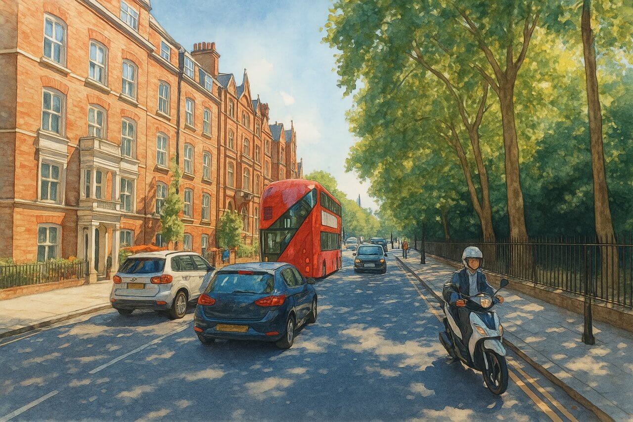
Painting of Chelsea Bridge Road, London (View image in full size)
Page Details
This page was created on 17 May 2025. Hi, my name is Timothy and created it from my research, for my own entertainment, knowledge and to satisfy my curiosity. I am providing the information to you in good faith and hope it is useful. I try to get the details as accurate as possible. I also try to update the page whenever I stumble on new details. So this and all my other pages are perpetual work in progress. If you discover any error, please politely inform me, pointing out where the error lies, and I will correct it as soon as possible. Your helpfulness will keep this page accurate, relevant and helpful to those who need the information.Moving to London?
New to London and need a place to live? Read our Renting A Flat Guide. This guide covers everything you need to know about renting a flat in London, from viewing to signing.Streets of London
Come, let's explore and discover the streets of London together! Listed here afre the Streets of London that I have documented. Dive in and discover!Map of Streets in London
View all the streets that I have documented on Google Maps in this Map of Streets in London.Want to share your London travel experiences or get tips from fellow travellers?
Join the London Travel Tips Facebook GroupMore information for visiting London
Here are some related articles to help you get to know London better.- Cost of Living in London: Discover the true cost of living in London, including housing, transport, groceries, and more - plus tips for budgeting in one of the world's most expensive cities.
- Driving in London: Planning to drive in London? Learn about roads, car rentals, parking, tolls, and key tips for tourists and visitors from outside the capital.
- Driving Tips for Visiting London: Thinking of driving to London? Discover the best times to travel, congestion tips, parking apps, breakdown help, and petrol advice for a smoother journey.
- Evolution of London's Streets: Discover the fascinating history of how London's streets developed from ancient footpaths to today's complex network of roads across the capital.
- History of Immigration to London: Discover the rich history of immigration to London, from Huguenots to Bangladeshis, and how diverse communities have shaped the city's vibrant identity.
- How Big Is London Compared to Other World Cities?
- How London's Streets Measure Up: A Global Comparison of Road Widths
- How Streets of London are Named: Discover how London streets get their names, who decides them, and how historic, political, and public influences shape street naming in the capital.
- How the Grosvenor Family Came to Own Much of Mayfair, Belgravia and Pimlico: Explore how the Grosvenor family came to own much of Mayfair, Belgravia, and Pimlico, and learn about their historical connection (or lack thereof) with the British royal family and government.
- Living and working in London
- London's Quiet Collapse: How Living Standards Fell as Costs Skyrockted (1975-2025): Explore how London residents endured rising costs and falling living standards from 1975 to 2025 - from rocketing rents to wage stagnation and inflation.
- Marvel of the London Underground: Discover the history, challenges, and triumphs of the London Underground - the world's first underground railway and a vital transport lifeline for the UK capital since 1863.
- Moving to London: Expat Tips for Settling in Westminster: Essential advice for expats moving to London's Westminster: neighborhood insights, cost of living, transportation, housing, healthcare, schools, and tips to help you feel at home in the heart of the city.
- Places in London that aren't pronounced the way they're spelled
- Shopping in London: Discover London's diverse shopping scene
- Taking the bus in London: This is your complete guide to taking the bus when in London.
- The Anglican Faith: A Visitor's Guide to the Church of England: Learn about the Anglican faith and its deep ties to London's landmarks like Westminster Abbey and St Paul's Cathedral.
- Top 10 London Streets Every Visitor Must See: Discover London through its most iconic thoroughfares - 10 streets every visitor must experience. From historic Abbey Road to vibrant Camden High Street, explore culture, shopping, and hidden gems.
- Why are most roads in Central London so narrow? Learn why there are so few multi-lane roads and elevated highways in the heart of the city.

