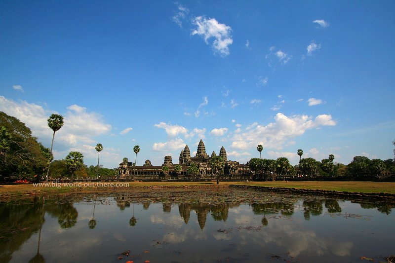
 Angkor Wat (26 February, 2006)
Angkor Wat អង្គរវត្ត (GPS: 13.40899, 103.8638) is the largest religious monument in the world, a true Khmer architectural masterpiece, and the highlight of any visit to Angkor.And also, the most photographed in all Cambodia.
Angkor Wat was built in the first half of the 12th century by King Suryavarman II, who reigned from AD 1113 to circa AD 1150. The name Angkor Wat roughly means "the city that became a temple". It is not the original name of the ruins, but rather one that came about when it was rediscovered.
Visiting Angkor Wat
You base for exploring Angkor Wat is the town of Siem Reap, located roughly 4 km to the south of the Angkor Archaeological Park.How to reach Angkor Wat
Angkor Wat is the star attraction in the entire Angkor complex. It is located about 5.5 km north of Siem Reap. It is impossible to miss, even if you're travelling independently. No tuk tuk driver worth his salt can fail to take you to Angkor Wat. If he doesn't know, get a different tuk tuk driver!Angkor Wat is the biggest of all the monuments in Angkor. You can spend hours and hours here, and still have much to cover. Best time to come is during early morning, in time to view the sun rise, or late evening, for the sunset. In between, it might get too hot, unless you explore the inner sanctuaries of Angkor Wat. If you need a good tuk tuk driver, contact the one I used, Mr Han (contact details below).
Orientation of Angkor Wat
We would enter Angkor Wat from the west, unlike other Angkor temples which would be entered from the east. This gives the belief that Angkor Wat was originally built as a funerary temple by Suryavarman II for himself, as the elements associated with death is orientated in mirror image to the living. Few Angkor temples faces west, the notable include Phimai in northeast Thailand, which faces southeast, and Preah Vihear, which faces north. At Angkor itself, two of the temples at Preah Pithu as well as the Vishnu temple at Preah Khan face west.Entering Angkor Wat
Having crossed the stone causeway, we arrive at the West Gopura of Angkor Wat. To be exact, we arrive at the entry tower or Main Entrance. Now, which way to go? Please see the map of the grounds and floor plan below:Most people will go straight to enter the temple. You can, if you are pressed for time. I have the privilege of returning to Angkor Wat several times during my visits, so I had the chance to explore it bit by bit. I even picnicked on its lawn at sunrise.
Before we enter the temple, let's explore the ground. There are dirt tracks that takes us to the North Gopura and East Gopura (see map above). These are usually quiet places where you won't find many tourists, except the few foolhardy ones like me who simply must see all of Angkor Wat.
To visit the North and East Gopuras, please click on the links below:
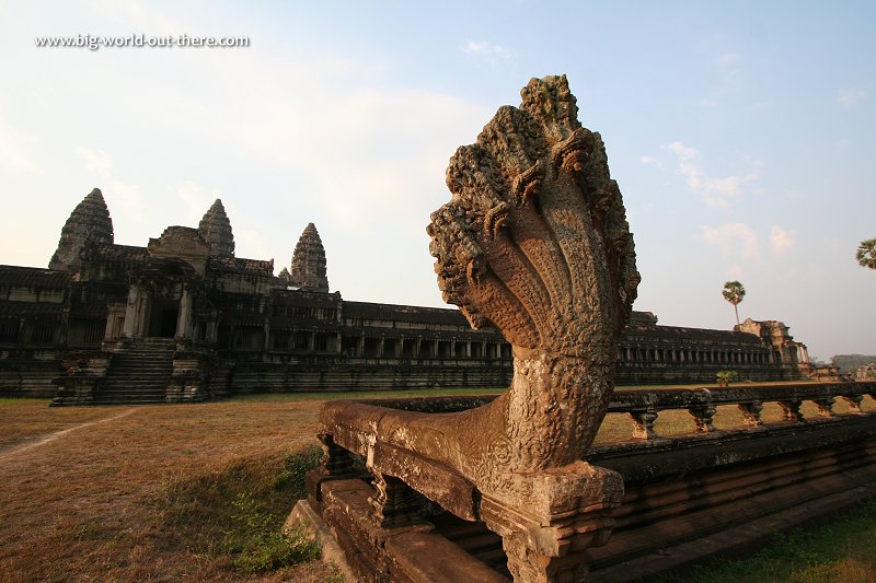 A naga balustrade, on the north side of Angkor Wat (26 February, 2006)
Galleries and sections of Angkor Wat:
 Here I am having my breakfast on the grounds of Angkor Wat (26 February, 2006)
About Angkor Wat
Originally constructed as a Hindu temple dedicated to Vishnu, Angkor Wat became a Theravada Buddhist monument some time around the 16th century, and earned the word "Wat" to its name. Construction of Angkor Wat probably began during the reign of Suryavarman II, and continue after his demise. The carving of the bas-reliefs continued long after Angkor Wat was constructed, although the later carvings were far inferior to those executed during Suryavarman II's reign. The whole project took 30 years to complete, rivalling in scale to the pyramids of Egypt. To appreciate the composition of Angkor Wat, it is necessary to recognise the repetitive elements of the architecture.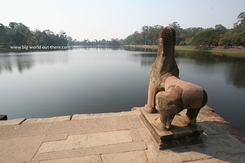 Angkor Wat (26 February, 2006)
Approaching Angkor Wat on its massive causeway from the west.
Angkor Wat is so ingeniously designed that one can only view all its five towers from special angels. It took me close to twenty minutes to make one full circle around it. I have visited Angkor Wat many times during my visits to Siem Reap, but I can't say I have fully explored it. There is just so much to cover that you just need to make a few trips to overcome fatigue.
The enormity of Angkor Wat is mind boggling. Consider these statistics: area occupied, 210 hectares; width of moat, 200 metres; height of tallest tower, 65 metres; the enclosure walls measures 5.5 kilometres! The area occupied by the temple itself measures 332 x 258 meters. That's nearly 9 hectares - the size of an airport terminal.
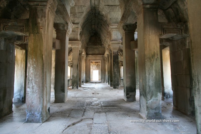 This is the inside of one of the "manuscript halls" flanking the causeway towards Angkor Wat (24 February, 2006)
Street View within the manuscript all.
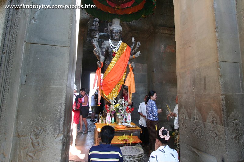 Statue of Vishnu, Angkor Wat (24 February, 2006)
Photographing Angkor Wat
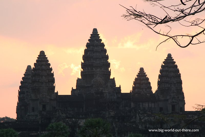
Depending on what sort of photography you are looking for, the best times to visit Angkor Wat is at sunrise, at afternoon, and at sunset. There are two man-made lily ponds in front of Angkor Wat (see the map below), of which the one on the left is bigger and offers a better view. During sunrise, you should position yourself somewhere in front of the left pond (where it can get very crowded). As the sun rises, try to get it between the prasats (towers).Once the sun has risen high (9:00am - 10:00am), it's time to go inside Angkor Wat, as the grounds outside will start getting hot. If you have the patience to explore it systematically, then the way to do it is anti-clockwise beginning from the West Gallery. Scroll down to Inside Angkor Wat to explore the bas-reliefs.
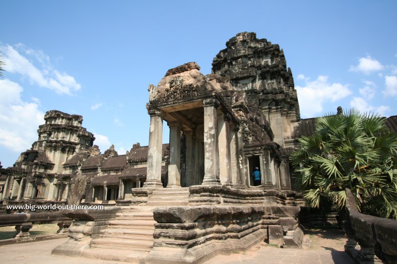 One of the entrances to the outer enclosure of Angkor Wat (24 February, 2006)
As Angkor Wat faces west, it will be challenging trying to get a good shot of the front façade in the morning. You'd have better luck in the afternoon, preferably after 3:00pm, when the sun is on one side. Then you'd get the front of Angkor Wat illuminated, just like the photograph at the top of this page. It will be an added bonus, of course, if there's blue sky. Plan to visit Angkor Wat during the dry season, around January-March, for greater likelihood of blue skies.
 The prasats or "lotus towers" within the inner sanctuary of Angkor Wat (26 February, 2006)
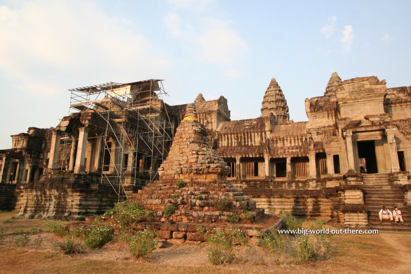 A chedi, built in 1702 but now in ruins, punctuate the grounds on the northeastern side of Angkor Wat (26 February, 2006)
Street View depicting the eastern side of Angkor Wat.
Inside Angkor Wat
While with other Angkor temples orientated to the east, ie Bayon, you will do a clockwise circuit around it. But for Angkor Wat, which faces the west, the recommended route is anti-clockwise from the main entrance.Statue of Vishnu / Buddha To the right of the Main Entrance is an imposing stone statue with eight hands. The symbols it carry in those hands indicates that this statue is originally Vishnu. (When Angkor Wat was built, the king was Hindu. However, a few centuries later, the later king was Mahayana Buddhist, and then today, Cambodia is primarily Theravada Buddhist.) However, it has been transformed into the statue of Buddha by being given a new head. This statue is still being worshipped today by modern Cambodians.
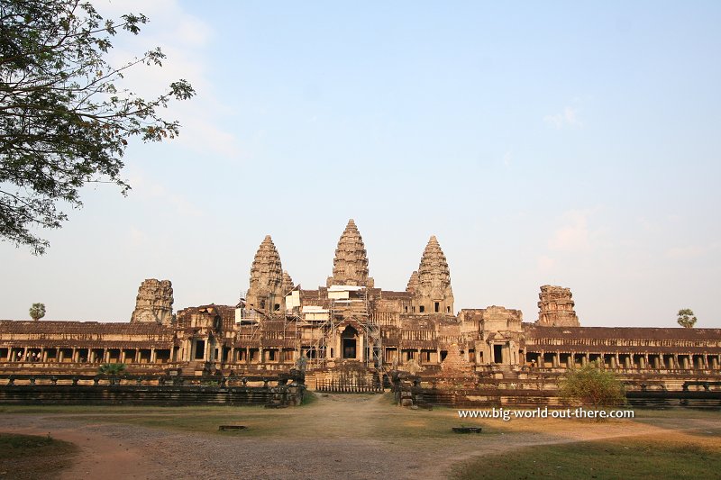 Angkor Wat, as seen from the east (24 February, 2006)
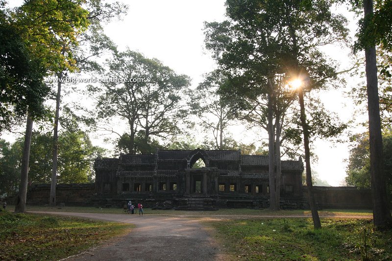 The eastern gopura, or gate, to Angkor Wat, on the far eastern end of the complex (24 February, 2006)
Street View of the Eastern Gopura.
Bas Reliefs Now let's make an anti clockwise circuit around Angkor Wat, and I'll explain to you the bas-relief (wall carvings) as we view them. The bas-reliefs of Angkor is regarded as one of the finest expressions of Khmer art of the 12th Century. There is lots and lots to cover, and if you don't have enough time, at the very list, the bas-reliefs that you should view are those on the southern half of Angkor Wat, namely the Battle of Kurukshetra, The Army of Suryavarman II, Judgement of Yama and Churning of the Ocean of Milk. In my description below, we will walk with the gallery on our left hand side. Walking down the passageway, we "read" the carvings from the left to the right.
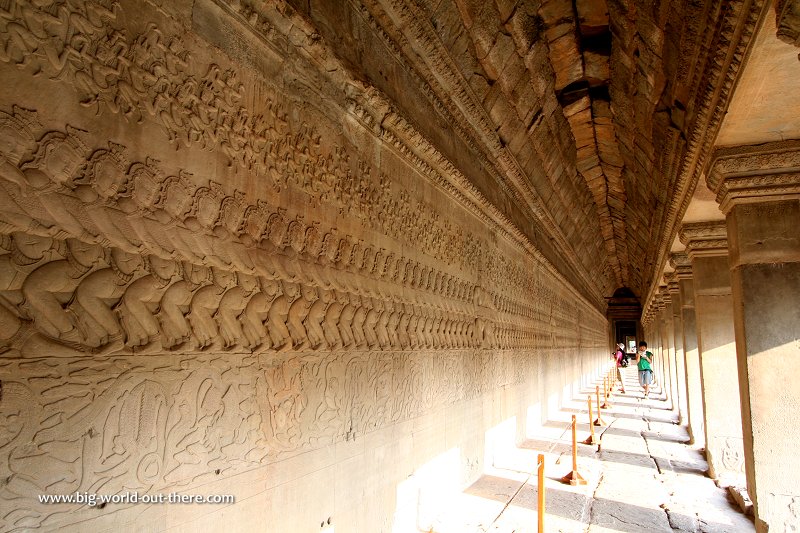 Churning the Ocean of Milk, the most famous gallery in Angkor Wat (24 February, 2006)
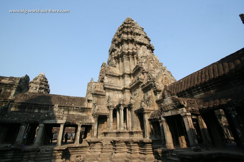 One of the towers of the Upper Level of Angkor Wat (24 February, 2006)
Street View showing the Upper Level of Angkor Wat.
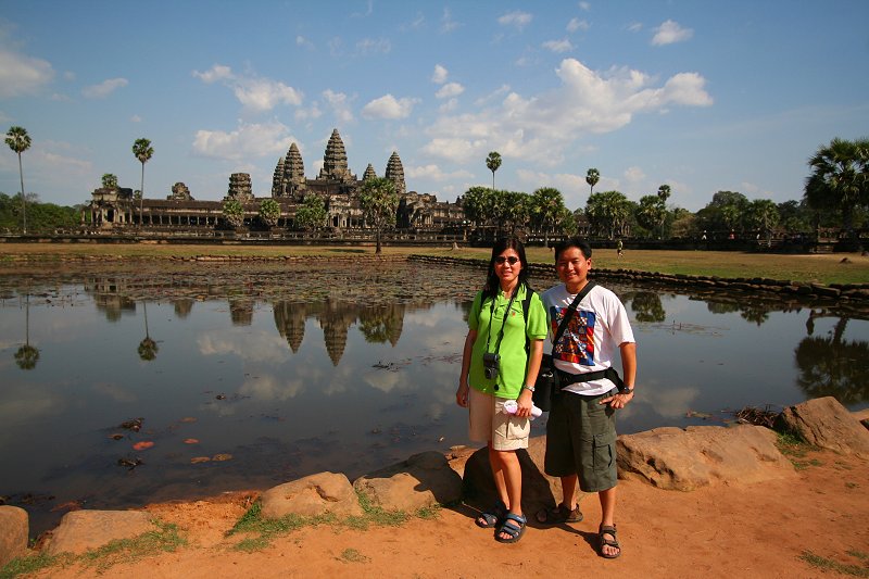 Tim and wife Chooi Yoke at Angkor Wat (24 February, 2006)
 Latest updates on Penang Travel Tips
 Map of Roads in Penang
Looking for information on Penang? Use this Map of Roads in Penang to zoom in on information about Penang, brought to you road by road.
Copyright © 2003-2025 Timothy Tye. All Rights Reserved.

 Go Back