 City Wall of Chiang Mai at Tha Phae Gate (24 October, 2006)
City Wall of Chiang Mai is the wall that once encloses the old city of Chiang Mai, Thailand. During medieval times, the walls keep intruders and invaders at bay. For further reenforcement, the walls were surrounded by a moat. The wall used to encase an area that is almost square, but not quite. It measured roughly 1.52 kilometers from east to west and roughly 1.55 kilometers from north to south. So, almost square.
I have been trying to determine when the city wall was first built. I do know that the city was established by King Mangrai somewhere between 1294 and 1296 (the official date is placed as 12 April, 1296). I do not suppose the present walls dates from its founding, but the floor plan possibly does.
Parts of the walls have broken down, or were broken during warfare. A great part of this has since been restored. The moat itself is well kept today, with water features such as fountains.
Today, once remnants of the wall is still standing. They are where the city gates are located, and the four corners where there were forts. The forts are now in ruins. Only the gates of the old city have been restored, and they are only standing today because they were rebuilt. In addition to the location of the four gates, there are several other crossings into the old city area.
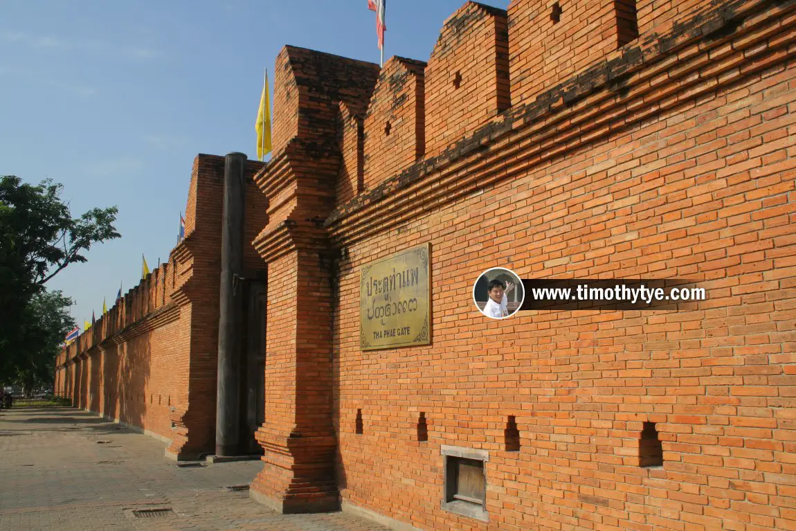
Perhaps the most important gate, and most often visited by tourists, is Tha Phae Gate, on the east side of the old city. It connects Thapae Road with Rachadamnoen Road.
On the northeast of the old city is Sriphui Corner. Some remains of the wall, know here as Fort Sri-Poom, is visible here. On the northside, the wall is still standing at the northern entrance into the city. This entrance is called Chang Phuak Gate, at Siphum Road. Only the section where the road enters across the moat appears to have been fully restored.
As you head from the northeast to the northwest, you will see quite a stretch of the wall before you reach the corner, the location of Fort of Hua-Lin. This section is in various stages of disrepair. On the west side, the restored section of the gate is at Saun Dok Gate. I always remember this gate for the big tree located to the south side.
On the southwest side of the Old City, remnants of the wall are also still visible, though not restored. This section is known as Fort Ku-Hueang. Next, on the south side of the Old City, the section of the wall that has been rebuilt is called Saen Pung Gate. Further on, is Chiang Mai Gate. And finally, on the southeast corner of the old city, is Fort of Ka-Tham. That corner of the wall is known as Katam Corner.
 City Wall of Chiang Mai at Tha Phae Gate (East Gate) (24 October, 2006)
 Saen Pung Gate (Southwest Gate), on the south side of the city (24 October, 2006)
 Suan Dok Gate (West Gate), Chiang Mai (24 October, 2006)
 Suan Dok Gate, Chiang Mai (24 October, 2006)
 Northwest corner of the city wall, location of Fort of Hua-Lin. (24 October, 2006)
 Fort of Hua-Lin, part of the northwest fortification of the Chiang Mai City Wall. (24 October, 2006)
 Chang Phueak Gate (North Gate) of the City Wall. (24 October, 2006)
 Katam Corner (Southeast Corner), Chiang Mai (26 October, 2006)
 Chiang Mai Gate (Southeast Gate) of the Chiang Mai Old City Wall (24 October, 2006)
 Chiang Mai Gate (24 October, 2006)
 Chiang Mai Gate (24 October, 2006)
Location Map of various points at the City Wall of Chiang Mai
City Wall of Chiang Mai on Google Street View
Saen Pung Gate, the southern gate of the City Wall of Chiang Mai (Apr 2017)Related Reading
 Latest updates on Penang Travel Tips
 Map of Roads in Penang
Looking for information on Penang? Use this Map of Roads in Penang to zoom in on information about Penang, brought to you road by road.More information for visiting Bangkok
- 7-Day Bangkok Family-Friendly Vacation: This is an itinerary for a 7-day family-friendly trip from Penang to Bangkok, with tips on flights, family-friendly hotels, toddler-friendly attractions, shopping highlights and practical travel advice.
Featured Video: Sukhothai, the Birthplace of Thai Civilisation
Buy Me A Coffee
If you enjoy the information I provide and want to support the work I do, please buy me a coffee! I appreciate it immensely, thank you so much!

 Backtrack | HOME | Latest Updates |
Copyright © 2003-2026 Timothy Tye. All Rights Reserved.