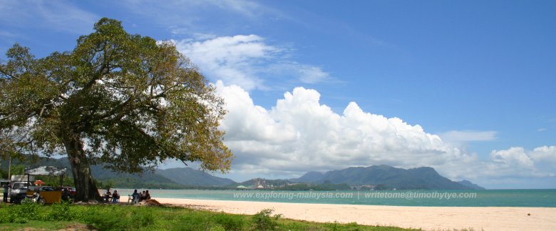
 Tanjung Rhu, Langkawi
Pulau Langkawi (GPS: 6.36443, 99.80529) is the biggest island in Langkawi, and the main island of the Langkawi Archipelago. It is also the biggest island on the west coast of Peninsular Malaysia. The island has a total area of 478.5 sq km, making it over 60% bigger than Penang Island (293 sq km), and 67% the size of Singapore (710.2 sq km).
Pulau Langkawi is surrounded by around one hundred islands of various sizes, scattered carelessly all around it. Of these, only Pulau Dayang Bunting and Pulau Tuba have permanent settlements on them. The rest are dense forest. Some are nothing more than karst outcrops that loom out of the emerald sea.
Pulau Langkawi is connected by ferry with Kuala Perlis and Kuala Kedah. It also has an international airport with regular flights from Kuala Lumpur, Penang and Singapore.
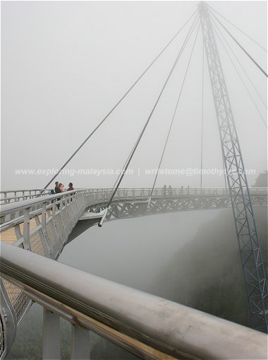
The main town in Langkawi is Kuah. It is located on the southeastern part of the island. The best beaches in Langkawi are at Pantai Cenang, on the western coast, and Tanjung Rhu, on the northern coast. The northwestern part of Pulau Langkawi is mountainous, with the highest peak here being Gunung Machincang, the second tallest mountain in Pulau Langkawi after Gunung Raya. Gunung Machincang is accessible by a dramatic cable-car ride that takes you to a crescent platform suspended high in the mountains. On the other hand, you can drive all the way to the top of Gunung Raya.
Although a duty free port, Langkawi does not have huge department stores, due mainly to the small population. Most of the shops are in Kuah.
If you are looking for souvenirs, you will find stalls throughout the island at the tourist spots. There is also a handicraft centre along Jalan Teluk Yu, near Pantai Pasir Hitam, on the northern part of the island.
A trip to Langkawi is incomplete without an island hopping excursion. Most travel agents offer a trip that comprises Pulau Dayang Bunting, Pulau Singa Besar and Pulau Beras Basah. This can be done in half a day. If you feel like snorkelling, then you should head for Pulau Payar. A trip to Pulau Payar usually takes a good part of a whole day. The water clarity at Pulau Payar, to the southeast of Pulau Langkawi, is superior to the main island. Here, you can watch baby sharks swimming close to shore, even right next to your ankle.
Unless you are a history buff, the historical relics on Langkawi are somewhat subdued. Even the grave of Mahsuri, the most famous legendary person in Langkawi's history, is not particularly impressive or outstanding. Nonetheless, the authorities have embellished the site and milk it for all it is worth.
There are plenty of man-made attractions around the island. While many do not rise above mediocrity, the two outstanding ones, in my opinion, are Galeria Perdana and Underwater World.
Would I recommend Langkawi? Definitely. For me, I love the scenery there. I love the wide open spaces, the opportunity to drive on roads with few traffic (where I come from, the roads are so congested). I love the natural beauty, from the limestone hills to the rocky formations of Gunung Machincang. I love swimming in Tasik Dayang Bunting or taking a trip through the mangroves in Kilim, or simply lying on the beach at Pantai Cenang.
If you have never been to Langkawi, you should come and see it yourself.
 Dataran Lang
Pulau Langkawi is  on the Map of Islands of Langkawi
Back to Discover Langkawi mainpage; list of Islands in Langkawi, Islands in Kedah and Islands in Malaysia
 Latest updates on Penang Travel Tips

Copyright © 2003-2025 Timothy Tye. All Rights Reserved.

 Go Back
 Gunung Machincang Platform
 Durian Perangin Waterfall