Hanover Street, London
Hanover Street is a short yet historically significant road in the City of Westminster, central London, linking the grand curve of Regent Street to the leafy elegance of Hanover Square. Though it stretches for only 114 metres (374 feet), it forms a vital connection between major retail, commercial, and cultural areas in the heart of the West End.
Location and Layout
Hanover Street runs east-west, beginning at Regent Street and terminating at Hanover Square. The road is one-way, allowing vehicular traffic to flow westward—from Regent Street to Hanover Square. This directionality is typical for short connector streets in busy areas of London, helping to regulate traffic around popular shopping and office districts.
Hanover Square
Hanover Square, which gives the street its name, is one of the oldest squares in Westminster, developed in the early 18th century. The square is laid out in a traditional Georgian pattern, centred around a public garden with mature trees and benches. It is surrounded by stately buildings that now house offices, private clubs, and luxury boutiques.
Other roads feeding into Hanover Square include Brook Street, Princes Street, and Harewood Place. Oxford Street, one of London's busiest shopping streets, is just to the north.
Pronunciation and Name Origin
The street name is pronounced HAN-uh-ver, with the stress on the first syllable. In the International Phonetic Alphabet, it is transcribed as /ˈhænəvə/  .
.
Hanover Street was named after the House of Hanover, the royal house of Great Britain at the time the street was developed in the early 18th century. The name celebrated the accession of King George I in 1714, the first British monarch from the Hanoverian dynasty. Streets named after royal connections were common during this era, particularly in the rapidly developing neighbourhoods of what is now Mayfair.
Historical Context
Hanover Street was laid out in the early 1720s during the expansion of London's West End. Its development coincided with the establishment of Hanover Square, part of an effort to attract affluent residents and nobility to new townhouses away from the crowded City. As the area developed, Hanover Street became a connector for commerce and movement within this increasingly fashionable district.
Street Character and Present-Day Use
Today, Hanover Street retains a refined commercial character, lined with elegant façades and modern retail units. The west end of the street near Regent Street is home to high-end shops, banks, and offices. Despite its short length, it serves as a transitional zone between the grand Regency architecture of Regent Street and the more intimate Georgian surroundings of Hanover Square.
The street is paved with wide pavements and flanked by heritage-style lampposts, giving it a timeless charm. It also features some trees, offering a touch of greenery in an otherwise bustling commercial environment.
Nearby Attractions and Points of Interest
- Regent Street: A globally recognised shopping street with flagship stores like Liberty and Hamleys.
- Hanover Square Gardens: A quiet spot to rest among trees and flower beds.
- Oxford Street: Located just north of Hanover Square, it's one of Europe's busiest retail districts.
- Royal Academy of Arts: Just a short walk away in Burlington House on Piccadilly.
Real Estate and Property Prices
Properties along Hanover Street and adjacent Hanover Square command high prices, reflecting the area's prestige. As of early 2025, office spaces along the street lease at around £110–£130 per sq ft (£1,184–£1,399 per sq m) per annum1. Residential properties in nearby Hanover Square can exceed £3,000 per sq ft (£32,292 per sq m), especially in new luxury developments with concierge services and underground parking2.
Typical residential flats in the area range from 1,200 sq ft (111 sq m) for a two-bedroom flat to 3,000 sq ft (279 sq m) for a penthouse apartment.
Transport and Accessibility
Nearest London Underground Stations
- Oxford Circus Station – Bakerloo Line, Central Line, Victoria Line
- Bond Street Station – Jubilee Line, Central Line
- Green Park Station – Piccadilly Line, Jubilee Line, Victoria Line
Bus Stops
The closest bus stops are located along Regent Street and Oxford Street. Routes serving these stops include:
- Route 12 – to Dulwich Library via Trafalgar Square
- Route 94 – to Acton Green via Notting Hill Gate
- Route 22 – to Putney Common via Sloane Square
Fun Fact
Hanover Street was one of the filming locations for the 1979 World War II romantic drama Hanover Street, starring Harrison Ford. Though most of the film is set in wartime London and France, the street's name and ambience made it the perfect backdrop for key scenes, giving the street a brief but memorable moment in cinema history.
Quick Facts
- Location: City of Westminster, central London
- Length: 114 metres (374 feet)
- Direction of Traffic: One-way westbound
- Connects: Regent Street to Hanover Square
- Nearby Stations: Oxford Circus, Bond Street, Green Park
- Nearby Bus Routes: 12, 22, 94
- Notable Sites: Hanover Square Gardens, Regent Street
- Real Estate Price (2025): £3,000+ per sq ft for residential; £110–£130 per sq ft for office spaces
- Pronunciation: /ˈhænəvə/
- Fun Fact: Featured in a 1979 film starring Harrison Ford
References
Map of Hanover Street, London
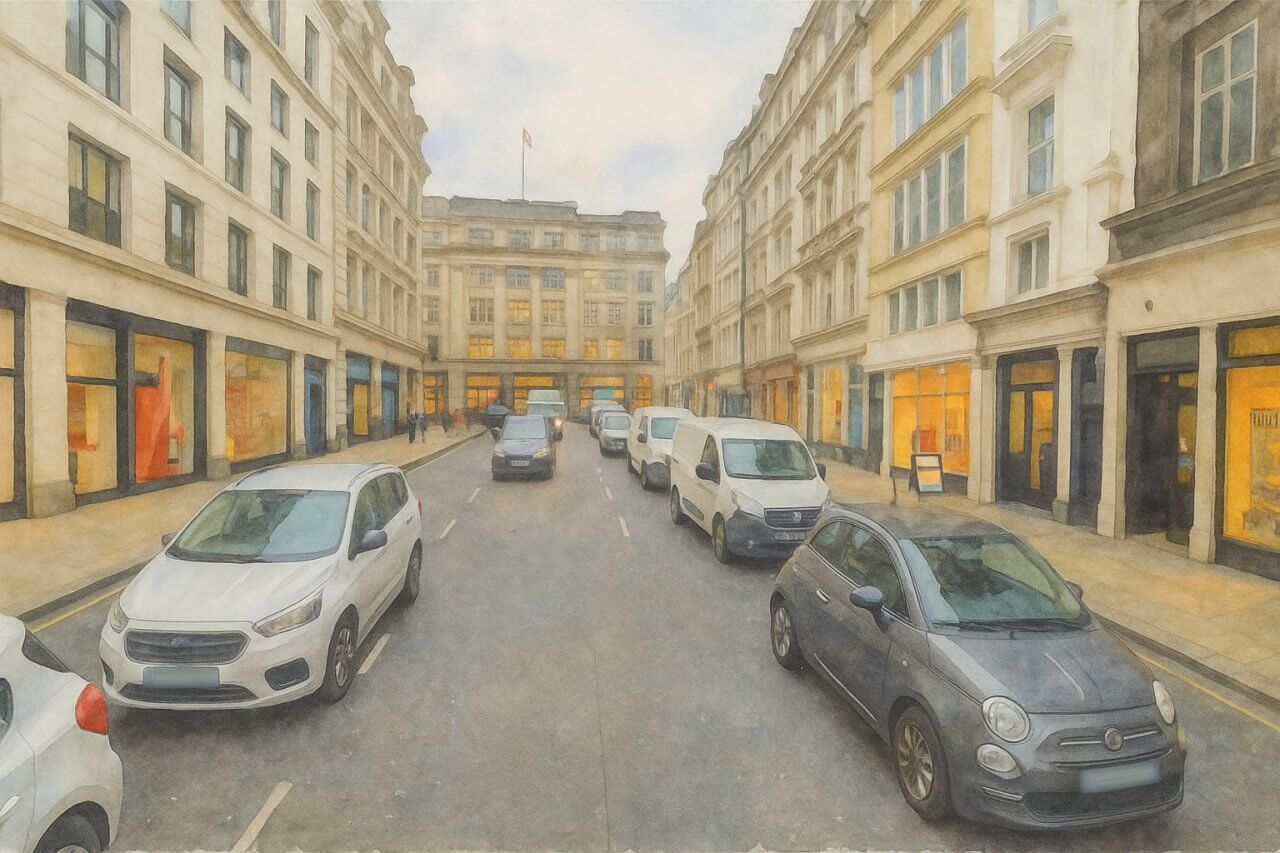
Painting of Hanover Street, London (View image in full size)
Page Details
This page was created on 26 May 2025. Hi, my name is Timothy and created it from my research, for my own entertainment, knowledge and to satisfy my curiosity. I am providing the information to you in good faith and hope it is useful. I try to get the details as accurate as possible. I also try to update the page whenever I stumble on new details. So this and all my other pages are perpetual work in progress. If you discover any error, please politely inform me, pointing out where the error lies, and I will correct it as soon as possible. Your helpfulness will keep this page accurate, relevant and helpful to those who need the information.Moving to London?
New to London and need a place to live? Read our Renting A Flat Guide. This guide covers everything you need to know about renting a flat in London, from viewing to signing.Streets of London
Come, let's explore and discover the streets of London together! Listed here afre the Streets of London that I have documented. Dive in and discover!Map of Streets in London
View all the streets that I have documented on Google Maps in this Map of Streets in London.Want to share your London travel experiences or get tips from fellow travellers?
Join the London Travel Tips Facebook GroupMore information for visiting London
Here are some related articles to help you get to know London better.- Cost of Living in London: Discover the true cost of living in London, including housing, transport, groceries, and more - plus tips for budgeting in one of the world's most expensive cities.
- Driving in London: Planning to drive in London? Learn about roads, car rentals, parking, tolls, and key tips for tourists and visitors from outside the capital.
- Driving Tips for Visiting London: Thinking of driving to London? Discover the best times to travel, congestion tips, parking apps, breakdown help, and petrol advice for a smoother journey.
- Evolution of London's Streets: Discover the fascinating history of how London's streets developed from ancient footpaths to today's complex network of roads across the capital.
- History of Immigration to London: Discover the rich history of immigration to London, from Huguenots to Bangladeshis, and how diverse communities have shaped the city's vibrant identity.
- How Big Is London Compared to Other World Cities?
- How London's Streets Measure Up: A Global Comparison of Road Widths
- How Streets of London are Named: Discover how London streets get their names, who decides them, and how historic, political, and public influences shape street naming in the capital.
- How the Grosvenor Family Came to Own Much of Mayfair, Belgravia and Pimlico: Explore how the Grosvenor family came to own much of Mayfair, Belgravia, and Pimlico, and learn about their historical connection (or lack thereof) with the British royal family and government.
- Living and working in London
- London's Quiet Collapse: How Living Standards Fell as Costs Skyrockted (1975-2025): Explore how London residents endured rising costs and falling living standards from 1975 to 2025 - from rocketing rents to wage stagnation and inflation.
- Marvel of the London Underground: Discover the history, challenges, and triumphs of the London Underground - the world's first underground railway and a vital transport lifeline for the UK capital since 1863.
- Moving to London: Expat Tips for Settling in Westminster: Essential advice for expats moving to London's Westminster: neighborhood insights, cost of living, transportation, housing, healthcare, schools, and tips to help you feel at home in the heart of the city.
- Places in London that aren't pronounced the way they're spelled
- Shopping in London: Discover London's diverse shopping scene
- Taking the bus in London: This is your complete guide to taking the bus when in London.
- The Anglican Faith: A Visitor's Guide to the Church of England: Learn about the Anglican faith and its deep ties to London's landmarks like Westminster Abbey and St Paul's Cathedral.
- Top 10 London Streets Every Visitor Must See: Discover London through its most iconic thoroughfares - 10 streets every visitor must experience. From historic Abbey Road to vibrant Camden High Street, explore culture, shopping, and hidden gems.
- Why are most roads in Central London so narrow? Learn why there are so few multi-lane roads and elevated highways in the heart of the city.

