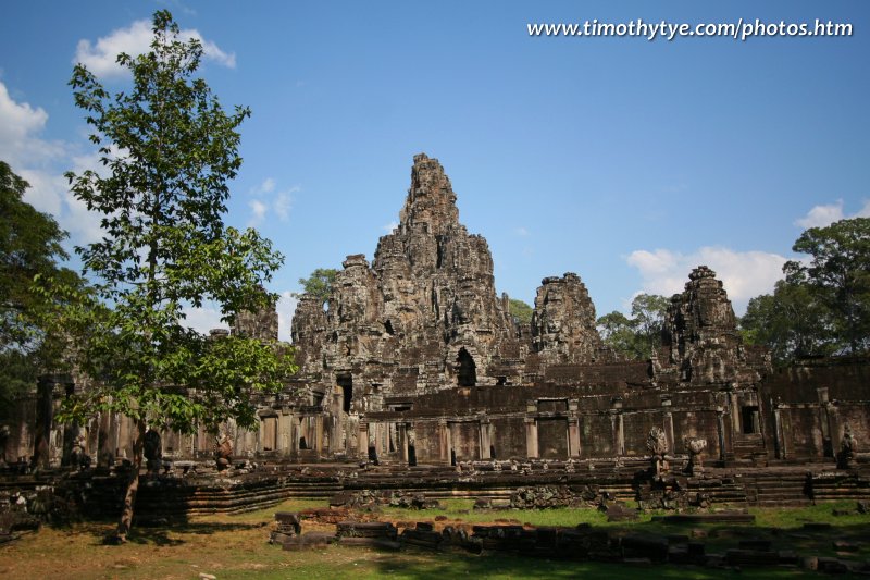
 Bayon, the State Temple of King Jayavarman VII (24 February, 2006)
Bayon (GPS: 13.44102, 103.85918) is the second most popular ruin in Angkor after Angkor Wat. This is the temple of stone faces. Built in the late 12th to the early 13th century by King Jayavarman VII, who reigned from AD 1181 to AD 1120, it is located right in the middle of Angkor Thom. Many visitors to Angkor regard a visit to the Bayon as one of the highlights of their trip to Angkor. In fact, it is so spectacularly unique in style that it even eclipses Angkor Wat as its most recognised icon of classic Khmer art and architecture.
360° View of Bayon on Google Maps Street View
Bayon is  in the centre of the Map of Angkor
The Bayon was one of the last major temples to be erected. Like many of the ruins in Angkor Thom, it was erected by the ever prolific King Jayavarman VII. Anybody seeing the Bayon for the first time would be awed. From far, it looked like a stone mountain. And in fact, that's what it was intended to represent, Mount Meru at the centre of the Hindu/Buddhist cosmos. But as you come closer and closer to it, something bewildering happens. The stone mountain starts to transform, and right before your eyes, they become a mountain of stone faces.
You would have been introduced to those stone faces when you entered Angkor Thom right any of the massive gateways. But now those very stone faces are piled together in what appears to be an assorted jumble. Faces peered at you from all corners. Lips as puffy as Tina Turner's smiled at you.
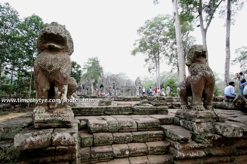
 Guardian lions, Bayon (26 February, 2006)
I have visited the Bayon a few times, and I am still awed by the effect. I learned that the temple consists of 57 standing towers spotting a forest of stone faces. People have calculated that there are all together over 200 faces towering over the Bayon. They represent either the Avalokiteshvara or a combination of Buddha and Jayavarman VII (two schools of thoughts exist on this, so I won't join in the frey). Whoever they represent, to me they are the most enigmatic icon of Angkor ruins.
The recommended way to explore the Bayon is to start from the main entrance located on the east side. There are entrances at all four cardinal directions, but the best carvings are those closest to the main entrance, and according to anti-clockwise route around the temple. As you go around the temple, you will be introduced to the many bas-reliefs that cover its walls. Unlike those in Angkor Wat that show grand processions, many of the reliefs at the Bayon are very much down to earth. They depict everyday life during the ancient times, specifically the time around the late 12th Century. And what do you know, much of the activities way back then is still common in rural Cambodia today.
So you have on the walls scene of market place, of people buying and selling, of cock fighting, cooks preparing for a banquet, a chess game, what a kaleidoscope of activities. I will revisit these walls and document them more fully another day.
No matter how organised you intended your visit to the Bayon to be, as soon as you entered the ground level, you're in a tight maze of narrow passageways. Some are blocked by fallen walls and ceilings. So it is not possible to explore every bit of the Bayon systematically, without coming upon roadblocks, so to speak.
After you are done with the lower level, climb the very steep stone staircase to the upper floor. In doing so, you free yourself from the jumbled world below. Upstairs is open, spacious, and it's here that you come face to face with the stone faces. As you examined them, you realised that they have been pieced together, block by block. So they're not all of one piece, but fit together like a massive stone jigsaw puzzle.
A visit to the Bayon is always one of the highlights of any Angkor trip. You should give yourself at least an hour to fully appreciate this awesome ruin. See it to your heart's content, and be satisfied that you have fully explored the Bayon.
How to reach the Bayon
The Bayon is located right at the centre of the ancient Khmer city of Angkor Thom, with roads leading north and south as well as smaller lanes leading towards the east and west. Most first time visitors will arrive from the direction of Angkor Wat. They will approach Angkor Thom and pass through its South Gate. The Bayon is just 1.5 km after the gate.If you have the time to spare, the best way to explore the Bayon is by hiring a tuk tuk for the day.
 Latest updates on Penang Travel Tips
 Map of Roads in Penang
Looking for information on Penang? Use this Map of Roads in Penang to zoom in on information about Penang, brought to you road by road.
Copyright © 2003-2025 Timothy Tye. All Rights Reserved.

 Go Back