
Bukit Pelanduk, Permatang Pauh
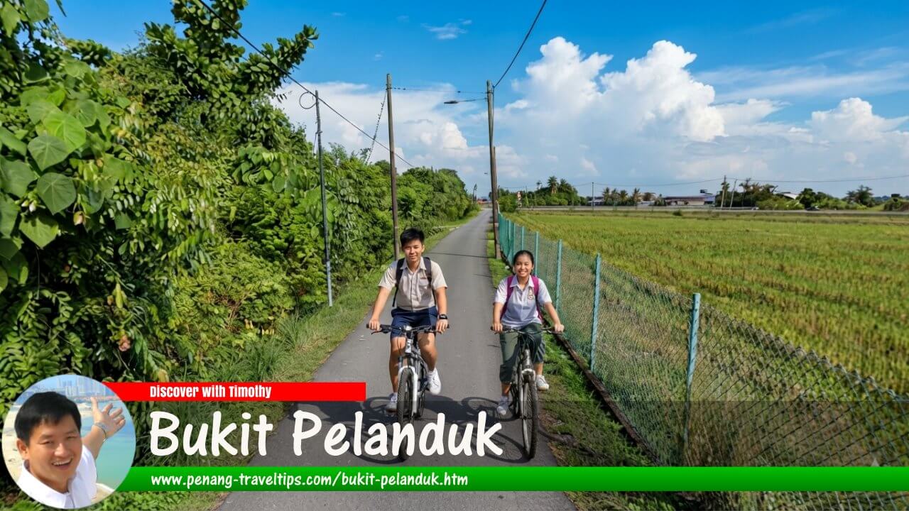 Bukit Pelanduk (AI generated on 20 October 2026)

Also available: Bukit Pelanduk, Permatang Pauh (Edisi BM)
Bukit Pelanduk (GPS: 5.41094, 100.42484) is a small hillock in Permatang Pauh, Seberang Perai Tengah, Penang, Malaysia. Situated amid a landscape that was once dominated by paddy fields, the hillock is surrounded by Kampung Bukit Pelanduk, a village with a cluster of houses and a predominantly rural character. Although much of the surrounding agricultural landscape has changed, Bukit Pelanduk remains a distinctive geographical feature of this part of mainland Penang. 1
Quick Facts
- Name: Bukit Pelanduk
- Location: Permatang Pauh, Seberang Perai Tengah, Penang, Malaysia
- Feature: Small natural hillock
- Coordinates: 5.41094° N, 100.42484° E
- Approximate elevation: 14–16 metres above sea level, according to mapping sources
- Nearby settlement: Kampung Bukit Pelanduk
- Nearby localities: Permatang Pauh, Permatang Pasir and Kubang Semang
- Historical landscape: Paddy fields and rural agricultural land
- Current character: Village settlement, residential areas and agricultural surroundings
- Main activities for visitors: Exploring the rural landscape, local photography and learning about the geography of Permatang Pauh
- Best way to visit: By car or motorcycle
Geography of Bukit Pelanduk
Bukit Pelanduk is located in Permatang Pauh, within Seberang Perai Tengah on the mainland of Penang. Unlike the prominent hills found in the interior of Penang Island, Bukit Pelanduk is a low hillock rising only slightly above the surrounding terrain. Mapping sources place its elevation at approximately 14 to 16 metres above sea level. 2
The hillock lies in a generally flat landscape associated with the agricultural plains of Seberang Perai. In the past, the surrounding paddy fields made the elevated ground particularly noticeable. The hillock appeared like a small island of higher land within the agricultural landscape, with the village settlement clustered around it.
Today, the surrounding area includes houses, village roads, agricultural land and newer residential development. Parts of the former paddy fields have been abandoned or have undergone changes in land use. Nevertheless, the hillock remains an identifiable feature of the local landscape.
Kampung Bukit Pelanduk
Kampung Bukit Pelanduk is the village associated with the hillock. It consists of a settlement surrounded by the broader landscape of Permatang Pauh, where traditional villages coexist with newer housing areas, schools, local businesses and agricultural land.
The village has a cluster of Chinese farmhouses around the hillock, as described in the existing geographical account of Bukit Pelanduk. 1 This settlement pattern contributes to the distinctive character of the locality, where the natural landform and village buildings form a small but recognisable landscape within Seberang Perai.
Kampung Bukit Pelanduk should be distinguished from the better-known Bukit Pelanduk in Negeri Sembilan. The Penang locality is situated near Permatang Pauh and Permatang Pasir, in Seberang Perai Tengah. 2
History of Bukit Pelanduk
The history of Bukit Pelanduk is closely associated with the development of rural settlements and agriculture in Permatang Pauh. The wider Seberang Perai region has a long history of settlement, dating back to a period when much of the mainland was covered by forest and wetlands. Agricultural land and villages developed over time as communities established themselves across the coastal plains and inland areas. 3
Permatang Pauh is known for its traditional Malay villages and agricultural surroundings, although the wider locality is now increasingly urbanised. The development of roads, schools, housing and commercial facilities has changed the way people live and travel in the area.
There is limited published historical documentation specifically about Bukit Pelanduk itself. Consequently, its early settlement date, the identities of its first residents and the precise sequence of its development should not be stated as established facts without further documentary evidence.
From agricultural landscape to mixed rural development
The landscape around Bukit Pelanduk was once closely associated with paddy cultivation. In such a flat agricultural setting, even a small hillock could stand out as a prominent geographical feature. The surrounding fields provided a clear contrast between the raised ground and the low-lying land used for cultivation.
Changes in agriculture and land use have altered parts of this landscape. Some areas formerly associated with paddy cultivation are no longer actively farmed, while residential development and improved road connections have changed the appearance of the wider Permatang Pauh area.
Despite these changes, Kampung Bukit Pelanduk retains its identity as a named settlement associated with the hillock. Its continued presence in geographical records helps preserve the name of this relatively small locality within Seberang Perai.
Origin of the Name Bukit Pelanduk
The name Bukit Pelanduk consists of two Malay words. Bukit means hill, while pelanduk refers to a mouse-deer, a small hoofed mammal found in parts of Southeast Asia. The English name for the animal is sometimes written as mouse deer or mousedeer.
The name can therefore be translated literally as "Mouse-Deer Hill". However, the precise reason the hillock received this name has not been established in the historical sources consulted for this article.
It is possible that the name reflects an association with the local natural environment, but there is insufficient evidence to conclude that mouse-deer once lived on the hillock or that a particular animal-related incident gave rise to the name. Such explanations should be treated as speculation unless supported by local historical accounts.
The name is used for both the geographical feature and the nearby settlement, Kampung Bukit Pelanduk. This relationship between a landform and a village is common in Malaysian place names, where a prominent geographical feature may provide the name for the surrounding community.
What to See at Bukit Pelanduk
Bukit Pelanduk is not a major tourist attraction with an established visitor complex. Its interest lies primarily in its geographical character, village setting and the rural landscape of Permatang Pauh. A visit is most suitable for people interested in local geography, small settlements and the changing landscapes of mainland Penang.
1. The hillock
The hillock itself is the defining geographical feature of the locality. Its low elevation makes it quite different from the larger forested hills elsewhere in Penang. Its significance lies in how it stands out from the generally flat surrounding terrain.
Visitors should not assume that the hillock has a developed hiking trail, viewing platform or public recreational facilities. It is best approached as a geographical landmark rather than a formal hill park. Access to the actual elevated ground may be limited by vegetation, private property or local land use.
2. Kampung Bukit Pelanduk
The surrounding village provides an opportunity to observe a small settlement within the broader Permatang Pauh landscape. The cluster of houses and local roads illustrates the relationship between the hillock and the village that bears its name.
Visitors interested in rural settlements may observe the area's layout and the contrast between older village surroundings and newer residential development. As this is a lived-in community rather than a tourist attraction, visitors should respect residents' privacy and avoid entering private land without permission.
3. The former paddy-field landscape
The agricultural landscape is an important part of the area's geographical story. Although some of the surrounding paddy fields have been abandoned or transformed, the flat terrain helps explain why the hillock was a distinctive feature in the past. 1
Depending on the season and current land use, visitors may still encounter open fields and remnants of the agricultural landscape. The appearance of the area can change over time, so it should not be assumed that all land surrounding the hillock remains under paddy cultivation.
4. Local photography
Bukit Pelanduk may appeal to photographers interested in less familiar parts of Penang. The hillock, village houses, surrounding roads and agricultural land offer subjects for documenting the local landscape.
The best photographic opportunities depend on the current condition of the surroundings. Visitors should use public roads or other places where access is permitted, avoid obstructing traffic and obtain permission before photographing people or entering private property.
How to Get to Bukit Pelanduk
Bukit Pelanduk is located near Permatang Pauh and can be reached through the local road network in Seberang Perai Tengah. Because it is a small geographical feature rather than a major visitor attraction, travellers should navigate to Kampung Bukit Pelanduk or the hillock's mapped coordinates rather than look for a large tourist entrance.
By car
Driving is the most practical way to reach Bukit Pelanduk. From the main roads serving Permatang Pauh, continue along the local roads towards Kampung Bukit Pelanduk. A navigation application can help identify the appropriate approach, particularly for visitors unfamiliar with the village road network.
From Bukit Mertajam, travel towards the Permatang Pauh area and continue using local roads to reach the village. From Seberang Jaya or Butterworth, use the main road connections towards Permatang Pauh before following the final approach to Bukit Pelanduk.
Journey times depend on the starting point, traffic conditions and the exact route. As the destination is a small village and hillock, check the final approach before departure and do not assume that the narrowest roads are suitable for every vehicle.
By motorcycle
A motorcycle is another convenient way to reach the village, especially for visitors familiar with the local roads. Motorcyclists should ride carefully along village streets, where residents, pedestrians and other road users may share limited road space.
Park only in a safe location where parking is permitted. Avoid leaving motorcycles in front of residents' homes, along narrow access roads or where vehicles need to pass.
By bus
Public buses serve parts of Seberang Perai, but a direct service to Bukit Pelanduk should not be assumed. Visitors wishing to travel by bus should check the current routes and stops serving Permatang Pauh or nearby localities.
A taxi or e-hailing vehicle may be needed for the final part of the journey. Travellers should also consider how they will return, as vehicle availability in smaller village areas may vary according to the time of day.
By train
KTM train services connect mainland Penang with other destinations in northern and western Peninsular Malaysia. Travellers can use a suitable railway station in the wider Seberang Perai area and continue to Bukit Pelanduk by road.
There is no railway station at Bukit Pelanduk itself. Before choosing this option, check the current train schedule and arrange onward transport to the village.
Where to Stay Near Bukit Pelanduk
Bukit Pelanduk is a small village locality rather than an established accommodation centre. Visitors are therefore likely to find it more practical to stay in a nearby town and visit the hillock as part of a wider exploration of Seberang Perai.
Permatang Pauh
Permatang Pauh is a convenient area to consider for visitors who wish to remain close to Bukit Pelanduk. The wider locality has residential neighbourhoods, shops, eateries and public facilities. Accommodation availability should be checked for the intended travel dates.
Visitors travelling for family visits, local research or other activities in the surrounding villages may prefer accommodation with convenient road access and parking.
Bukit Mertajam
Bukit Mertajam offers a wider selection of urban amenities and can serve as a base for exploring the central part of Seberang Perai. Travellers can look for hotels and other accommodation according to their budget, transport requirements and preferred facilities.
Staying in Bukit Mertajam may also be useful for visitors who wish to explore other places in the district. However, the journey to Bukit Pelanduk will require additional road travel.
Seberang Jaya and Butterworth
Seberang Jaya and Butterworth are further alternatives for visitors who want access to a broader range of commercial facilities, transport connections and accommodation. They may be especially convenient for travellers arriving from other parts of Malaysia or planning to visit several destinations across mainland Penang.
When booking accommodation, compare the actual driving distance to Bukit Pelanduk rather than relying only on a general description such as "near Permatang Pauh". The most suitable base depends on the wider itinerary.
Food and Dining Near Bukit Pelanduk
Bukit Pelanduk is a village locality, so visitors should not expect a dedicated tourist dining district. Food options are more likely to be found along nearby roads and in the surrounding settlements of Permatang Pauh and neighbouring areas.
Visitors can look for local coffee shops, restaurants, food stalls and other everyday dining establishments. The range of food available depends on the particular location and time of day. For a wider selection, travellers can head towards the commercial areas of Permatang Pauh or Bukit Mertajam.
Food for Muslim travellers
Muslim visitors can look for Malay eateries and other restaurants that meet their halal requirements. Where halal certification is important, check the current status of the establishment rather than assuming that every restaurant serving a particular cuisine is halal-certified.
As Bukit Pelanduk is not a major tourist centre, visitors planning a short visit should consider eating before arriving or identifying a suitable restaurant in a nearby town. Bringing drinking water is also advisable, particularly in hot weather.
Getting Around Bukit Pelanduk
A car or motorcycle is the most convenient way to travel between Bukit Pelanduk and the surrounding localities. The village is part of a wider network of rural roads connecting Permatang Pauh with nearby settlements and residential areas.
Walking may be suitable for a short exploration of the village, provided the roads and surroundings allow it. However, there may be limited pedestrian facilities on some roads, and the hillock should not be assumed to have a maintained public walking trail.
Taxis and e-hailing services may be available for travel to or from the area, although availability can vary. Visitors without private transport should plan their return journey in advance and confirm a convenient pick-up point.
For those travelling by bicycle, the rural landscape may offer an opportunity to explore local roads at a slower pace. Cyclists should remain alert to traffic, avoid obstructing other road users and take care on narrow roads with limited shoulders.
Best Time to Visit Bukit Pelanduk
Bukit Pelanduk can be visited throughout the year, as it is a geographical feature and village rather than a seasonal attraction. Daytime visits are generally more practical because they provide better visibility for navigating village roads and observing the landscape.
Morning or late afternoon may be more comfortable for walking or photography because temperatures are generally lower than during the middle of the day. Weather conditions and the appearance of the surrounding fields will influence the experience.
During or after heavy rain, village roads and open ground may be wet or muddy. Visitors should avoid entering waterlogged agricultural land or walking onto fields without permission. As the hillock is not a developed recreational park, there may be no visitor facilities, public toilets or designated rest areas at the site itself.
Responsible Visiting
Bukit Pelanduk is primarily a local settlement and geographical landmark. Visitors should treat it as a residential area rather than a commercial tourist attraction.
- Respect residents' privacy and avoid entering private property without permission.
- Park without obstructing village roads, driveways or access to homes.
- Do not enter agricultural plots or abandoned fields without permission.
- Avoid leaving rubbish in the village or surrounding countryside.
- Take care when walking along roads without dedicated pedestrian paths.
- Do not assume that the hillock has a public trail or unrestricted access.
- Ask for permission before photographing residents or private premises.
Nearby Places to Explore
Visitors can combine a trip to Bukit Pelanduk with other localities in Seberang Perai Tengah. These places offer a broader view of the region's village settlements, urban development and everyday life.
Permatang Pauh
Permatang Pauh is the wider locality in which Bukit Pelanduk is situated. It contains traditional villages, residential areas, educational institutions and local commercial facilities. Exploring the surrounding area provides a better understanding of the relationship between smaller villages and the developing urban landscape of Seberang Perai.
Permatang Pasir
Permatang Pasir is a nearby village locality that forms part of the wider rural and residential landscape around Permatang Pauh. It can be included in a drive through the surrounding villages for visitors interested in local settlement patterns and the changing landscape of mainland Penang.
Kubang Semang
Kubang Semang lies in the wider inland part of Seberang Perai and is another locality that can be considered when exploring the area by road. The surrounding region includes villages, residential development and agricultural land, although the character of individual places varies.
Bukit Mertajam
Bukit Mertajam is a larger urban centre with a wider range of shopping, dining, accommodation and other facilities. It is a practical destination for visitors who wish to combine a short visit to Bukit Pelanduk with other activities in central Seberang Perai.
Conclusion
Bukit Pelanduk is a small hillock and village locality in Permatang Pauh, Seberang Perai Tengah. Its geographical interest comes from its low elevation and its position within a landscape historically associated with paddy fields and rural settlement.
Although Bukit Pelanduk is not a major tourist attraction and has limited dedicated visitor facilities, it offers an opportunity to learn about the smaller geographical features and villages that form part of Penang's mainland landscape. Visitors can explore the area by road, obtain food and accommodation in nearby towns, and combine their visit with other destinations in Seberang Perai.
Bukit Pelanduk is  on the Map of Permatang Pauh
References
- Bukit Pelanduk, Permatang Pauh, Penang — Penang Travel Tips' existing geographical account of the hillock, village settlement and surrounding paddy-field landscape.
- Mapcarta: Bukit Pelanduk — geographical location, elevation and nearby localities.
- Malaysia Geonames Gazetteer: Penang — official geographical naming information and historical background on the settlement of Penang and Seberang Perai.
- Mapcarta: Kampung Bukit Pelanduk — location of the village and its relationship to nearby settlements.
- Penang State Government: History of Penang and Seberang Perai — historical background on the wider region.
Page Details
This page was created on 20 October 2026. Hi, my name is Timothy and created it from my research, for my own entertainment, knowledge and to satisfy my curiosity. I am providing the information to you in good faith and hope it is useful. I try to get the details as accurate as possible. I also try to update the page whenever I stumble on new details. So this and all my other pages are perpetual work in progress. If you discover any error, please politely inform me, pointing out where the error lies, and I will correct it as soon as possible. Your helpfulness will keep this page accurate, relevant and helpful to those who need the information.Want to share your Penang travel experiences or get tips from fellow travellers?
Join the Penang Travel Tips Facebook GroupUseful guides for visiting Penang
My Videos of Penang
 Latest Pages & Updates
Buy Me A Coffee
If you enjoy the information I provide and want to support the work I do, please buy me a coffee! I appreciate it immensely, thank you so much!
