
 Go Back
 Sumatra, Indonesia (28 April 2006)
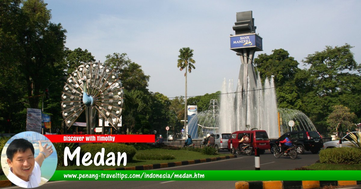
Sumatra is one of the major islands of Indonesia. Covering 473,481 sq km (182,812 sq mi), it is the sixth largest island in the world, and the biggest which is entirely within Indonesia. Sumatra has a population exceeding 50 million people (2011 estimate), making it the fourth most populous island in the world behind Java, Honshu and Great Britain. Its biggest city, which is also the provincial capital of North Sumatra, is Medan.
Map of Sumatra, Indonesia
Tourist Destinations in Sumatra
- Berastagi (GPS: 3.18529, 98.50491)

- Bukittinggi (GPS: -0.30391, 100.38347)

- Gundaling Hill (GPS: 3.19186, 98.5024)

- Gunung Sibayak (GPS: 3.2, 98.51666)

- Gunung Sinabung (GPS: 3.16963, 98.39303)

- Kabanjahe (GPS: 3.10007, 98.48687)

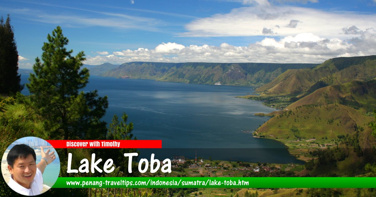
- Lake Toba (GPS: 2.78607, 98.61606)

- Lembah Harau (GPS: -0.11346, 100.67078)

- Pematang Purba (GPS: 2.91359, 98.71508)

- Nias Island (GPS: 1.12552, 97.52472)

- Samosir Island (GPS: 2.62744, 98.79218)

- Sibolangit (GPS: 3.28196, 98.55562)

- Sipisopiso Waterfall (GPS: 2.91648, 98.5195)

- Tongging (GPS: 2.91013, 98.52267)

Major Cities in Sumatra
- Banda Aceh (GPS: 5.54829, 95.32375)

- Bandar Lampung (GPS: -5.39713, 105.26678)

- Bengkulu (GPS: -3.79284, 102.26076)

- Jambi (GPS: -1.61012, 103.61312)

- Lubuklinggau (GPS: -3.29958, 102.85723)

- Medan (GPS: 3.59519, 98.67222)

- Padang (GPS: -0.94708, 100.41718)

- Palembang (GPS: -2.97607, 104.77543)

- Parapat (GPS: 2.66251, 98.93416)

- Pekanbaru (GPS: 0.50706, 101.44777)

- Pematang Siantar (GPS: 2.96514, 99.06263)

Provinces of Sumatra
Provincial capital in parenthesis.- Aceh (Banda Aceh)
- Bangka-Belitung (Pangkalpinang)
- Bengkulu (Bengkulu)
- Jambi (Jambi)
- Lampung (Bandar Lampung)
- Riau (Pekanbaru)
- Riau Islands (Tanjung Pinang)
- West Sumatra (Padang)
- South Sumatra (Palembang)
- North Sumatra (Medan)
National Parks in Sumatra
- Berbak National Park
- Bukit Barisan Selatan National Park
- Gunung Leuser National Park
- Kerinci Seblat National Park
Sumatra is separated from Java by the Sunda Straits. The Strait of Malacca separates it from the Malay Peninsula, while the Karimata Strait separates it from the island of Borneo. The tallest mountain in Sumatra is an active volcano, Mount Kerinci, which is 3,805 m (12,467 ft). Sumatra also has the biggest lake in Indonesia, Lake Toba, the result of a massive eruption some 70,000 years ago.
Once covered with dense rainforest, Sumatra is today overwhelmingly deforested, and rainforest land is being converted to palm oil plantations. Illegal logging is another issue that has threatened the rainforest of Sumatra. Slash and burn cultivation in Sumatra and other Indonesian islands have been blamed for causing haze to envelope Southeast Asia, usually between June and October.
Visiting Sumatra
There are international airports in Medan, Palembang, Pekanbaru, Padang and Banda Aceh, with most of the international flights dominated by low-cost carrier, AirAsia. Most of the visitors to Sumatra come from Malaysia and Singapore, arriving through Medan. Latest updates on Penang Travel Tips
Discover with Timothy YouTube Channel
PG Food Channel
Learn Penang Hokkien YouTube Channel
SojiMart Videos
Destination Indonesia
Latest from Discover with Timothy: Gurney Bay - what to see and do there
About this website

Hello and thanks for reading this page. My name is Timothy and my hobby is in describing places so that I can share the information with the general public. My website has become the go to site for a lot of people including students, teachers, journalists, etc. whenever they seek information on places, particularly those in Malaysia and Singapore. I have been doing this since 5 January 2003, for over twenty years already. You can read about me at Discover Timothy. By now I have compiled information on thousands of places, mostly in Peninsular Malaysia and Singapore, and I continue to add more almost every day. My goal is to describe every street in every town in Malaysia and Singapore.
Robbie's Roadmap
- Episode 1: Robbie's Journey to Financial Freedom
- Episode 2: Lost in America
- Episode 3: The Value of Money
- Episode 4: The Mentor
- Episode 5: The Thing that Makes Money
- Episode 6: The walk with a Billionaire
- Episode 7: The Financial Freedom Awakening
- Episode 8: Meet Mr Washington
- Episode 9: The Pizzeria Incident
Copyright © 2003-2024 Timothy Tye. All Rights Reserved.