 Sa Pa, Vietnam
Source: https://commons.wikimedia.org/wiki/File:Sapa_vu_du_mont_Ham_Rong.jpg
Author: Zeugma fr

Author: Zeugma fr

Sa Pa (Vietnamese: Thị xã Sa Pa
 ) is a famous highland resort in northern Vietnam. Founded by the French as a hill station, after a Jesuit priest discovered it in 1918 and announced it to Hanoi, it was rediscovered by backpackers in the mid-1990's. Located 380 km (236 mi) from Hanoi, it is a popular holiday spot for people from the capital. Today it is the main highland town learning to cash in on tourism. It is the most accessible place for visitors to get a good view of the minority hill tribes of northern Vietnam.
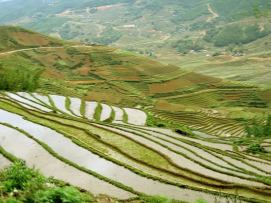
The journey to Sa Pa (also written Sapa) passes through spectacular views of the undulating hills, with cascades of stepped rice terraces and lush vegetation. You can see the shacks belonging to the Dao hill tribe as your vehicle approaches Sa Pa. You will not miss the hill people in their traditional costumes, with their metal jewelry and headpieces.
 Rice terrace of Sa Pa
Source: https://commons.wikimedia.org/wiki/File:Sapa10.jpg
Author: Casablanca1911

Author: Casablanca1911

The gateway village to Sa Pa is Lao Cai. It is about 40 km (25 mi) to the northeast of Sa Pa itself. The town is a grim, unappealing truck stop, offering few reasons for you to linger.
Sa Pa itself is a cluster of old French villas. Many of these were destroyed in the turbulent years of World War II followed by the Vietnamese War, but a number have now been restored. There are also newer resthouses now being built in Sa Pa to cater to the influx of tourists in recent years.
To move about in Sa Pa, you can take motorcycle taxis or go on foot. You can also arrange jeep trips with tour operators or through your hotel. Do note that many of the hill tribe villages now charge an extrance fee ranging from 5,000 dong to 15,000 dong for your visit, to supplement their income. I just hope that this fee, which smells of commercialization, really helps the village preserve their lifestyle, and not degenerate the hill people towards materialism.
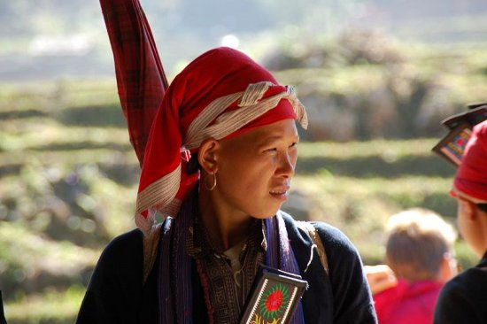
 Young woman of the Red Dao hill tribe of Sa Pa
Source: https://commons.wikimedia.org/wiki/File:Yao_young_woman.jpg
Author: Ruud van Leeuwen

Author: Ruud van Leeuwen

About 3 km (2 mi) from Sa Pa is Cat Cat, the village of the Black Hmong hill tribe. The Hmong people built their shacks of mud, wattle, bamboo and thatch. Everywhere you can see vats of indigo dye which they use to color their costumes. Another 4 km (2.5 mi) from Cat Cat is another Hmong village, Sin Chai.
Another hill tribe, the Red Dao, also has their village, Ta Phin, some 10 km (6 mi) from Sa Pa. To go to Ta Phin, you pass through a valley with stepped rice terraces spread below you. On the way, you will pass an abandoned French seminary. It was built in 1942 but destroyed during the wars.
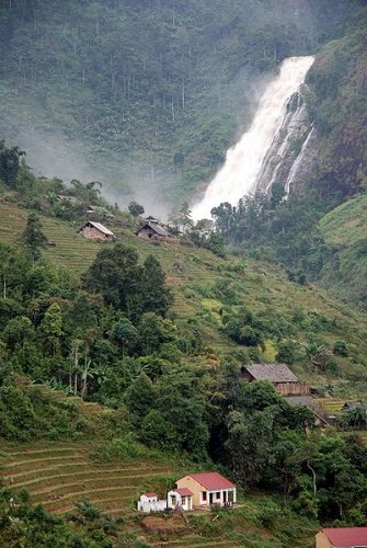
There's also a waterfall, about 15 km (9 mi) to the southwest of Sa Pa. Called Thac Bac, or Silver Waterfall, it thunders 100 m (328 ft) down the slope. Quite a number of tourists come here, which explains the stalls set up by the hill tribe people to sell fruits in its vicinity.
 Thac Bac Waterfall Thac Bac WaterfallSource: https://commons.wikimedia.org/wiki/File:Th%C3%A1c_B%E1%BA%A1c.jpg
Author: Heiko Carstens  |
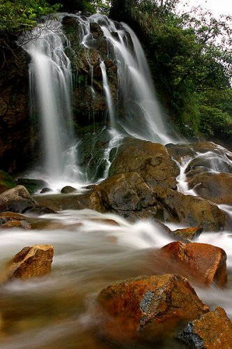
 A waterfall at Cat Cat village A waterfall at Cat Cat villageSource: https://commons.wikimedia.org/wiki/File:Cat_Cat_waterfall.jpg
Author: KS Chew  |
For those with mountain climbing experience, the tallest peak in Vietnam, 3,143-meter (10,311-foot) Mount Fan Si Pan, is just a stone's throw west of Sa Pa. It can be climbed in the company of a guide, which you can arrange from a tour operator in town.
How to go to Sa Pa
You can take a bus from Hanoi to Lao Cai. Alternatively join a package offered by a tour operator. Check our AsiaExplorers Tours below for what we have to offer! Latest updates on Penang Travel Tips
 Map of Roads in Penang
Looking for information on Penang? Use this Map of Roads in Penang to zoom in on information about Penang, brought to you road by road.
Copyright © 2003-2025 Timothy Tye. All Rights Reserved.

 Go Back