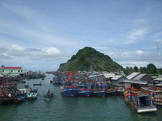
Ha Tien is a small but attractive resort town in Kien Giang Province in southern Vietnam. It is just about 10 km from the Cambodian border, and about 306 km (190 mi) from Ho Chi Minh City. The town has a population of 86,000 and is famous for its natural beauty.
 Ha Tien
Source: https://commons.wikimedia.org/wiki/File:B%E1%BA%BFn_c%C3%A1_Ba_H%C3%B2n.jpg
Author: ntt

Author: ntt

Ha Tien was founded by Mac Cuu, an ethnic Chinese from Guangzhou province, China, who established Ha Tien in 1670 following the fall of the Ming Dynasty in 1644. Mac Cuu left China because he refused to work with the new Manchu rulers. He scoured the south seas until he reached the Ha Tien area, where he procured an agreement with the king of Cambodia and the Nguyen lords of Vietnam, to settle and found the town. Within a few years, Mac Cuu turned Ha Tien into an important port town.
In 1714, Ha Tien came under the ownership of Nguyen Phuc Chu, the lord of Hue, who made Mac Cuu the general of Ha Tien. The town continued to prosper, its revenue derived from gambling and tin mining. Mac Cuu's son Mac Thien Tu inherited his father's work. Under Mac Thien Tu, an army was formed which successfully repelled invasions staged by the Cambodians and Siamese.
Today, visitors come to Ha Tien to visit some of its tourist sights. There are tombs and mausoleums dedicated to Mac Cuu and his clan. The mausoleum to Mac Cuu was built of bricks in 1809. The largest of the Mac clan tombs, it is decorated with a blue dragon and a white tiger.
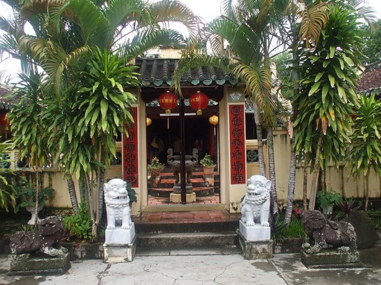
 Temple in Ha Tien
Source: https://commons.wikimedia.org/wiki/File:C%E1%BB%95ng_th%E1%BB%A9_hai.jpg
Author: Thuydaonguyen

Author: Thuydaonguyen

Mac Chu also built the Tam Bao pagoda, at 328 Phuong Thanh Street, in 1730. It has a statue of the Quan Am on a lotus in front of the structure. Not far away is the pagoda of Phu Dung, established by Mac Cuu's second wife, Nguyen Thi Xuan, in 1750. Her tomb is located on the hillside behind the main prayer hall of the pagoda.
The town has a pontoon bridge that was built by the U.S. Army. It can be used by pedestrians and cyclists. The bridge divides Ha Tien between the East Lake and the To Chau River.
The local handicraft of Ha Tien are souvenirs made of sea turtle shell. The turtles are reared in pools along the coast.
Not far outside the town center of Ha Tien is the cave known as Thach Dong Thon Van, which translates as the "grotto that swallows the clouds". Inside the grotto is a temple. There are funerary tablets of the departed, and altars to Quan Am and Ngoc Hoang, the Jade Emperor. From here, you can get panoramic views of the surrounding rice fields and the islets off the coast. A short distance from the grotto is a mass grave of 130 victims killed by the Khmer Rouge in 1978. A tablet called Bia Cam Thu, meaning the "stele of hatred" stands to commemorate the victims.
On the coast of Ha Tien, at Binh An beach, are a couple of limestone outcrops in the sea. They stand almost vertical, and are known as The Phu Tu, or the "Father and Son Rocks". Abut 15 km (9 miles) off the coast of Ha Tien is Hon Giang Island, a charming island with secluded beach ideal for picnic and swimming.
How to reach Ha Tien
You can go to Ha Tien by taking a bus from Ho Chi Minh City or from Chau Doc. Latest updates on Penang Travel Tips
 Map of Roads in Penang
Looking for information on Penang? Use this Map of Roads in Penang to zoom in on information about Penang, brought to you road by road.
Copyright © 2003-2025 Timothy Tye. All Rights Reserved.

 Go Back