 Hualamphong Railway Station (22 December 2002)
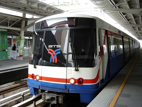
The Subway Stations of Bangkok emcompasses the stations for the various forms of mass rapid transit in the city. This includes the elevated BTS Skytrain and the underground Bangkok Metro. Listed on this page are the stations of the BTS Skytrain and the Bangkok Metro, and the Hualamphong Railway Station, the main railway terminus of Bangkok.
 BTS Skytrain
 https://commons.wikimedia.org/wiki/File:BTS_train.jpg
 Shinji
 The The BTS Skytrain passing above Sukhumvit Road passing above Sukhumvit Road
 https://commons.wikimedia.org/wiki/File:Skytrain_4.jpg
 Mike Powell
 Wongwian Yai Station, Silom Line
 https://en.wikipedia.org/wiki/File:BTSWongwianyaiStationa.jpg
 Hdamm
Hdamm
 Sala Daeng Station, Silom Line (22 October 2006)
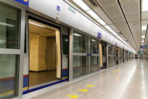
 Hualamphong MRT Station
 https://commons.wikimedia.org/wiki/File:Hua_Lampong_MRT_station.jpg
 Ilya Plekhanov
- Ari Skytrain Skytrain Station, Sukhumvit Line
- Asok Skytrain Skytrain Station, Sukhumvit Line
- Bang Sue MRT Station, MRT Blue Line
- Chatuchak Park MRT Station, MRT Blue Line
- Chit Lom Skytrain Station, Sukhumvit Line
- Chong Nonsi Skytrain Skytrain Station, Silom Line
- Ekkamai Station, Sukhumvit Line
- Huai Khwang MRT Station, MRT Blue Line
- Hua Lamphong MRT Station, MRT Blue Line
- Kamphaeng Phet MRT Station, MRT Blue Line
- Khlong Toei MRT Station, MRT Blue Line
- Krung Thonburi Skytrain Station, Silom Line
- Lat Phrao MRT Station, MRT Blue Line
- Lumphini MRT Station, MRT Blue Line
- Mo Chit Skytrain Station, Sukhumvit Line
- Nana Skytrain Station, Sukhumvit Line
- National Stadium Skytrain Station, Silom Line
- On Nut Skytrain Station, Sukhumvit Line
- Phahon Yothin MRT Station, MRT Blue Line
- Phaya Thai Skytrain Station, Sukhumvit Line
- Phetchaburi MRT Station, MRT Blue Line
- Phloen Chit Skytrain Station, Sukhumvit Line
- Phra Khanong Skytrain Station, Sukhumvit Line
- Phra Ram 9 MRT Station, MRT Blue Line
- Phrom Phong Skytrain Station, Sukhumvit Line
- Queen Sirikit National Convention Centre MRT Station, MRT Blue Line
- Ratchadamri Skytrain Station, Silom Line
- Ratchadaphisek MRT Station, MRT Blue Line
- Ratchathewi Skytrain Station, Sukhumvit Line
- Sala Daeng Skytrain Station, Silom Line
- Sam Yan MRT Station, MRT Blue Line
- Sanam Pao Skytrain Station, Sukhumvit Line
- Saphan Khwai Skytrain Station, Sukhumvit Line
- Saphan Taksin Skytrain Station, Silom Line
- Si Lom MRT Station, MRT Blue Line
- Siam Skytrain Station, Sukhumvit Line and Silom Line
- Sukhumvit MRT Station, MRT Blue Line
- Surasak Skytrain Station, Silom Line
- Sutthisan MRT Station, MRT Blue Line
- Thong Lo Skytrain Station, Sukhumvit Line
- Thailand Cultural Centre MRT Station, MRT Blue Line
- Victory Monument Skytrain Station, Sukhumvit Line
- Wongwian Yai Skytrain Station, Silom Line
List of Districts of Bangkok
 Latest updates on Penang Travel Tips
 Map of Roads in Penang
Looking for information on Penang? Use this Map of Roads in Penang to zoom in on information about Penang, brought to you road by road.
Copyright © 2003-2025 Timothy Tye. All Rights Reserved.

 Go Back