 East-West Highway (29 April, 2017)
East West Highway is a 215-kilometer highway between Gerik in Perak and Jeli in Kelantan. The highway passes through the Bintang Range and the Titiwangsa Range, which is regarded as the backbone of the peninsula. As part of Federal Route 4, it extends to the east beyond the highway proper, to reach the interchange with the Kota Bharu-Gua Musang Highway (Federal Route 8). On the western side, Federal Route 4 continues as Jalan Baling-Gerik and Jalan Kuala Tawar-Sedim to eventually join with the Butterworth-Kulim Expressway (E15).
Construction of the East West Highway began in 1970. On top of providing improved transportation between the east and west coasts of Peninsula Malaysia, the highway was intended to cripple subversive activities by the Communist guerrilas that have retreated into the jungle and would easily cross between Malaysia and Thailand. This purpose was not lost on the guerrilas, and they launched numerous attacks on the JKR workers and security forces involved in the construction, causing loss of lives as well as material damage, and delaying the completion for many years. As a result, the original cost of construction estimated to be RM85 million, was overblown, and the final total cost was RM396million.
The East West Highway finally opened to the public on 1 July, 1982. For safety reasons, in the beginning, the public was only allowed to use it during the day time, and a curfew was imposed at the Gerik and Jeli ends from 6pm. It was only after a peace treaty was signed by the Malaysian Government with the Malayan Communist Party, on 2 December, 1989, that a ceasefire and surrender of arms brought peace to the area, allowing the evening curfew to be lifted.
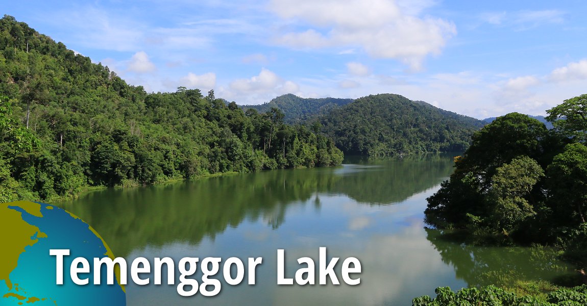
There are five bridges along the East-West Highway. The two longest are on the western and eastern sides of Pulau Banding, on Temenggor Lake. The one on the west, at 880 meters, is the longest, while the one on the east is at 640 meters. Both are called Jambatan Tasik Temenggor. From west to east, the five bridges are Jambatan Sungai Rui (256 meters), Jambatan Tasik Temenggor Barat (880 meters), Jambatan Tasik Temenggor Timur (640 meters), Jambatan Hulu Sungai Pergau (159 meters) and Jambatan Hilir Sungai Pergau (158 meters).
Map of East West Highway
 Car journey on the East-West Highway (29 April, 2017)
Shell Petrol Station
The Shell Petrol Station (GPS: 5.45501, 101.1921) located 10.9km from Gerik and 114km from Jeli, is the final stop for eastbound motorists to refuel before the long journey.
 Shell Petrol Station in Gerik, on the East-West Highway (29 April, 2017)
East-West Highway Monument (Tugu Peringatan Jalanraya Timur Barat)
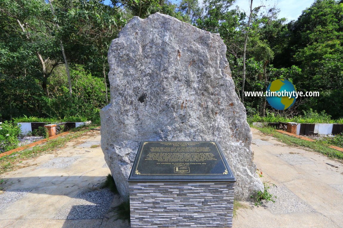
East-West Highway Monument
East-West Highway Monument (GPS: 5.53055, 101.24874) , also called Tugu Peringatan Jalanraya Timur Barat, commemorates those who perished during the construction of the highway. It is located 10.9km from Gerik and 98.5km from Jeli.
Details
 My wife and I at the East-West Highway Monument (29 April, 2017)
Hentian Sungai Lebey
Hentian Sungai Lebey (GPS: 5.47332, 101.23025) is 17km from Gerik and 108km from Jeli. There is a small hawker centre where - if open - you can buy some food items.(Mar 2014)
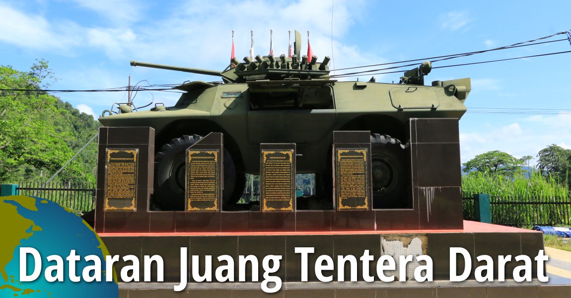
Dataran Juang Tentera Darat
Dataran Juang Tentera Darat (GPS: 5.54375, 101.33047) , located 42km from Gerik and 114km from Jeli, is a public square honouring the contribution of the armed forces in the construction of the East West Highway.
Details
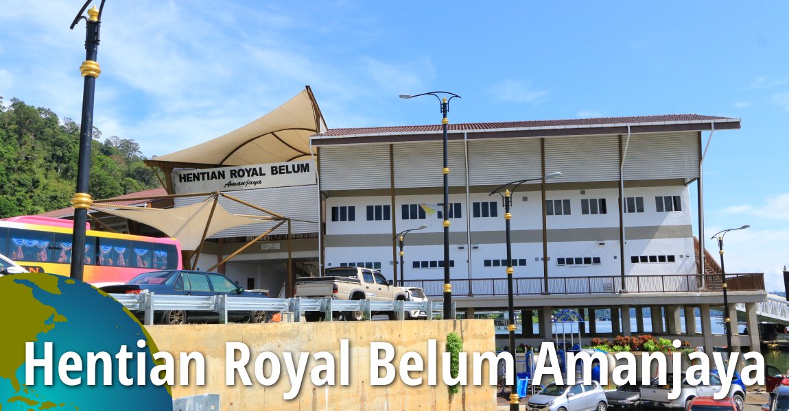
Hentian Royal Belum Amanjaya
Hentian Royal Belum Amanjaya (GPS: 5.55158, 101.34703) is a rest area and public jetty complex on Pulau Banding. It is located 44.4km from Gerik and 80.9km from Jeli. From here, you can view the 640-meter eastern Jambatan Tasik Temenggor.Details
 Jambatan Tasik Temenggor East (29 April, 2017)
Kompleks Pusat Perikanan Darat Banding
Kompleks Pusat Perikanan Darat Banding (GPS: 5.5515, 101.35336) is located 45km from Gerik and 79.6km from Jeli. It is part of the Perak branch of the Malaysian Fisheries Department (Jabatan Perikanan Malaysia), under the Ministry of Agriculture & Agro-based Industries.Kawasan Rehat Air Banun
Kawasan Rehat Air Banun (GPS: 5.57761, 101.43259) is a makeshift rest stop along the East West Highway about 56.3km from Gerik and 67.5km from Jeli. What you find here is a cluster of sheds where you can have a hot meal if you wish.Hentian Titiwangsa
Hentian Titiwangsa (GPS: 5.53055, 101.24874) is the main rest stop along the East-West Highway. It is located 73.1km from Gerik and 51.3km from Jeli. From here, you can get a panoramic view of the Titiwangsa Range and the Royal Belum State Park. Situated 1,050 meters above sea level, it is also one of the highest points on the highway.Gunung Reng
Gunung Reng (GPS: 5.54375, 101.33047) , located 113km from Gerik and 12.8km from Jeli, is a massive limestone outcrop visible from the East West Highway.
Details
 The eastern end of the East-West Highway (29 April, 2017)
References
- Highway interpretive board: Sejarah Pembinaan Jalan Raya Timur-Barat (1967-1982)
- mStar: Pengorbanan Dalam Kenangan by Ahmad Abd Hamid
Back to Discover Malaysia mainpage; List of Highways in Malaysia; see also Expressways in Malaysia
 Latest updates on Penang Travel Tips

Buy Me A Coffee
If you enjoy the information I provide and want to support the work I do, please buy me a coffee! I appreciate it immensely, thank you so much!

 Backtrack | HOME | Latest Updates |
Copyright © 2003-2026 Timothy Tye. All Rights Reserved.