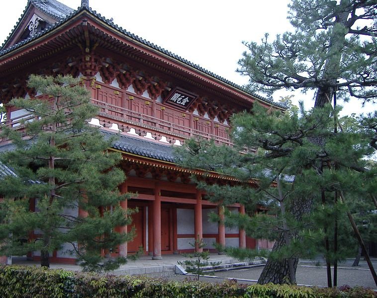
Daitoku-ji Temple (GPS: 35.04389, 135.74603) is a Buddhist temple in Kita-ku, Kyoto. It is a temple that is closely associated with the development of the tea ceremony.
Daitoku-ji is one of the fourteen autonomous branches of the Rinzai school of Zen Buddhism. It was established as a small monastery by monk Shuho Myocho between 1315 and 1319. It became a temple following the request of the retired Emperor Hanazono, to convert the monastery into a supplication hall, with a dharma hall and living quarters for the abbot.
 Daitoku-ji Temple, Kyoto
Source: http://commons.wikimedia.org/wiki/File:Daitoku-ji.JPG
Author: Hiro2006

Author: Hiro2006

360° View of Daitoku-ji Temple on Google Maps Street View
Entrance and bus park for Daitoku-ji TempleHigh walls surround the compound of Daitoku-ji Temple.
In the 16th century, Daitoku-ji Temple received the patronage of powerful warlords (and tea ceremony enthusiasts) Oda Nobunaga and Toyotomi Hideyoshi. As a result it became closely linked to masters of the tea ceremony such as Sen no Rikyu and Kobori Enshu. The temple grounds cover an area of 23 hectares, and within this spacious area is a complex of some twenty-two sub-temples, the most important being Daisen-in, Juko-in and Shinju-in.
Daisen-in is famous for its Muromachi-period dry garden. In Koto-in is a grove of slender maples that grow over an expanse of moss. Zuiho-in was built in 1502 for a Christian daimyo. It has a garden designed by Shigemori, with rocks arranged to form a crucifix.
Daitoku-ji Temple is  on the Map of Kyoto
 Latest updates on Penang Travel Tips
 Map of Roads in Penang
Looking for information on Penang? Use this Map of Roads in Penang to zoom in on information about Penang, brought to you road by road.
Copyright © 2003-2025 Timothy Tye. All Rights Reserved.

 Go Back