Xishuangbanna (Chinese: 西双版纳
 , Thai: สิบสองปันนา
  ) is an autonomous prefecture of the Dai people in southern Yunnan Province, China. This autonomous prefecture shares borders with Myanmar to the west and Laos to the east. To the north of Xishuangbanna is the prefecture-level city of Pu'er.
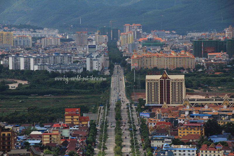 Jinghong City, Xishuangbanna (17 August, 2014)
Xishuangbanna covers an area of 19,700 square kilometers (7,600 square miles) and have a population of 993,3971. The three prefecture is divided into three administrative divisions. They are Jinghong City, the prefectural capital, located on the central part of Xishuangbanna, and the counties of Menghai to the west and Mengla to the east. Each of these counties have their own urban centres.
The city of Jinghong, with a population of 519,935 people, is the biggest urban area in Xishuangbanna. It is also the base for tourists visiting the prefecture, as most of the major hotels are located here.
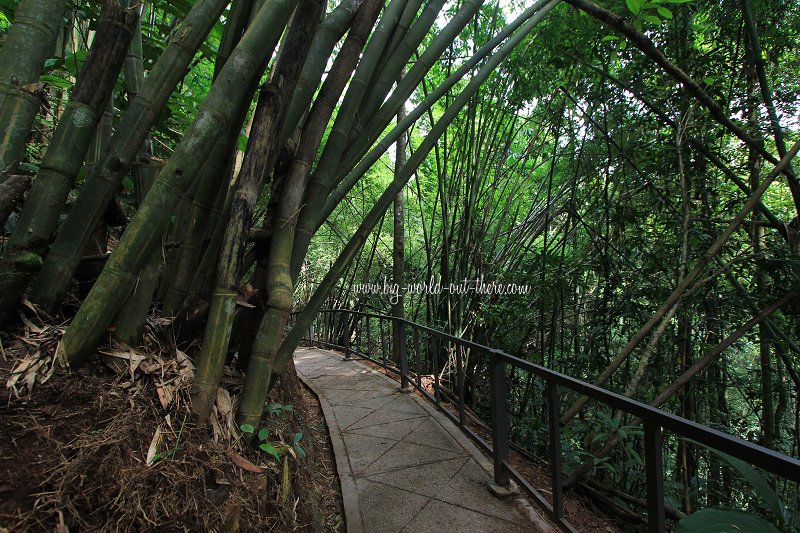 Bamboo forest at Xishuangbanna National Park (17 August, 2014)
The Dai people forms the majority of the population of Xishuangbanna. Their percentage (29.89%) is just slightly over that of the Han Chinese (29.11%). Dai is in fact an umbrella term that includes some 56 ethnic groups2. The language is part of the Tai-Kadai group of languages which also includes standard Thai or Siamese as well as the Laotian language and the Shan language of Myanmar.
Since the 1950s, the Dai language is written using the New Tai Lue alphabet. It was developed based on the traditional Tai Lue alphabet that dates back to 1200 AD.3. You will see script written in New Tai Lue alphabet when you are in Xishuangbanna. However, as learning of this script is not mandatory, many people even in Xishuangbanna are not literate in it. Mandarin appears to be the predominant language in Xishuangbanna.
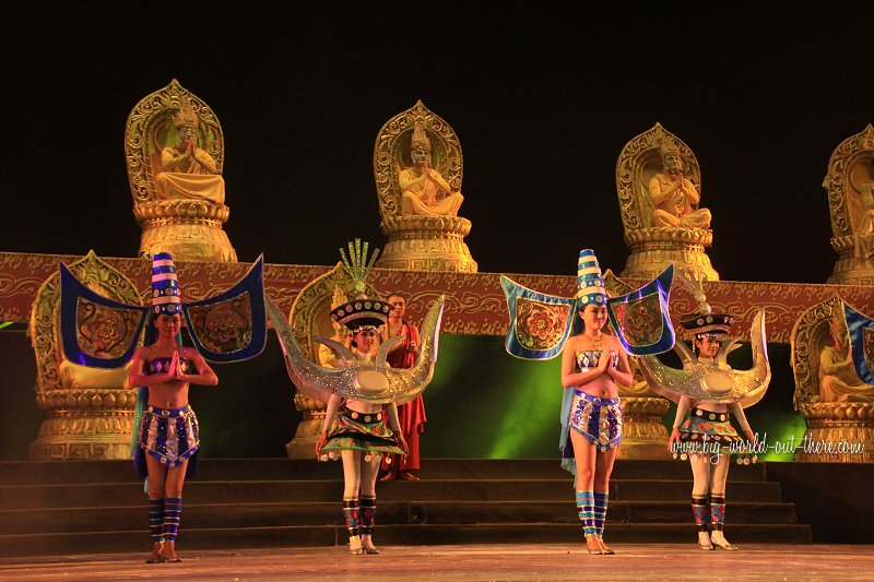 Xishuangbanna song and dance revue (17 August, 2014)
Culture of Xishuangbanna
Xishuangbanna is created as the birthplace of Songkran, known here as the Dai Water-Splashing Festival. The festival usually takes place from 13 to 15 April every year. During this period, people who splash water at one another as a form of cleansing. There would be dragon-boat races held in the area.Tourism in Xishuangbanna
Until recently, Xishuangbanna attracted mostly domestic tourists. In the past decade, there has been an increase in tourists from Thailand, due to similarity in language and culture. Conversely, there is also an increase in Chinese tourists from Yunnan visiting Thailand. The destination is now promoting itself to international tourists particularly those from Malaysia and Singapore.Malaysian tourists wanting to visit Xishuangbanna may contact Beautiful Planet Holiday in Kuala Lumpur (7805 5506) and Penang (226 8121) for upcoming tours.
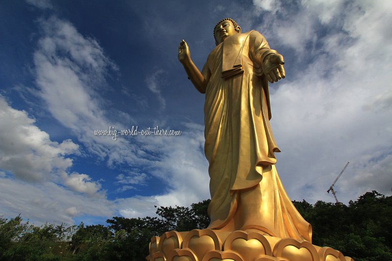 The gigantic Buddha statue of Wat Sipsongpanna in Jinghong City, Xishuangbanna (17 August, 2014)
Places of Interest in Xishuangbanna
- Ji'nuo Village
- Mengle Temple
- Wat Sipsongpanna
- Xishuangbanna National Park
- Xishuangbanna Virgin Forest Park
Getting there
You can fly to Xishuangbanna, arriving at the Xishuangbanna Gasa International Airport (西双版纳嘎洒机场). It receives flights from Bangkok-Suvarnabhumi (China Eastern Airlines), Beijing-Capital, Chengdu, Chongqing, Dali, Diqing, Guangzhou, Hangzhou, Kunming, Lijiang, Luang Prabang (Lao Airlines), Shanghai-Hongqiao, Tengchong, Wuhan and Xi'an.Packaged Tours
Malaysian tourists can contact Beautiful Planet Holiday in Kuala Lumpur (7805 5506) and Penang (226 8121) for tours to Xishuangbanna.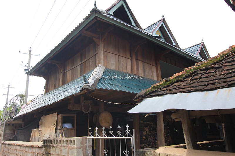 Dai traditional architecture in Xishuangbanna (17 August, 2014)
References
 Latest updates on Penang Travel Tips
 Map of Roads in Penang
Looking for information on Penang? Use this Map of Roads in Penang to zoom in on information about Penang, brought to you road by road.
Copyright © 2003-2025 Timothy Tye. All Rights Reserved.

 Go Back