Proposed Carnarvon Street Park
 Go Back - HOME | Latest PENANG | Travel Tips | Penang Hokkien : Dictionary | YouTube | Facebook | Contact Me
Carnarvon Street Park is a proposed public park in the George Town Special Area Plan. This small park, with covers just 0.13 acres, is located at the junction of Carnarvon Street and Jalan Cheong Fatt Tze.
 area. For that reason, Carnarvon Street is still known today as Lam Chan'a, meaning "damp paddy fields". The street was formerly known as Lower Pitt Street, for it was in fact the extension of Pitt Street, going all the way to end at the Prangin Canal.
Jalan Cheong Fatt Tze was originally called Hong Kong Street, because it was a predominantly Cantonese-speaking neighbourhood, when the area developed from farmland to village housing and then to brick housing. The Cantonese-speaking people settled here as well as in neighbouring streets such as Kimberley Street, following an influx in the third quarter of the 19th century.
The original Cheong Fatt Tze Street was located off Tek Soon Street. It made way for the Komtar development. To honor this prominent pillar of Penang society, Hong Kong Street was renamed Jalan Cheong Fatt Tze.

Appreciating the History of this Site
Until the mid 19th century, this area was a soggy vegetable farmland leading towards the marshes and mangroves further south, in presently Sia Boey area. For that reason, Carnarvon Street is still known today as Lam Chan'a, meaning "damp paddy fields". The street was formerly known as Lower Pitt Street, for it was in fact the extension of Pitt Street, going all the way to end at the Prangin Canal.Jalan Cheong Fatt Tze was originally called Hong Kong Street, because it was a predominantly Cantonese-speaking neighbourhood, when the area developed from farmland to village housing and then to brick housing. The Cantonese-speaking people settled here as well as in neighbouring streets such as Kimberley Street, following an influx in the third quarter of the 19th century.
The original Cheong Fatt Tze Street was located off Tek Soon Street. It made way for the Komtar development. To honor this prominent pillar of Penang society, Hong Kong Street was renamed Jalan Cheong Fatt Tze.
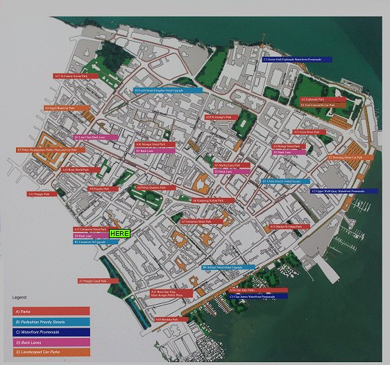
Location Map of Carnarvon Street Park
Location of the public realm is marked with "HERE".
Buy Me A Coffee
If you enjoy the information I provide and want to support the work I do, please buy me a coffee! I appreciate it immensely, thank you so much!
 Backtrack | HOME | Latest Updates |
Copyright © 2003-2026 Timothy Tye. All Rights Reserved.