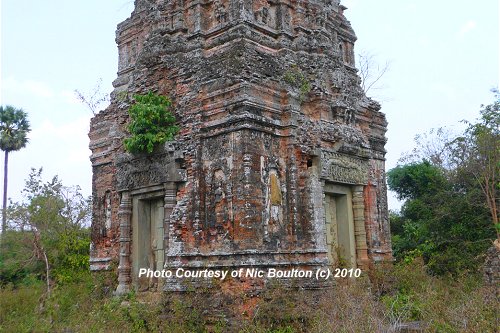
 Prasat Trapeang Phong, view of north and west façades (1February, 2010)
© Nick Boulton
Prasat Trapeang Phong (GPS: 13.30921, 103.96773) is one of the lesser ruins of Angkor. It is part of the Roluos Group of ruins. It was explored by my online friend Nic Boulton, who contributed the directional details and photos for this page.
Prasat Trapeang Phong comprises a single prasat, or tower, sanctuary. The style is similar to that of Lolei. On the walls flanking the entrance are apsaras or devatas. As with most Angkorian prasats, it is entered through the east, with false doors on the north, south and west.
360° View of Prasat Trapeang Phong on Google Maps Street View
Prasat Trapeang Phong is  in the centre of the Map of Angkor
Some conservation work has been carried out here by the German Apsara Conservation Project, which is financed by the Federal Foreign Office of the Federal Republic of Germany, through the University of Applied Sciences in Cologne.
How to get to Prasat Trapeang Phong
From the Community Learning Centre, head south, passing between the two yellow painted concrete buildings. You will also pass by a couple of houses on the left side of the path.About 200 meters down the road you will come to a T-junction
 . Turn right and head west towards the village. Go for another 20 meters, and there the road forks two
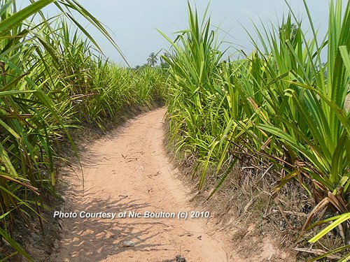
  . Take the left fork and head south. You may have to ditch your vehicle as the path gets very sandy (see the pictures on this page).
After 300 meters, the lane makes a bend 90 degrees to the left and starts heading east. Follow the curve route, crossing an irrigation ditch
 (The photo of
  is shot from the north. That means you would be walking from the right to the left of the picture).
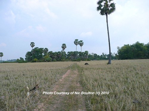
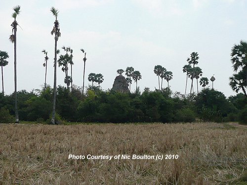
Continue going east, and you will start to see the top of Prasat Trapeang Phong in front of you in the horizon. You can see it in photo
 , raised area with trees. It is just above and to the right of the anthill in the centre-frame.
Now there are a couple of obstacles between you and your destination. In front, and slightly to the left is a raised, wooded area (which you can see on the left of photo
 ). Leave the path and go diagonally across it to the left. Behind that is a large farm with bamboo fencing around its perimeter. Find your way around the left side of the farm, keeping the fencing on your right. When you have semi-navigated the farm, continue on your easterly direction, and you will see Prasat Tropeang Phong looming large in front of you.
Note
My friend Nic explored Prasat Tropeang Phong in January 2010, in the middle of the dry season. If you come here in the wet season, the irrigation drain will be filled with water, making it impassable. You'd probably have to come by boat!Location Map of Prasat Trapeang Phong
Prasat Trapeang PhongPhotos of the approach to Prasat Trapeang Phong
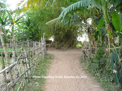 Prasat Trapeang Phong, Junction
  (1February, 2010)
© Nick Boulton
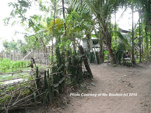 Prasat Trapeang Phong, Junction
  (1February, 2010)
© Nick Boulton
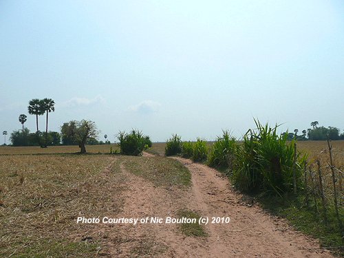 Prasat Trapeang Phong, 100 meters after Junction
  looking onward south (1February, 2010)
© Nick Boulton
 Prasat Trapeang Phong, 200 meters after Junction
  looking back to the north (1February, 2010)
© Nick Boulton
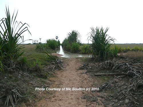 Prasat Trapeang Phong, Junction
  , viewed from north (1February, 2010)
© Nick Boulton
 Prasat Trapeang Phong, Junction 1 (1February, 2010)
© Nick Boulton
 Prasat Trapeang Phong, Junction 1 (1February, 2010)
© Nick Boulton
Photos of Prasat Trapeang Phong
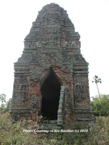 Prasat Trapeang Phong, east facade, with entrance (1February, 2010)
© Nick Boulton
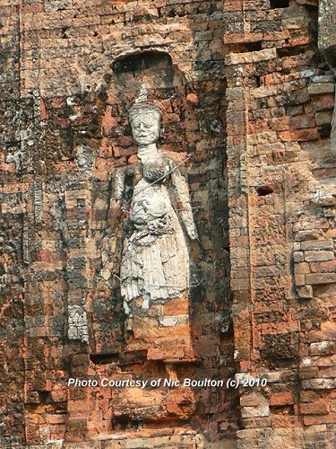 Devata on wall of Prasat Trapeang Phong (1February, 2010)
© Nick Boulton
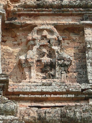 Eroded sculpture on wall of Prasat Trapeang Phong (1February, 2010)
© Nick Boulton
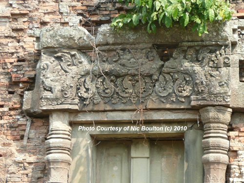 Lintel of Prasat Trapeang Phong, depicting outward-facing makara (1February, 2010)
© Nick Boulton.
 Latest updates on Penang Travel Tips
 Map of Roads in Penang
Looking for information on Penang? Use this Map of Roads in Penang to zoom in on information about Penang, brought to you road by road.
Copyright © 2003-2025 Timothy Tye. All Rights Reserved.

 Go Back