 Phnom Bakheng (27 February, 2006)
Phnom Bakheng (GPS: 13.42372, 103.85594) is a temple built on a hill of the same name, where the first city at Angkor was established. This gives its state temple on Phnom Bakheng special significance. Phnom Bakheng was built in the late 9th to early 10th Century by King Yasovarman I who reigned from AD 889 to AD 910. It was to here that Yasovarman I moved his capital from Roluos. His capital city, called Yasodharapura, was larger than Angkor Thom, which came later, and was centred around the hill of Phnom Bakheng.
360° View of Phnom Bakheng on Google Maps Street View
Phnom Bakheng is  in the centre of the Map of Angkor
The design of the temple of Bakheng borrowed elements from the Bakong which was built 20 years earlier. Both are step pyramids of ascending square terraces. We do know that work on the temple began at the end of the 9th century. The lingga in the central sanctuary was dedicated around 907AD, while construction work continued. The temple was called Yasodharesvara, after its patron deity, which means Lord who Bears Glory. In 928 the temple was abandoned, only to be briefly rehabilitated in 968 by Jayavarman V.
I visited Phnom Bakheng with my wife on the late part of the morning, when the sun was beginning to warm up the day. As I have visited before using the short but steep way, this time around, I decided to use the elephant trail, which is longer but less steep. This allows for a more leisurely climb up the hill.
 Phnom Bakheng (27 February, 2006)
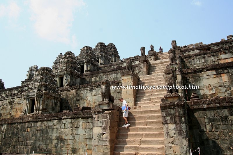
When the temple was built, there used to be an outer enclosure that surrounded the hill. There were four gopuras at the cardinal points at the foot of the hill. Today only their foundation can be traced. Stairways lead up from the east, north and west gopuras, but not the south, probably because (as with most Angkor temples) the work was never fully completed. The east entrance was the main one, and here, one can still see the pair of guardian lions.
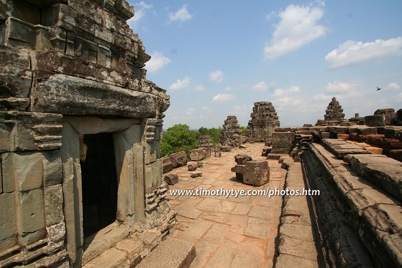
The pyramid temple is 13 meters high, consisting of five terraces. The pyramid is not exactly centered, but set slightly to the west. At the base of the pyramid are 44 brick towers set in groups of 2, 3 and 4 each. On the terraces are another 60 small towers, with pairs flanking the stairway. On the summit are another five towers each 1.6m high and set back slightly to the west. In total, there are 108 towers, corresponding to a sacred number in Hinduism and Buddhism.
How to reach Phnom Bakheng
Phnom Bakheng is located 1.2km north of the west entrance of Angkor Wat. From Siem Reap you should take the road to Angkor Wat, and then continued on till you arrive at Phnom Bakheng, which is on the left side of the road. The climb up to Phnom Bakheng is quite tiring, depending on your own level of fitness. If you're like me, with a heavy load of camera gear in tow, then I would suggest following the elephant trail. It is a more leisurely climb than less steep than the straight route. Some times an elephant service is also available at about US$10 per ride. Latest updates on Penang Travel Tips
 Map of Roads in Penang
Looking for information on Penang? Use this Map of Roads in Penang to zoom in on information about Penang, brought to you road by road.
Copyright © 2003-2025 Timothy Tye. All Rights Reserved.

 Go Back