
Bukit Berangan Travel Guide
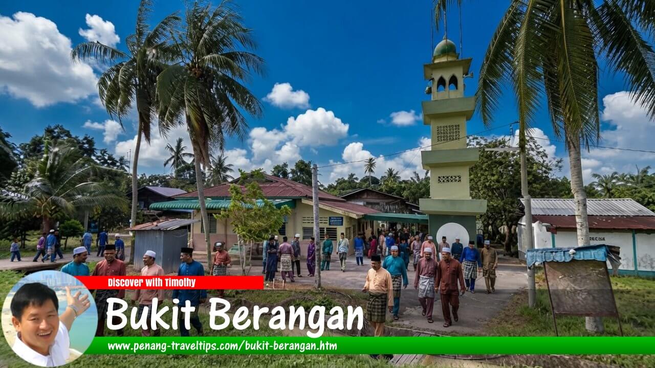 Bukit Berangan Travel Guide (AI generated on 30 September 2026)

Also available: Panduan Melawat Bukit Berangan
Bukit Berangan (GPS: 5.43565, 100.47185) is a traditional village in Central Seberang Perai, on the mainland portion of Penang, Malaysia. Located near Kubang Semang and Guar Perahu, it forms part of the rural settlement landscape of the district, where village homes, local roads and neighbouring communities are linked by a network of routes through the interior of Seberang Perai. Sungai Kulim lies to the north of the village, while Kampung Guar Perahu is to its south.
Unlike George Town, with its historic streets and major visitor attractions, Bukit Berangan is primarily a residential community. Visitors who come here are more likely to be interested in the geography and everyday character of rural Penang than in conventional sightseeing. Its location also makes it possible to combine a visit with nearby settlements such as Kubang Semang, Penanti, Guar Perahu and Mengkuang Titi.
Quick Facts
- Name: Bukit Berangan
- Location: Central Seberang Perai, Penang, Malaysia
- Type of settlement: Traditional village
- Nearby settlements: Kubang Semang, Guar Perahu, Penanti and Mengkuang Titi
- Nearby river: Sungai Kulim
- Important local road: Jalan Kubang Semang
- General character: Rural residential area
- Main visitor interest: Village scenery, local geography and the surrounding rural communities
- Getting around: Car, motorcycle, e-hailing services and buses on nearby routes
- Accommodation: More options may be available in Bukit Mertajam and other nearby urban areas
Geography and Location
Bukit Berangan is situated in Central Seberang Perai, one of the administrative districts of Penang on the Malay Peninsula. Seberang Perai occupies the mainland portion of the state, across the water from Penang Island. Central Seberang Perai contains a mixture of urban centres, established villages, agricultural land and areas undergoing residential and commercial development.
Bukit Berangan lies within this inland setting. The village is associated with the Kubang Semang area, and Jalan Kubang Semang is an important local road for reaching the surrounding settlements. Jalan Padang Menora is also listed among the roads serving the wider locality. 2
Sungai Kulim runs to the north of Bukit Berangan. The river forms part of the natural geography of this part of Seberang Perai, where waterways and local roads connect rural communities. Conditions along the river vary by location, and visitors should not assume that every riverside area is accessible or suitable for recreation.
Kampung Guar Perahu lies to the south of Bukit Berangan. Penanti and Mengkuang Titi are among the other settlements in the surrounding area. These communities are connected through local roads and form part of a wider network of villages and small urban centres in Central Seberang Perai.
The landscape is best understood as a rural residential environment rather than a purpose-built tourist destination. Visitors may encounter village houses, local roads and the everyday activities of residents. The precise appearance of the surroundings depends on the part of the village visited, as well as changes in land use and development over time.
History of Bukit Berangan
A traditional village in Seberang Perai
Bukit Berangan is recorded as a traditional village in Central Seberang Perai in planning documentation relating to Penang. 3 This places it within the network of established settlements that form part of the state's rural heritage.
The broader history of Seberang Perai is associated with settlement, agriculture, the opening of land for cultivation and the gradual development of roads connecting villages with market towns. Rural communities played an important role in supporting the agricultural economy and providing homes for people whose work and daily activities were centred on the surrounding countryside.
Bukit Berangan should be understood within this wider regional context. However, information about the exact date the village was founded, its earliest settlers and specific historical events associated with it is limited in readily available sources. It would therefore be misleading to assign a precise founding date or identify a particular founder without supporting historical evidence.
Connections with neighbouring communities
The village's relationship with Kubang Semang and nearby settlements is important to understanding its development. Residents can use the local road network to reach shops, services and other facilities in neighbouring communities. These connections also make it easier for visitors to explore several villages during a single trip.
Over time, the growth of towns, increased use of private vehicles and improvements to road connections have changed how rural communities interact with larger centres. Nevertheless, development has not necessarily occurred at the same pace in every village. The history of Bukit Berangan should not be assumed to mirror that of neighbouring places in every detail.
Origin of the Name Bukit Berangan
The name Bukit Berangan consists of two Malay words. Bukit means a hill or elevated area of land, while berangan can refer to a type of tree known by that name in Malay usage.
Place names in Malaysia often reflect local geography, vegetation, historical activities or features that were familiar to early residents. It is therefore possible that the name Bukit Berangan refers to a landscape feature or vegetation once associated with the area.
However, the literal meaning of the words does not establish the actual origin of the village's name. Without a reliable historical account or documented local tradition, it cannot be confirmed whether the name refers to a particular hill, the presence of berangan trees or another local feature. This interpretation should be treated as a possibility rather than an established historical fact.
Places to See Around Bukit Berangan
Bukit Berangan is not a major tourist centre with a large collection of purpose-built attractions. Its interest lies mainly in its rural setting and its connections with neighbouring villages. Visitors can make a more varied excursion by including nearby settlements and places of interest in Central Seberang Perai.
1. Bukit Berangan village
The village itself is the starting point for understanding the local landscape. Its residential surroundings and local roads offer a glimpse of everyday life in inland Seberang Perai. Visitors interested in local geography can observe how the village connects with nearby settlements and how residential areas sit within the wider countryside.
There may not be designated walking routes, visitor facilities or formal sightseeing stops. The best approach is to explore from public roads and respect the privacy of residents. Houses, gardens, agricultural plots and other privately owned properties should not be entered without permission.
2. Guar Perahu
Guar Perahu lies to the south of Bukit Berangan and is one of the nearby settlements that can be included in a local excursion. Travelling between the two areas provides an opportunity to see more of the village landscape of Central Seberang Perai.
Visitors can look for local shops, food stalls and everyday services in the wider area. Guar Perahu is primarily a local community rather than a dedicated tourist attraction, so the activities available will depend on the facilities operating at the time of the visit.
3. Penanti
Penanti is another settlement in the surrounding area. It can be useful as a stop for everyday facilities or as a starting point for continuing to other parts of Central Seberang Perai. Its connection with the neighbouring communities makes it relevant to understanding how people travel between the villages and the area's larger centres.
Visitors should treat Penanti as a local town and residential area rather than assume it has a concentrated tourist district. Its suitability as a stop depends on the visitor's interests and the facilities available on the day.
4. Mengkuang Titi
Mengkuang Titi is a nearby village associated with the rural character of Central Seberang Perai. The wider area has links with agriculture and small-scale local activities. Visitors interested in the countryside can consider adding it to a drive through the surrounding villages.
Mengkuang Dam is located within the broader Mengkuang area. The distance and access route depend on the visitor's starting point and the relevant entrance. Check access arrangements before travelling, and do not assume that every part of the reservoir or its surrounding land is open to the public.
5. Bukit Mertajam
Bukit Mertajam is one of the principal urban centres in Central Seberang Perai. It offers a wider range of shops, restaurants, accommodation and commercial services than Bukit Berangan. It is therefore a practical place to visit before or after exploring the village.
Visitors who want more options for dining, shopping or arranging onward transport may find Bukit Mertajam convenient as a base. Travel time will depend on the route taken and prevailing traffic conditions.
Food Around Bukit Berangan
As Bukit Berangan is primarily a residential village, food choices within the village itself may be limited. Visitors can look for places to eat in the surrounding areas, including Kubang Semang, Guar Perahu and Penanti. The availability of particular dishes and opening hours will depend on individual businesses.
Malay food and everyday local dishes
Food stalls and small eateries in rural parts of Seberang Perai may serve everyday Malaysian meals such as nasi campur, nasi lemak, fried noodles, fried rice, roti canai and traditional kuih. These are general examples of dishes to look for in the wider area, rather than a verified list of outlets in Bukit Berangan.
For Muslim travellers, it is sensible to choose establishments that can clearly confirm their halal status. Do not assume that a restaurant is halal solely because of its location or the type of food it serves.
Eating in nearby towns
If there are few suitable options in the village, Kubang Semang or Penanti may offer alternatives. Bukit Mertajam has a broader selection of eateries and may be more convenient for visitors who want greater choice.
Travellers planning to eat in the evening should check opening hours in advance. Some small-town eateries and village stalls operate only during particular parts of the day or on selected days.
Where to Stay
Bukit Berangan is not a major accommodation centre. Visitors planning an overnight stay may find it easier to search in nearby towns, where there are more options for hotels, guesthouses and short-term accommodation.
Kubang Semang and Penanti
Accommodation in or around Kubang Semang and Penanti may be worth considering for visitors who want to stay relatively close to Bukit Berangan. Availability can vary, and not every property will be located in the centre of either settlement.
Before booking, check the full address, parking arrangements, access roads and guest reviews. If you do not have your own vehicle, confirm whether public transport or e-hailing services are practical for reaching the accommodation.
Bukit Mertajam
Bukit Mertajam offers a wider range of commercial facilities and may be a convenient base for exploring several destinations in Central Seberang Perai. Visitors can compare accommodation by price, location and facilities, including parking and access to restaurants.
Butterworth and other parts of Seberang Perai
Butterworth and other urban areas in Seberang Perai may be suitable for travellers who need access to wider transport connections or a greater choice of hotels. However, staying farther away will mean additional travel to and from Bukit Berangan.
Because accommodation availability changes, search for properties according to your travel dates rather than relying on an assumed list of places to stay in the village. If the visit is mainly for a family gathering or local appointment, prioritise convenient road access and a location that fits your itinerary.
How to Get to Bukit Berangan
By car
A car is one of the most practical ways to reach Bukit Berangan, particularly for visitors arriving from outside the area. Jalan Kubang Semang is a useful road reference when approaching the locality. From the Kubang Semang area, follow navigation directions towards Kampung Bukit Berangan and confirm the final access road before setting off.
From Bukit Mertajam, the journey can be planned using the road network linking the town with Kubang Semang and the surrounding villages. From Butterworth or northern Seberang Perai, travel towards Central Seberang Perai before continuing along local roads.
Journey times vary according to the starting point, traffic and route selected. Use a navigation application for current directions and estimated travel time, and allow extra time during busy periods or when roadworks are taking place.
By motorcycle
A motorcycle can be convenient for short journeys between Bukit Berangan and neighbouring settlements. Riders should take care on narrow roads, at junctions and where local traffic shares the carriageway. Wet weather can make road surfaces slippery, particularly in areas close to waterways.
By public bus
Public buses may be useful for reaching nearby parts of Seberang Perai, although a bus may not stop directly inside Bukit Berangan. Public transport listings identify bus services in the wider vicinity of Jalan Bukit Berangan and Medan Selera Guar Perahu, including routes listed as 20 and 606. 4
Bus routes, timetables and stopping arrangements can change. Check current service information before travelling, and determine how far you will need to walk from the nearest stop to your destination. If necessary, an e-hailing service can help complete the final part of the journey.
By e-hailing service
E-hailing is an option for visitors who do not have their own transport. Enter the village name or a specific address in the application and confirm the destination with the driver. Sharing a precise map location can help avoid confusion where local roads or place names are similar.
Getting Around Bukit Berangan
Walking may be suitable for short distances along public roads, but Bukit Berangan should not be assumed to have continuous pavements or dedicated pedestrian routes. Walk carefully, remain alert to passing vehicles and give local residents space to carry out their daily activities.
A car or motorcycle is generally more practical for travelling between Bukit Berangan, Guar Perahu, Kubang Semang, Penanti and Mengkuang Titi. Visitors relying on buses should plan around the location of stops and the frequency of available services.
When parking, avoid blocking house entrances, narrow roads, driveways or emergency access routes. Do not enter private property or agricultural land without the owner's permission.
Suggested Short Itinerary
Bukit Berangan can be included in a half-day excursion through the rural communities of Central Seberang Perai. Since the village itself is not a major tourist centre, combining it with nearby settlements makes for a more varied trip.
- Morning: Have breakfast in the Kubang Semang or Guar Perahu area, depending on which eateries are open.
- Late morning: Continue to Bukit Berangan to explore the village surroundings and observe the local road network.
- Lunch: Find a place to eat in the nearby settlements, choosing from the options available on the day.
- Afternoon: Continue towards Mengkuang Titi or Penanti before travelling to Bukit Mertajam or returning to your accommodation.
This is a flexible suggestion rather than a fixed sightseeing route. If you intend to visit a specific facility or outdoor destination, check its access arrangements and opening hours before leaving.
Practical Tips for Visitors
- Confirm the location: Make sure your destination is Bukit Berangan in Central Seberang Perai, Penang, as similar place names may appear in searches.
- Use the local road network: Jalan Kubang Semang is a useful reference when approaching the village.
- Plan public transport: Check current bus routes, schedules and stopping points before travelling.
- Respect local residents: Bukit Berangan is a residential community. Ask permission before photographing people or entering private property.
- Check food options: Confirm opening hours and halal status where relevant to your needs.
- Prepare for the weather: Bring protection from sun and rain, especially if you plan to walk outdoors.
- Drive carefully: Allow for local traffic, narrow roads and vehicles entering or leaving residential properties.
Conclusion
Bukit Berangan is a traditional village in Central Seberang Perai, near Kubang Semang, Guar Perahu, Penanti and Mengkuang Titi. Its inland location, local road connections and proximity to Sungai Kulim make it part of the wider rural settlement landscape of mainland Penang.
Although Bukit Berangan is not a major tourist destination, it offers an opportunity to learn about the geography and settlement patterns of Seberang Perai beyond the better-known urban and heritage centres. Visitors can combine a brief visit with nearby communities while respecting the privacy and everyday routines of local residents.
Bukit Berangan is  on the Map of Seberang Perai
References
- Penang Travel Tips, Bukit Berangan, Penang.
- OpenAlfa, Bukit Berangan Street Guide and Map. https://malaysia-streets.openalfa.com/bukit-berangan
- PLANMalaysia, Laporan Lampiran Rumusan Dasar Perancangan Fizikal Negara, including a record of Kampung Bukit Berangan as a traditional village in Central Seberang Perai. https://www.planmalaysia.gov.my/portalassets/docs/LAPORAN_LAMPIRAN_RUMUSAN_DPFDN.pdf
- Moovit, Public Transport to Jalan Bukit Berangan, Penang. https://moovitapp.com/index/en/public_transit-Jalan_Bukit_Berangan-Penang-site_80008838-5390
Page Details
This page was created on 7 September 2026. Hi, my name is Timothy and created it from my research, for my own entertainment, knowledge and to satisfy my curiosity. I am providing the information to you in good faith and hope it is useful. I try to get the details as accurate as possible. I also try to update the page whenever I stumble on new details. So this and all my other pages are perpetual work in progress. If you discover any error, please politely inform me, pointing out where the error lies, and I will correct it as soon as possible. Your helpfulness will keep this page accurate, relevant and helpful to those who need the information.Want to share your Penang travel experiences or get tips from fellow travellers?
Join the Penang Travel Tips Facebook GroupUseful guides for visiting Penang
My Videos of Penang
 Latest Pages & Updates
Buy Me A Coffee
If you enjoy the information I provide and want to support the work I do, please buy me a coffee! I appreciate it immensely, thank you so much!
