Gillette is a small city in northeastern Wyoming. The county seat of Campbell County, Gillette covers 13.4 sq mi (34.7 sq km) and has a population of 29,000 (2011 estimate). The city is located at an elevation of 4,554 ft (1,388 m) above sea level. It was named after surveyor-civil enginner Edward Gillette, and was incorporated in 1892, two years before Wyoming achieved statehood.
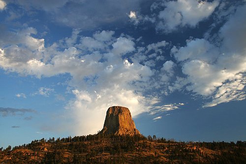
 Devils Tower, near Gillette, Wyoming
Source: https://commons.wikimedia.org/wiki/File:B_D_-_Devil%27s_Tower_select_%283%29_1.1_%28by%29.jpg
Author: B D

Gillette has a semi-arid climate. Warmest month here is July, when the average high temperature reaches 84.5°F (29.17°C). January is the coldest month, when the average low temperature drops to 10°F (-12°C). Snow can be expected between December and March.
Gillette is often nicknamed the Energy Capital of the Nation. That's because it is a producer of coal, oil and methane gas. The city has the tallest structure in Wyoming, that being the 700-ft radio transmitter mast. The most popular sight near to Gillette is Devils Tower.
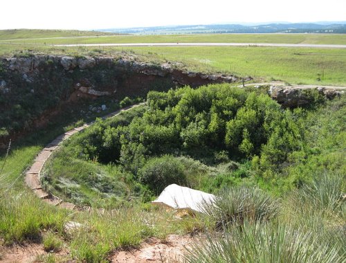
 Vore Buffalo Jump, Wyoming
Source: https://commons.wikimedia.org/wiki/File:Vore_Buffalo_Jump.jpg
Author: Jeff the quiet

Visiting Gillette, Wyoming
Interstate 90 connects Gillette to Buffalo, Wyoming, to the west, and Rapid City, South Dakota, to the east. You can also fly to the Gillette-Campbell County Airport (GCC), served by Great Lakes Airlines, United Airlines and SkyWest Airlines. There are daily flights connecting Gillette with Denver, Salt Lake City and Billings.Places of Interest in Gillette, Wyoming
- Devils Tower National Monument
- Durham Buffalo Ranch
- Eagle Butte Coal Mine
- Gillette Science Center
- Keystone State Park
- Vore Buffalo Jump
 Latest updates on Penang Travel Tips

Copyright © 2003-2025 Timothy Tye. All Rights Reserved.

 Go Back