 Herd of bison at Wind Cave National Park, South Dakota
 http://commons.wikimedia.org/wiki/File:WICA2348.jpg
 Huebi, National Park Service photo
Wind Cave National Park is the first cave system in the world to be designated a national park. President Theodore Roosevelt established it on 9 January, 1903, making it the 7th national park in the country. Wind Cave National Park covers 28,295 acres (114 sq km) about 10 miles (16 km) to the north of the town of Hot Springs in western South Dakota, not far from Jewel Cave National Monument.
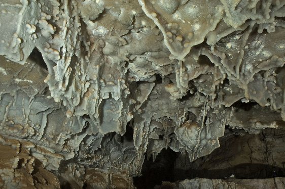
 Boxwork in the Lower Cave of Wind Cave National Park, South Dakota
 http://commons.wikimedia.org/wiki/File:Wind_Cave_lower.jpg
 Dave Bunnell
The cave system in Wind Cave National Park is famous for its calcite formation called boxwork. 95 percent of the world's boxwork formations are in Wind Cave. In addition, the cave system is also known for its frostwork, a needle-like crystal of aragonite or calcite.
With 119.58 miles of explored cave passageways, Wind Cave is the fourth longest cave system in the world. It is also recognized as having the densest cave system in the world, with the most passage volume per square mile. The entire cave system at Wind Cave is believed to be 131.04 miles (210.89 km) also a few more miles are discovered every year.
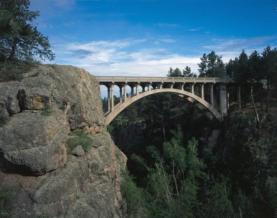
 Beaver Creek Bridge, Wind Cave National Park
 http://commons.wikimedia.org/wiki/File:Beaver_Creek_Bridge_in_Wind_Cave_National_Park.jpg
 US Dept of the Interior, National Park Service
Wind Cave is regarded as sacred to the Sioux people who live in the Black Hills of South Dakota. According to their myth, the first Sioux (or Lakota) people came out from the ground from the cave. In modern times, the earliest documented discovery of Wind Cave was made by two brothers, Tom and Jesse Bingham, in 1881. The sound of the wind heard by the Bingham brothers gave the cave its name.
In addition to the subterranean cave system, Wind Cave National Park also protects the above ground terrain, which includes the largest remaining natural mixed-grass prairie in the United States as well as ponderosa pine forests. Among the wildlife of the area includes bisons, elk, black-footed ferrets, pronghorn antelopes and prairie dogs.
 Boxwork of the Upper Cave
 http://commons.wikimedia.org/wiki/File:Wind_Cave_upper.jpg
 Dave Bunnell
Visiting Wind Cave National Park, South Dakota
Wind Cave National Park is located to the southeast of Custer. The nearest major city to Wind Cave National Park is Hot Springs. From there, take US Highway 385 heading north. Follow the highway and look out for signage to the visitor center. An alternative route is through Custer State Park on South Dakota Soute Routes 36 and 87. These are a slower alternative, but they provide scenic vistas of the Black Hills, Custer State Park and Wind Cave National Park along the way to the visitor center.Wind Cave National Park is open year round. The visitor center is open daily except for Thanksgiving Day, Christmas Day and New Years Day. Its opening hours range from 8:00 am to 4:30 pm in winter to 8:00 am to 6:00 pm in summer. While driving through the park or hiking through it is fee, there are some fees involved with specific activities and specialty tours such as the Garden of Eden Cave Tour ($7 per adult aged 17 and above), Natural Entrance Cave Tour ($9 per adult aged 17 and above), Fairgrounds Cave Tour ($9 per adult aged 17 and above), Historic Candlelight Cave Tour ($9 per adult aged 17 and above) and Wild Cave Tour ($23 per adult).
List of National Parks in the United States
 Latest updates on Penang Travel Tips

Copyright © 2003-2025 Timothy Tye. All Rights Reserved.

 Go Back