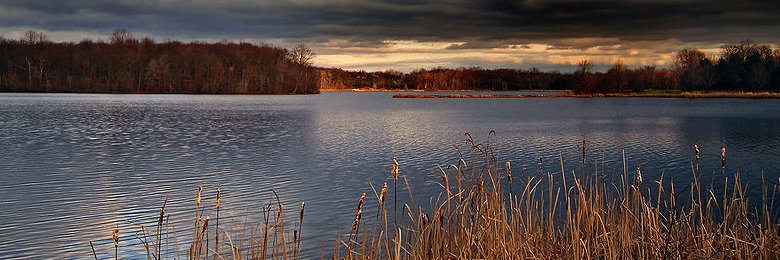
 Minsi Lake, Northampton County, Pennsylvania
Source: https://commons.wikimedia.org/wiki/File:Incoming_Storm_clouds,_Minsi_Lake,_Northampton_County.jpg
Author: Nicholas

Pennsylvania, officially designated as the Commonwealth of Pennsylvania, is a state within both the Northeastern region and Middle Atlantic region of the United States. It covers an area of 46,055 sq mi (119,283 sq km), making it the 33rd state out of 50 in terms of size.
Pennsylvania measures 280 miles (455 km) from east to west and 160 miles (255 km) from north to south. It is bordered by New York to the north, New Jersey to the east, Maryland to the south, West Virginia to the southwest and Ohio to the west. The highest point in the state is Mount Davis, at 3,213 ft (979 m).
Pennsylvania is the 6th most populous in the United States. Its population as of 2010 is estimated at 12.7 million people. The biggest city is Philadelphia while the capital is Harrisburg. Pennsylvania is located within the Eastern time zone (-5/-4 GM). Its abbreviation is PA.
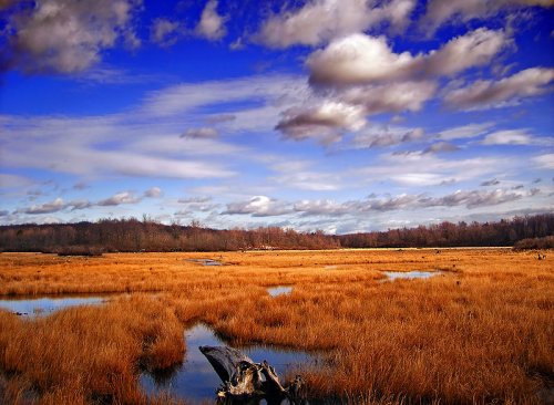
 Gouldsboro State Park, Pennsylvania
Source: https://commons.wikimedia.org/wiki/File:GboroSP_Wetland.jpg
Author: Nicholas

Travel to Pennsylvania
By PlaneThe main airports serving Pennsylvania are the Philadelphia International Airport (PHL) and Pittsburgh International Airport (PIT). Both airports are major airports for US Airways.
By Train
You can take the Amtrak trains to Philadelphia from New York City, Charlotte and New Orleans. There are also train services from Chicago and Washington, D.C.
By Road
Interstate highway 70/76/78 covers the southern part of Pennsylvania, passing through Pittsburgh, Harrisburg, Allentown and Philadelphia. Interstate 80 passes through the northern part of the state from Ohio to New York.
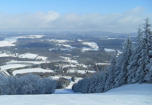
 View of Endless Mountains from Elk Mountain, Pennsylvania
Source: https://commons.wikimedia.org/wiki/File:Elkmountaintop.jpg
Author: Ekem

Cities in Pennsylvania
- Allentown (111,000)
City in Lehigh County. - Erie (104,000)
City in northwestern Pennsylvania, on the southern shore of Lake Erie. - Harrisburg (49,000)
Capital of Pennsylvania. - Lancaster (55,000)
City in south-central Pennsylvania. - Philadelphia (1,540,000)
Sixth most populous city in the United States. - Pittsburgh (312,000)
Second largest city in Pennsylvania. - Reading (88,000)
City in northeastern Pennsylvania. - Scranton (72,000)
City in southeastern Pennsylvania. - Williamsport (31,000)
County seat of Lycoming County.
Places of Interest in Pennsylvania
- Allegheny Portage Railroad National Historic Site
- Gettysburg National Military Park
- Hershey
- Johnstown Flood National Memorial
- Lehigh Valley
- Longwood Gardens
- Poconos and Endless Mountains
- Reading
- Steamtown National Historic Site
- York
World Heritage Site in Pennsylvania
- Independence Hall (1979)
 Latest updates on Penang Travel Tips

Copyright © 2003-2025 Timothy Tye. All Rights Reserved.

 Go Back