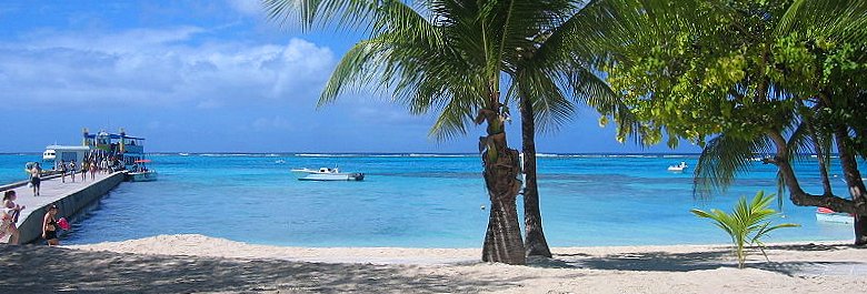
 Northern Mariana Islands, Pier at Mañagaha Island
Source: https://commons.wikimedia.org/wiki/File:Managaha.jpg
Author: Chad fitz

The Northern Mariana Islands are officially called the Commonwealth of the Northern Mariana Islands. It is a group of 15 islands located in the western Pacific Ocean. It is part of the Mariana Islands, which is a larger area that includes Guam. The islands cover a total area of 179 sq mi (463.63 sq km) and has a population of about 80,000. The most populous island in the Northern Marianas is Saipan, which is also the location of Capitol Hill, the administrative center.
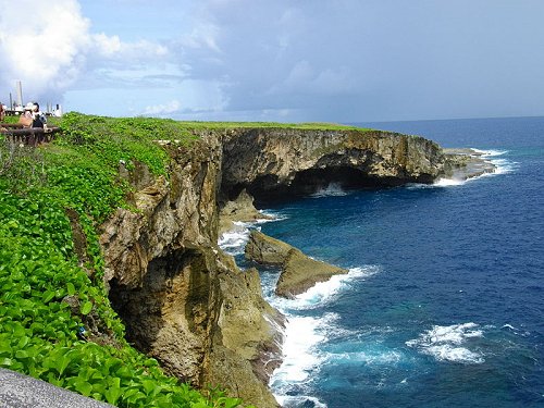
 Banzai Cliff, Saipan
Source: https://commons.wikimedia.org/wiki/File:Banzai_Cliff_in_Saipan.jpg
Author: Abasaa

The highest point in the Northern Mariana Islands is the volcano on Agrihan, which stands at 3,166 feet (965 meters). Northern Mariana Islands use the US Dollar. It is in the time zone 10 hours ahead of GMT.
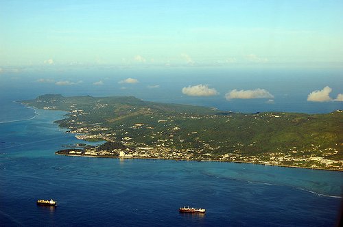
 Aerial view of Saipan
Source: https://commons.wikimedia.org/wiki/File:Saipan.jpg
Author: P. Miller

Travel to Northern Mariana Islands
U.S. citizens wishing to enter the Northern Mariana Islands must show proof of citizenship, usually by producing a valid passport. Countries enjoying the U.S. Visa Waiver program are granted a 30-day stay on entry. Citizens of other countries should check with the nearest U.S. Embassy for visa requirements.By Plane
There are regular scheduled flights to Saipan from Japan, South Korea, Taiwan. Visitors coming from the United States have to transit in Guam.
 Volcanic Bomb at Craters of the Moon National Monument, Idaho
Source: https://commons.wikimedia.org/wiki/File:Mid-Hudson_Bridge_2010-03-07.jpg
Author: Juliancolton

Principal Islands of Northern Mariana Islands
- Saipan - capital
- Northern Islands
- Rota
- Tinian
National Monuments in the Northern Mariana Islands
 Latest updates on Penang Travel Tips

Copyright © 2003-2025 Timothy Tye. All Rights Reserved.

 Go Back