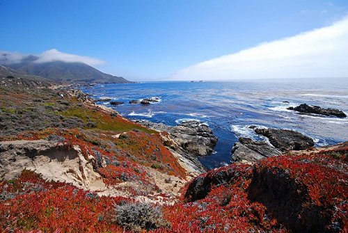
 Big Sur coast with Bixby Bridge
Source: https://commons.wikimedia.org/wiki/File:Big_Sur_June_2008.jpg
Author: Calilover

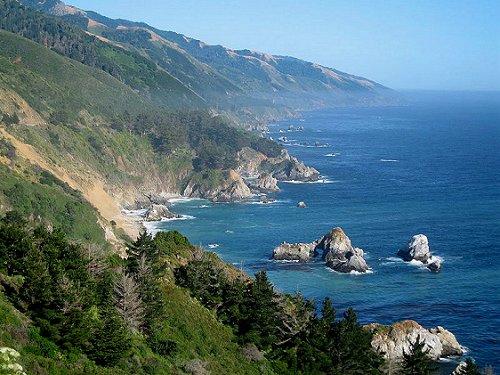
Big Sur is a scenic coastal stretch of California. Along this stretch, the Santa Lucia Mountains faces the Pacific Ocean. It is the highest mountain range immediately before the ocean in the whole contiguous United States, and this abruptness creates some stunning landscapes.
The highest peak along this stretch of coast is Cone Peak, which looms 5,155 ft (1,571 m) above sea level, just three miles from the ocean. By most definition, Big Sur covers a 90-mile (140-km) stretch of the Californian coast, from the town of Carmel in the north, to San Simeon in the south.
 Big Sur vista
Source: https://commons.wikimedia.org/wiki/File:Big_Sur_color_explosion.jpg
Author: Eric Chan

The Big Sur coastline is served by California State Route 1, otherwise known as Highway 1. The construction of this highway in 1937 brought development to the otherwise remote area. It also drew creative people in search of natural beauty and solitude, among them Henry Miller, Emile Norman and Hunter S. Thompson.
One of the highlights of a trip to California, to a first-time visitor especially, is to take a car trip through Big Sur. The pleasure of cruising down Highway 1 with the Pacific Ocean next to you is a memorable experience for many.
 Big Sur coastline
Source: https://commons.wikimedia.org/wiki/File:CalifCentralCoast.jpg
Author: Paul Lee

Visiting Big Sur
Highway 1 is the only main road through Big Sur.If you are coming from Los Angeles, take US Highway 101 north and enter Highway 1 at San Luis Obispo.
From San Francisco, rather than traveling the entire stretch of Highway 1, you can use US Highway 101 south to California Highway 156, which merges with Highway 1 at Castroville.
Places of Interest in Big Sur, California
- Bixby Bridge
- Henry Miller Memorial Library
- Point Sur Lighthouse
- McWay Falls
- New Camaldoli Hermitage
 Latest updates on Penang Travel Tips

Copyright © 2003-2025 Timothy Tye. All Rights Reserved.

 Go Back