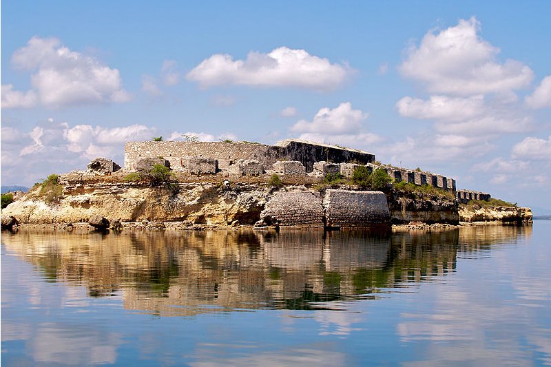
 Ruins of Fort-Liberté, Haiti
Source: https://commons.wikimedia.org/wiki/File:Fort_Saint_Joseph_-_Fort_Liberte_%28Looking_South%29.jpg
Author: Nick Hobgood

Haiti is a semi-presidential republic in the Caribbean. It occupies the western, smaller portion of the island of Hispaniola, which it shares with the Dominican Republic. Haiti covers 27,750 sq km (10,714 sq mi) and has a population of 9.7 million people. Its capital and largest city is Port-au-Prince.
The official languages of Haiti are Haitian Creole and French. It is just one of two independent nations in the Americas (the other being Canada) to designate French as an official language.
Haiti is five hours behind Coordinated Universal Time (UTC-5). Its official currency is called the Gourde (HTG). The phone IDD code is +509. Traffic is driven on the right here. The electricitiy is 110V/60Hz using USA plugs.
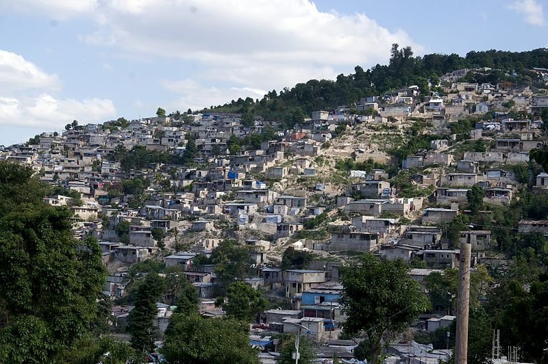 Carrefour, Haiti
Source: https://commons.wikimedia.org/wiki/File:Carrefour,_Haiti.jpg
Author: PWRDF

The island of Hispaniola was inhabited by the Arawakan-speaking Taíno Indians at the time of the arrival of Europeans. Christopher Columbus arrived at Môle Saint-Nicolas in Hispaniola on 5 December, 1492 and claimed the island for Spain. In the next two centuries, French settlers as well as French pirates also landed and claimed parts of the island, resulting in hostilities between France and Spain, which was settled with the Treaty of Ryswick in 1697, dividing the island into two.
France received a third of Hispaniola. They named it Saint-Domingue, and soon more French colonists were arriving on their side of the island. By 1790, Saint-Domingue had become much more prosperous than the western portion controlled by Spain. It was in fact the wealthiest French colony in the New World, deriving its wealth from the profit it generated in sugar, coffee and indigo industries.
Inspired by the French Revolution, the free people of color and slaves of Saint-Domingue started a revolution in 1791 demanding greater freedom and civil rights. The revolt led to the declaration of independence of Saint-Domingue on 1 January, 1804, at which time the former slaves gave the nation a new name, Ayiti, meaning "mother of the earth" in the Taino-Arawak language.
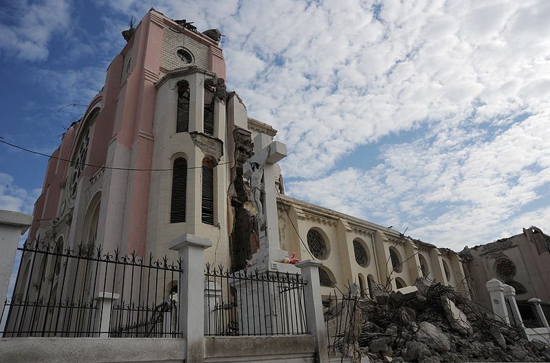 Cathédrale Notre-Dame de Port-au-Prince, after the 2010 earthquake
Source: https://commons.wikimedia.org/wiki/File:Cath%C3%A9drale_Notre-Dame_de_Port-au-Prince_2010-01-26.jpg
Author: Tech. Sgt. Prentice Colter, USAF

Haiti is the only nation born of slave revolt, a costly affair which claimed the lives of 100,000 blacks and some 24,000 of the 40,000 white colonists. It also caused a massive exodus of refugees from Haiti, many streaming into New Orleans, doubling the city's population, and providing a cultural link between the city and Haiti.
By the 20th century, the prosperity that Haiti enjoyed (in its early incarnation as Saint-Domingue) had all but evaporated. It was occupied by the United States from 1915 until 1934, during which time the US controlled the island with an iron fist. The departure of the Americans did nothing to improve on the Haitian well being, as Dominican Republic dictator went on a genocidal spree killing Haitians on the Dominican Republic side of the border. From 1957 to 1986, Haiti was governed by the heriditary dictatorship that began with Dr François "Papa Doc" Duvalier, and ending with his son Jean-Claude "Bébé Doc" Duvalier.
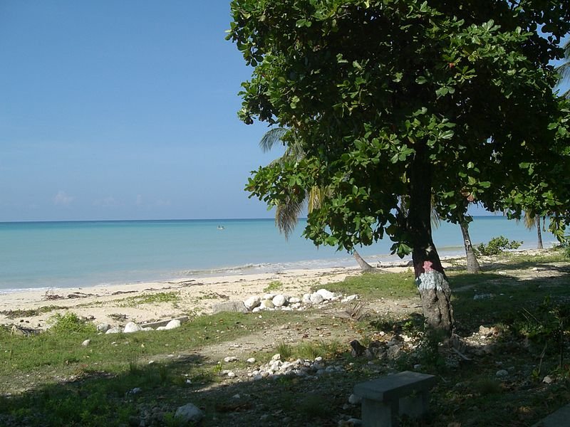 Port Salut, Haiti
Source: https://commons.wikimedia.org/wiki/File:Port_Salut_Ha%C3%AFti.JPG
Author: Bruno Le Baisais

Haiti entered the 21st century with a stagnant economy and a volatile political climate. Then came the 2010 Haiti earthquake. The 7.0 magnitude quake struck the country on 12 January, 2010, causing massive devastation in Port-au-Prince and killing some 220,000 people and making 1.6 million homeless. Many major structures in the capital were destroyed by the quake, among them the Presidential palace and Parliament building. The country suffered from a cholera outbreak in October 2010, and to complete its catalog of calamities, it was hit by Hurricane Tomas in November.
Haiti today remains the poorest country in the Americas, and one that is continuously being torn by political upheavals. In 2009, Haiti had a nominal GDP of $6.6 billion and a per capita nominal GDP of just $733. Its per capita GDP at purchasing power parity is $1,338.
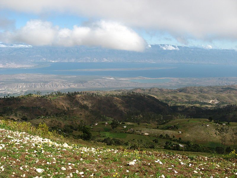 Haitian landscape
Source: https://commons.wikimedia.org/wiki/File:Azuei_foret_pins.JPG
Author: Xapitoun

Planning your visit to Haiti
With all the tension in the country, Haiti isn't exactly your ideal tourist destination. Tourism infrastructure can be described as inadequate, cholera continues to pose a health threat, and crime from robbery to kidnapping remains high. Casual visitors are therefore advised not to make a trip to the country until the situation improves, which would not be within the near future.Major Cities in Haiti
- Port-au-Prince - capital
- Cap-Haïtien
- Gonaïves
- Jacmel
- Jérémie
- Les Cayes
- Milot
- Miragoane
- Mirebalais
- Petionville
- Port-de-Paix
- Port-Salut
- Saint-Marc
World Heritage Sites in Haiti
Haiti ratified the World Heritage Convention on 18 January, 1980. As of August 2010, it has one World Heritage Sites which is in the cultural category. Haiti also has another one site on the World Heritage Tentative List.Sites in Haiti on the World Heritage Tentative List
- Centre historique de Jacmel (2004)
 Latest updates on Penang Travel Tips

Copyright © 2003-2025 Timothy Tye. All Rights Reserved.

 Go Back