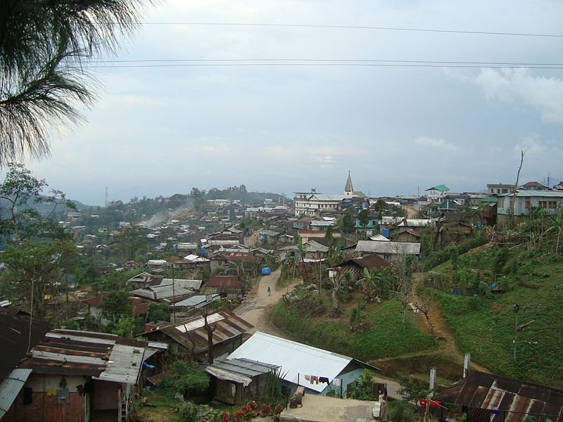
 Mokokchung, Nagaland
Source: http://commons.wikimedia.org/wiki/File:MokokchungVillageSkyline.jpg
Author: Limasenla

Nagaland is a state in northeastern India. It covers 16,579 sq km (6,401 sq mi) and has a population of 1.98 million people (2011 estimate). The capital is Kohima while the largest city is Dimapur.
Nagaland is located in the Naga Hills, which rise from the Brahmaputra Valley in Assam to reach some 610 m (2,000 ft) above sea level. The highest mountain in Nagaland is the 3,826 m (12,552 ft) Mount Saramati. This is where the Naga Hills continue into the Patkai Range of Myanmar.
Nagaland experiences a monsoon climate. Temperature of the lowland is fairly constant, ranging from 21°C (70°F) to 40°C (104°F). During winter, some parts of Nagaland get temperatures below 4°C (39°F). Wettest months are from May to September.
The people of Nagaland speak some 60 different dialects from the Sino-Tibetan family of languages. Many of these languages are not scripted, although Christian missionaries have introduced the Roman script to write these languages. English is used as the medium of instruction and education.
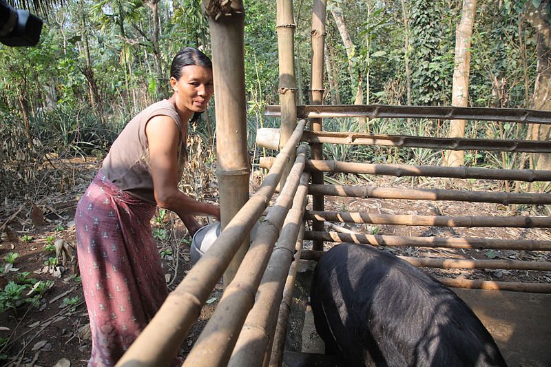
 A woman feeds her pigs in Nagaland
Source: http://commons.wikimedia.org/wiki/File:A_woman_prepares_feed_for_her_pigs_in_Nagaland.jpg
Author: ILRI

Agriculture forms the backbone of the economy of Nagaland. Among the crops produced include rice, corn, millets, pulses, tobacco, sugar cane and potatoes.
How to go to Nagaland
Non-Indian nationals need to obtain a Restricted Area Permit for traveling to Nagaland. This is available from the Indian consular offices in your home country. Nationals of India need an Inner Line Permit for visiting Nagaland. You can fly to Dimapur Airport (DMU) from Kolkata, Guwahati and Imphal.Main Cities in Nagaland
- Kohima - capital
- Dimapur - biggest city
- Mokokchung
- Tuensang
- Wokha
- Zunheboto
 Latest updates on Penang Travel Tips
 Discover with Timothy YouTube Channel
 PG Food Channel
 Learn Penang Hokkien YouTube Channel
 SojiMart Videos
 Share your travels and/or ask a travel-related question
Join the Penang Travel Tips Facebook Group to share photos, tips and anything related to your travels, or ask travel-related questions.
 Map of Roads in Penang
Looking for information on Penang? Use this Map of Roads in Penang to zoom in on information about Penang, brought to you road by road. Discover with Timothy
Let me take you to explore and discover Penang through my series of walking tours on YouTube. You may use these videos as your virtual tour guide. At the beginning of each video, I provide the starting point coordinates which you may key into your GPS, Google Maps or Waze, to be navigated to where I start the walk, and use the video as your virtual tour guide.Disclaimer
Please use the information on this page as guidance only. The author endeavours to update the information on this page from time to time, but regrets any inaccuracies if there be any.Latest from Discover with Timothy: Gurney Bay - what to see and do there
About this website

Hello and thanks for reading this page. My name is Timothy and my hobby is in describing places so that I can share the information with the general public. My website has become the go to site for a lot of people including students, teachers, journalists, etc. whenever they seek information on places, particularly those in Malaysia and Singapore. I have been doing this since 5 January 2003, for over twenty years already. You can read about me at Discover Timothy. By now I have compiled information on thousands of places, mostly in Peninsular Malaysia and Singapore, and I continue to add more almost every day. My goal is to describe every street in every town in Malaysia and Singapore.
Robbie's Roadmap
- Episode 1: Robbie's Journey to Financial Freedom
- Episode 2: Lost in America
- Episode 3: The Value of Money
- Episode 4: The Mentor
- Episode 5: The Thing that Makes Money
- Episode 6: The walk with a Billionaire
- Episode 7: The Financial Freedom Awakening
- Episode 8: Meet Mr Washington
- Episode 9: The Pizzeria Incident
Copyright © 2003-2024 Timothy Tye. All Rights Reserved.


 Go Back