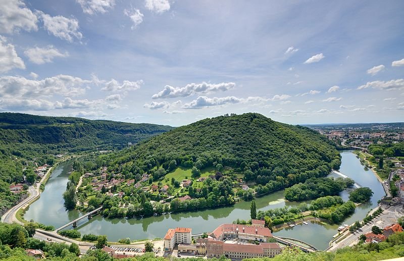
 Besançon on the oxbow of Doubs River
Source: https://commons.wikimedia.org/wiki/File:2011-06-12_15-48-27-vue-doubs.jpg
Author: Bresson Thomas

Besançon (German: Bisanz, Spanish: Besanzón) is the capital and main city of the Franche-Comté region in eastern France. Located near the border with Switzerland, the city covers 65.05 sq km (25.12 sq mi) and has a population of 118,000 (2011 estimate) and a metropolitan population of around 220,000. Its old town features 17th century buildings often enriched with beautiful wrought-iron work.
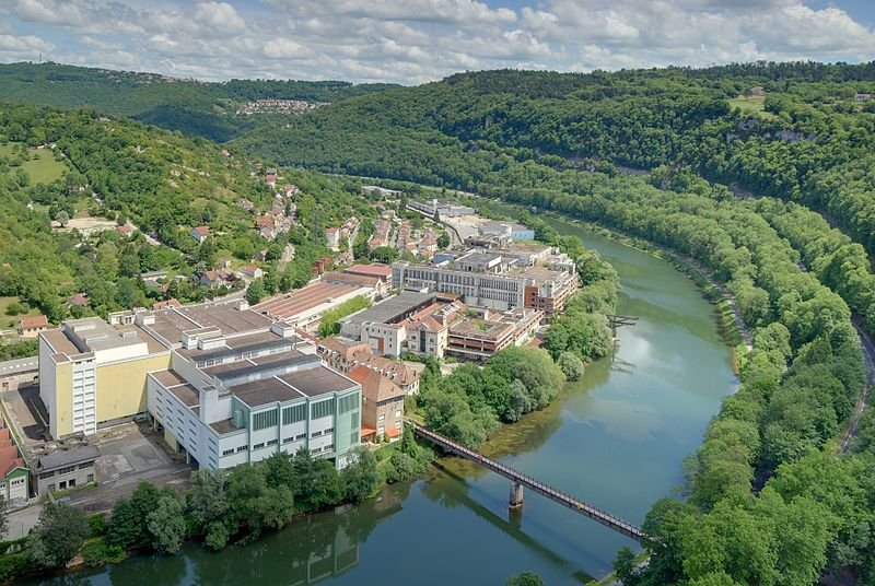 Loop of the Doubs River in Besançon
Source: https://commons.wikimedia.org/wiki/File:2011-06-12_14-18-42-vue-doubs.jpg
Author: Bresson Thomas

Besançon on Google Maps Street View
View Larger Map Besançon is located on a loop of the river Doubs. Within then inner loop, the ground has a maximum elevation of 250 m (820 ft) To the south of the loop is 371 m (1,217 ft) Mont Saint-Étienne, while surrounding Besançon are other hills rising to 500 m (1,640 ft).
Besançon experiences an oceanic climate with cold winters and warm, dry summers. The warmest month is August, when the average high temperature rises to 26.1°C (79°F). January is the coldest month, when the average low temperature drops to -0.8°C (30.6°F). November is the wettest month in Besançon, receiving some 96.7 mm (3.8 in) of precipitation.
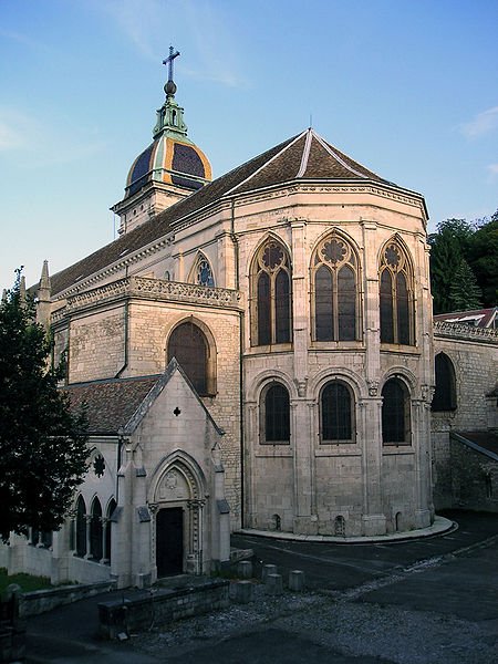 Cathédrale Saint-Jean in Besançon
Source: https://commons.wikimedia.org/wiki/File:Cath%C3%A9drale_Saint-Jean_Besan%C3%A7on.jpg
Author: Wikipedro

Besançon is today a modern city specializing in microtechnology, precision engineering and watch making. The watch industry of Besançon, relying on the traditional method of watch making, suffered a terrible blow when cheap quartz watches from Asia flooded the market. The city watch makers persevered to ride through the lean years until the industry eventually recovered.
The history of human settlement on the oxbow of the Doubs River, where present-day Besançon is located, goes back to the Bronze Age, around 1,500 BC. Its location made it of military importance to the ruling powers. The area was a Gaulic settlement until conquered by the Romans under Julius Caesar, who name the site Vesontio. That name has since permutated to Besantio, Besontion and Bisanz in Middle High German, to arrive as Besançon in modern French.
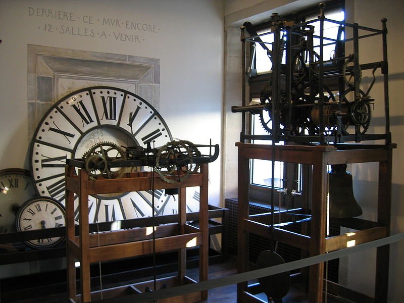 Musée du temps, Besançon
Source: https://commons.wikimedia.org/wiki/File:Mus%C3%A9e_du_temps_Besan%C3%A7on_1.jpg
Author: Arnaud 25

Visiting Besançon
Besançon is about three hours by high-speed train from Paris. You can also get there from Lyon and Strasbourg.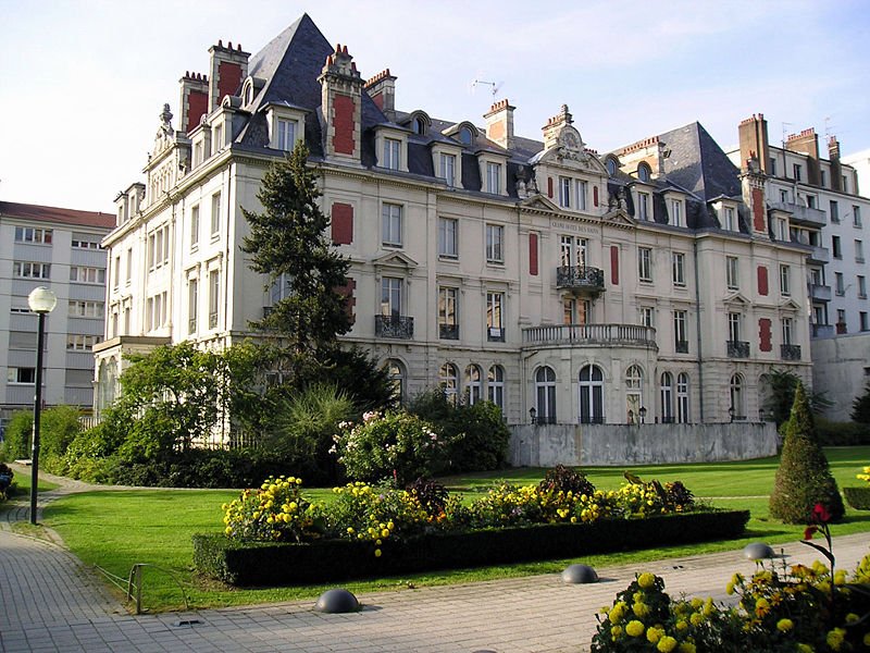 The grand old Hôtel de Bains in Besançon
Source: https://commons.wikimedia.org/wiki/File:H%C3%B4tel_des_Bains_Besan%C3%A7on.jpg
Author: Wikipedro

World Heritage Sites in Besançon
Places of Interest in Besançon
- Horloge Astronomique
Clock on the 12th century Cathédrale St-Jean with its hourly automatons. - Musée Comtois
Museum housed in the citadel built by military engineer Sébastien Le Prestre de Vauban, today showcasing local artifacts. - Musée des Beaux Arts et d'Archéologie
Museum housed in the old corn market displaying works by various artists including Goya, Matisse and Picasso. - Musée du Temps
Museum showcasing a fine collection of time-pieces, a tribute to Besançon's position as a center for clock making. - Porte Noire
Remains of a Roman arch.
 Latest updates on Penang Travel Tips
 Discover with Timothy YouTube Channel
 PG Food Channel
 Learn Penang Hokkien YouTube Channel
 SojiMart Videos
Latest from Discover with Timothy: Gurney Bay - what to see and do there
About this website

Hello and thanks for reading this page. My name is Timothy and my hobby is in describing places so that I can share the information with the general public. My website has become the go to site for a lot of people including students, teachers, journalists, etc. whenever they seek information on places, particularly those in Malaysia and Singapore. I have been doing this since 5 January 2003, for over twenty years already. You can read about me at Discover Timothy. By now I have compiled information on thousands of places, mostly in Peninsular Malaysia and Singapore, and I continue to add more almost every day. My goal is to describe every street in every town in Malaysia and Singapore.
Robbie's Roadmap
- Episode 1: Robbie's Journey to Financial Freedom
- Episode 2: Lost in America
- Episode 3: The Value of Money
- Episode 4: The Mentor
- Episode 5: The Thing that Makes Money
- Episode 6: The walk with a Billionaire
- Episode 7: The Financial Freedom Awakening
- Episode 8: Meet Mr Washington
- Episode 9: The Pizzeria Incident
Copyright © 2003-2024 Timothy Tye. All Rights Reserved.


 Go Back