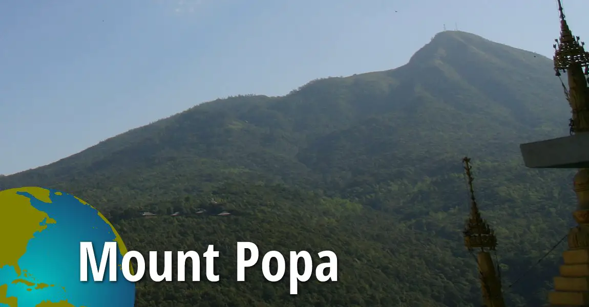
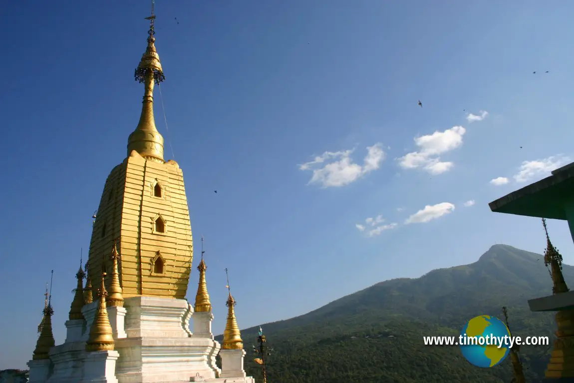
 Mount Popa, as seen from Popa Taungkalat (26 November, 2003)
Mount Popa is a sacred mountain in Myanmar located 50km away from Bagan. It is the remnant of an extinct volcano. The name "popa" means flowers in Sanskrit, because of a local belief that the forest around Mount Popa was once home of Mai Wunna, a flower-eating ogress.
The volcano had a circular crater, but much of the northwestern rim had been blown away, suggesting that the last eruption was not vertical, but inclined towards the northwestern slope. Although from a distance Mount Popa looks like one single peak, it in fact consists of three peaks which are 4981, 4801 and 4501 feet high. Mount Popa is on a plateau that is 1000 feet above the surrounding plains, and 1800 feet above sea level. Therefore, the actual volcano is 3000 feet from the base. The area around Mount Popa is today designated a national park, and the authorities are keen to develop it for ecotourism.
The abundance of petrified fossil trees in the Bagan region suggests that the land had witnessed violent eruptions in the past, including earth movements and massive lava flows. In fact it erupted for the last time three hundred and twenty years ago.
On the southwestern slope of Mount Popa is Taung Kalat, an isolated peak that juts out of the landscape. Taung Kalat, also called Popa Taungkalat, is often confused with Mount Popa. It is 737 m (2417 ft) tall peak that some believe to be part of the main volcano was was blown apart and landed here. Another theory suggested that Popa Taungkalat is the infilled neck or plug of another smaller volcano.
Mount Popa's attraction today lies not so much in its geological past, but more in its religious and mystical attraction. Mt. Popa is regarded as the home of Myanmar's most powerful nats and as such is the most important nat worship center. Nats are local spirits which are commonly worshipped throughout Myanmar, and Mt. Popa was the Mountain of Spirits. There are many nat shrines on this mountain.
Pilgrims from all over Myanmar visit Mt. Popa every year, especially during the festival season, which are on the full moon of Nayon (May/June) and the full moon of Nadaw (November/December). This festival is known as Taunghyon (near Mandalay). Before King Anawrahta's time, thousands of animals were sacrificed to the nats during festivals. According to Burmese superstition, one should not wear red or black to Mount Popa, or to bring meat, especially pork, as it could offend the resident nats.
 Shrine on Popa Taungkalat with Mount Popa in the background. (26 November, 2003)
Mount Popa Travelogue, 26-27 November, 2006
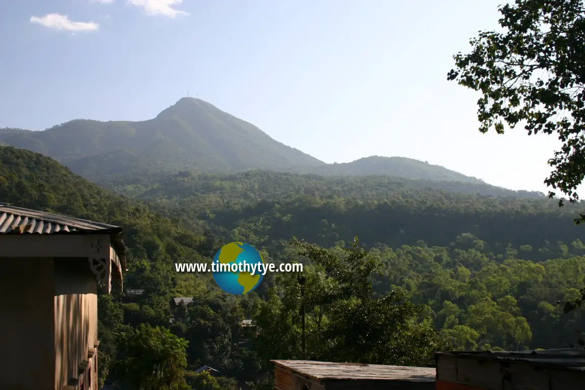
I visited Popa Taungkalat, not Mount Popa. I was curious that Henry, my tour guide, kept on saying to me that the peak in front of me was not Mount Popa, but it's Popa Club - or something. Only recently did I finally understand that he was referring to Popa Taungkalat, which sounded like Popa Club to me. View of Mount Popa from the steps going up Popa Taungkalat. (26 November, 2003)
 Latest updates on Penang Travel Tips
 Discover with Timothy YouTube Channel
 PG Food Channel
 Learn Penang Hokkien YouTube Channel
 SojiMart Videos
 Share your travels and/or ask a travel-related question
Join the Penang Travel Tips Facebook Group to share photos, tips and anything related to your travels, or ask travel-related questions.
 Map of Roads in Penang
Looking for information on Penang? Use this Map of Roads in Penang to zoom in on information about Penang, brought to you road by road. Discover with Timothy
Let me take you to explore and discover Penang through my series of walking tours on YouTube. You may use these videos as your virtual tour guide. At the beginning of each video, I provide the starting point coordinates which you may key into your GPS, Google Maps or Waze, to be navigated to where I start the walk, and use the video as your virtual tour guide.Disclaimer
Please use the information on this page as guidance only. The author endeavours to update the information on this page from time to time, but regrets any inaccuracies if there be any.Latest from Discover with Timothy: Gurney Bay - what to see and do there
About this website

Hello and thanks for reading this page. My name is Timothy and my hobby is in describing places so that I can share the information with the general public. My website has become the go to site for a lot of people including students, teachers, journalists, etc. whenever they seek information on places, particularly those in Malaysia and Singapore. I have been doing this since 5 January 2003, for over twenty years already. You can read about me at Discover Timothy. By now I have compiled information on thousands of places, mostly in Peninsular Malaysia and Singapore, and I continue to add more almost every day. My goal is to describe every street in every town in Malaysia and Singapore.
Robbie's Roadmap
- Episode 1: Robbie's Journey to Financial Freedom
- Episode 2: Lost in America
- Episode 3: The Value of Money
- Episode 4: The Mentor
- Episode 5: The Thing that Makes Money
- Episode 6: The walk with a Billionaire
- Episode 7: The Financial Freedom Awakening
- Episode 8: Meet Mr Washington
- Episode 9: The Pizzeria Incident
Copyright © 2003-2024 Timothy Tye. All Rights Reserved.


 Go Back